Vancation Adventures, Part I: Taking Vanna Grey Where They Spell Her Name Correctly

Canada, that is—where the colour grey is spelt the English way. Especially in British Columbia. 

Vanna and I both felt most at home–and so did Liza, my bike, who got to enjoy this view.

In the week following Memorial Day, The Mate and I had a nice free chunk of days between various commitments and appointments. Perfect timing to introduce Vanna to our favorite portion of North America…starting with a quick visit to the auto glass shop to fix her poor rear window.

I love when The Mate mows the lawn…but this time the mower threw out a chunk of gravel. Owie.

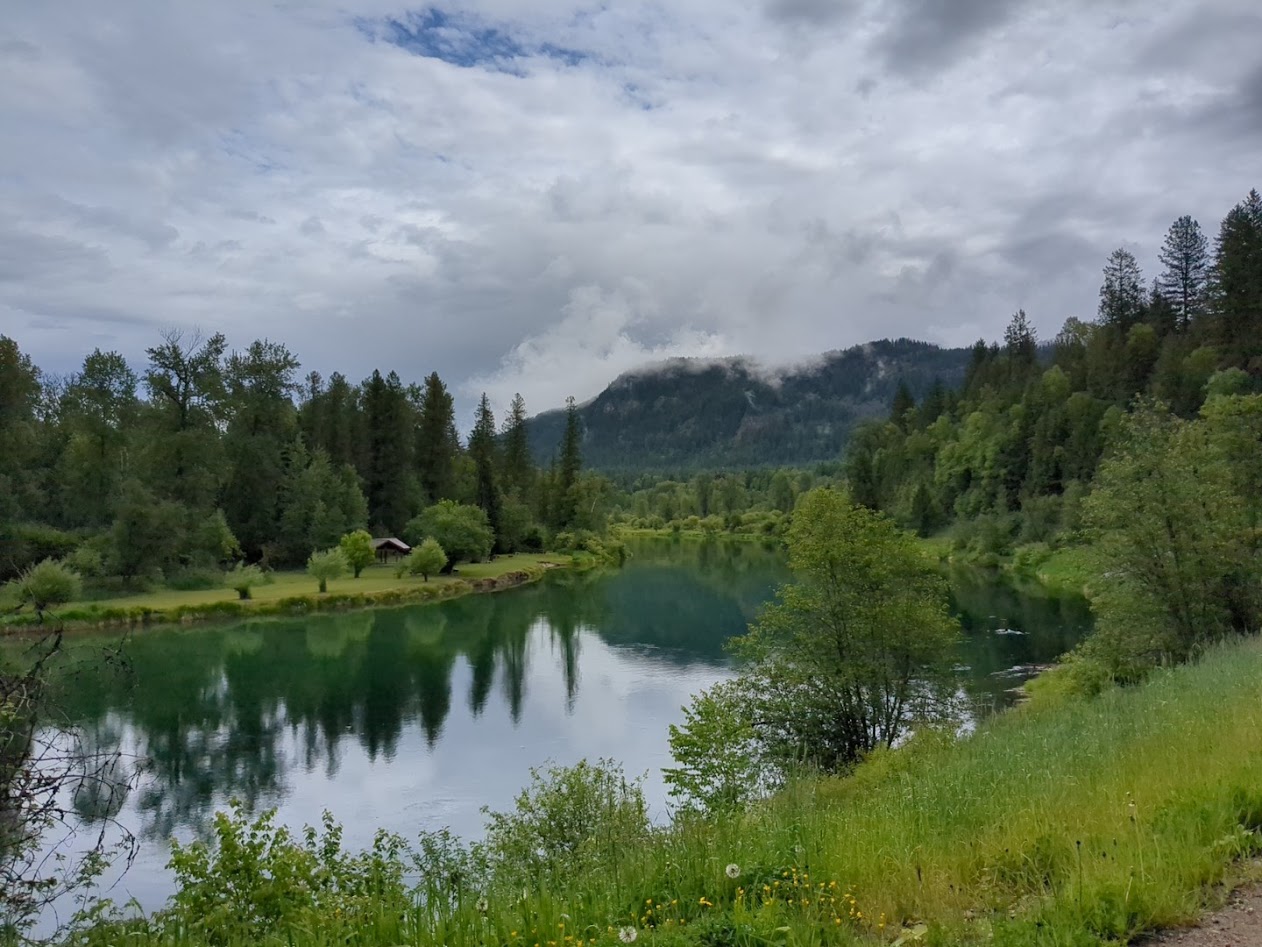
Heading for the eastern portion of the province, we crossed Washington’s Cascades and spent our first night in Twisp, right next to the Methow River.

Vanna’s-eye view of river

Thanks to the window glass, it was late afternoon when we arrived, but also so windy we were just as happy to skip the bike ride we’d normally look forward to there.

Next morning, the Methow got its turn in the sun’s spotlight.
Our campsite above Lake Skaha used to be an apricot orchard, and the poor ol’ trees were still trying to leaf out.

We were happy to finally poke around Penticton, given its reputation as a bike-trail nexus.

They even have special traffic lights for bikes!!

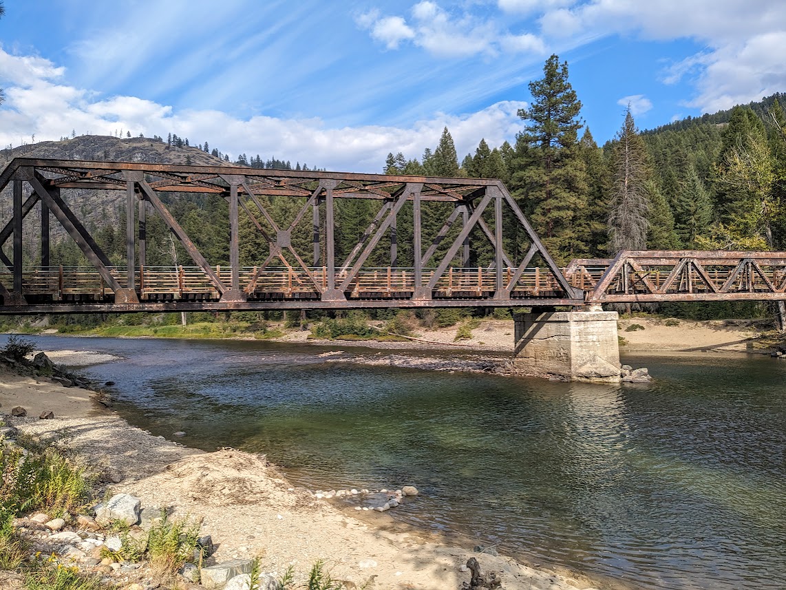
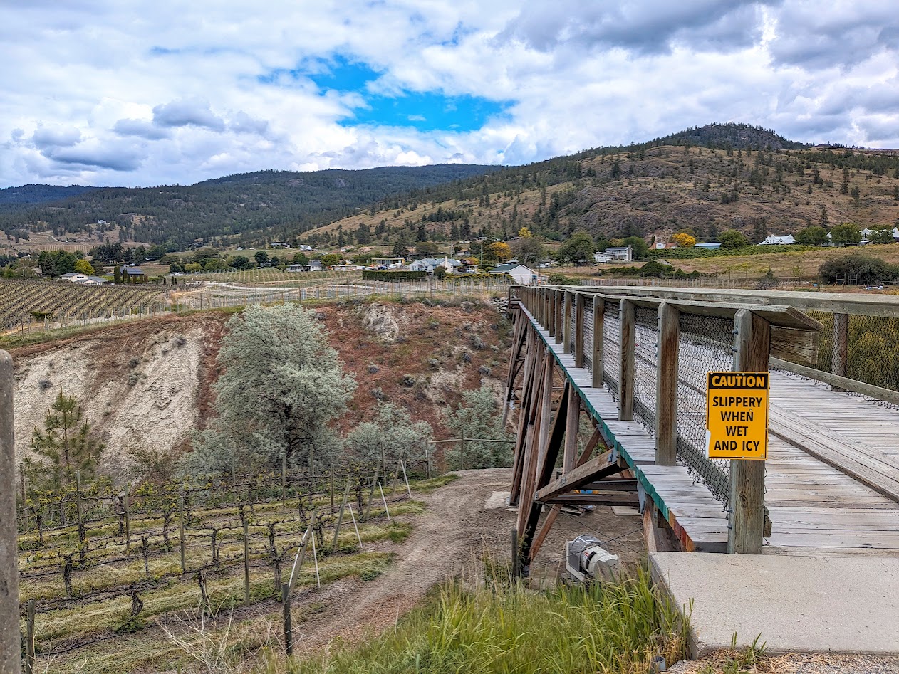
The Kettle Valley River Trail goes right around Okanagan Lake, through town, and up the other shore…

…with fun add-ons like this trestle, traveling through vineyards…

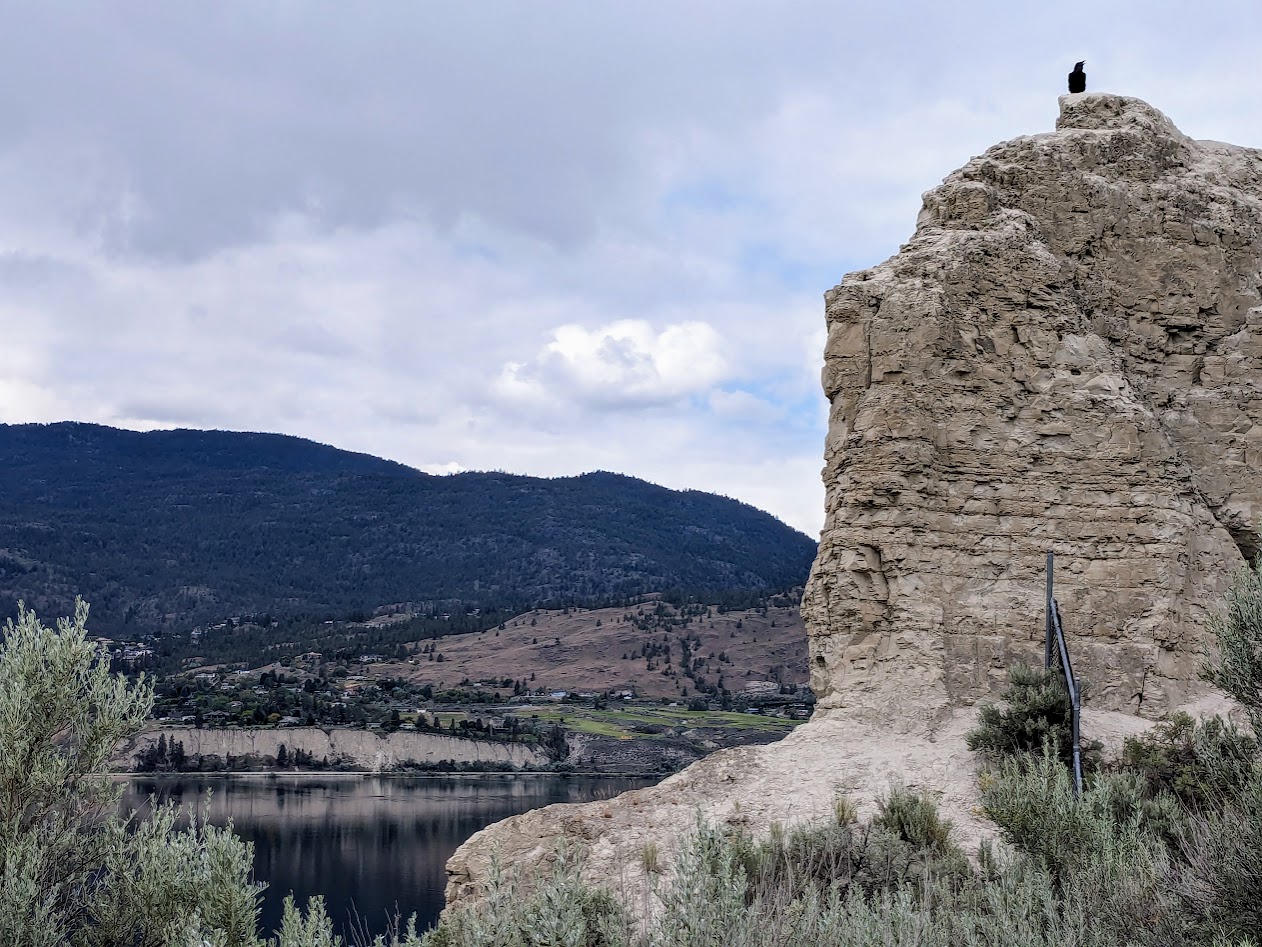
…and this raven, guarding its throne:

Oh, and speaking of guarding: I also met this guy along the path:

when you’re rich enough to own your own house-sized T-Rex

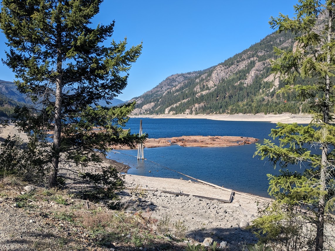
Can I just say, Okanagan Lake is RIDICULOUS? 84 miles long (135 km), 2.5 – 3.1 miles wide (4-5 km)…it just goes and goes and goes. [thanks, Wikipedia]

Who wouldn’t want to sit and look? Pairs of red Adirondack chairs are kind of a Canadian thing. Haven’t looked that one up yet.

Midway up this endless, snaky lake is the town–city?–of Kelowna. It was very close to Ground Zero in last year’s fire, so we were glad to see it seemed to have survived…but we found it too big and trafficky for the vibe we were in. After riding a short piece of rail-trail, we got out of town. (Might go back in a non-Vanna-sized car someday; tons more trail there.)

[Not pictured: Kelowna traffic jam. But also not pictured, to be fair, the 3-foot long gopher snake we met on the bike path.]
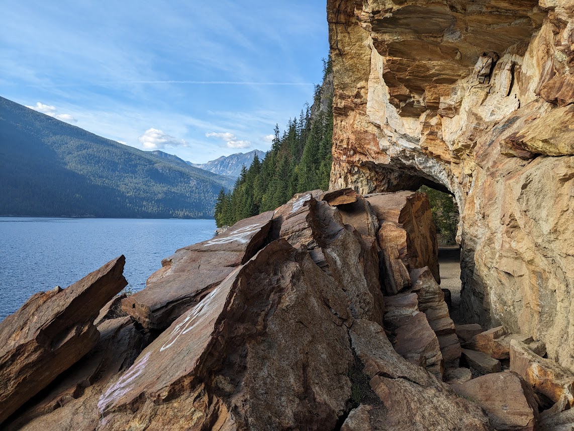
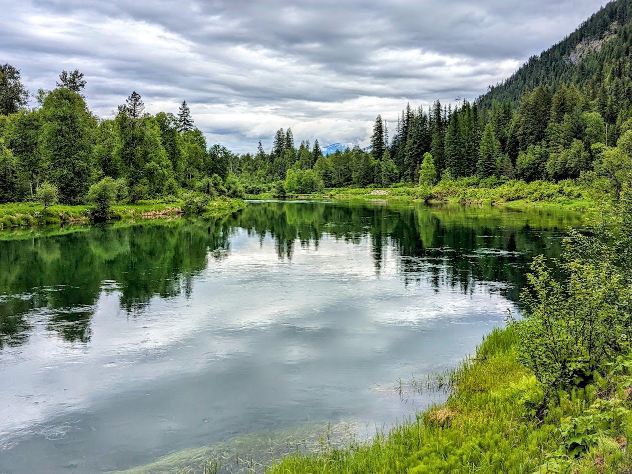
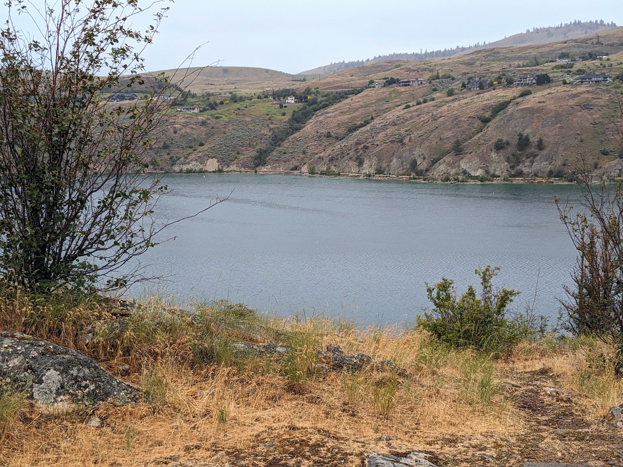
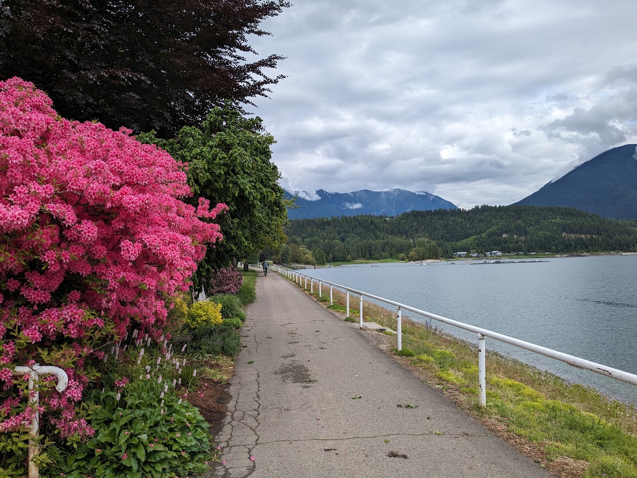
Not a car in sight!

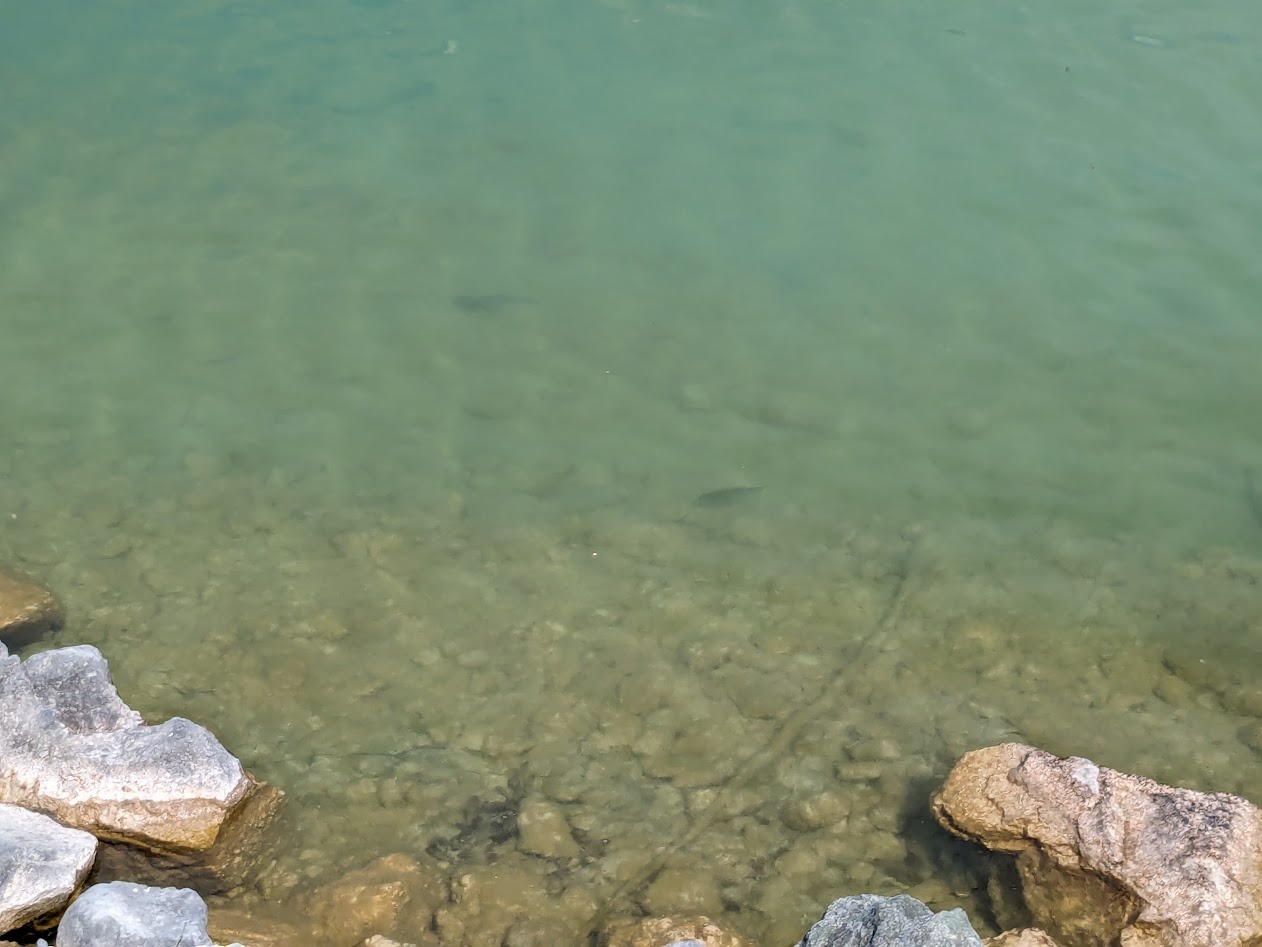
Tiny in comparison to the endless Okanagan, Kalamalka is twice as deep (over 400 feet in places) and famously color-changing (colour-changing) thanks to molecules from limestone deposits which are temperature-sensitive. I learned all this from a kiosk I had ridden past last year…but I was still more fascinated by the scenery along the ride.

Like this mama grebe and her grebelings. Greeblings? Greebettes? So CUTE.

The water’s so clear I even found myself taking pictures of fish.

See ’em? Eating size!

But, just as last year, I found myself focused on the parkland across the water, which includes no campgrounds–day use only.

But I want to go over THERE!

Instead, we spent the night in Dutch’s Campground, a funky old place at the head of the lake. Not a park–but for campering, just our speed.

Vanna and Liza chilling by the creek

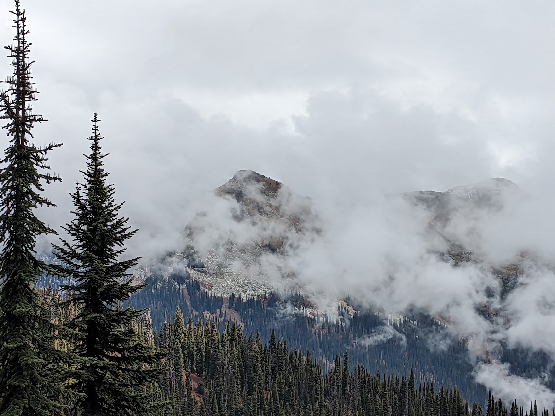
Next morning broke drizzly but warm, and I was thrilled to finally experience the land across the lake I’d been staring at: Kalamalka Lake Provincial Park.

On the promontory, looking right back at the place from which I’d taken its picture the day before

SO satisfying to finally get in there and hike all through its uppy-downy trails.

Ahhhh.

From Kalamalka P.P. we turned right and headed straight east, reversing our route from last fall. Truth be told, any road driven in Vanna vs. our Toyota feels like a completely different road. (As in, “Who put all these curves and steep downgrades in here?!”)

The steepest downgrade–12 percent!–took us to the ferry across the Columbia. Did this last year, but it still weirds me out, ferrying over a river.

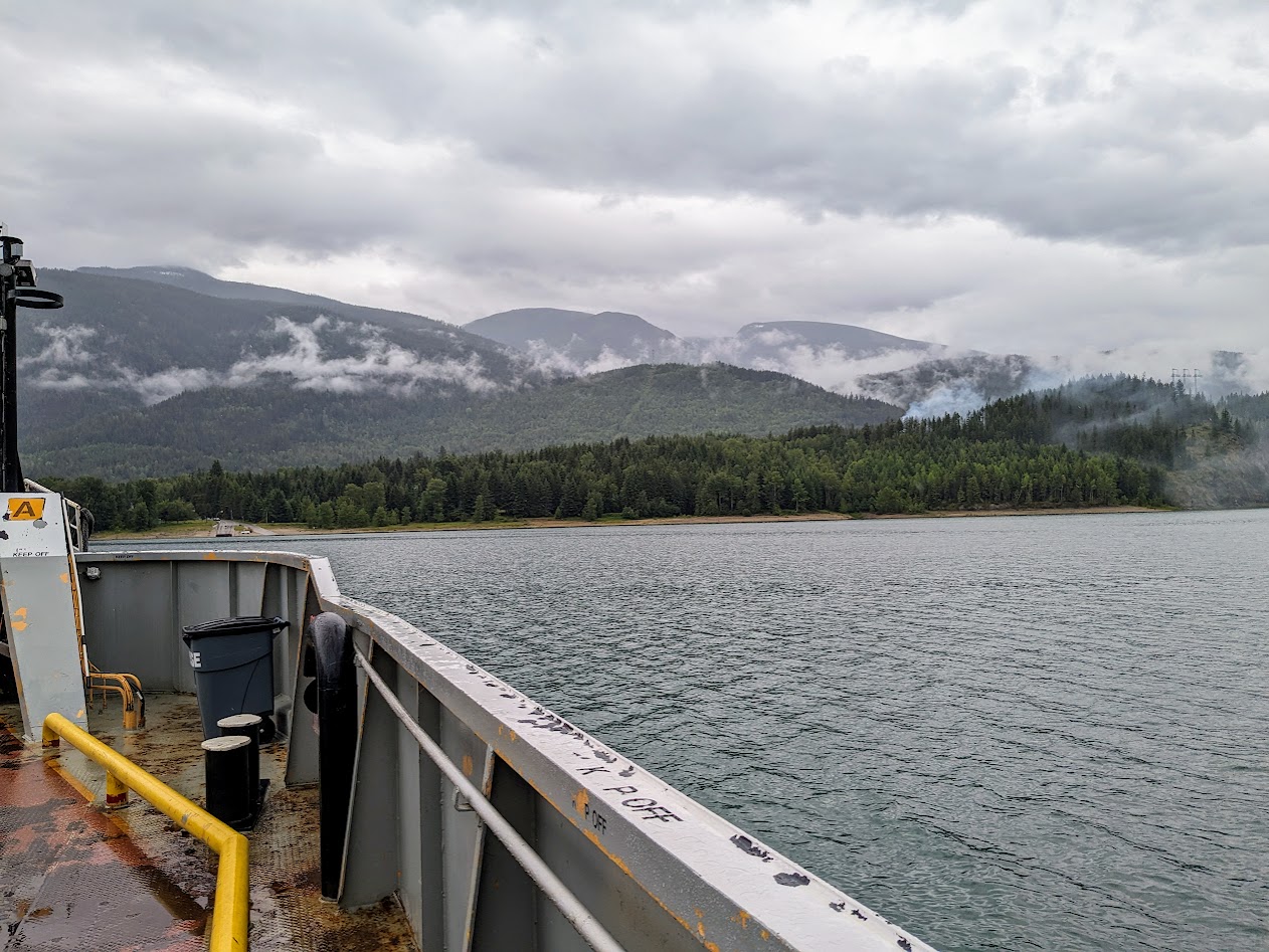
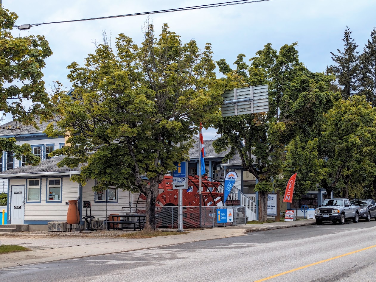
But we also stopped in places we skipped past last year. Like the town of Nakusp (na-CUSP).

Nakusp’s waterfront, along Arrow Lake (aka the Columbia, dammed up). To be fair, everything’s gorgeous in azalea season, right?

Travel Tip: wherever you go in Canada, look for the Information Centres. Even the smallest towns have them, and we’ve always found them to be staffed by the FRIENDLIEST, most helpful folks. Which might be redundant when describing Canadians.

Nakusp Info Centre–look for the yellow “i” on blue background.

At the RV campground in Nakusp, it wasn’t only the people who were friendly.

These gals were ready to hop right into Vanna!

[not pictured: Gretchen cleaning the floormats next morning from what we’d tracked in. Turns out camping around free-range chickens isn’t the best idea.]

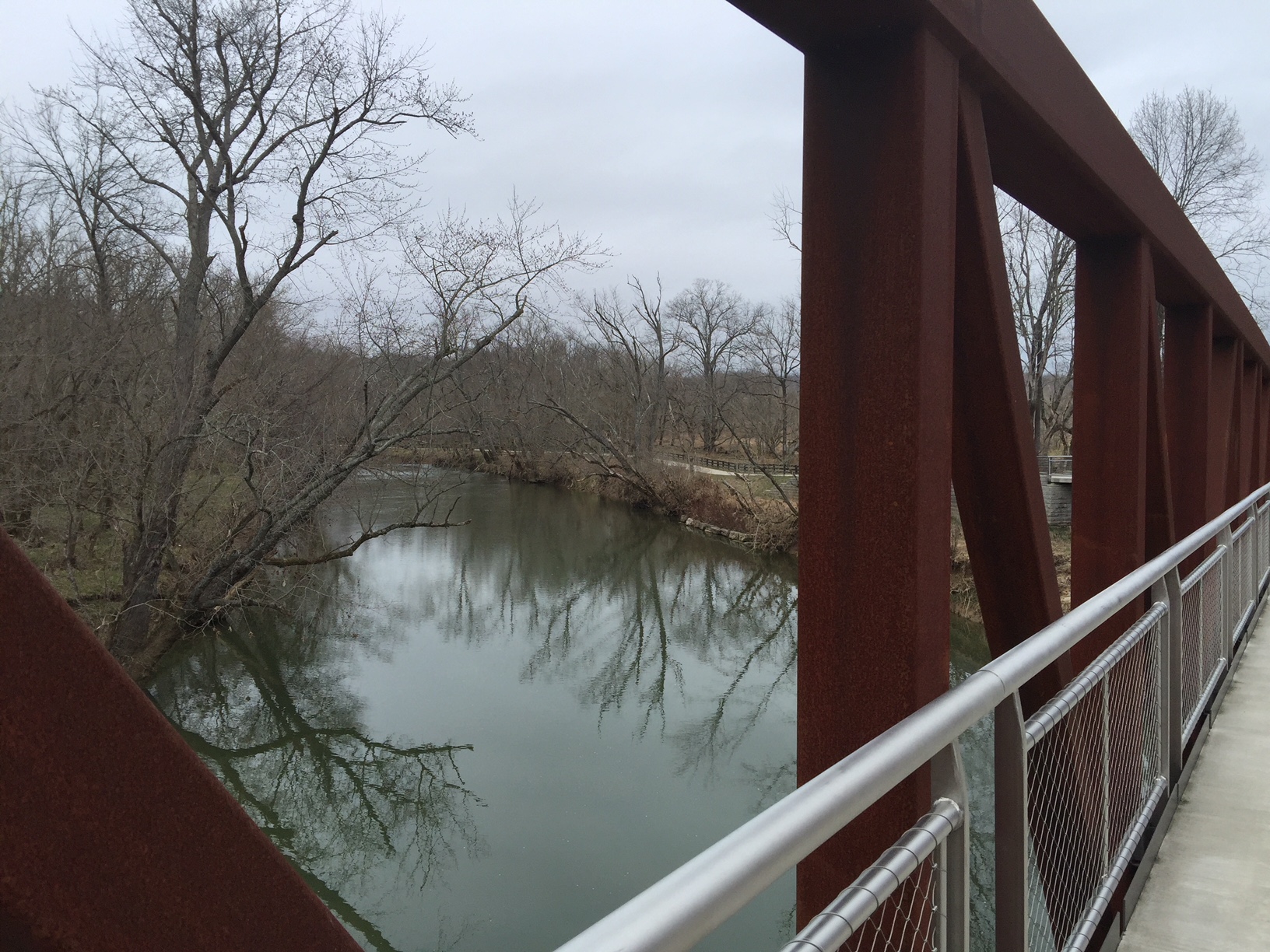
Now in the Slocan River Valley, where we’d spent two nights last year, we treated ourselves to an easy walk along the rail-trail, digging the peace.
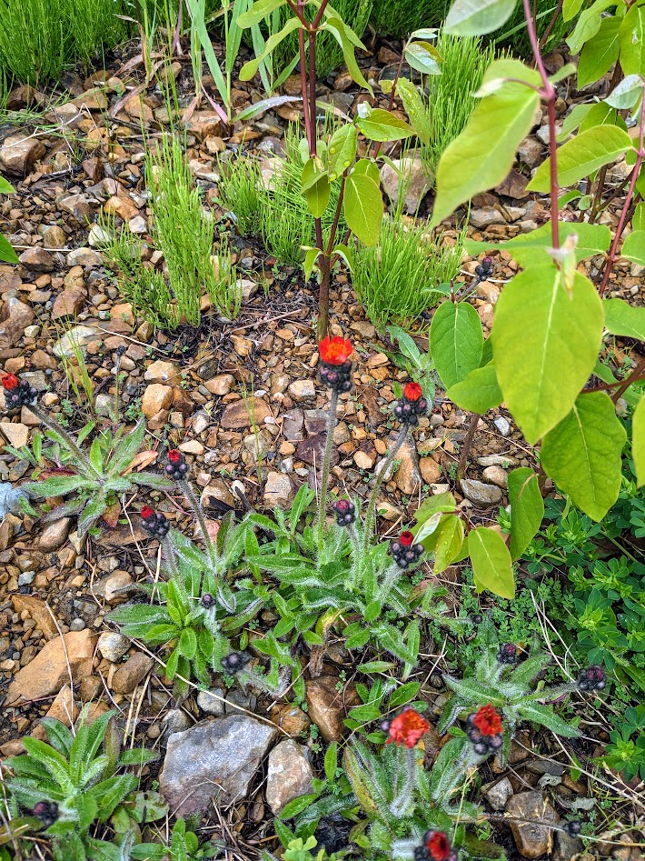
Canada’s BC: An Acronym in Search of Worthy Words

The Mate and I have always had a huge crush on British Columbia. We’ve meandered up the Sunshine Coast, used Harrison Hot Springs as a base camp for checking out multiple provincial parks, thrilled ourselves with the Discovery Islands, and last September, spent two weeks exploring the lower half of Vancouver Island. And that’s not even counting the many times we’ve driven through on our way to the Rockies, murmuring, “Why aren’t we stopping here?

Pictured: “Here,” a.k.a. some throwaway lil’ waterfall along Rt. 23

Beautiful Coastline? Best Countryside?

We started in Manning Prov. Park, especially of interest to me because it’s the terminus of the Pacific Crest Trail, of which I’ve hiked many sections.

Note the “You are Here” triangle up top

Since we were camped at Lightning Lakes, it seemed only fair to hike around them.

“2,400 miles–no thanks. 4 is fine.”

Bear Country? Bewitching Conifers?

The weather window started closing behind us at Manning, with snow predicted the next night, so we kept moving, down toward the flat(ter) Okanagan. We’d heard of the famous Kettle Valley rail trail, and in Princeton we did ride a section of it, but we also checked out trails in the community reserve of China Ridge, just above the town.

Thanks to the lovely woman at the Info Centre who sent us here! We’d never have found it.

The trails were more mountain-bikey than we usually ride, but we enjoyed our short stint up there.

Aspens! LOVE aspens.

Biking Country? Best Camping?

Next night we camped by the Kettle River, right where the rail trail crosses. Having had two rides that day, we just strolled some of it; the river was the best part. Notice the burned area in the back left? That’s from a 2015 fire. We were hyper-aware, this whole trip, of the fires still burning near Kelowna, and made sure to avoid the area.

Burning Cruelly? (unfortunately that “BC” could apply many place)

Following lovely Rt. 3 (the Crowsnest Highway) to Castlegar, we once again met up with the Kettle Valley River Trail, and rode another section…along the Columbia River. Yes, THE Columbia River–what we Washingtonians, and probably some Oregonians too, tend to think of as OUR Columbia River.

Horribly lowered by drought, dammed to within an inch of its life, clogged with industry…”Roll On, Columbia,” and good luck!

Behold Columbia? (That one at least makes some sense!)

After that ride, we swung north on little Rt. 6 to the tiny town of Slocan. We’d chosen Slocan because of its proximity to Valhalla Prov. Park, whose photos looked more national-park level than provincial.

Zooming in on Gibli Peak–gorgeous, but pretty inaccessible

But we soon discovered how hard it is to get INTO Valhalla.

It’s really a backpackers’ park, and we hadn’t come to backpack.

We ended up just hiking the bottom left portion of the lakeside trail, and that was PLENTY.

Big Cop-out? Maybe. But luckily for us, Slocan boasts its own rail-trail, which follows the Slocan River as it flows out of Slocan Lake.

Oh, OK. We’ll settle for this.

Slocan itself is a sweet, quirky little town with rainbow crosswalks and helpful volunteers in the library. We’d go back there in a minute, and maybe ride all the way down to some other simpatico towns on Rt. 6 with hippy-sounding cafes and bakeries.

Bakery Central? (I guess that applies to lots of places too) Biking Capital?

Even rockslides don’t stop these folks. You can hike right through this one.

Leaving Slocan, we decided to loop around a bit. The plan HAD been to camp 2 nights at Glacier National Park…but that weather window slammed shut, and we didn’t want to camp in snow. With an extra day before our hotel reservation in Revelstoke, we followed Rt. 6 back west in a squiggly semi-circle that took us back to–ta dah! The Columbia.

Or more accurately, ACROSS the Columbia, by FERRY.

They don’t even call it a river there, they call it Arrow Lake! Seeing that mighty river so abused brought us no joy. OK, a little joy. It was still fun ferrying across.

Burdened Columbia?

But that afternoon cheered us right up. First we got to ride yet another rail trail (Okanagon) along Laka Kalamalka, an honest-to-gods, true-blue, undammed stretch of watery glory…

On & on, just like this!
Looking across at another Prov. Park I wish we’d stayed in

…and then, that evening, near the lake, the Mate and I got our first Glamping experience, on a hydroponic farm!

Don’t worry, I didn’t know what a hydroponic farm was either.

Doug, the friendly owner of Utopia Feels glamping, gave us the full tour, including veggies:

Inside that white tube-tower, it’s raining!

…critters:

Silly & Billy, the goats, and Bad Bunny, enjoying veggie trimmings

…and of course, the glamping tents!

If anyone’s looking for an AMAZING wedding venue, I highly recommend this place!

I can’t say we’ll ever do this again, but it was a hoot and a half to do once!

And this is a SMALL tent. Some sleep up to six!!

Bountiful Campgrounds? Bodacious Comfort?

Bunny Cuddles?

Leaving the Okanagan behind, we turned north and east again, as if heading for the grand Rockies. But this time we stopped short, in the town of Revelstoke, home of…

…Columbia?! Is that really you?

…you guessed it: the Columbia River. Still dammed (just upstream from town), but looking closer to a real mountain river than I ever dreamed it could.

Beautiful Clarity!

Revelstoke nestles into a whole batch of mountains, including Mt. Revelstoke, which has its own national park. Clear skies were in short supply when we drove the single road in and up to hike toward the summit:

…but we got the idea.

Over the next couple of days, as the rains moved in, we took advantage of little breaks to revel in local awe (Revel? in Revelstoke? See what I did there?).

Creek showing glacial silt
glaciers of Mt. Begbie, part of where that silt comes from

Just up the road (literally, up) from Revelstoke is Canada’s Glacier National Park, and it KILLED me to be so close and not go. But we were disinclined to drive in possible snow & ice. So…next time, B.C.

Best Choice?

But Revelstoke was quirky enough for us. Examples: Woodenhead, apparently carved decades ago by some dude for the fun of it, and adopted by the town:

Not creepy at all!

…and this Indian-German fusion restaurant we found.

Curry mit spaetzle? Jawohl!

Road Trip XI, Days 22-26, NC to VA to WV to MD to PA: M is for More Mountains–Mmmmmmm

On the 3-week anniversary of this Extra-Strength-Making-Up-For-2021-Road Trip, we left my folks’ farm and headed west. Well duh, you might think–turning for home means west, right? Yest, but no. We were simply heading back to the Blue Ridge, and friends we’d missed on our first visit the week prior.

Mountains + Friends = Happiness

THEN we turned north, which is why I’m writing this from Allentown, Pennsylvania, two days and several states away from where we started yesterday. (We spent literally 10 minutes crossing Maryland–the suuuuper skinny part that probably involves some interesting history that I need to look up.)

Our goal is Vermont, and cousins, and a donkey almost as cute as Stevie (World’s Cutest). But since we were gifted with both time and good weather…

Hiking just above the Blue Ridge Parkway near Asheville

…back we went.

(Actually, about that weather? It did catch up with us one day, when The Mate and I were preparing to ride our bikes in the rain just for the sake of riding on a closed section of the Parkway. But we got up there only to find ourselves enveloped in a cloud so thick it made driving dangerous, let alone biking. Ah well.)

[Not pictured: us not riding in the rain on the socked-in Blue Ridge Parkway.]

Saying farewell to our friends, we headed north into Virginia, and stopped to ride the New River State Park Trail.

I mean, how could we not? It was a GORGEOUS day.

Have I mentioned how much I adore rural rail-trails?

And the crushed gravel was so soft it barely made a sound.

It was really hard to turn around, but the trail is 57 miles long, so…

OK, OK. Riding on now…Bye, New River!

With a Tarheels game to watch and a special St. Patrick’s Day love-anniversary to celebrate, we opted for a generic motel with a kitchen that night in rural Virginia near Shenandoah National Park…but were still rewarded with another spectacular Motel Sunset.

Why thank you!

Next morning, we took advantage of the mountains’ proximity–the reason we’d chosen this route–to hike a section of the Appalachian Trail heading into Shenandoah NP.

Quite some distance from the last AT sign picture I took!

It started off intriguingly enough…

Hey, only 965 miles to Georgia!

…but ended up being pretty, y’know…meh, at least for a National Park. This creek was the main highlight:

Pretty…but not much different from my folks’ woods, really.

Lesson learned; next time we’ll actually drive INTO Shenandoah NP and be more intentional about choosing a trail. But it was still a lovely walk. And just when we turned around, saying to each other, Really? This is it? we noticed these:

Why thank you again!

So there ya go: this is why I always choose mountains. Even when the trail isn’t spectacular, it always finds some kind of gift to give. And as we head north tomorrow, through New Jersey, up into New York and over to Vermont’s Green Mountains, I’ll be looking for even more of those gifts to accept. With gratitude.

Road Trip VIII, Days 36-38, Cincinnati, St. Louis, Salinas, Kansas: Bike-Pathing Across America—Thank You, Trail Link!

Planning a drive across the country? Planning on staying in shape as you go? Does this look like a nice break from the highway?

Pedestrian/bike bridge on the Louisville Loop

Consider this post a full-on advertisement. Luckily, it’s for a non-profit organization. Also I’m not being paid. I just want anyone out there who travels across the US with a bike, or with a pair of good legs which like to stretch themselves on trails, to know about Trail Link.

Trail Link is a service provided by the Rails-to-Trails Conservancy, “a nonprofit organization dedicated to creating a nationwide network of trails from former rail lines and connecting corridors to build healthier places for healthier people.”

For a small subscription you get access to a website with an incredibly well annotated national map of trails, everything from small nature trails to strolls in parks to converted rail trails stretching hundreds of miles. Here’s an example:

One of our favorite trails ever—it goes through tunnels!

Clicking on any of those icons gives you directions to parking, plus more info, although Trail Notes sections are already as thorough as any well-written guidebook, complete with photos and reviews.

The Mate and I are dedicated Trail Linkers. When possible, we plan our routes through areas with inviting trails. Often we find these in out of the way places like Susanville, California—one of our favorites—but also near quite urban places like Atlanta.

Susanville! A destination trail. And the town’s pretty cool too.

The reason? Trains go everywhere, and when they are retired and organizations like … get on the case, then the trails go everywhere too. It’s a beautiful thing.

Our most recent example: the terrific Louisville Loop, a series of wonderfully curvy, hilly, bridge-studded trails that will eventually encircle the entire city by connecting its greenways. Easy access, a fantastic workout, your daily hit of natural beauty—what else does a road-tripper need?

Just look at those whoopy, swoopy, woodsy curves!

Here’s one from last year’s trip—a trail along the Illinois River.

Ahhhh…no pavement.

We’ve even found trails in Canada using Trail Link, like this amazing one around a lake on BC’s Sunshine Coast:

LOVED this trail.

Just because you’re driving purposefully without a lot of time to meander, does not mean you have to sacrifice your needs for exercise, beauty and adventure. Check out the Rails-to-Trails Conservancy for yourself, and happy riding/walking!