Maybe I should drop the whole finding-a-better-meaning-for-the-initials-BC thing. It’s called British Columbia, Gretchen. Get over it–and get on with your blog post.
We took Vanna back to BC. Because we Could.
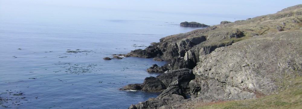
This was what our departure looked like, ferrying east from Lopez Island:

If that red sunrise was a bad omen, it was a day late. We’d actually tried to leave the day before, but a) missed the 6:15 ferry b/c we didn’t realize how many trucks depart the island on Thursdays, leaving few overheight spaces for our tall Vanna Grey, and b) they cancelled the 9:30.
So we awarded ourselves a “free day” at home and had one fewer day in BC. Best Choice.
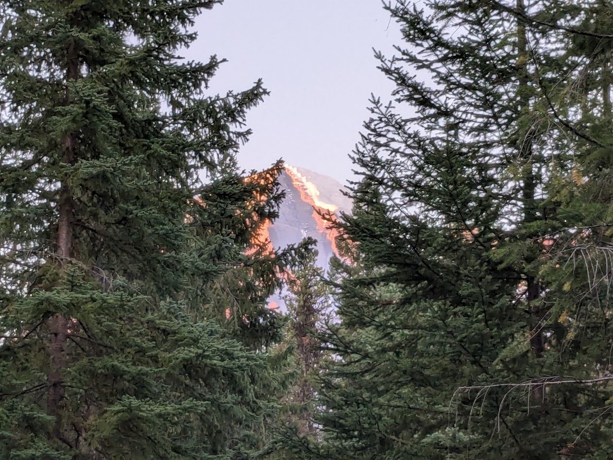
We went straight to a park we’ve usually passed by on our way to the better-known Jasper National Park: Mt. Robson Provincial Park. Named for the tallest of the Canadian Rockies.
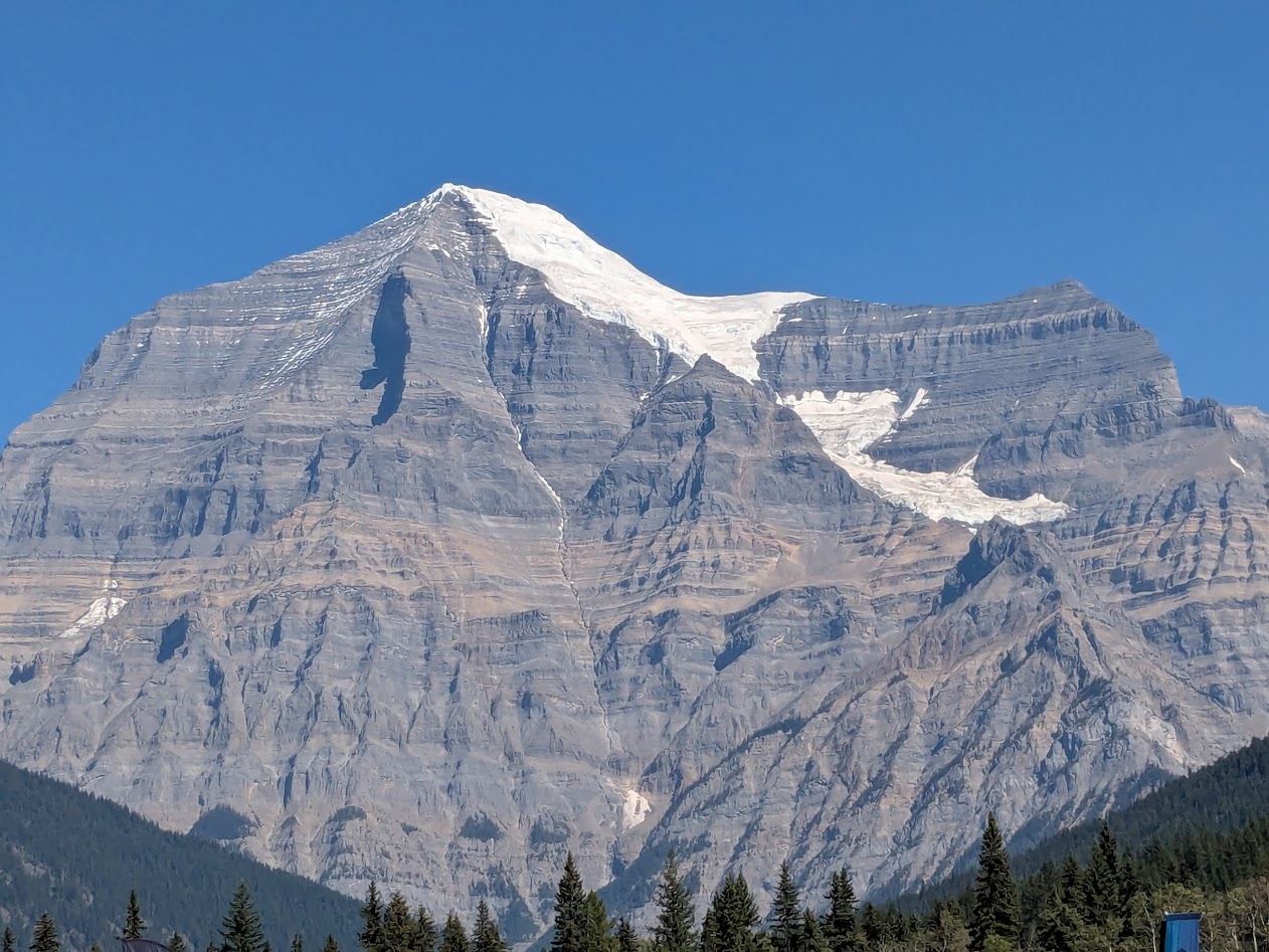
Despite our campsite’s thick shelter of trees, we still had a view of the mountain’s peak:

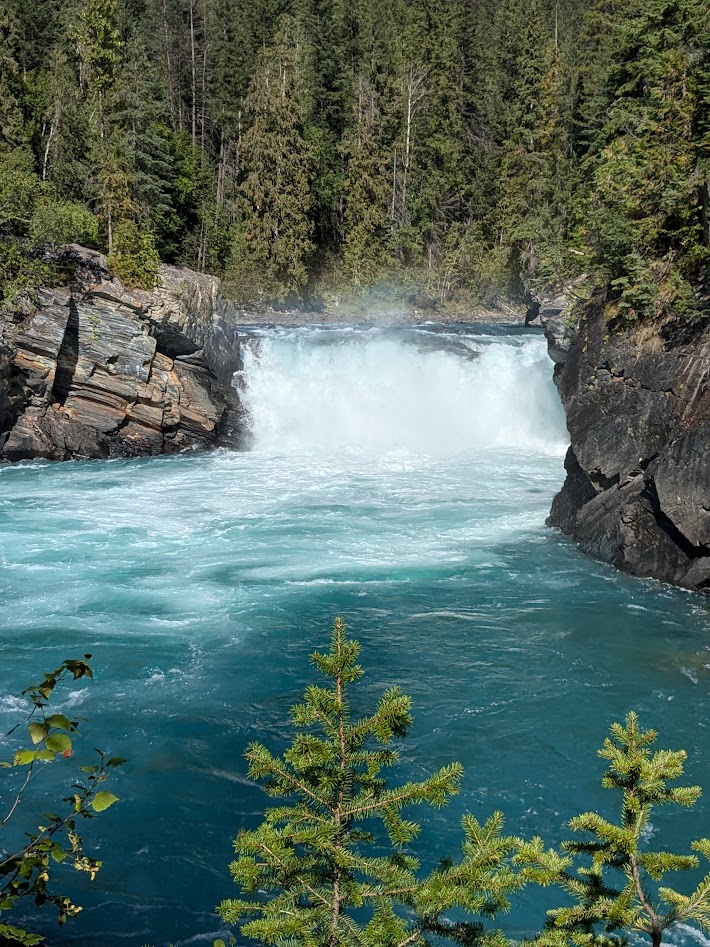
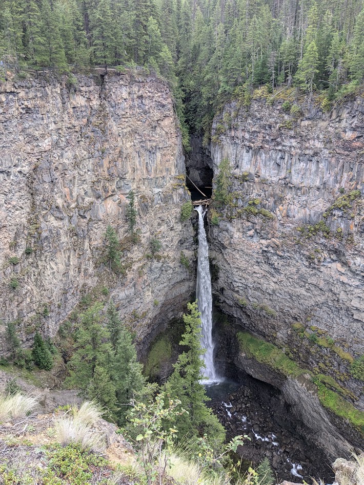
There’s really only one MAIN hike in the park, so, saving it for our longer day, we spent our first afternoon checking out the falls of the Fraser River. Hard to believe something this bright becomes the familiar brown body of water passing by Vancouver.
The weather was dry and hot (for Canada, and for The Mate & me), but that didn’t stop the mushrooms.

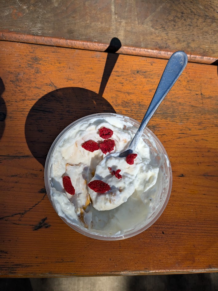
Too late in the season for most wildflowers–but I did manage to find a few ripe thimbleberries to add to my yogurt.
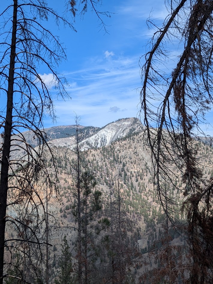
Mt. Robson appeared to soaked up all the sun he could; can you blame him?
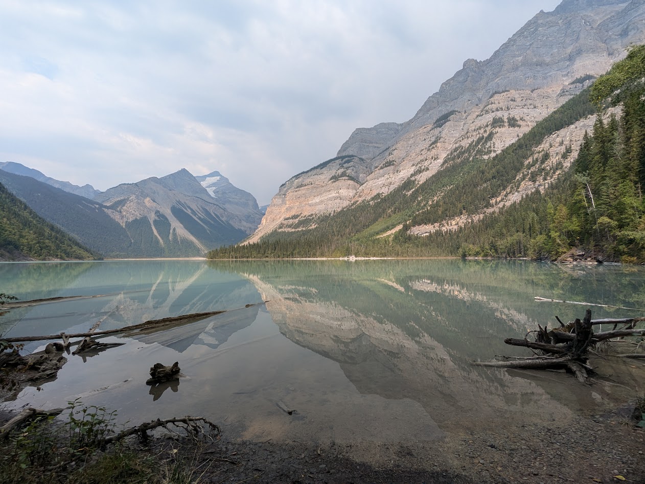
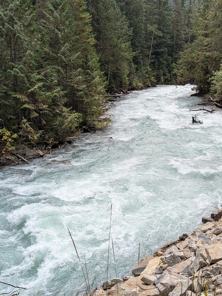
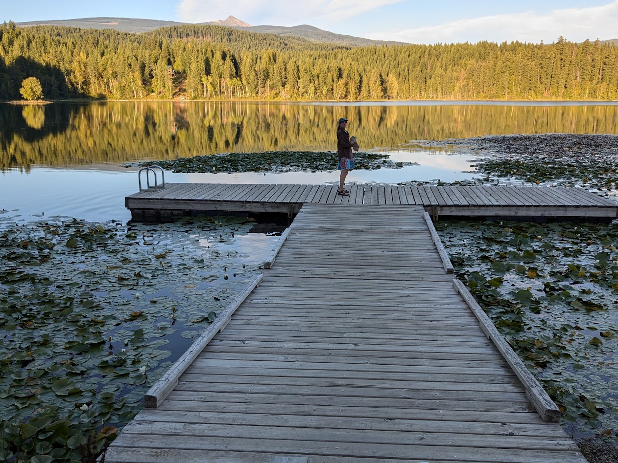
Next day we headed up the trail, following the Robson River to its source, Kinney Lake.

That incredible mountain seemed to follow us every step of the trail, even in what seemed like a pretty dense forest. I guess it’s just THAT tall (just shy of 13,000 ft…close to Mt. Rainier height!).
Up top, the trail skirts the lake in ridiculously postcardy vistas.

It was hard to make ourselves turn around and go back down. But even more impressive to follow that wild river, imagining the calm from which it came.
After two full days at Mt. Rob, we headed back south on the Yellowhead Highway (5), stopping to check out the small part of enormous Wells Gray Prov. Park that’s accessible to a big van.
Wells Gray’s campground was on a rougher road that we wanted to drive Vanna on, so we opted for a private site down below, in the town of Clearwater.
Next, we left the boreal forest behind, heading back into BC’s dry region, in the rain shadow of the coastal mountains, west of Kamloops. Some of it bore signs of last year’s terrible wildfires.
Not only did we score a campsite at a rafting company that was preparing to close for the season, but the owner let us camp for free.

We had the place to ourselves…including our own personal canyon.

Oh, and those trains? There are tracks on both sides, demonstrating the stubbornness of capitalists, as we learned from this sign:
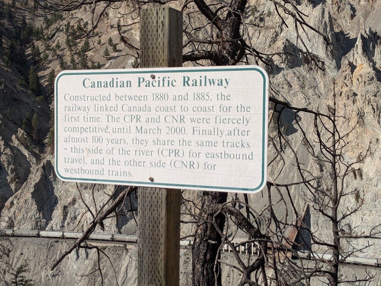
Here’s where I should note that those trains did a mighty good job of keeping us company. All night. Both directions. Bad Choice.
But how can you not choose your own personal canyon, at sunset?

Our last day, it was back to the wet: both in terms of ecosystem, and weather. We went to Hope, close to the US border, just an hour or so east of Vancouver. There we discovered an old friend: the Kettle Valley River rail-trail.
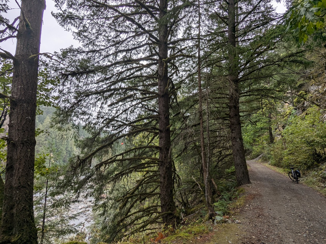
Unfortunately for us, construction work prevented us from riding all the way over to the Othello Tunnels, which we’d visited on a past trip. But Vanna took us there.

In under a week, we were back home. Too short a trip? Not at all. Vanna’s whole raison d’etre in our lives these days is to keep us reminded what’s in our big backyard.
Better Closer. Back to Canada! By Choice.

Wonderful photos. I wanna go there too!!
Ann
Especially in a US election year, Canada feels so much more…peaceful.
So beautiful!
Thanks, Laurel. Yes–it’s a soul-feeding place. Say hi to Asheville for me!