You’re halfway up Vancouver Island. You only have a few days before heading back to the mainland–not enough time to get out to the Wild West Coast, nor down to Victoria. Where do you go?
How ’bout here?
This is Englishman Falls Provincial Park, just a hop & skip off the main highway between Campbell River and Nanaimo. And yes, that disappearing waterfall is even more insane in real life. Here’s what it looks like face-on:
Hold up–WHERE is that river going??
…and from the top, just above the drop:
Who, me? Just a boring old clear Canadian river…
That little park was one of several blips on the map of east-central Vancouver Island that, in classic Canadian fashion, fail to call attention to themselves…until you are standing there with your jaw a-drop.
Campbell River–the actual river for which the town is named–is dammed, but not only does it offer the salmon a big side-channel to bypass the dam, it provides guardians for those fish on their passage:
Not as good as a wild, free river–but way better than nothing
Further inland, Strathcona Provincial Park certainly shows up on the map, but this little waterfall? We only found it when directed there by a volunteer docent we happened to meet.
No one else was around. Just me and that pool.
We’d intended to camp in Strathcona, but the weather went sideways. No problem backpacking in the rain, but wet car camping? That just feels stupid. So we got in a short hike…
(I can just imagine that trail repair crew going, “Eh…good enough! Let ’em climb.”)(forcing myself to resist the biggest Chicken-of-the-Woods mushrooms I’ve ever seen!)
…and rode our bikes along the 14-mile long (and unfortunately-named) Buttle Lake…
Bit wet; still pretty
…before heading back to Campbell River, where we’d scored one of those cheap hotel deals at a NOT-cheap hotel, Painter’s Lodge.
as seen from the lodge’s dock, at very low tide
On that dock we found this map–WONDERFULLY helpful for orienting ourselves in BC’s bewildering array of islands:
Not our usual type of stay, but we took full advantage. Especially because the part we stayed in seemed to be a mashup of our last name & our favorite BC island:
Of course the rain stopped when we got there. But then it came back. Phew.
Luckily for us, they let us cook our cheeseburgers out in the patio area!
“This counts as camping, right?” (Quadra Island in the background)
Our last day, after those amazing Englishman Falls, we found a very cool bike path–along the highway, yes, but screened by bushes & trees, with plenty of curves and hills giving it a very adventurous feel.
Some of those bushes had blackberries on them, and I was shocked at how sweet they still were, in September! So: lunch.
Peanut Butter, Honey & Blackberry Sammy!
Our final night on the Big Island (move over, Hawai’i–actually, never mind, you’re already pretty far over) we spent in Nanaimo, in order to catch our ferry next morning. I walked all over, discovering the best kind of quirks, like this Flower Wall:
Just an apartment building, far as I could tell
Along with flowers, Nanaimo boasted its own poster-of-random affirmations, because I found a number of these type of signs, here and there:
Why thanks, Nanaimo. I’ll try!
Next week, the exciting BC conclusion: University of! Thanks for riding along.
Actually, Cortes Islanders would probably prefer that “quirky” label, while we found Quadrans (Quadrants?) plenty cordial. Either way, both islands, between BC’s mainland and big Vancouver Island, became big highlights of our British Columbia wanderings in 2018, and we were overjoyed to wander back.
Whale-com back to Quadra!
With a week to spend, between our Bella Coola adventures and our visit with our friends in Vancouver, we headed over to Horseshoe Bay for the big ferry to Nanaimo. BC ferries are SO nice. And, unlike Washington State’s they run on time. And they actually run! (#ferryEnvy).
In Horseshoe Bay I was thrilled to see a healthy batch of young purple sea stars.
Since these critters have been suffering through a terrible die-off in the Salish Sea, I was super encouraged by these guys.
…and super thrilled by these Horseshoe Bay treats: seriously the best doughnut I’ve ever eaten!
After our 90-minute ride to Nanaimo, we drove a couple of hours north to Campbell River for groceries, then a much shorter crossing on a much smaller boat to Quadra Island. The We-Wai-Kai Campsite there is run by the First Nations People of the same name. Pleasant place, and pleasantly close to Rebecca Spit, a Provincial Park perfect for short bike rides and strolling.
Why do we call long, skinny points of land “spits”? Anyone?
Much of Quadra, we came to remember, is a bit steep for biking, at least for a couple whose combined age is edging close to 143 years. Since we’d be passing back from Quadra automatically on our return from Cortes…
(Courtesy Wikimedia) Ferry goes: Vancouver Is. to Quadra, then from the opposite side of QI to Cortes
…we put a pin on some hikes for our return , and headed over to our old Cordial friend…
…on an even smaller ferry!
On this 40-minute ride (reminiscent of our Lopez Island commute), we were treated to a pair of humpback whales. (Too far for good photos, but great views through binoculars.)
For our picnic lunch, we defaulted back to Manson’s Landing, remembered from 7 years ago.
This time the tide was out. WAY out.
Such healthy-looking tidal creatures! No sea stars…
…but I’ll settle for sand dollars. Worth every sand penny.
This trip, instead of springing for the extraordinary, but expensive Hollyhock Retreat Center, The Mate and I stayed in a modest motel with a kitchen. It was a stone’s throw from a set of community trails we’d missed last time…
Steep but worth it!
…not to mention an enormous, clear lake, shallow & warm enough for real swimming.
not pictured: swimming Wings
That huge log and those background cliffs, speak of Cortes’ drama. But its Friday Market, complete with music, homemade treats and upcycled clothing, speaks of its community. “Cordial” indeed. I didn’t want to interrupt the vibe by taking photos.
…we found purple sea stars! So many healthy specimens!
Recovering from Pisaster Disaster (#LatinNamePun)
Returning to Quadra–the ferry workers kindly squeeeeeezed us onto the boat–
Phew! Thanks!
…we determined to find an extra-special way to spend the day, because it was our wedding anniversary.
#38, since you asked! 🙂
First we found a fairly level hike to a lake; later, we drove to a deserted cove for another picnic. I could write a whole blog post about Peanut Butter & Honey sandwiches…
…but I won’t. This maple leaf caught my eye, though–emblematic of all the Canadian flags we saw flying across BC (#IWouldTooIfIWereThem)
We’d hoped to spend our anniversary night at the sweet inn we stayed in in 2018, but they were full. So we settled for dinner there.
Happy #38, babe.
Meanwhile–on that quirkiness question? Look what we found lurking around the parking lot of our Quadra motel!
“Clever girl.”
There were about a dozen of these, obviously by the same artist who made that campground whale…
…not quite life-size, but close! That’s a LOT of driftwood.
The final piece of “quirk” that caught my eye on Quadra was this sign outside an ice cream parlor:
When you consider that Bowie died in January 2016…well…hard to argue w/ this, eh?
Thanks for traveling along! Next time: back to the Big Island–Canadian version. Keep those maple leaves flying!
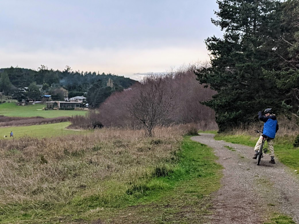
Like my new word? I was trying to find a way to describe the way The Mate and I tend to travel, and it occurred to me: pretty much all we do, wherever we are, is look for trails to walk or paths to bike (or vice-versa).
Cathedral Grove, near Port Alberni
Leaving Tofino, we drove less than 20 miles down the road to Pacific Rim National Park, a thin strip of forest and beach that runs a good length down Vancouver Island’s Wild West Coast. The hiking trails are all short, but the longest of them is run by the Nuu-chah-nulth people, whose land it occupies.
It’s hard to get The Mate to turn around for a photo.
Along with offering some moments in the best parts of the forest, the trail tries to deepen one’s awareness of that culture, like this:
If only I knew how to pronounce those words…
This totem pole along the trail is maybe the most beautiful I’ve ever beheld.
I had a hard time leaving this.
Everywhere you go in that park, signs remind you whose land you are on–a convention our US parks would do well to emulate.
That sign, by the way, greets walkers and bikers for MILES as they traverse the longest path of all: the bike path that runs the entire 20+ miles of the park. The Mate & I LIVED on this path during our camping days there, using it to move from one beach or hiking trail to the next. And, given the number of poop-piles we counted, the local bears live on this path too!
Does the bear shit in the woods? Actually, no…not when there’s pavement available. (Not sure why someone placed a rock on this batch)
Of course we didn’t spend ALL our camping time on the move.
Not when there’s giant fungus to groove on! (foot included just for scale)
I’m not a “beach person” in the sense of lying on them for hours, but give me a beach with tidepools and I’m good–at least till the next mealtime! 🙂 PRNP has some AMAZING rocks and tide pools.
This one comes with its own window.
In one pool, I was amazed to discover an eating-sized fish who appeared trapped, as if in an aquarium. I vowed to come back next morning to try to save him if the tide hadn’t come in far enough…
Hang in there, dude!
…only to discover him, to my chagrin, still there…along with an even larger buddy…both of them attached through the gills by a nylon line, and the fisherman who’d caught them still trying to augment his catch. Apparently he was using this tide pool as his bucket to stash his fish, even overnight!
[Not pictured: pathetic caught fish in tide pool. I’m a terrible hypocrite; I just like to eat ’em.]
Seriously, though, I can’t say enough about this part of Canada. Come for the big trees…
…stay for the big trees at sunset!
Leaving the Wild West (regretfully), we moved slowly back through the center of the island, spending the night in Port Alberni. Not much pathing nor trailing there–but I did fall deeply in love with their bakery. If you want to know more about this very blue-collar town at the far end of the LOOOONG inlet which bisects the west coast, let me refer you to my friends’ blog–they do a good bit more than pathing and trailing when they travel.
[Not pictured: Port Alberni. Nothing really grabbed me there, visually; probably due to lack of trails & paths.]
On the way out, however, we walked in the Cathedral Grove (pictured at top), and later stopped at Little Qualicum Falls Provincial Park, where we vowed to come back sometime and camp. Here’s why.
Any salmon in there?
Luckily, we’d already had our leaping-salmon experience the week before at Stamp River, because…
Yeah, no.
…these falls were not exactly leap-able. Ridiculously gorgeous, yes. We had some of our best “trailing” around this river, seeing its falls from all angles.
Our final stop was Lake Cowichan, where I’d attempted to take The Mate on last fall’s ill-fated Mystery Birthday Trip (see previous post). The Trans Canada Trail runs through there, so we had high hopes of pathing it on our bikes.
But it was closed for construction. So we had to make do with the lake.
Oh darn.
Lake Cowichan looked even better from above, although the trail itself led mostly through the scruffy results of clearcutting.
The scenery finally got pretty just about when we were ready to turn around. Oh well.
We spent our final Vancouver Island night near Nanaimo, where we’d be boarding the ferry next morning. Yes, we did manage to find a couple more trails & paths nearby, but by this time we were starting to feel all that mileage in our legs. So we kept the walks short, and fell gratefully into the bed which took up our entire tiny room in this adorable pub/hotel.
Did I order the poutine for dinner? Yes I did.
We arrived home to find the Cascade skies still hazy with wildfire smoke. Happy as I am to be reunited with Maya the Malamute, I’ll end with this photo from the ferry back to the Canadian mainland, because…
[not pictured: the orcas we saw splashing along the way]
…see all those mountains out there? Can you imagine how many paths and trails they’re hoarding?
Thanks, Canada. With or without the doggone excuse, we’ll be back, eh?
After coming to grips with our sweet Maya’s need for intensive training to ease her reactivity to other dogs, the Mate and I booked her a two-week stay with local dog whisperer Stephanie Vallejo (highly recommended, but get in line: she’s very much in demand!). Then we looked at each other.
“You thinking what I’m thinking? If our dog is already being cared for…”
Washington State Ferries hasn’t resumed its service to Sidney, British Columbia, so we had to take the long way round. Oh darn.
Our first stop was the town of Sooke, just west of Victoria, where most tourists go. We’re not really into cities–particularly very Anglophile cities like Victoria immediately following the death of the Queen. Plus Sooke is known for its glorious rail-trail, the Galloping Goose, which the Mate & I have been eager to try out.
You can see why.
“The Goose” stretches 55 kilometers, much of which is as gorgeous as this part (where I saw a bear the next day). With a few exceptions, it’s perfectly level, and includes fun little additions like…some VERY high trestle bridges…
Don’t look down
…mixed forests, and shoreline, like this part fronted by what Canadians call Arbutus, and we call Madrona (or Madrone, in California).
Beautiful, eh
From Sooke we headed back toward Victoria, then followed the main highway north to not-quite-halfway up this INCREDIBLY big island, where we entered its mountainous middle. I was on a mission. I wanted to see bears, and leaping salmon. Maybe even together!
I got my wish. Sorry about the poor zoom quality on my phone.
That bear’s two cubs showed up a moment later, but I took a video of them instead of stills, so you just have to imagine. Were we nervous about the bears being only one river away from our campsite? Well…we would have been, had the ranger not assured us that these particular bears had been coming every evening, checking for fish and leaving, without seeming to care about crossing over.
Good enough for us to sleep well. We happened to know that the fish were just downriver…
…nope, further downriver…
…where the BIG falls are, summoning the energy to leap. As with the bears, I took videos of the salmon doing their thing and forgot to take stills. But if you look very closely…
VERY closely!
…you can see them massing in the canyon just below the falls. Dozens of them. Hundreds. Several specials. Getting ready for the big push. (But they also have a fish ladder to fall back on, in case they give up after 80 or 90 tries.)
Our next night of camping was on Sproat Lake, where the scenery was nice but not breathtaking. However, following my nose and some truly baffling maps, I stumbled upon one of the most magical waterfall pools I’ve ever encountered.
Did I skinny dip? Are you kidding? Of COURSE.
What’s weird is, I accessed this place via an ugly logging road under a power line, then had to climb down a bluff using a VERY scary rope “ladder”–to find this lil’ piece of Narnia waiting below.
Oh, and then climb back up again.
Good job, Vancouver Island–make us work a little for your treasures.
One of our two weeks is now behind us, and The Mate and I are at the end of the world, or what feels like it: the towns of Ucluelet and Tofino, one at each end of a peninsula hanging off the Big Island.
Image courtesy of VisitTofino.ca
Tofino’s where the kayak photo came from. “But Gretchen,” you may ask, “don’t you already live on an island? Why would you vacation somewhere so similar to your regular ol’ life?”
Could this photo have been taken in the San Juan Islands? Possibly.
But my answer is:
Nothing “regular” about THIS…
…or THIS: the First Nations village of Opitsat, which our kayak guide told us was the oldest continuously-inhabited settlement in North America, dating back at least 5,000 years (but more likely, he had learned, 10,000). Seeing it gave me goose bumps. (again–apologies for poor zoom lens)
The background snowy peaks of the mountains in Strathcona Provincial Park are just…extra.
And I’ll let Ucluelet speak for itself:
Just a teensy bit wilder than where I live.And so are the trees.
One more thing The Mate and I are really enjoying about this part of B.C.: its quirkiness. For example, our rented room is in the lower part of this…structure?
Home, sweet whatever you want to call this.
And their official control-your-dogs-at-the-beach signs are hilarious:
Wait, did somebody say Good Dog? Oh, we sure hope so. But meanwhile–thanks for the vacation, Maya! See you in a week!
[Disclaimer: I fully understand that the storm of November 15, 2021 took an enormous toll on the lives, environment and property of thousands of folks in the Pacific Northwest, on either side of the border. Please know that this tale of plans gone sideways is not meant to lighten that truth.]
That said…here’s my response to “So that Birthday Mystery Trip you planned for your Mate–how’d it go?”
Chapter One: NO Canada!
Our top-secret Mystery Destination was the lovely Cowichan Valley on Vancouver Island, a place I’d been introduced to by a friend’s travel blog. Having studied the regulations, I knew we’d need a COVID test–the PCR type that requires labwork, not the instant antigen test. That test needed to be taken 72 hours in advance, no more. Since we were leaving on a Monday, I did the math: take test Friday morning, immediately send it off via UPS. The nice person at the company whose test kits I ordered assured me our results should be available online by mid-morning Monday, just in time for us to present at the border.
The Mate met me at the bakery Friday morning, just after our local UPS-ing shop opened. I went on break and we gingerly took our tests on the back deck. We sealed them up and walked over to the shop…where we were informed the UPS driver had already left. “With so few ferries, they just zip in first thing and go,” the woman in the shop told us sympathetically.
Horrified, we raced over the post office, ready to pay whatever it took to get that precious, swab-filled package to the lab next day. No luck: living on an island, “next day” has a whole new meaning. But, the clerk helpfully informed us, “The UPS driver’s probably waiting in the ferry line right now. Maybe you could drive down there and catch him?”
The Mate did just that, while I went back to work. Twenty minutes later he returned, reporting success! Hugs all ’round. Canada, here we come!
Or not. Next day, tracking our package, I found its arrival listed as Monday. I called the test-kit company…and once more a nice person informed me that, even with my package expedited, the best we could hope for would be results…”Maybe Monday evening. Maybe.”
Somehow, hanging around the border until evening, waiting on a “maybe” just didn’t appeal. And that was before I started paying attention to the weather.
Chapter Two: Plan B
So I said goodbye to my Canada plans. I called BC ferries and that cute little motel to cancel reservations. Then I got busy making more.
Some place special! Some place further away than the usual 1-or-2-night trip (we had 3 to play with). Some place with some options for not-too-steep hiking and biking. And some place not too high up; I didn’t want us getting snowed in anywhere.
Got it! The Hoh Rainforest.
I found us a cute cabin near the town of Forks (famous for glittery vampires), on the Soleduc River. Beautiful, remote venue near gorgeous hiking? Check. Beds for us plus surprise guest, Son Two? Check. (Son One couldn’t get away from work.) Small kitchen for me to prepare delicious birthday dinners? Check. Weather report? Uh, yeah…I mean, it’s supposed to be rainy. And pretty windy, come to think.
But hey–rainforest! Where else would we want to be?
Chapter Three: Nope.
So early that dark, wet and windy Monday morning, the Mate & I boarded the earliest ferry, the 6:40. It was already running 30 minutes late. How, we wondered, was that possible? Crew problems? Fog?
Turns out, that wind I’d been ignoring? It was now blowing so hard through Rosario Strait that the boat had to slow to what I texted Son Two (waiting on the mainland) as “a wallowing crawl.” But slowly, rolling and juddering, we made it to Anacortes, by now a full hour late.
This next part? It went exactly according to plan. (I had no idea how special that was.) As agreed with Son Two, I pulled into a convenience store and went in to get a growler filled–and he slipped into the driver’s seat. Surprise!
Happiness all ’round. We let the Mate drive, and I directed him toward the Coupeville ferry, the jumping-off point to the Olympic Peninsula. “Don’t worry,” I told Mate & Son, “that ferry’s running. I just checked.”
Well, it was running, when I checked. But 20 minutes later, when we got there, it wasn’t. “Might the winds die down later?” we asked the guy at the booth. His response: “Actually, they’re going to get worse. I’m sorry.”
Chapter Four: My Family’s Smart
Smarter than me. I was at a complete loss. Backtrack north, then head for the Cascades? Into what was probably a blizzard by now?
“Look, Mom,” Son Two said, consulting his phone. “We can keep going south and get on the other ferry, to the mainland. Then drive just a little and get on the one that goes to the Peninsula.”
“Are they actually running? In this weather?”
They were. I guess those crossings were short and sheltered enough. So here’s the route we took:
Totally, totally worth it. Huge shoutout to Washington State Ferries!
Chapter Five: Not So Fast
Along our happy way, as I congratulated myself on saving Plan B, my phone rang. The connection was spotty, but I managed to discern that it was the owner of the cabins near Forks. Saying something about “It’s pretty much Armageddon here.” I promised we’d bed down in Sequim that night–just fine, after such a long detour–and we’d see her in the morning. (Got a motel with a kitchen–yes!)
Next morning, she texted me this photo of her property.
Oh shit
With sincere wishes for a quick relief from the flooding and a mutually agreed-upon cancellation, I scrambled to find a motel in Forks NOT too close to a river. With a kitchen. Gotta have that kitchen! And I found one. Hooray. Off we go to hike in the rainforest!
“How far a drive is it?” the Mate asked.
“Lemme check the Google.” …. “Oh. Google says we can’t get there.”
Google was right. Highway 101 was closed just outside of Pt. Angeles. (Photo by WSDOT)
Thanks to WSDOT, whose photos I’m using here, I learned that the flooded Elwha River had strained the bridge so hard they couldn’t re-open until after major structural assessments.
Oh shit again (photo by WSDOT)
Chapter Six: Happy Endings
OK. No Forks. No Rainforest. Not even any of the beautiful points west of where we are. What’s left?
Why, everything! We found a trail leading up up up into the heart of Olympic National Park…
OMG, look at that flow!
It was steep enough, the water came pouring directly out of the mountainside…but that steepness kept it from pooling. Safe hiking!
Of course, as we gained elevation, we met up with frost…
…then snow…
…then…y’know what? I’m good with turning around here. You? Alrighty then. Let’s go find a motel, then check out the coastline.
Vancouver Island, from Port Angeles: the closest we got!
A visit to Dungeness Spit reminded us just how hard that wind was still blowing, even after the sun came out.
Returning from this walk, we had to take an alternate route–a tree had fallen over the road.
Thanks to my fixation with cooking dinner (no kitchen luck in Pt. A), I changed our final night’s reservations to the only affordable place I could find in Port Townsend with a kitchen: Fort Worden State Park.
What a joyous find! It had the coolest housing, converted officers’ quarters:
Our house wasn’t QUITE this grand–but close!
…amazing views…
Mt. Baker, looking back toward Whidbey Is. (photo by Son Two)
…bike trails…
Happy Birthday, Mate!
…and even, up among the batteries–huge structures to house huge guns (which I did not photograph)–poetry!
And yes–it had a wonderful kitchen for a wonderful birthday meal for my wonderful family.
“Can we eat now?”
Chapter Seven: Moral of the Story, or, Can We Wrap This Thing Up?
We came home to discover the storm had been much, MUCH worse than we’d imagined.
That road in the video? That’s the road to our house–our only exit. Here’s what the storm did:
Oh shit again, again.
But any “oh shits” for my island PALE in comparison with what the storm did to Vancouver Island and others north of here. They got SLAMMED, not only by rain and wind, but by snow, which then melted. As of this writing, much of the island is still under a state of emergency due to flooding. Ferries have been cancelled. Misery abounds.
O Canada, you’re in my thoughts. But I’m so relieved those COVID tests didn’t allow us to visit you in your time of trial.
There’s no place like home. There’s no place like home. There’s no…
I didn’t manage to put this post out there in time for official Thanksgiving. But my unofficial thanksgiving is this: thanks for the bravery of those who stride straight into the teeth of a storm. Thanks for the cozy love of my family, who made wherever we were be where I wanted to be. And thanks to who or whatever was responsible for getting us all home safely.
Having checked out some of its wee satellites (Quadra and Cortes), we turned our attention to Vancouver Island itself, a mothership so vast it’s hard to remember it’s an island. (Although I suppose one could say that about our continent as well, eh?)
With only two days before our ferry home, we didn’t have time to head all the way over to the wild West Coast–that trip will have to wait. Instead, we bumbled into the easiest possible gateway to gorgeous: Strathcona Provincial Park, just west of Campbell River.
Our goddaughter had described her “best bike ride ever” a couple of years ago, along the shores of Buttle Lake in the park. That’s talking our language! In scrutinizing the map, we discovered Strathcona Park Lodge. And since it was now raining more or less continuously and we were no longer interested in campgrounds, we crossed our fingers and gave the lodge a try.
They had one cabin free.
“Tent, shment.”
They also had 180 Canadian teenagers staying on the grounds…because Strathcona Park Lodge, it turns out, is an Outdoor Education Center–I mean, Centre. In their own words, they are “a self contained community of more than 20 buildings, 50 or more staff and hundreds of guests. The entire operation is powered by a micro-hydro system, which means we’re highly sensitive to energy conservation. We also treat our own water and heat some of it with passive solar technology.”
Yup–we’d found our peeps. Those 180 teenagers? Not only did they get whisked away to spend their days hiking in the rain and learning to kayak, they also returned at night to tuck into a dining-hall meal that truly shocked us in its boldness: curried eggplant and lamb, with samosas and yogurt! Can you imagine American teens eating that? Good for you, Strathcona! Good for you, Canada!
[If I were the kind of person who takes pictures of food…but I’m not, so you’ll just have to imagine it.]
The second night we cooked, using our camp stove out on the cabin’s front deck, with this view.
This will do.
Nights were awfully cozy.
“Tent, shment.”
Oh, and that bike ride? As beautiful as described, going on for miles and miles and miles. (I mean kilometers.) AND relatively flat. I did one section with the Mate, and another alone, stopping to take pictures.
Looking into the interior, where the mountains rise to 7,000 feet.
Their version of the dogwood…and, I THINK, BC’s provincial flower (too lazy to fact-check this)
Don’t think I’ve ever noticed maples changing color outside-in like this.
The hiking was no more jaw-dropping than a hike in our own Cascades–like I’ve said before, I’m completely spoiled. But I did encounter some FANTASTIC fungi.
These guys usually have red caps! Is this the Black Panther version?
Who needs maple leaves when you have this?
The rare British Columbian Boobshroom in full fruit
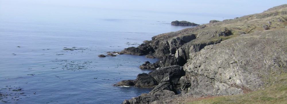
On our way back to the ferry in Sidney, we made a few stops to smaller provincial parks. This one, Elk Falls, was a favorite–right outside Campbell River.
Elk Falls, falling.
Must…cross…suspension bridge over ridiculously deep gorge!!!
There’s a reason for those high side fences.
Returning home to the San Juans, we received a sunset reminder not to feel sorry for our vacation coming to an end.
Last week we finally made time to visit with our neighbors. They’re nice people–just like us, actually, only nicer. Because they’re Canadians. In fact, our neighbor IS Canada. British Columbia, to be exact.
The Mate and I were embarrassed to say how little we knew Vancouver Island and the smaller islands between it and mainland British Columbia…given that we can literally see the nighttime glow of Victoria from our house, and on clear days, the mountains of the big island’s center.
In the past eight years since we moved to within viewing distance, we have been to Vancouver Island exactly ONCE. Just to Victoria. Yes, we took our kids hiking on the West Coast Trail, but that was TWENTY YEARS AGO. And yes, we once visited friends on Denman Island, but that was THIRTY-TWO YEARS AGO.
We were overdue for a visit.
As followers of Wing’s World know, my blog only occasionally morphs into Travel Blog mode, and even then, not the kind of travel blog with tips and descriptions of where to find the best artisanal meal. Over the next few posts, I’ll simply share some pictures and brief descriptions, and leave it to you to decide if you feel inspired to visit where we’ve been. Please do let me know if you’d like more specific recommendations about places to go or stay.
Up first: Quadra Island.
To get there, we took the ferry from San Juan Island (next to our Lopez) to Sidney, BC, then drove 3+ hours up the coast to Campbell River. Except for Mount Findlayson Provincial Park (with ENORMOUS old growth cedars and a salmon-spawning stream, right outside Victoria), this was a pretty dull drive, because we were beelining it on the inland highway. I’d recommend taking the slower coastal route…but we were in a hurry to get to the islands.
Campbell River itself? Not as cosy as its neighbor across the sound, Powell River, but it had its charm, including an excellent natural foods store, and this sculpture:
OK, Campbell River…creepy, but cool.
The ferry to Quadra took 10 minutes, but we still saw a humpback on the crossing. (Didn’t grab my camera fast enough for that.)
We had planned to camp, but neither of the two big Provincial Parks there had car-type campgrounds, and we weren’t set up for backpacking this time. The Heriot Bay Inn’s campground was WAY too sardine-packed for our taste (a tent between 2 RVs just doesn’t conjure up that camp-y feeling). But we were able to get a cute little room in the 100 year-old building…
…that came with its own cat.
Hard to take selfies with an ipad, turns out.
Our first two days of hiking were sunny, but also smoky from the many forest fires further north. Quadra’s beaches reminded us of ours…
Interesting note: no anemones in the tidepools, but lots of oysters!
…as did its giant, moss-covered hummocks rising out of forest.
Not pictured: me taking a skinny-dip in that lake back there!
When the rain came, it was very welcome, as it chased away all that smoke and (we trust) also helped the firefighters win their fight. The wild, wet coast felt familiar and exotic at the same time.
Ahhhhh…
Smaller than our Salish Sea ones. Typical? Unusual? Don’t know.
But this fir tree was in a class by itself.
They call this the Octopus Tree. Wonder why.
One of our favorite spots, on the southern end of the island, was Rebecca Spit, a day-use only park that is probably bustling in summer. But for us, on a sunny September day (which just happened to be our 31st anniversary), it was peaceful, and picnic-perfect.
Lovely place for a stroll, eh.
And then there was this guy on the road-paving crew near the inn, with his buddy, all vested up for safety:
Our kind of island, Quadra.
Next up: Cortes Island! (If you think Quadra’s quirky…)