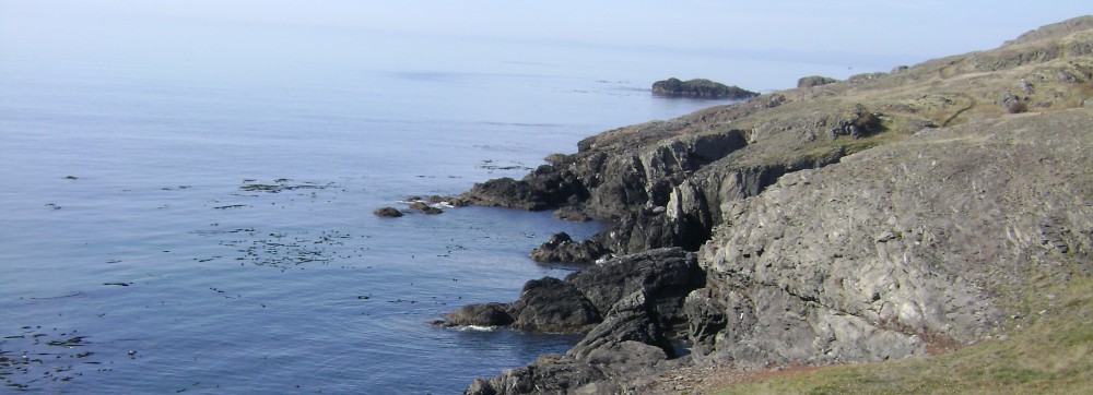
As I described last entry, we survived 40 degrees Celcius–that’s 102 for us!–in Jalpan by hiding out in its clear blue oases. But there weren’t enough of these within a reasonable drive (on unreasonable roads).
So we decided to spend out last 2 days (1 night) where we started, in Tamasopo.
Aquí
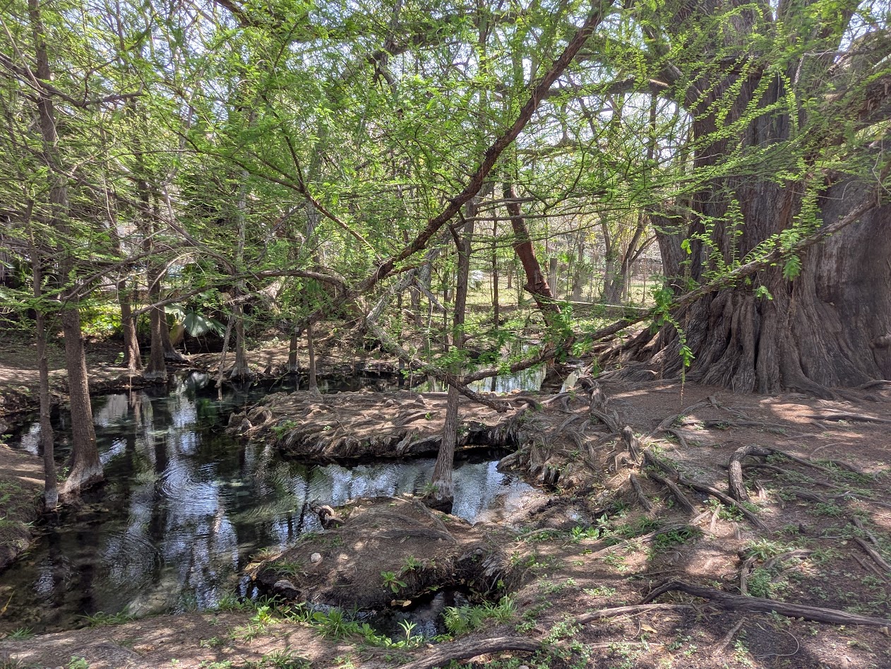
We had a couple of adventures getting back there–one on purpose, one not. The purposeful one was a visit to a tree Hijo Dos had found mention of online: a 1,000 year-old cypress, in a small town right off the main highway.
1,000 year old tree? Sí, por favor.
We were not disappointed.
If this thing looks big, please know the picture doesn’t come close to showing how MASSIVE this ancient goddess is. And since cypresses are deciduous, we got to enjoy the sight of this building-sized tree sporting tiny, fresh baby leaves. Circle of life!
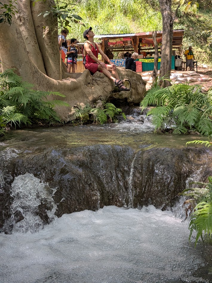
El Arbol Milennario’s secret, I think, is this spring, right at its base. This part was fenced off (luckily), but I was able to sit in the clear water just downstream.
Adventure #2 was Google’s fault. Well, maybe it was ours…for taking the route as Google directed, even though the road appeared not to have a name. It started nice and paved, but when it abruptly turned to rutted dirt, it was too late to turn around.
At a maximum of 15 mph, I had plenty of opportunity to take cactus photos out the window.
Luckily we got through 45 minutes of potholes without damage to the car, and after regaining pavement, we were back in Tamasopo in no time, and back in that incredible river.
Miss you already
Early next morning, Hijo Dos y yo paid one last visit to the Puente de Diós we’d first met the week before. But there was a guide nearby, so no illegal swimming this time…plus it was a little chilly anyway.
Miss you too
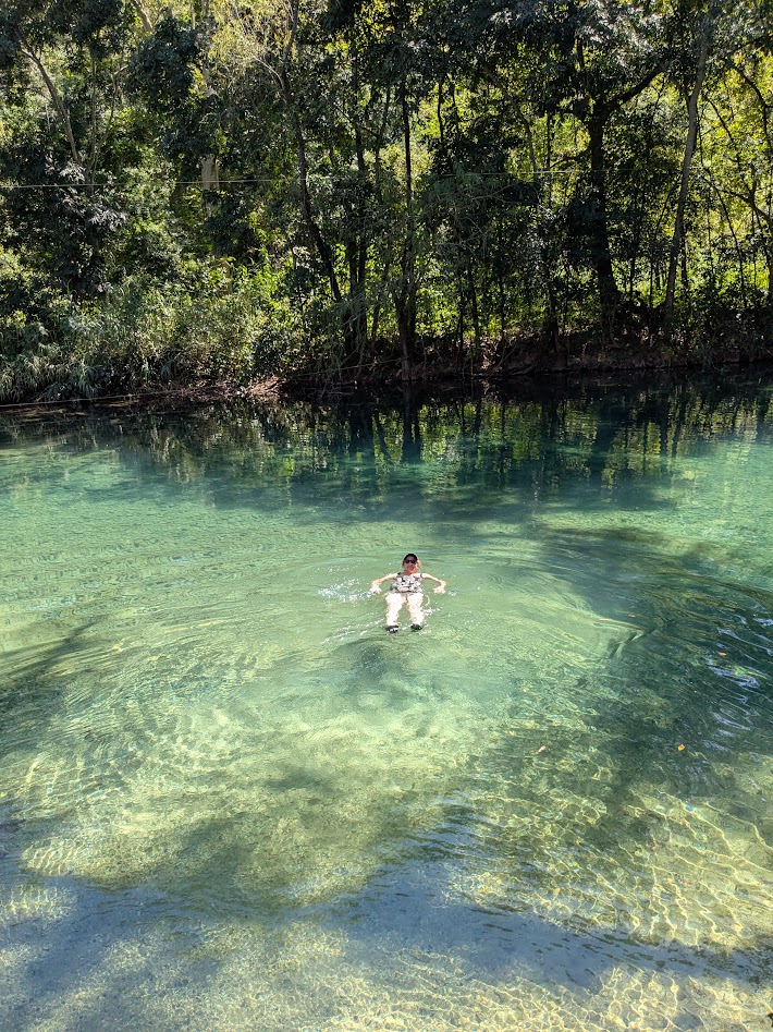
Next morning, on our way back to the city of San Luis Potosí (as opposed to the state of the same name…it’s not that confusing; just thing New York, New York), we stopped at one more aquatic wonderland still on our list: El Trampolín. I’m still baffled why it’s called this, but…
…honestly, who cares? This photo is now my computer’s wallpaper.
A lazy part of the same blue river that starts at the Puente de Dios, El Trampolín has the added feature of being PUBLIC. No entrance fee, no guides, no nothing…just hop on in and float!
And look up at the Spanish moss while doing so.
The only disadvantage to the public part of this gorgeous oasis was…garbage. Not a ton, but enough to be noticeable. And disappointing. Sometimes people suck.
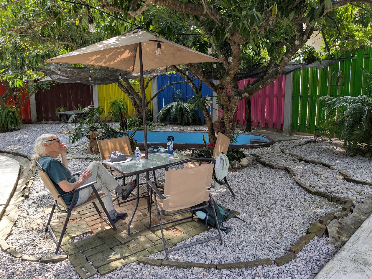
Back in the city of San Luis (or the outskirts; after all our beautiful blue-green experiences, we weren’t in the mood for touring a hot city), we took ourselves out to dinner at a place close by our airport hotel. Hijo Dos picked it out. “It’s famous for grilled meat,” he said.
If you’re thinking, “Wait–is The Mate eating a cheeseburger??” you are not wrong. What a gringo! (But he said it was one of the best cheeseburgers he ever had. The he helped me and Hijo Dos eat the big meatpile)
Next day we were up EARLY, flying back to Dallas. (My seatmates were two lovely women going on their own, Northern adventure; I had the pleasure of apologizing to them for my current wretched government.) In Dallas we said Adios to Hijo Dos, who flew back to Seattle, while we flew on to…
…guess where?
Here’s a hint.
But before this travel blog switches gears, can I just say this about the part of Mexico we saw? The people were LOVELY. The food was DELICIOUS. We felt SAFE. And we still feel humbled to have spent such happy time in a region that no one in the U.S. seems to have heard of.So…thank you, Aussie bloggers, for steering us there!
Next week: back down on the farm with the fam. Thanks for traveling with me!
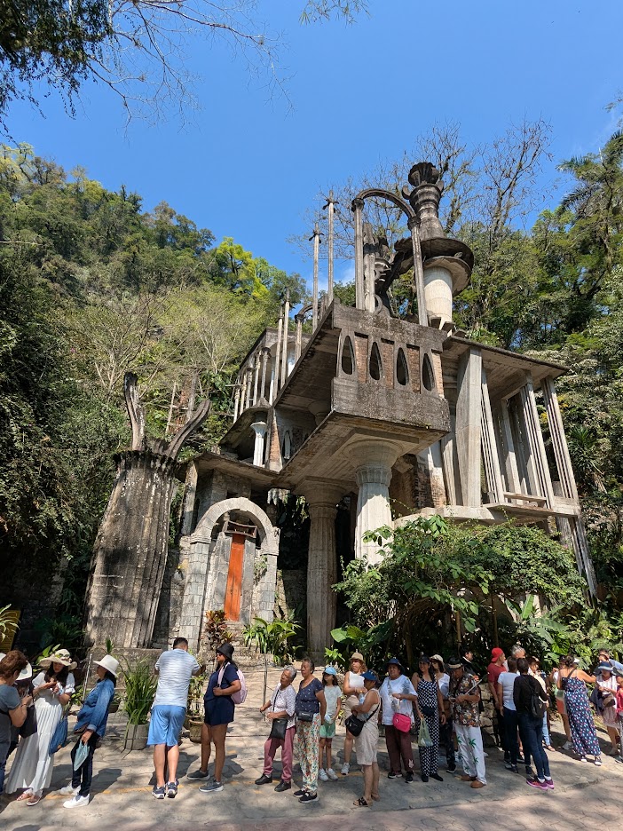
Leaving the blue waters of La Huasteca Potosina would have been hard, except that we were looking forward to new wonders. Starting with the town of Xilitla, which is famous for the Surrealist Gardens built by an eccentric Englishman almost a century ago.
Eccentric enough for ya?
Since we don’t enjoy standing in line, we decided to view the Gardens from the outside, which was still pretty cool.
Very M.C. Escher. But you aren’t allowed to walk in it, so…I’m not sure we missed much.
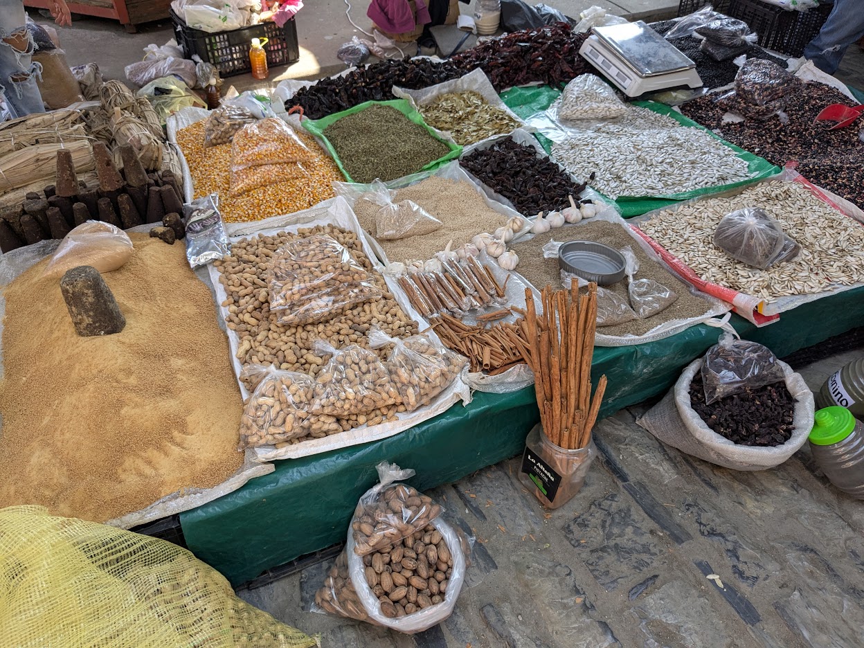
Instead, we spent a happy hour meandering through the main town of Xilitla (pronounced Hee-leet-la), which was as colorful as Aquismon, with an even prettier hilltop aspect.
It was a market day–even more colorful!
I found myself wishing I’d brought a bigger suitcase.
That sandy-looking pile on the left is brown sugar, ground from that dark cone in the middle. Mmmm!
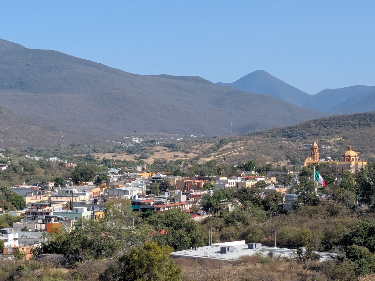
Since there were no hikes in Xilitla, we hadn’t made reservations there. So we pushed on, crossing over into the state of Queretaro. To my dismay, while the mountains grew taller, they also grew drier.
And browner. Oh dear.
The main town, Jalpan, looked pretty enough, but…where’s all the green I expected?
Anybody see any waterfalls?
This new landscape worried me, given the weather forecast. It was supposed to be in the 90s our first day, followed by 102. That’s too hot for hiking! And too hot for anything else. I began to wonder if I’d made a mistake, bringing us here.
Our only neighbors: hummingbirds, doves, and a group of camping high schoolers.
And walking into town that night, we were equally cheered by Jalpan itself: another well-named Pueblo Mágico.
town plaza
Jalpan went all-out for their “Magic Town” designation, seemed like. Not only was the plaza decorated…
Ay, que precioso
…but each side alley had its own colorful theme.
Why can’t we do this at home?
Oh, and the church wasn’t bad either:
The front is intricately carved. I really should’ve taken close-ups. But you get the idea.
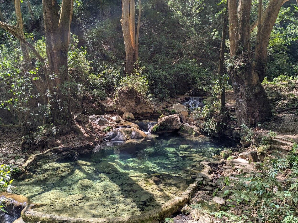
So Jalpan itself stole our hearts. Still, I worried: are we really going hiking in 98 degrees? Turns out, I wasted a good worry. La Sierra Gorda is all about hidden mountain oases.
Ahhhhhh…
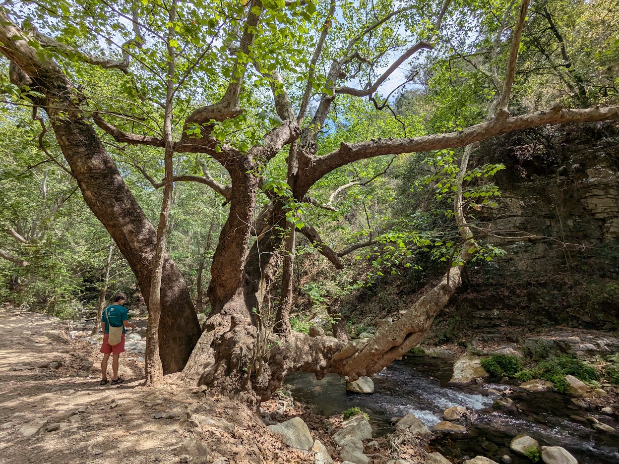
Our first hike, along this creek, featured all the blue water we’d been missing. And big ol’ sycamore trees…
And yes! a waterfall.
Let me zoom in a sec on that fan of rock…which, understand, is CREATED by the water itself–a fan-shaped stalactite.
I’m a fan of stalactites, myself!
One wasn’t allowed to swim in this pool, as it’s a habitat for highly endangered axolotls. (Which we didn’t find.) But at the end of the hike…
¡¡¡SÍ!!!
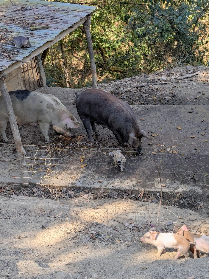
Oh–and another reward: highly cute piggies at the trail entrance.
Even cuter in the video.
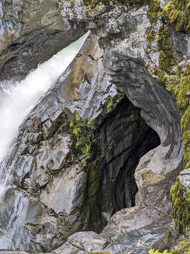
Buoyed by our first oasis experience, we ventured out on Day 2…the 102-degree day…with high hopes for lower temps in another cool oasis: El Puente de Diós (Sierra Gorda version, not to be confused with the one in Tamasopo). This hike is famous and sensitive enough that we were required to hire a local guide. And this time, we were also rewarded beyond our wildest expectations.
The hike started similarly to the day before: clear stream, big trees.
Hola, Madre
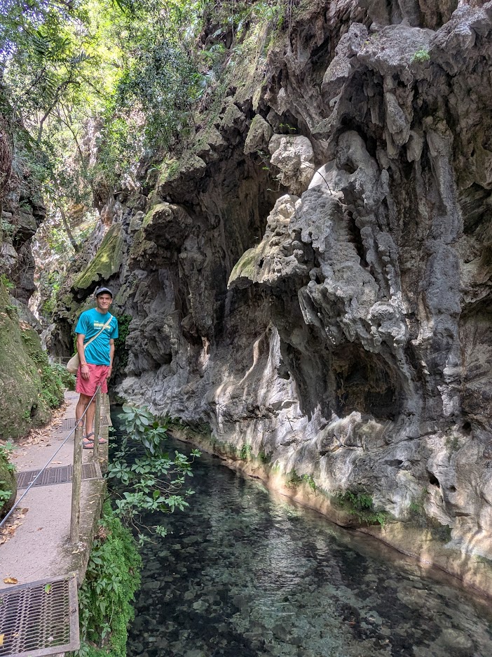
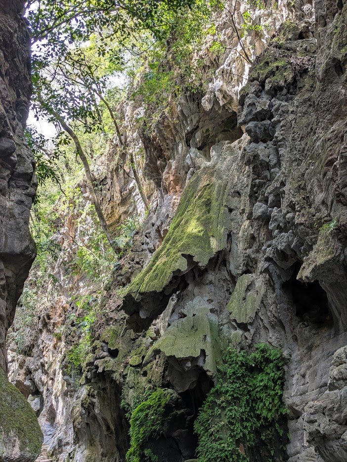
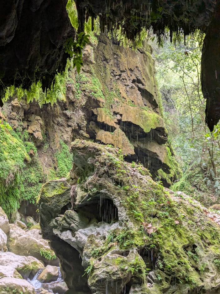
But soon enough the canyon narrowed.
Keep an eye on that fluted-looking rock, above.
And narrowed further.
Notice that some of those stalactite fans have broken off.
We didn’t realize it at the time, but those rocky fans on either side of the canyon are growing closer to each other with each drop of water than pours down.
Closer…and closer…
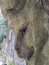
Soon we would see just how close those rocky sides could grow. But first…fun with rock faces!
I see a baboon. What do you see?
Soon after this stretch, the canyon opened back up…
…and we started hearing a waterfall roar.
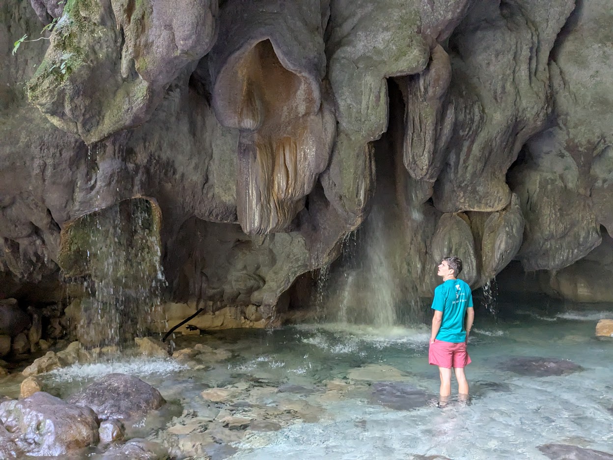
But not just any waterfall. This Bridge of God was…
…awe-striking.
Can you see what happened here? The two sides of the canyon “grew” together, millennium by millennium, drop by mineral-laden drop, to connect into this bridge.
But the most incredible view was from underneath. Here’s looking THROUGH the bridge…
Oh, did those drips feel good!
…but here is looking UP…into the bridge’s belly.
Or whatever body parts you want to call these.
Imagine a roar too loud for conversation.
Hijo Dos noticing that some of God’s pipes seem to be blocked. (You okay, Madre?)
Our guide assured us the water was safe to drink; we took him at his word.
How could you NOT?
No need to swim at God’s Bridge; we were fully cooled by our own awe, all the way back down the trail. Oh, and our guide pointed out this tree, which he said was 800 years old.
Again: we saw no reason not to believe him. Gracias, Ricardo.
On the drive back to Jalpan, as coda to a perfect day, we stopped at the tiniest little lunch spot off the road, run by the tiniest little woman, Doña Mary.
Her kitchen was about the size of this table.
No menus; our host simply narrated what she’d cooked that day. Something she mentioned sounded to me like “little mushrooms” (honguitos), so I asked Hijo Dos to inquire. Turns out she served something called Huitlacoche, which Google told us later is “a fungus that grows on corn kernels, forming a blue-gray, tumor-like growth,” which is considered a delicacy.
It looked as disgusting as it tasted delicious.
You had me at blue-gray. Gracias, Doña Mary.
Approaching Jalpan, we watched the temp guage in our rental car climb and climb. I’d never seen 40 degrees Centigrade before! Let’s hear it for oases.
Next day, we decided to say goodbye to La Sierra Gorda. Most of it, we found, is inaccessible–a wonderful, thriving natural habitat, but not offering many more hikes than those we’d enjoyed. Not wishing to drive long distances on some INCREDIBLY twisty roads, we opted to spend our next night back in Tamasopo.
We ate brunch before leaving Jalpan next morning, where I tried one more ingredient new to me: prickly-pear fruit (in a burrito), which they call tuna or tunita.
Fresh, pretty…tastes a bit like okra, without the sliminess!
I just gotta say, Jalpan–you grew on us, big time.
“Oh, alright…I’ll get back in the car…”
Next up: last days in the blue waters, and giant Meatpile! Thanks for keeping me company.
I’ll be honest: I’d never heard of a Pueblo Mágico. Apparently it’s a special designation conferred in Mexico by the government–though state or federal, we never learned.
All I can say is: Aquismón fits the bill of Magical Town.
You could quibble with the colorlessness of their sign…but the rest of the place made up for that.
Word of warning. You know those really talky blog posts I sometimes do? This one isn’t that. I have pics to share!
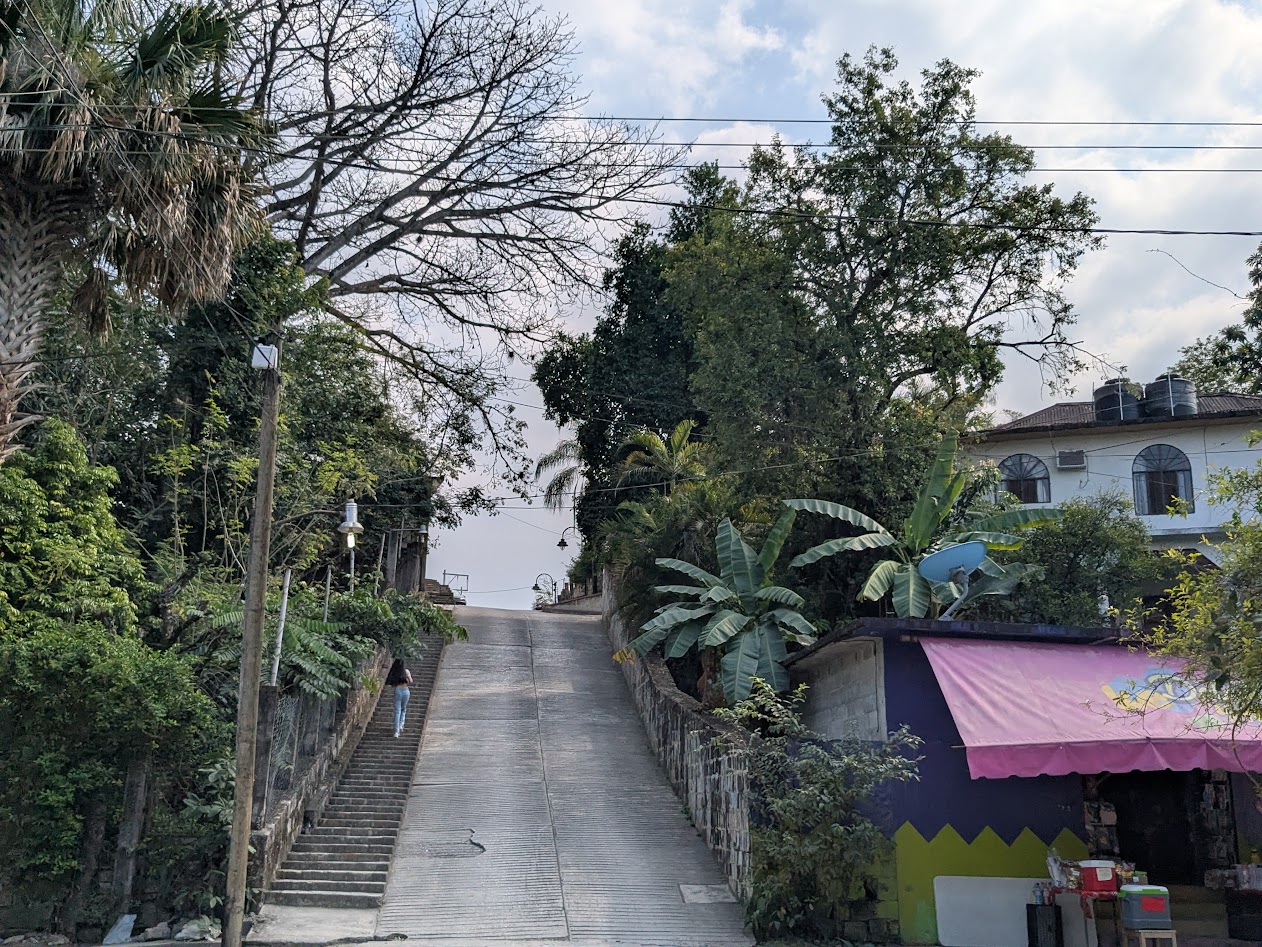
Like this one, showing how picturesquely steep the village streets are.
Our first day there, all I really did was walk around and revel in the beauties of the place.
If my neighbor HERE painted their house like this, I’d hate it. But here? Fits right in.Ditto. And you gotta love that hillside behind.
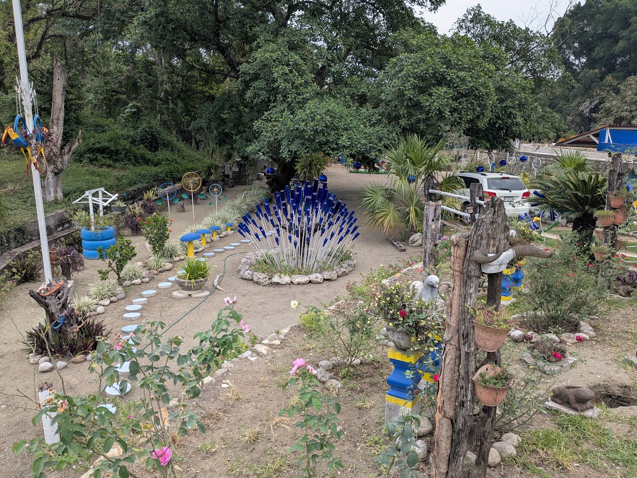
Not only the houses, but the yards themselves spoke of people who loved color and design.
Yes, that is a “bush” made of deep blue glass bottles! (Ukrainians would love this backyard.)
Oh, and the gardens???
Nothin’ much…just your average 4-colored bouganvillea vines…
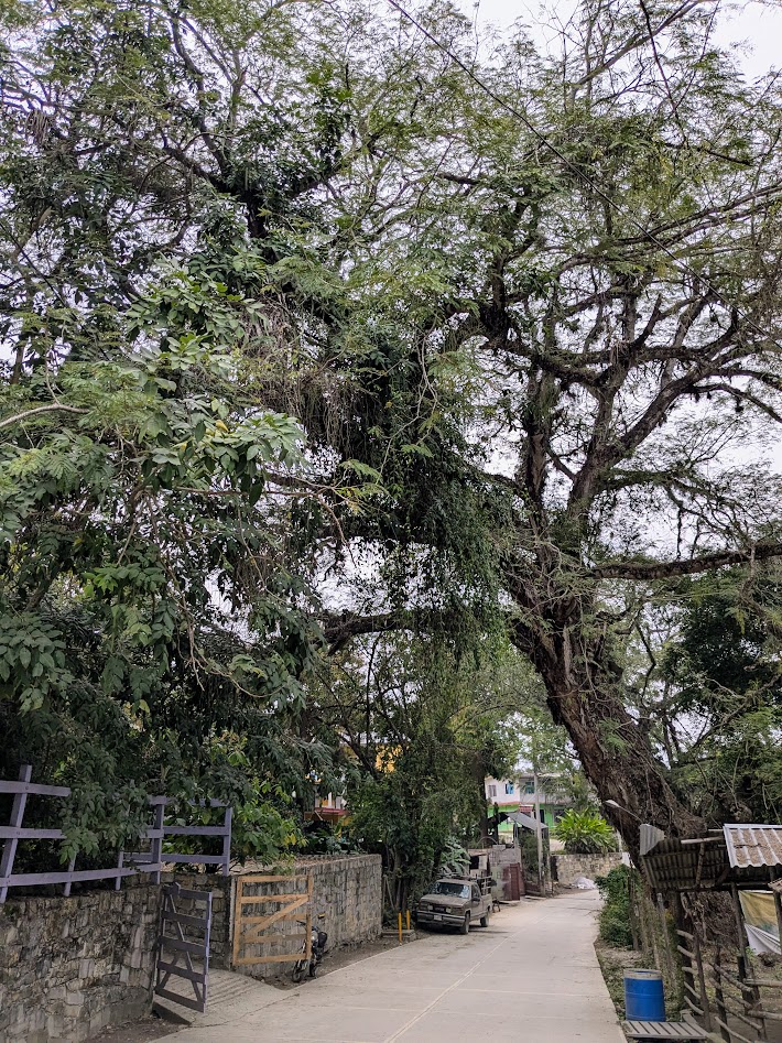
Carved out of the base of the jungly cliffs of the region, the village still hosted what looked like some magnificent old growth.
Hola, Guapo Viejo.
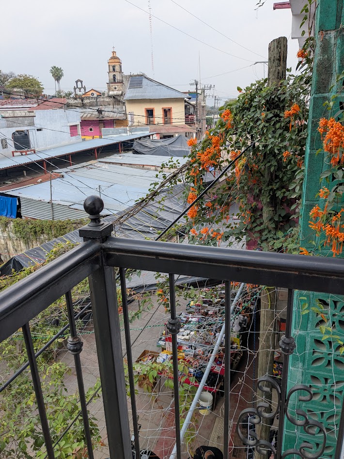
We stayed one night in one teensy little hotel, directly above an alley bustling with vendors…
…and two more in another small place, even more modest, with a very sweet courtyard. Pretty sure we were the only guests in both.
Again with the color!
The tree shading El Esposo in this picture was bursting with blossoms. Hijo Dos assured me that, yes–that’s a mango tree, meaning that these…
…are actually the TEENSIEST baby mangoes ever!
You could tell that the citizens of Aquismon had a lot of pride in their village. I saw zero trash, and this sign on a public wall explained why:
“If you have culture and pride, don’t litter”
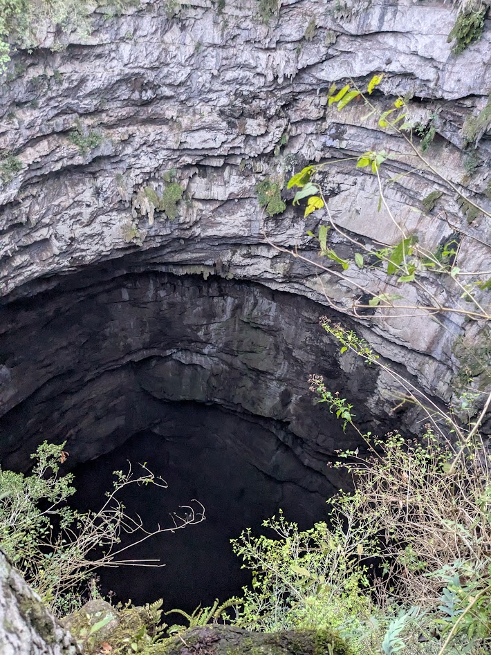
We made two excursions from Aquismon. The first involved getting up before daybreak, and driving up, up, up a twisty road into the mountains behind town…in order to walk down, down, down 600 steps to a giant hole in the ground.
This.
Not just any hole, though. This is El Sotano de Los Golondrinas, literally, Cellar of the Swallows.
Photo courtesy of Hijo Dos, who got himself roped up to peer into the depths from the edge. Eek.
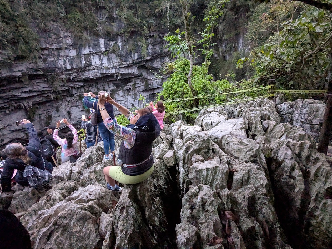
Gazillion birds spend the night there, and at daybreak, come swirling out again. If you’re lucky. Sometimes, if it’s cloudy, they decide to sleep in, and you’re left just staring at their giant hole. Which is, admittedly, pretty cool: 1600 feet deep (512 m); the deepest cave shaft in the world, and the second-largest cave in Mexico.
Fellow tourists waiting to photograph the birds. Not a very comfy seat, that limestone.
We were semi-lucky: enough birds swirled out for us to be able to ooh and ahh and call it a swirl (though not exactly sky-blackening).
And now…back up those 600 steps!
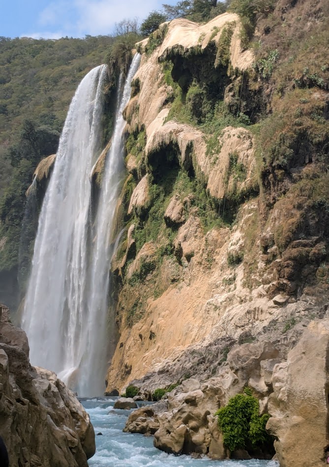
Next day’s excursion was a little further afield: Cascada Tamul, the highest waterfall in the region. We learned we could either hike to it–with instructions that sounded a bit iffy for folks like us with rental cars and bad knees–or rent a spot in a lancha and paddle up toward it.
We chose the lancha, with a half-dozen fellow tourists, from Mexico City.
The trip wasn’t far, maybe 30 minutes of paddling, but it started spectacular and stayed that way.
We all got out and walked around as our boat captain hauled the boat over the only rapids on this stretch.
When we got to the actual falls themselves, so many other boats were there, full of people taking photos, it was actually an anticlimax.
A very pretty one–don’t get me wrong. And imagine what it looks like at high water season!
Truly, though, I was more captivated by the journey than the destination. Especially the fluted limestone…
…which I couldn’t stop taking photos of. Even though I was supposed to be paddling.
Such shapes! Such colors! OK, you get the idea.
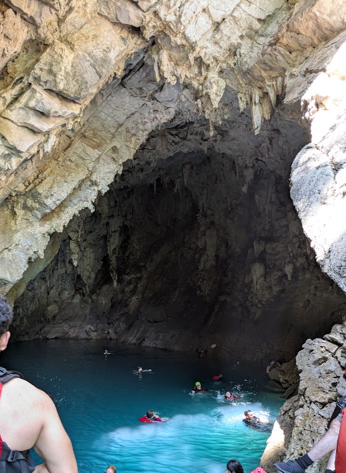
But probably THE COOLEST part of the excursion was the Cueva de Agua (Water Cave) we stopped at on the way back downstream. Our captain pulled the boat over to let us all troop up some rough steps, then even more steps, up the bank…
This isn’t the river. Where’s all this water coming from??
…to this. Exactly as advertised: it’s a cave full of water sprung straight up from the earth. And warm.
Just don’t think about any of those giant stalactites dropping on your head.
I wish, oh how I wish, we could’ve seen it without anyone else there, as we did the Puente de Dios at Tamasopo. But being part of a group, we didn’t have a choice. Luckily folks were nice, and gave each other plenty of space in there.
Afterwards, waiting for everyone to have their swim, we enjoyed sitting in the cascading creek from that magical cave.
I am LITERALLY sitting in this waterfall pool to take this photo of Hijo 2.
This photo of that creek pouring into the river captures the whole experience better than I can describe.
But, lest you can’t quite believe what that photo is showing, here’s the same waterfall, looking up from the river.
(with El Esposo’s hat in the lower corner)
And one more:
(I did warn you about the pics)
Back in Aquismon, I walked around some more, soaking up that cute little town. I even found a few ugly things, like these drying intestines at a carniceria (butcher’s):
…but for intestines, they’re still pretty cool-looking.
But the sunset from our hotel balcony was right on brand.
Buenas noches…
Next up: Jalpan (another Magic Town) and La Sierra Gorda. Thanks for traveling with me!
Let’s take a break from waterfalls for just a sec.
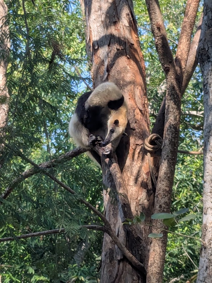
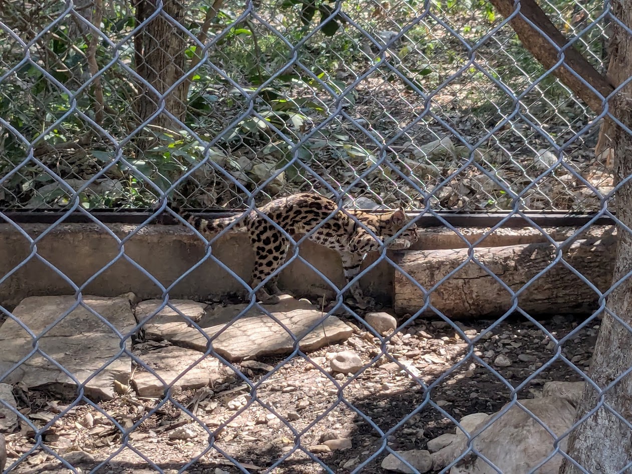
That’s what El Esposo, Hijo Dos, y yo did on our fourth day in La Huasteca Potosina. Because sometimes you just need to stare a jaguar in the face.
Or a tamandua: an anteater–with the coat of a skunk, the charm of a sloth, and the agility of a monkey
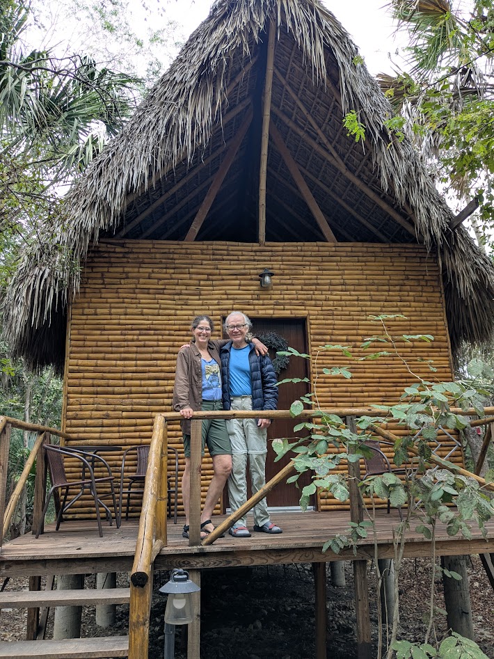
After reading about Selva Teenek Ecopark in the blog I consulted for our itinerary, Sallysees.com, I immediately booked us a night there. Turns out Sally knows her way around wildlife rehab facilities endowed with gracious hospitality, as well as she knows waterfalls.
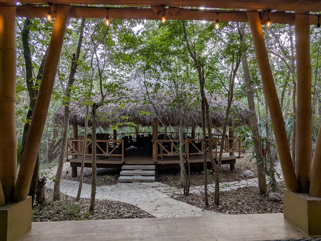
The whole place was built in traditional-looking Huastec (or Teenek) style
As soon as we arrived, our host (and co-owner) Eduardo met us in a structure like this to go over expectations–stuff like no wandering off trail; nighttime feeding of the carnivores happens at 8:30 pm; oh, and coffee or tea for breakfast? We learned we were the only tourists staying there at the moment (ooh, a private tour!), but that there was a large contingent of conservation biologists on site for classes. Turns out Selva Teenek (pronounced Teneck, meaning Jungle of the Huastec people) is no cheesy “come pet a creature” place, but a beacon of true wildlife rehab and conservation.
They just happen to be very good at taking care of people there too.
Before the special nighttime tour, we were given one in daylight, featuring some VERY cute rescued margays.
Basically a teeeeeensy little leopard! (Fun fact: my aunt once kept a pet one. Don’t tell.)
The focus on the Teenek/Huastec people was as striking as the animals. This mural in the open-air dining area, for example, which cracked me up because…
…can you see it? My Mate’s legs almost look like they go with the girl on the wall! (who looks like she’s spray-painting my head)
But no lie–we were there for the animals, especially the two big cats on the nighttime feeding tour. The puma (who’d been raised as a pet till that idea went sideways) greeted her keeper by walking back and forth, tail high, purring like…well, like a big cat. I didn’t bother with a picture because, honestly, it was the purring part that was really striking.
But the jaguar? That girl was NOT tame. She appeared out of the darkness, into the keeper’s red light…and CROUCHED. I’d never felt like prey before, but those huge eyes glaring from a few feet away…they made me very grateful for that fence.
What’s really missing from this photo: the CRUNCHING sound as she chomps bones
We did, in fact, visit a nearby waterfall on our way in, Cascada Micos. I couldn’t take a very close-up photo because we had to SWIM to this one.
Believe me, those falls are farther away than they look! Hijo 2 & yo swam to that little island which, yes, somebody had actually decorated with a heart for Valentines Day (sigh)
I don’t know if anyone reading this will ever actually get to La Huasteca Potosina, a region toured mostly by folks from Mexico City. But if you do…definitely spend the night here! And tell Eduardo (and his jaguar) we said Hola.
Next post: More blue water…and caves! And caves full of blue water!
Sometime this winter The Mate allowed that he wouldn’t mind a little break from splitting firewood and running our wood stove. So, with our family obligations cleared, our thoughts turned to Mexico, where lately it seems a good half of our (retired) acquaintance has been sojourning in the cold months.
Can’t imagine why.
When it came to Mexico, we quickly found out our knowledge fell into two categories . 1. Things we don’t know about Mexico: almost everything 2. Things we do know about Mexico: any place where we are likely to meet lots of fellow Americans is a place we don’t want to visit right now.
With that in mind, I bought a Lonely Planet book and started checking out regions. That’s when La Huasteca Potosina and the Sierra Gorda caught my eye and held it. I started doing some reading, and stumbled onto the most helpful travel blog I’ve encountered, written by an intrepid pair of Australians. Sallysees.com helped me create my own itinerary, and I strongly recommend their blog for many areas of Mexico and some other places they’ve traveled.
Wherever THIS is? I want to go there.
Following Sally’s advice, I planned to rent a car in the city of San Luis Potosi and drive a big circle. My Spanish has been improving, and I was looking forward to testing it.
Or I thought I was. But when Hijo Dos (Son Two), who’s fully fluent, offered to accompany us, I think I was relieved as my Mate in saying ¡Sí, por favor! So we all flew together from Seattle.
Luckily we all like each other.
Our plane got in late so we spent the night in a hotel near the airport, but next day we drove about three hours through increasingly impressive desert…
How do you say Joshua Tree in Spanish?
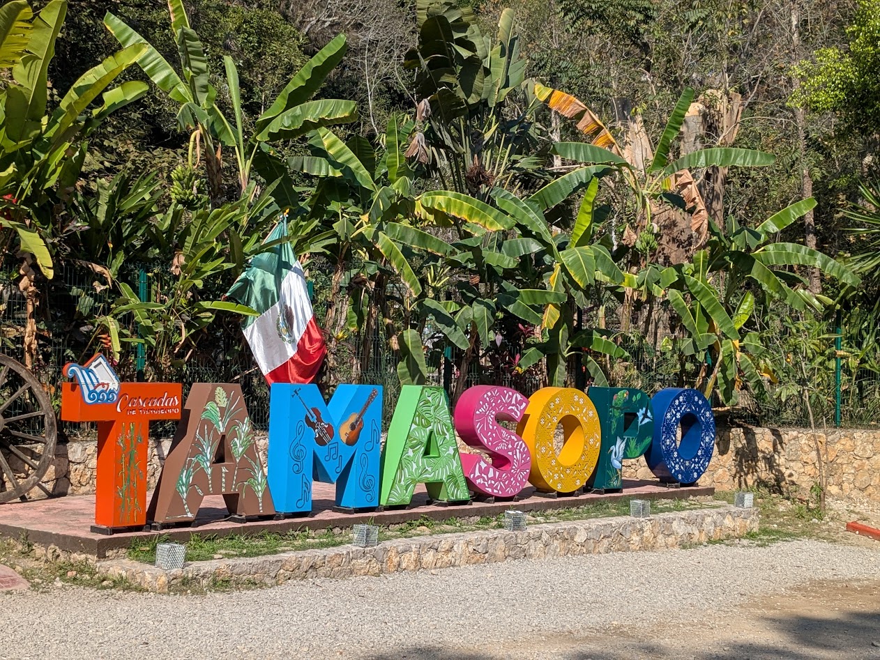
…to La Huasteca, a region named for the Huastec people, a place of lush, jungly green oases with magical blue rivers and waterfalls. Our first stay was the small town of Tamasopo.
Apparently these cute town name signs are a big thing now, and not just in Mexico. Instagram Effect?
The Rio Tamasopo ran right past our first accomodations–such a relief after hours of desert driving!
Lemme in there!Ay, sí….
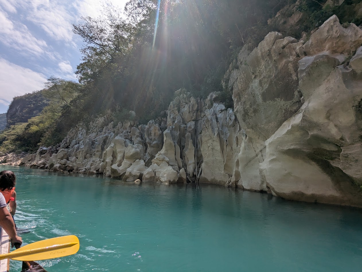
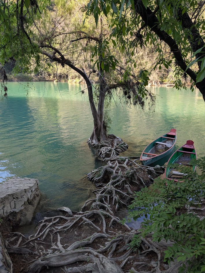
The cypress trees there are as impressive as the water; in fact, they shape the water’s flow with their roots.
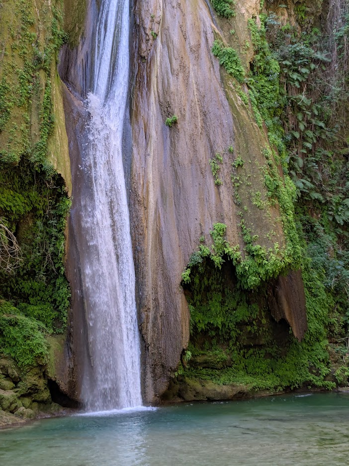
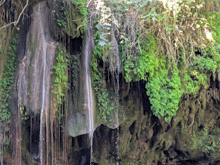
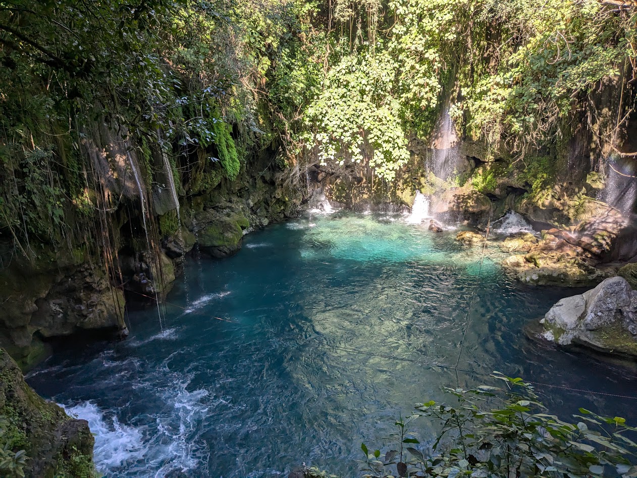
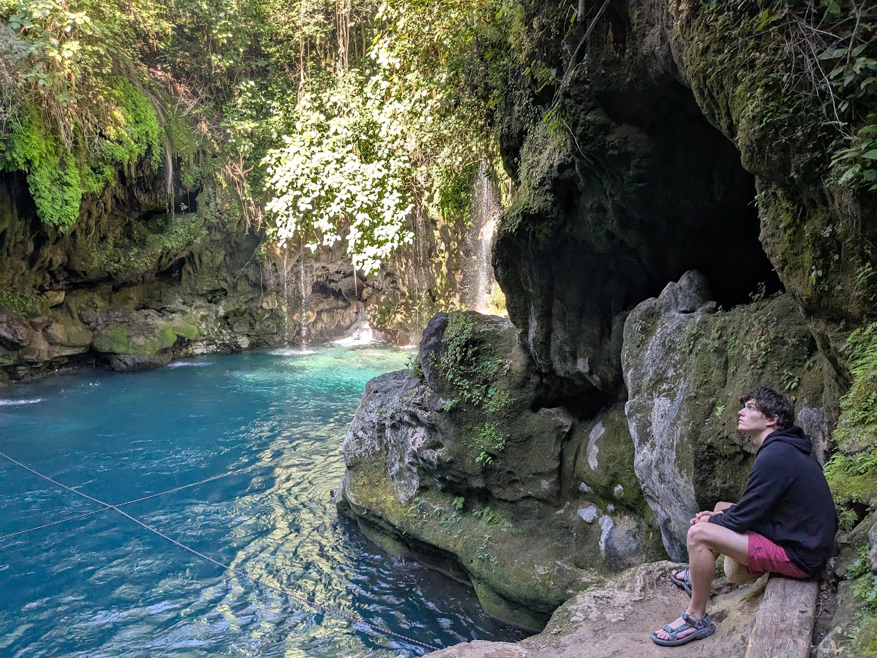
Another huge plus of our cabaña was its proximity to what could well be the top attraction of the whole area (except that it has so many competitors): el Puente de Diós (Bridge of God).
This
It’s less a bridge than it is a roaring waterfall which comes to rest in a magical, dark blue cenote—ringed by drapery of ferns and more tiny waterfalls—from which the river somehow disappears through the cliff and comes out the other side.
Those fan-shaped “rocks” are actually stalactites formed by the mineral-laden water over millennia.Bridge, no. Of God–yes.
Tourists can float through this underwater cavern with lifejackets on…
…watched over by a lifeguard in the world’s coolest natural lifeguard tower! (Note rope to help floaters exit)
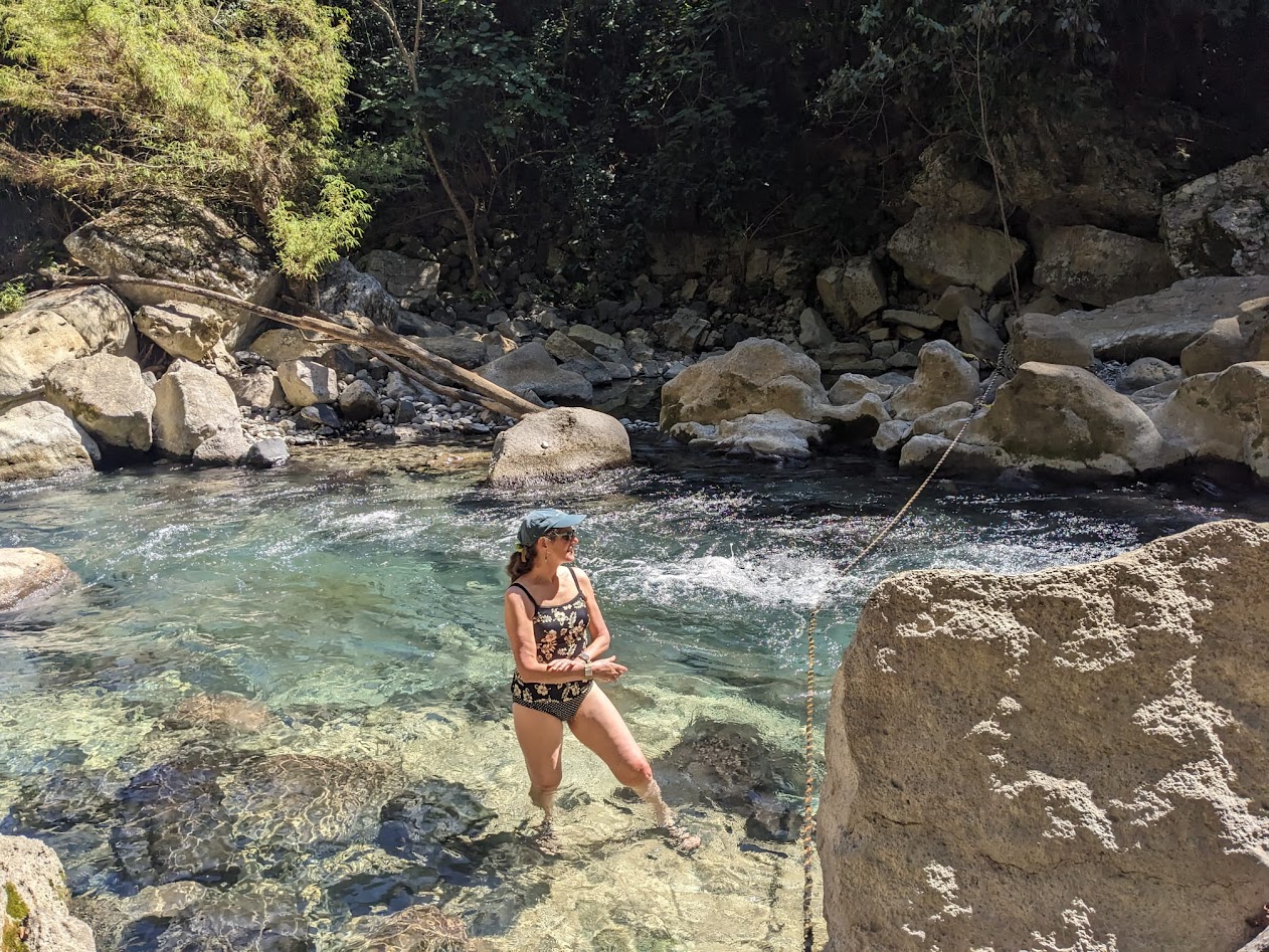
My family never opted for the boisterous-seeming life-jacket-cave-float option, preferring to hang out in the sunny water just downstream…
…and (Hijo Dos y yo) to sneak back in next morning before the guides and tourists arrived.
Being there alone with only the roar of the falls, steaming in the chill air, was magical.
He swam; I took pictures. (In my defense, it was a pretty chilly morning!
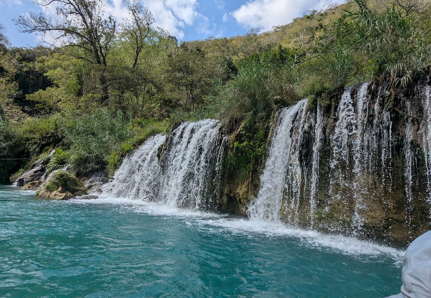
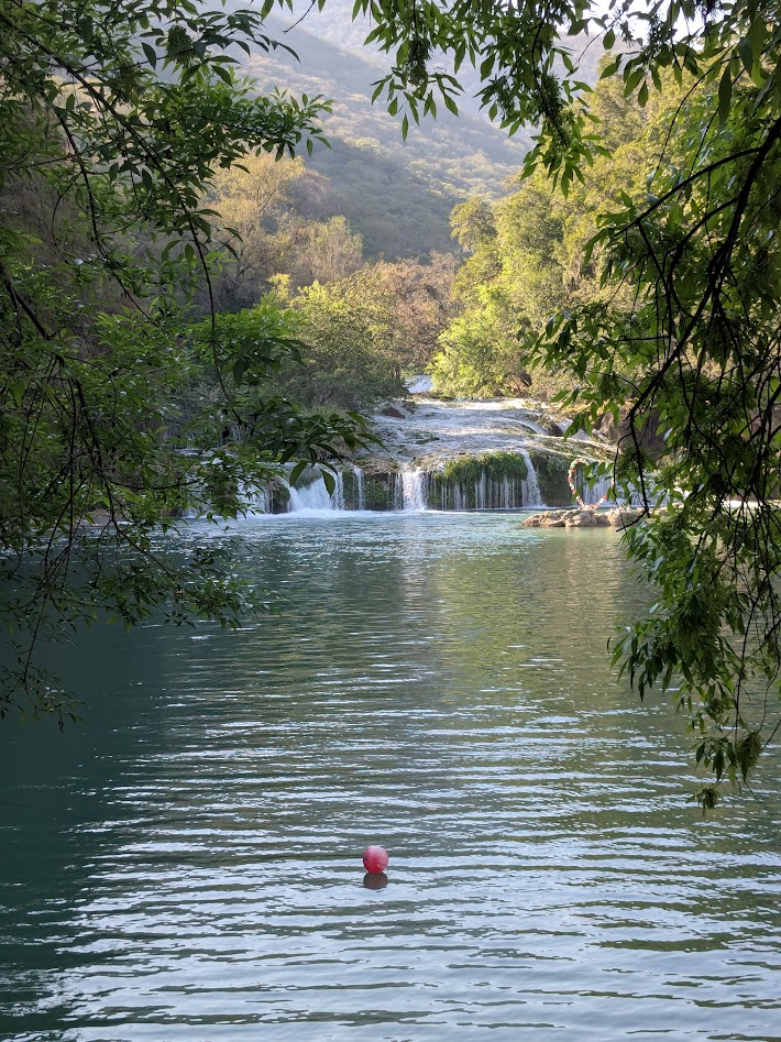
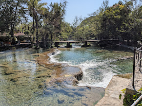
Another nearby attraction, just a couple of miles by car, were the Cascadas de Tamasopo. Having been warned by Sally’s blog that these falls had been curated into a kind of waterpark, we saved them for the day we left Tamasopo.
Note the jumping platform on the left. Salvavidas (life jackets) required for that.
Because we got there early we were still able to fully enjoy the natural beauty of the water without being too distracted by The surrounding eateries and lounge chairs.
This will definitely do!
Not exactly wilderness, but very well protected
Three days into our trip, we had yet to meet a single non-Mexican tourist. ¡¡¡Sí!!!
Vamos a volver (we’ll be back)
Next stop: the Selva Teenek Wildlife Rehabilitation Ecopark. Let’s see some critters!
The second half of our BC road trip reminded me of that old children’s book, “Fortunately, Unfortunately.” Except the other way ’round.
Unfortunately, the mid-part of BC that we had to drive through, East-West from Revelstoke to Pemberton, is very dry (which is why it’s so vulnerable to wildfires).
Fortunately, it’s also lovely.
Unfortunately, when we got to Pemberton, so did the rain.
Fortunately, waterfalls don’t care much about rain.
And I thought this hole was just as intriguing as Nairn Falls.Ditto for the mosses, and the river “potholes” in the rock!
Just above Pemberton is Joffre Lakes Prov. Park, which I’d heard was special, so I decided to make the drive up there. Unfortunately, this meant 20 miles up an evilly steep and twisty road. Fortunately, I learned ahead of time that you can’t even peek down the trail without an online reservation.
Oh…maybe that’s why the reservation?
Unfortunately, it was still raining. But fortunately, that meant fewer people competing for reservations, so I was able to get one. (And they’re free.)
Unfortunately, the hike is STEEP. But fortunately…I’ll let the photos do the talking now.
Middle LakeLil’ ol’ waterfall you pass on your way to Upper LakeFirst glimpse of Upper LakeHoly cow, am I looking right at a glacier?!Yep. Glacier. How else does that water get that color?
Unfortunately, I had to hike back down, and next day we had to leave BC and head homewards.
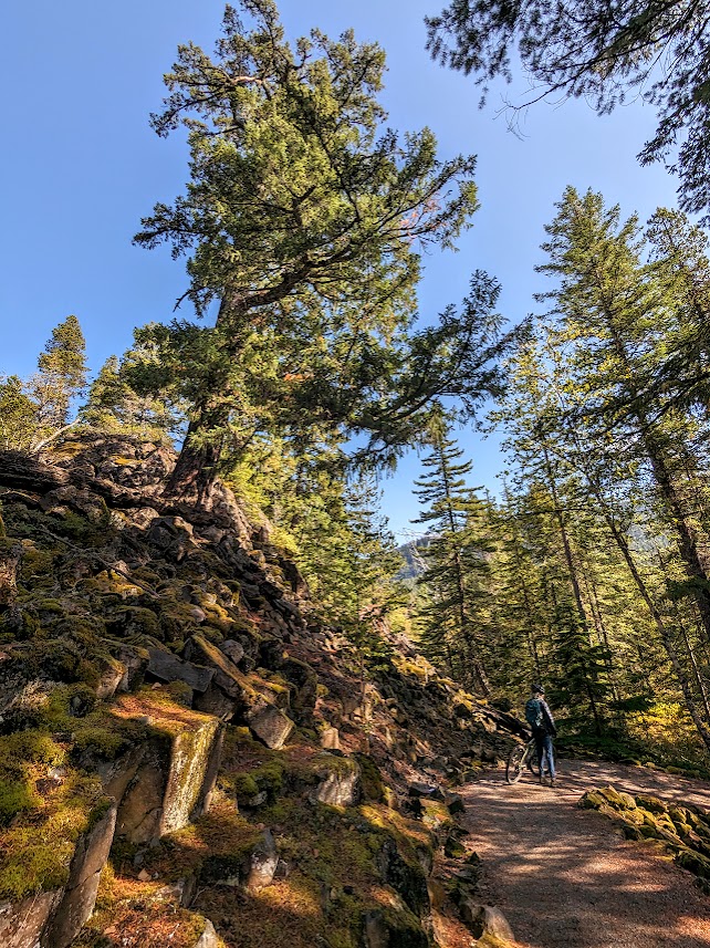
But fortunately, we hit a couple more pretty Provincial Parks on the way down Rt. 99, past Whistler, toward Vancouver: Brandywine Falls…
…which is also an easy hop-on spot for Canada’s exciting Sea to Sky multi-use trail.
Unfortunately the trail was a bit too steep and mountain-bikey for us,
but Fortunately walking your bike is good exercise…and it was still gorgeous!
Or make that “gorge-ous,” as in this one, which hosts a bungee-jumping bridge!
Unfortunately we accidentally drove past Garibaldi Prov. Park, one of the biggest in the province, because we didn’t think its raggedy access road could actually be the right road, and then turning around on the freeway got complicated.
But fortunately I got a nice consolation walk at Alice Lake, the definition of serenity:
So, yeah, unfortunately we finally had to leave “Beyond Compare” BC,
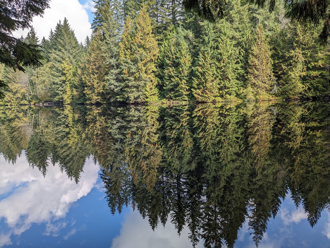
but fortunately I brought THIS image home with me, so I can transport myself with a glance…like right now.
O Canada–thanks for being! O BC–thanks for being the bestest, closest part to us!
I know you’ve had it a bit rough this last week, re-discovering your own racism and all. Welcome to the club. Gotta tell you, though–I still need to thank you for the ten days I just spent with The Mate, introducing my parents to your Rocky splendor. You may not be perfect, Canada (big surprise), but you’re still pretty stellar in my book.
Thank you for your waterfalls.
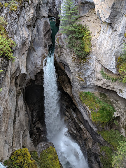
Like this classic: Athabasca Falls in Jasper National Park
Or this one, coming right out of a cliff face! (Jasper)
Another classic, joining the Maligne River in Jasper
Can you ever have too many waterfall pictures?
Thank you for your canyons.
Athabasca
Johnston Canyon, Banff National Park. (Even though it was so crowded there I stopped taking pictures.)
Even your dry canyons are awesome!
Thank you for waterfalls IN canyons!
Maligne Canyon. Got pretty crowded there too…but can you blame us?
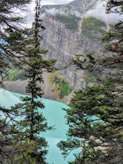
Thank you for the colors of your lakes.
The famous Lake Louise.
Lake Agnes in Banff.
The Inkpots, Banff.
Hard to tell where sky ends and water begins. (Jasper)
Can’t…stop..photographing…water!
Thank you for your glaciers, even though their shrinkage scares the shit out of us.
Athabasca Glacier, coming off the Columbia Icefield, is still making its own weather…
…but look how far the poor glacier has receded since we first visited in the early 80s!
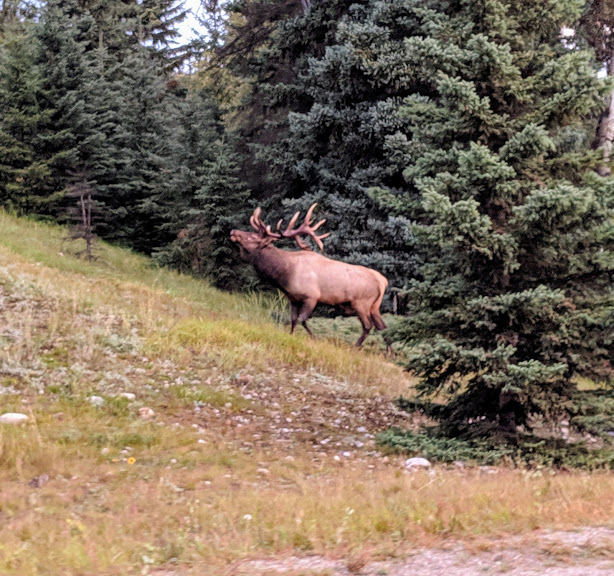
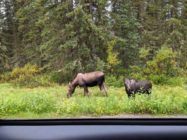
Thank you for your wildlife, even when it’s right beside the damn road.
Jasper traffic jam.
Big guy. I was hoping to see him fight another big guy, but he was too busy guarding his harem.
Moose are my FAVORITES. We saw four along just this one stretch of Maligne Road.
My second bear on this trip had me wishing for a zoom lens for my phone. Gotta work on that.
After the disappointment of seeing NO bighorn sheep in any of the parks, we met a giant herd on the very edge of the city of Kamloops! This is only some of them.
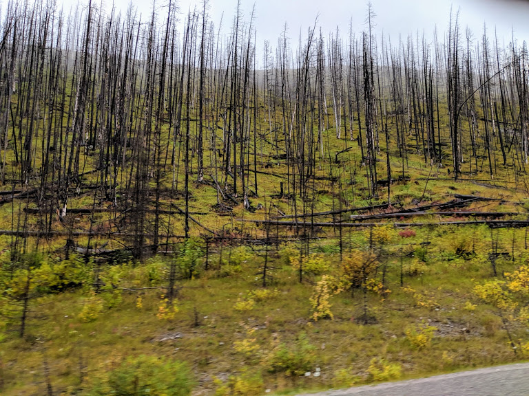
Thank you for the reassurance that, even when all your pine-beetle-ravaged forests do eventually burn, which they must…
(Yeah, pretty horrible to see–trees weakened by drought)
…Nature WILL know what to do.
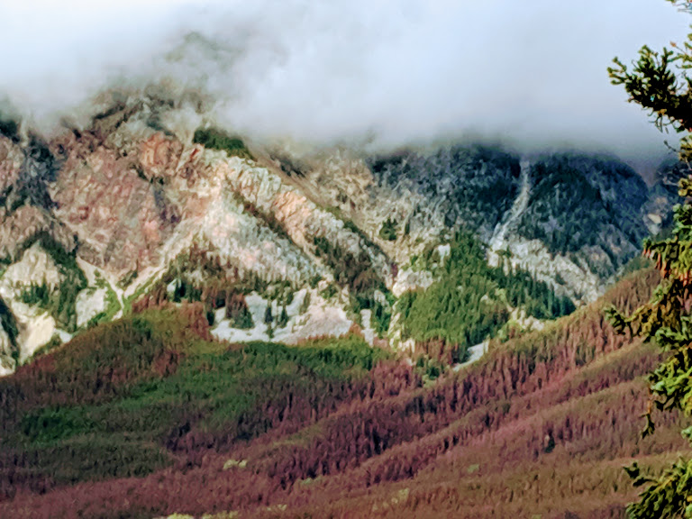
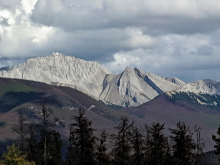
Thank you for your mountains, which are not like any other mountains I’ve known.
Maligne Range…rock from 600 million years ago, uplifted
But on second thought–thank you, too, Washington. Your mountains are no slouch either.
The Mate at Washington Pass Overlook
And for that matter…thanks for the reminder, Lopez Island, that I don’t NEED to go to Canada to worship beauty. (But thank the gods I can! And I wish some of it for everyone.)
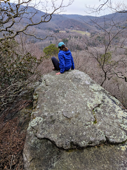
Consider this post a small gravel-chunk in the stretch of road that constitutes the travelogue of Road Trip IX. The Mate and I just spent four days and nights in Appalachian Trail country—northern Georgia, western North Carolina—and I want to capture my musings on these mountains before we arrive back in Tarheel Territory the Piedmont and give ourselves over to a week of screaming at the TV, eating BBQ and fried chicken, raising our arms for luck on free throws catching up with old friends over the ACC basketball tournament.
Amicalola Falls State Park, Georgia…near the southern terminus of the Appalachian Trail.
Fellow native east coasters, I must confess to you: since moving to Washington in 1990, I’ve become a horrible Western Chauvinist. One of those people who comments that the tallest mountain in the east—Mt. Mitchell, 6,683—comes up to less than halfway up our Mt. Rainier (14,110).
Shame on me.
Height doesn’t matter.
Four days of hiking and riding around the Appalachians has reminded me of this simple truth: you can’t compare them to western mountains.
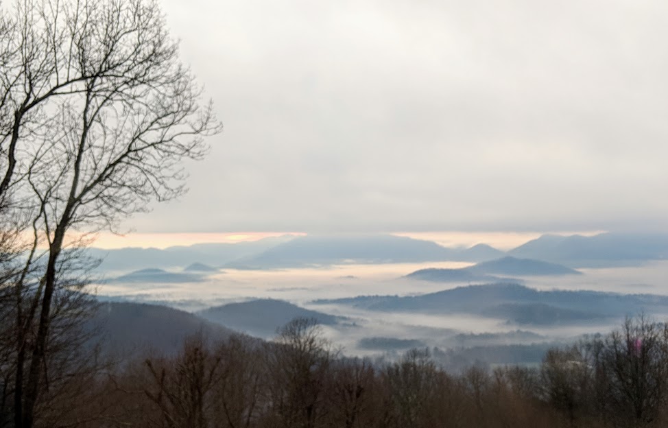
Western mountains are formidable ranges, awesome volcanoes, places of raw wilderness and dazzling danger. But the Appalachians are a sea.
Sometimes a sea of fog.
There are two reasons for this contrast, two interconnected reasons. The great age of the Appalachians has subjected them to forces of erosion and plate-stretching that have created mountains in the shape of waves.
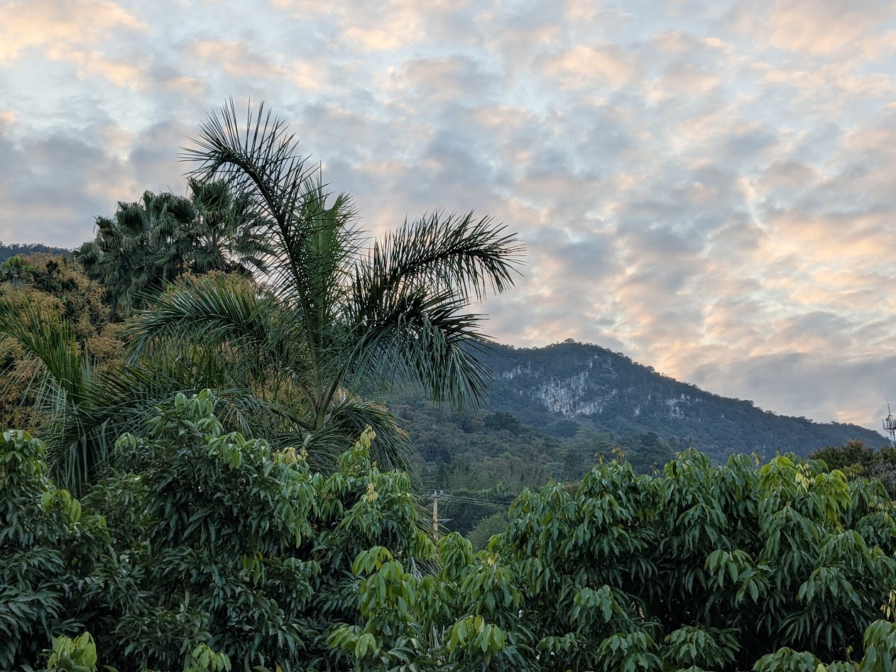
Waves at sunrise (taken through the window of Amicalola Lodge)
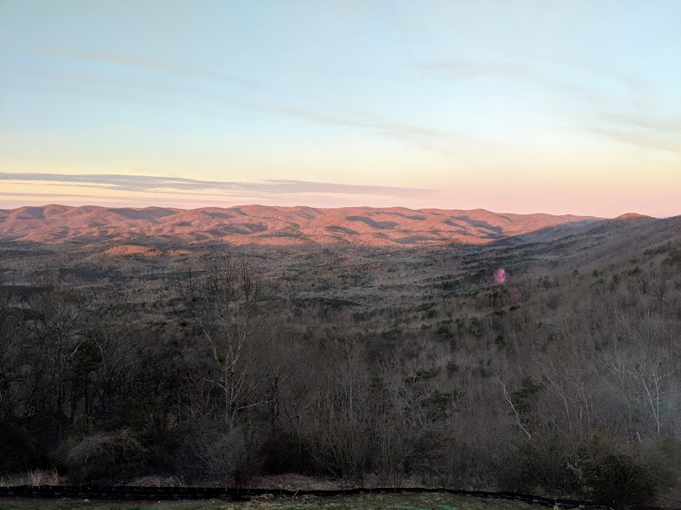
A wave is a crest and a trough. In the Appalachians, the myriad valleys and hollers are as much a part of the mountains as the peaks…because people can live there. They’ve been living there for millennia. Even European settlers have been there for over 250 years!
Waves at sunset
Of course people live high up in the Rockies and the Cascades, here and there. But the very steepness and height of those ranges rendered them inhospitable to permanent settlement back when Europeans first got there. That’s why they have no equivalent culture, identity, or musical heritage to Appalachia. (Sorry–John Denver doesn’t count.)
Here’s where I ought to have some pictures of good ol’ Appalachians doing good ol’ Appalachian things like playing bluegrass or drinking ‘shine. But since I wasn’t thinking about a blog post when we were hiking and biking and driving through, all I have is pictures of The Mate with some friends.
“Foggy Mountain Breakdown,” anyone?
So thanks, Appalachians, for slapping me upside the head with this reminder. If they’re lucky, all those gorgeous western mountains will look like you in a few million (billion?) years.