No, The Mate and I were not touring a college campus in a fit of nostalgia for our parenting days. We had someone to visit.
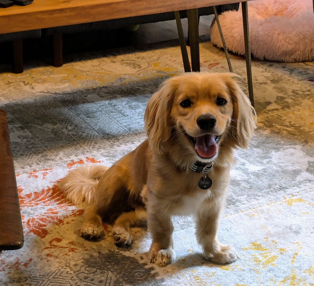
Meeeee!
No, Oliver–Ollie to his friends, which we now are!–did not invite us to Vancouver. But Ollie’s “dad”, a former student of The Mate’s, now practically family–just took an important job @ UBC. Apart from all the other good reasons to, um, get away to Canada just now…we couldn’t WAIT to come visit and see firsthand the new Canadian life of our friends.
…Exhibit A
But of course we HAD to wait. Bust in on a newly-hired student dean in the first week of his new job? Eh…we’ll go visit Bella Coola and Vancouver Island and come back, OK?
So we did that (see 2 previous posts). Now: UBC.
Thanks to their University connections (and their small apartment), our friends housed us in UBC’s own on-campus hotel.
View of campus, from up on the 8th floor!
In case you don’t know–as I did not–UBC is ENORMOUS. 60,000 undergrads, 30,000 grads. A beautiful tapestry of (mostly youthful) humanity to walk through every morning. We only had two days, but I made the most of it, re-visiting two sites I’d spent time in, lo, nearly 30 years ago, when I took our small kids up to Vancouver for a visit.
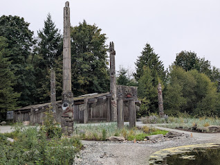
I well remembered their famous Anthropology Museum…
A wry note: on a nearby trashcan I found these words spray-painted: “Land Back!”
Back then, since my kids’ museum stamina lasted barely an hour (and frankly, that’s about all I can usually manage before sloowwwwing dowwwwwnnn), we went outside to explore. Found a mysterious staircase disappearing down the side of a forested bluff.
“Ooh, where does this lead?” It led to a nude beach–right on the edge of campus! I was so impressed by that, I had to see if the place was still there.
Yep
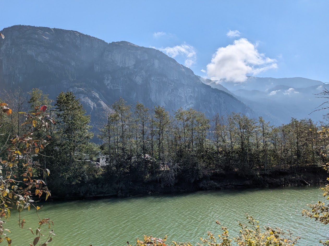
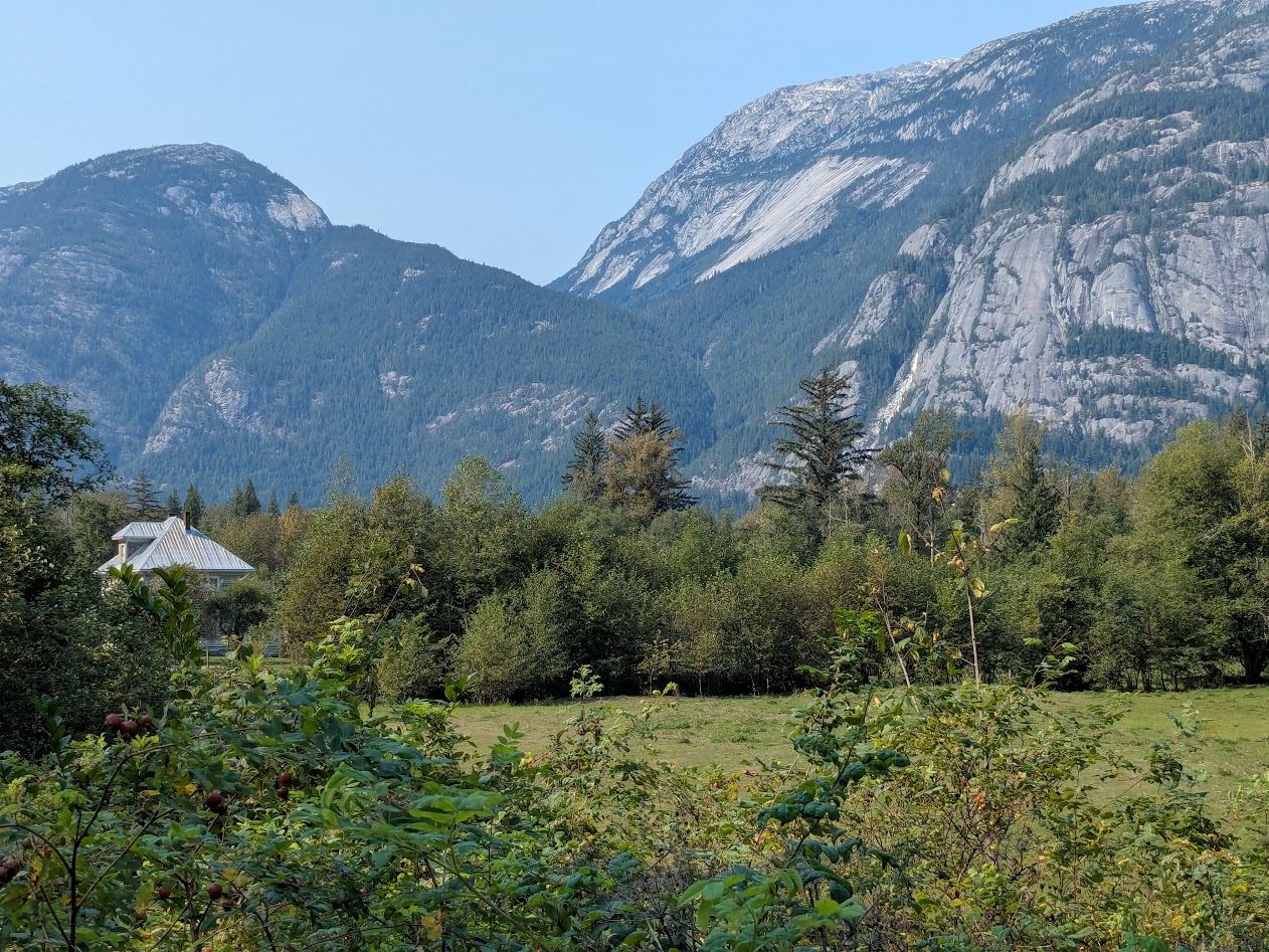
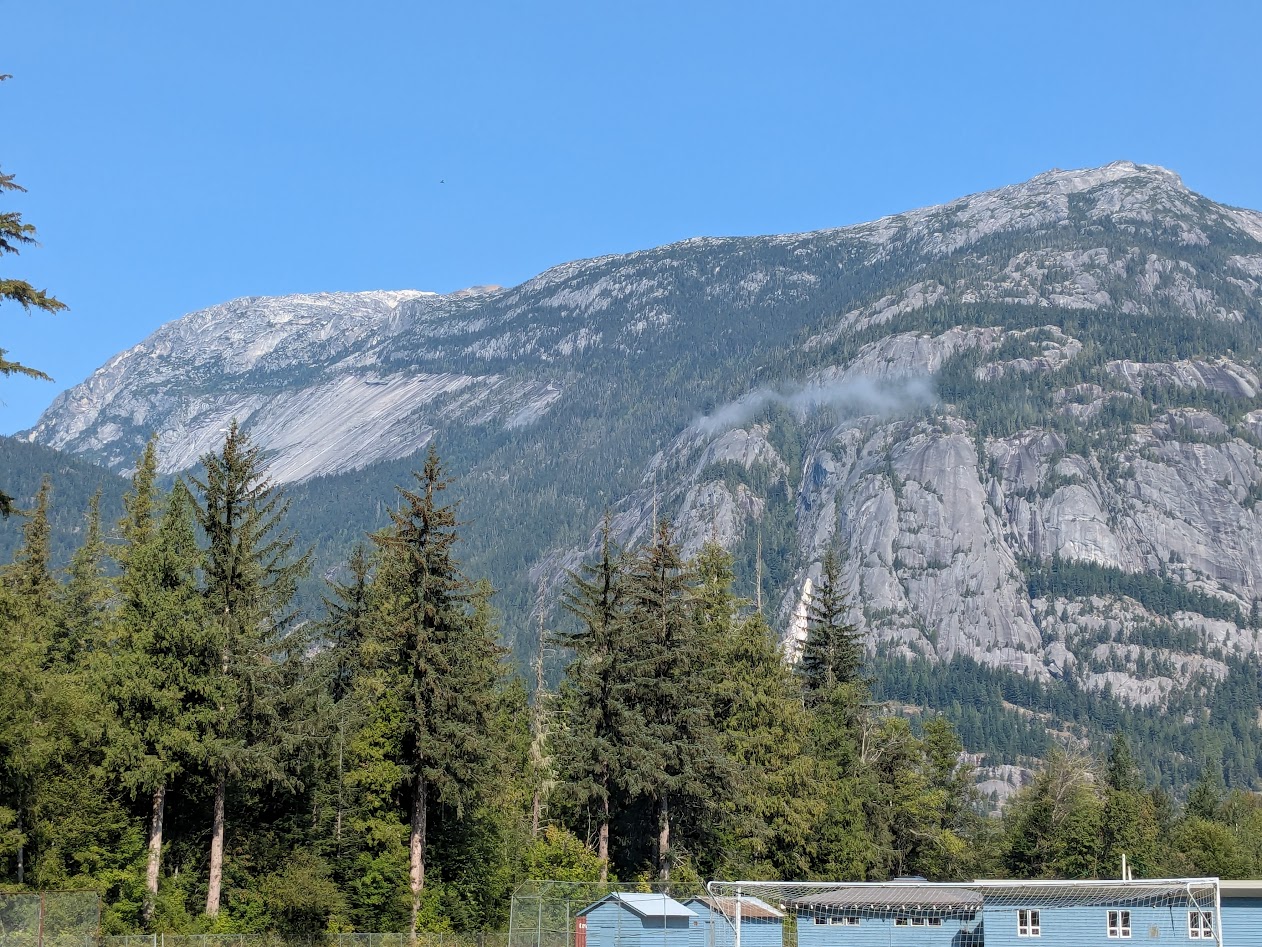
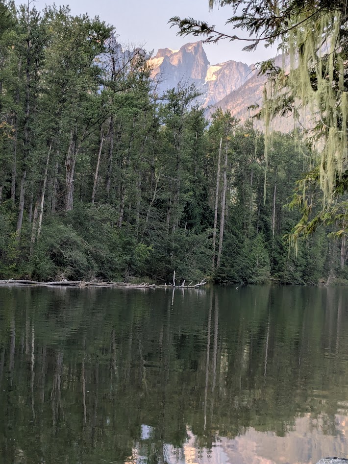
Of course, being brand-new British Columbians, our friends were as eager to explore Vancouver’s environs as we were. So we planned a half-day trip up the road to the town of Squamish, which is halfway between the city and the Whistler ski area. But that description doesn’t do the place justice.
Hopefully this does. The parking lot just shows how integrated this mountain is to the town.
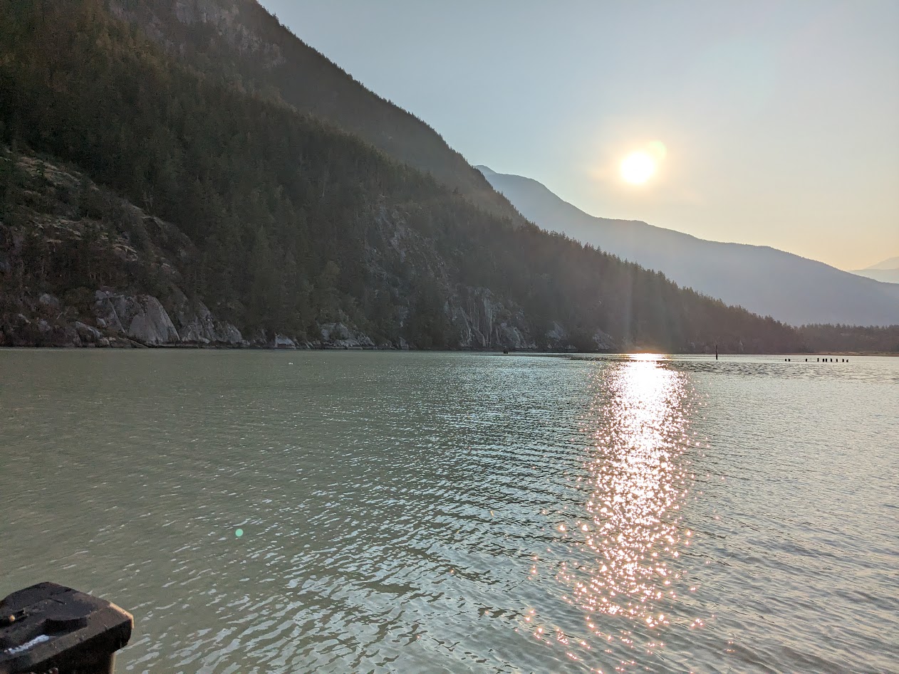
We didn’t do much there–just ate lunch, took a walk to the base of the inlet…
Mountain. Construction lot. Inlet. Y’know, just regular town stuff.
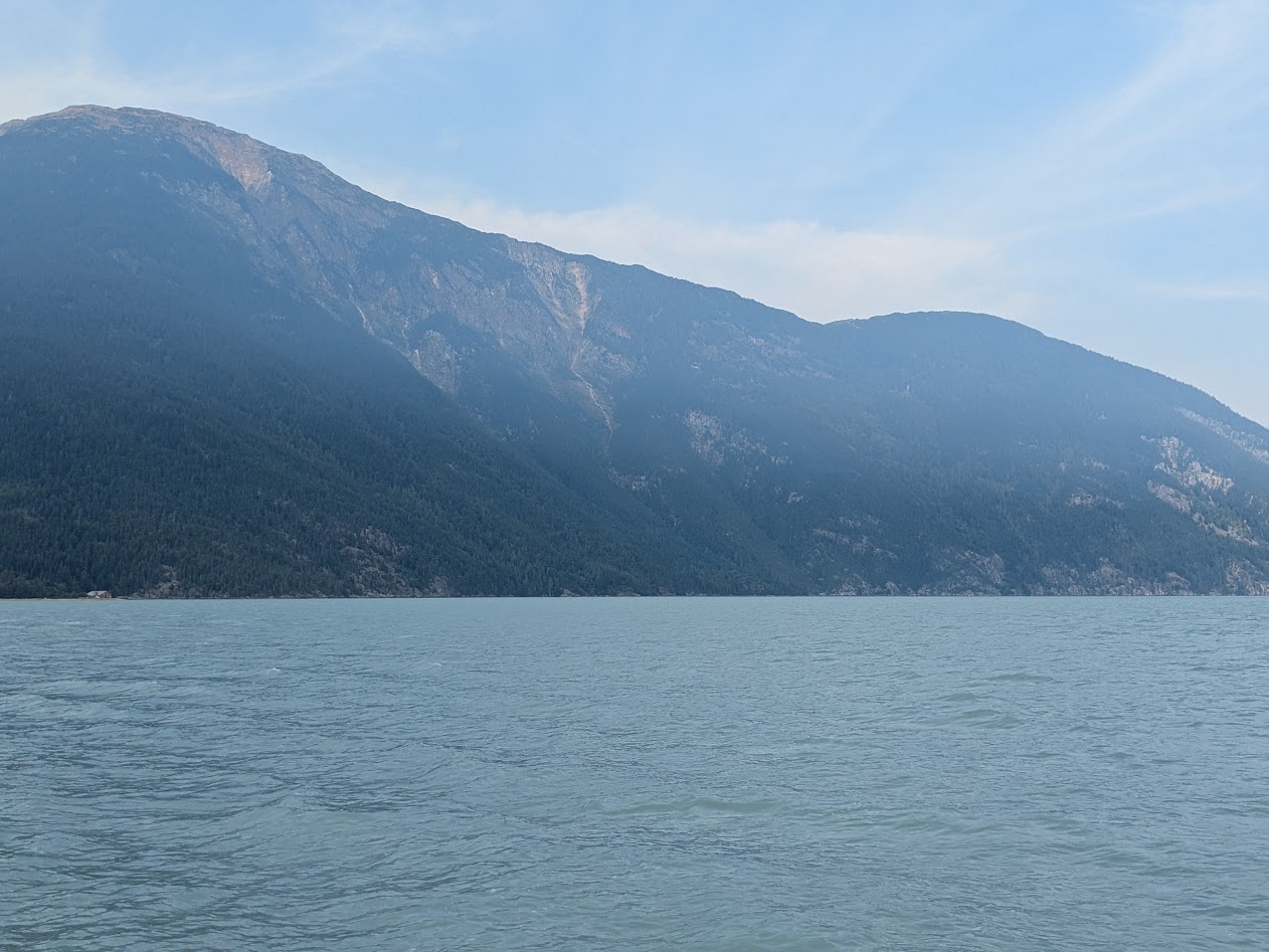
…remembering to turn around occasionally to appreciate the town’s background:
Behold Mt. Garibaldi
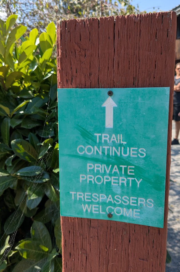
…and noticing inviting little quirks, like this sign:
Canada, you are so stinkin’ adorable!
Don’t know if this will be the death of that cute little town or just its next iteration, but I do have to note the presence of an ENORMOUS development of apartments (or condos?) just getting going, behind this pretty mural…
CanNOT blame anyone who wants to live here!
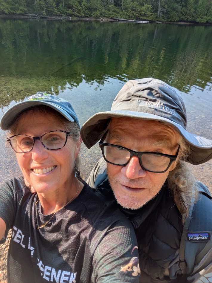
Back in Vancouver, we spent one last evening with our friends, feeling SUCH gratitude for being able to sip from their overflowing, British Columbian cup.
Me, right? I’m the cup!
Yeah, Ollie, you kind of are. But I feel like I should close this final B.C. post with something a little more…conclusive-feeling, eh?
like this
So that’s it for BC, this time around! The Mate & I are applying for Nexus, though, so we can travel back & forth more often to see Ollie our friends.
You’re halfway up Vancouver Island. You only have a few days before heading back to the mainland–not enough time to get out to the Wild West Coast, nor down to Victoria. Where do you go?
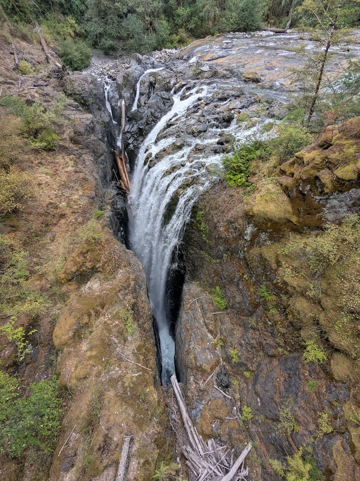
How ’bout here?
This is Englishman Falls Provincial Park, just a hop & skip off the main highway between Campbell River and Nanaimo. And yes, that disappearing waterfall is even more insane in real life. Here’s what it looks like face-on:
Hold up–WHERE is that river going??
…and from the top, just above the drop:
Who, me? Just a boring old clear Canadian river…
That little park was one of several blips on the map of east-central Vancouver Island that, in classic Canadian fashion, fail to call attention to themselves…until you are standing there with your jaw a-drop.
Campbell River–the actual river for which the town is named–is dammed, but not only does it offer the salmon a big side-channel to bypass the dam, it provides guardians for those fish on their passage:
Not as good as a wild, free river–but way better than nothing
Further inland, Strathcona Provincial Park certainly shows up on the map, but this little waterfall? We only found it when directed there by a volunteer docent we happened to meet.
No one else was around. Just me and that pool.
We’d intended to camp in Strathcona, but the weather went sideways. No problem backpacking in the rain, but wet car camping? That just feels stupid. So we got in a short hike…
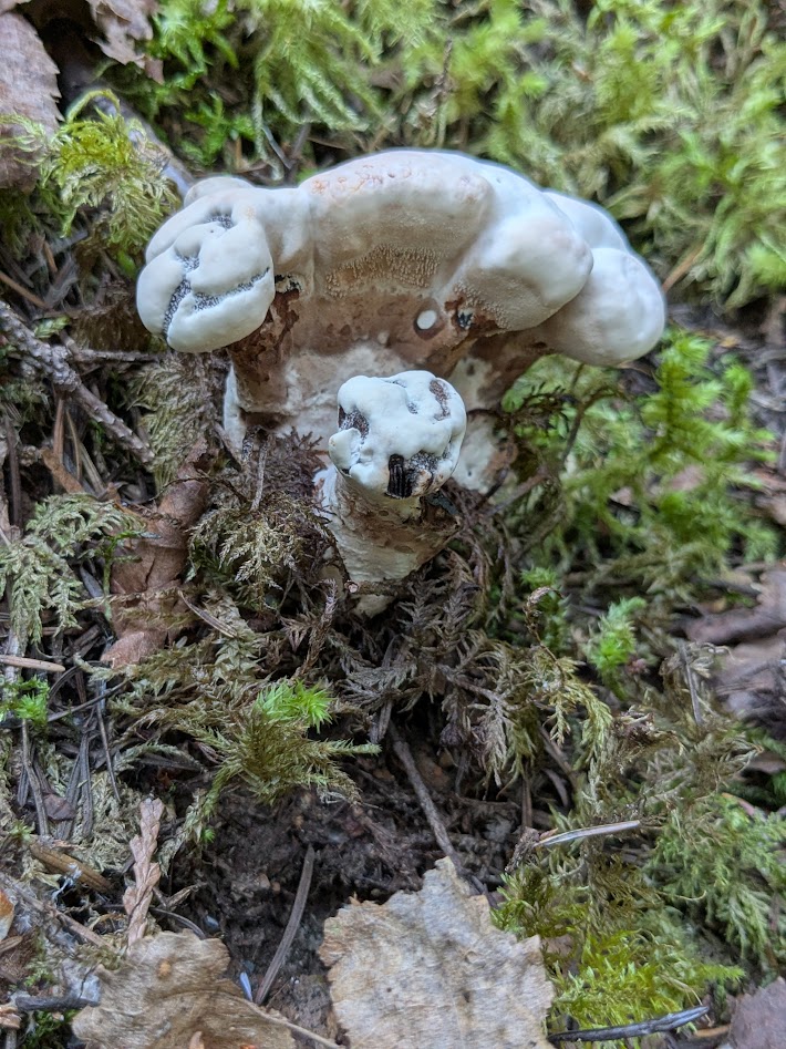
(I can just imagine that trail repair crew going, “Eh…good enough! Let ’em climb.”)(forcing myself to resist the biggest Chicken-of-the-Woods mushrooms I’ve ever seen!)
…and rode our bikes along the 14-mile long (and unfortunately-named) Buttle Lake…
Bit wet; still pretty
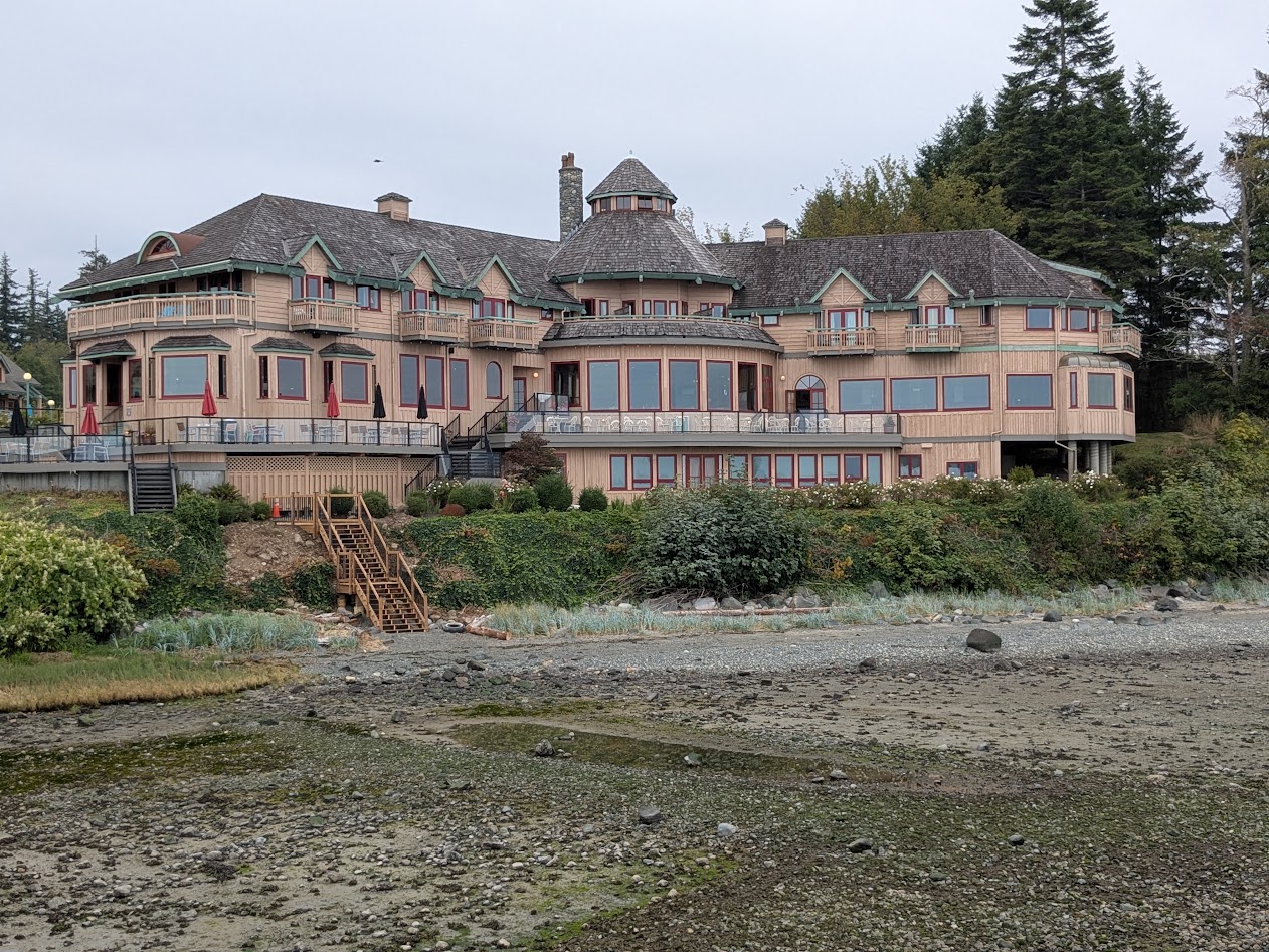
…before heading back to Campbell River, where we’d scored one of those cheap hotel deals at a NOT-cheap hotel, Painter’s Lodge.
as seen from the lodge’s dock, at very low tide
On that dock we found this map–WONDERFULLY helpful for orienting ourselves in BC’s bewildering array of islands:
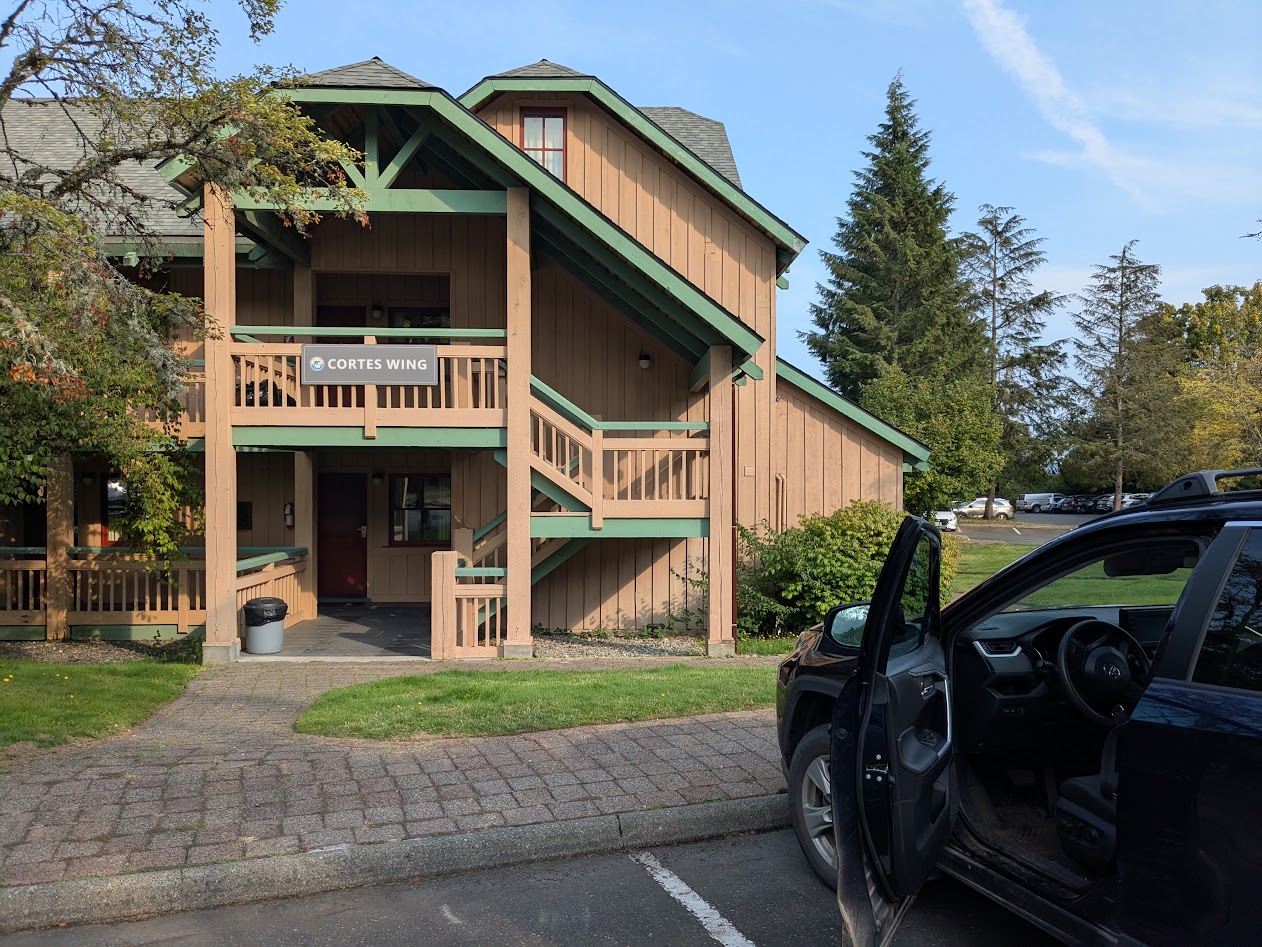
Not our usual type of stay, but we took full advantage. Especially because the part we stayed in seemed to be a mashup of our last name & our favorite BC island:
Of course the rain stopped when we got there. But then it came back. Phew.
Luckily for us, they let us cook our cheeseburgers out in the patio area!
“This counts as camping, right?” (Quadra Island in the background)
Our last day, after those amazing Englishman Falls, we found a very cool bike path–along the highway, yes, but screened by bushes & trees, with plenty of curves and hills giving it a very adventurous feel.
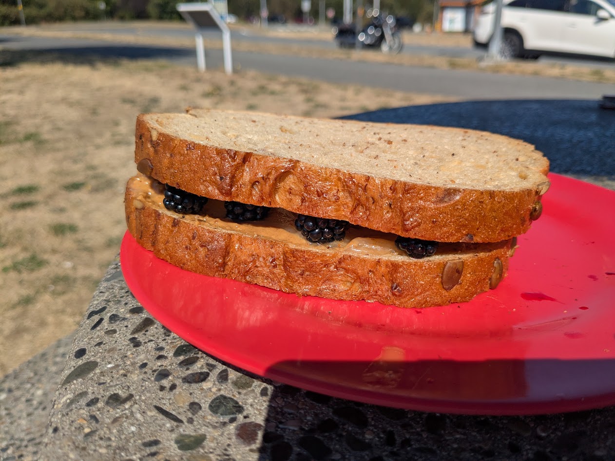
Some of those bushes had blackberries on them, and I was shocked at how sweet they still were, in September! So: lunch.
Peanut Butter, Honey & Blackberry Sammy!
Our final night on the Big Island (move over, Hawai’i–actually, never mind, you’re already pretty far over) we spent in Nanaimo, in order to catch our ferry next morning. I walked all over, discovering the best kind of quirks, like this Flower Wall:
Just an apartment building, far as I could tell
Along with flowers, Nanaimo boasted its own poster-of-random affirmations, because I found a number of these type of signs, here and there:
Why thanks, Nanaimo. I’ll try!
Next week, the exciting BC conclusion: University of! Thanks for riding along.
Actually, Cortes Islanders would probably prefer that “quirky” label, while we found Quadrans (Quadrants?) plenty cordial. Either way, both islands, between BC’s mainland and big Vancouver Island, became big highlights of our British Columbia wanderings in 2018, and we were overjoyed to wander back.
Whale-com back to Quadra!
With a week to spend, between our Bella Coola adventures and our visit with our friends in Vancouver, we headed over to Horseshoe Bay for the big ferry to Nanaimo. BC ferries are SO nice. And, unlike Washington State’s they run on time. And they actually run! (#ferryEnvy).
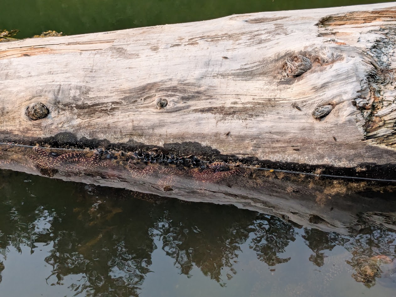
In Horseshoe Bay I was thrilled to see a healthy batch of young purple sea stars.
Since these critters have been suffering through a terrible die-off in the Salish Sea, I was super encouraged by these guys.
…and super thrilled by these Horseshoe Bay treats: seriously the best doughnut I’ve ever eaten!
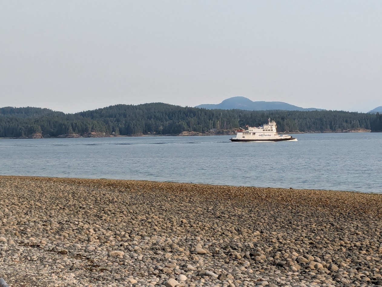
After our 90-minute ride to Nanaimo, we drove a couple of hours north to Campbell River for groceries, then a much shorter crossing on a much smaller boat to Quadra Island. The We-Wai-Kai Campsite there is run by the First Nations People of the same name. Pleasant place, and pleasantly close to Rebecca Spit, a Provincial Park perfect for short bike rides and strolling.
Why do we call long, skinny points of land “spits”? Anyone?
Much of Quadra, we came to remember, is a bit steep for biking, at least for a couple whose combined age is edging close to 143 years. Since we’d be passing back from Quadra automatically on our return from Cortes…
(Courtesy Wikimedia) Ferry goes: Vancouver Is. to Quadra, then from the opposite side of QI to Cortes
…we put a pin on some hikes for our return , and headed over to our old Cordial friend…
…on an even smaller ferry!
On this 40-minute ride (reminiscent of our Lopez Island commute), we were treated to a pair of humpback whales. (Too far for good photos, but great views through binoculars.)
For our picnic lunch, we defaulted back to Manson’s Landing, remembered from 7 years ago.
This time the tide was out. WAY out.
Such healthy-looking tidal creatures! No sea stars…
…but I’ll settle for sand dollars. Worth every sand penny.
This trip, instead of springing for the extraordinary, but expensive Hollyhock Retreat Center, The Mate and I stayed in a modest motel with a kitchen. It was a stone’s throw from a set of community trails we’d missed last time…
Steep but worth it!
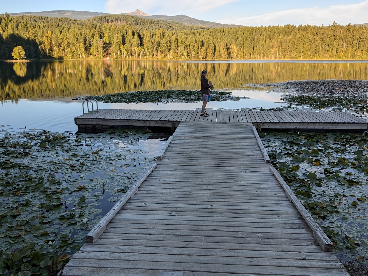
…not to mention an enormous, clear lake, shallow & warm enough for real swimming.
not pictured: swimming Wings
That huge log and those background cliffs, speak of Cortes’ drama. But its Friday Market, complete with music, homemade treats and upcycled clothing, speaks of its community. “Cordial” indeed. I didn’t want to interrupt the vibe by taking photos.
…we found purple sea stars! So many healthy specimens!
Recovering from Pisaster Disaster (#LatinNamePun)
Returning to Quadra–the ferry workers kindly squeeeeeezed us onto the boat–
Phew! Thanks!
…we determined to find an extra-special way to spend the day, because it was our wedding anniversary.
#38, since you asked! 🙂
First we found a fairly level hike to a lake; later, we drove to a deserted cove for another picnic. I could write a whole blog post about Peanut Butter & Honey sandwiches…
…but I won’t. This maple leaf caught my eye, though–emblematic of all the Canadian flags we saw flying across BC (#IWouldTooIfIWereThem)
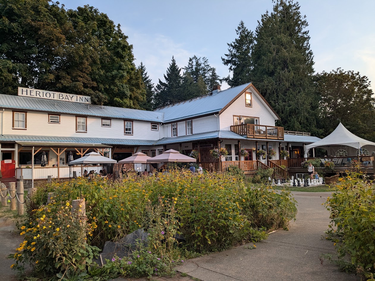
We’d hoped to spend our anniversary night at the sweet inn we stayed in in 2018, but they were full. So we settled for dinner there.
Happy #38, babe.
Meanwhile–on that quirkiness question? Look what we found lurking around the parking lot of our Quadra motel!
“Clever girl.”
There were about a dozen of these, obviously by the same artist who made that campground whale…
…not quite life-size, but close! That’s a LOT of driftwood.
The final piece of “quirk” that caught my eye on Quadra was this sign outside an ice cream parlor:
When you consider that Bowie died in January 2016…well…hard to argue w/ this, eh?
Thanks for traveling along! Next time: back to the Big Island–Canadian version. Keep those maple leaves flying!
For those of you who read my 2023 post on the various meanings of “BC”–don’t worry, I won’t subject you to more of that. I just couldn’t resist a nod to one more extraordinary BC discovery.
This place: Bella Coola, BC
Since The Mate & I learned that a close friend got an amazing admin job at UBC in Vancouver–just up the road from us–we’ve been itching to go visit. Of course, since said friend’s job is just starting, we realized we needed to give him a little time before popping by…but by then our fires were lit. Maps were out. Venues were calling.
So we heeded the call.
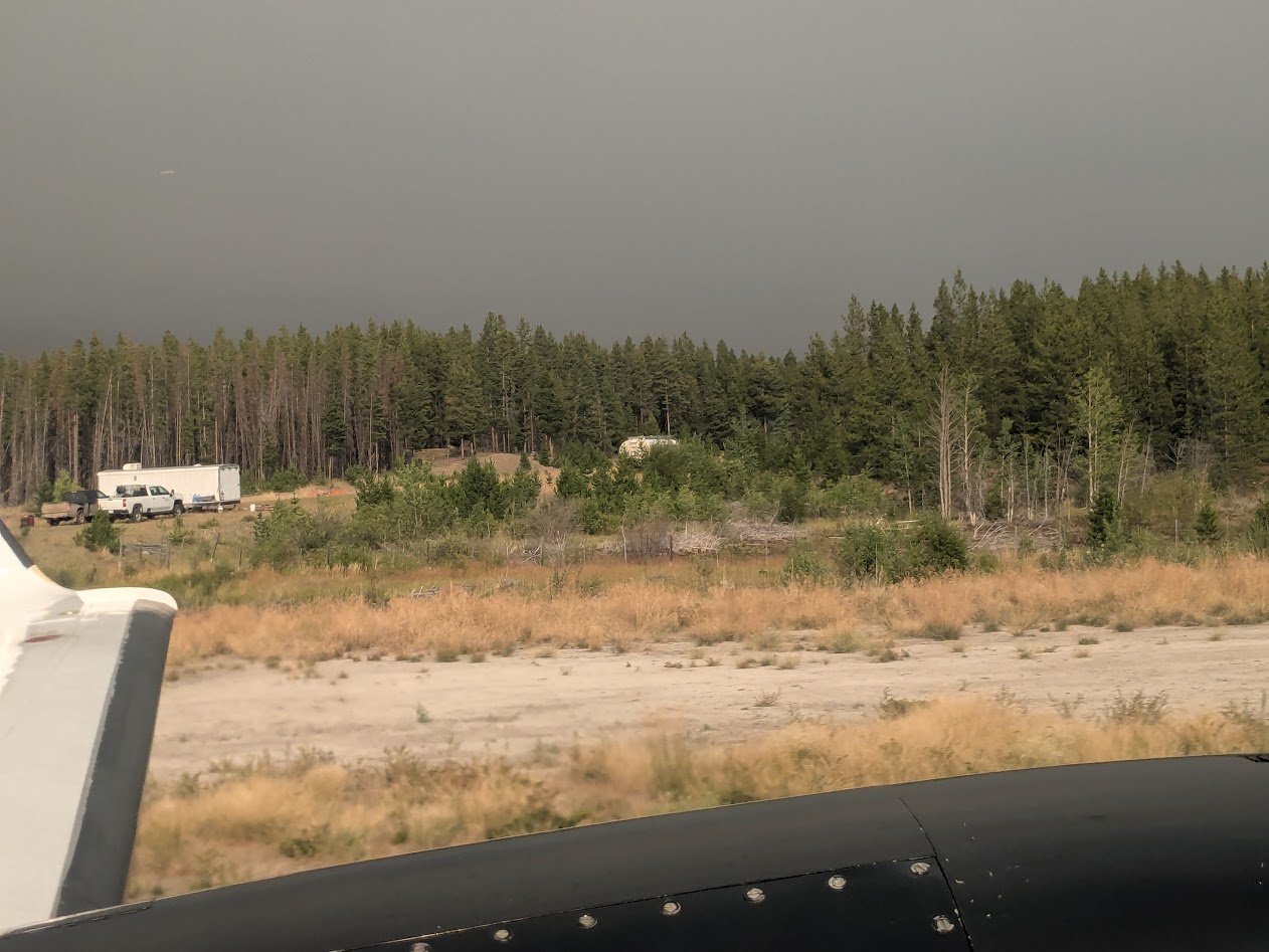
Yes, that’s a glacier, as seen from an airplane. I’ll explain.
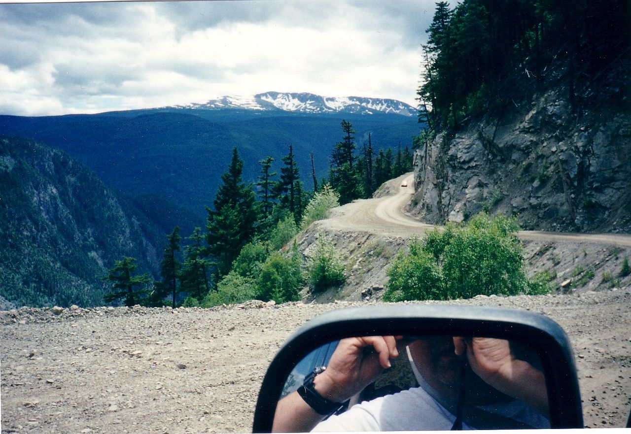
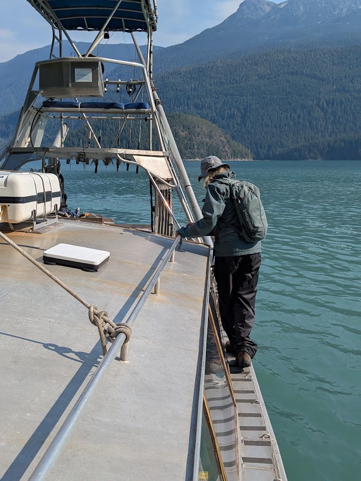
Bella Coola is accessible three ways: by ferryboat–if you go to Vancouver Island, drive all the way up to Port Hardy, and ride the ferry for 16 hours. By car–if you drive 350 miles north from Vancouver, then turn left and drive another 250, 60 of which is gravel, including a super-sketchy portion known as “The Hill.”
photo courtesy Wikimedia, by some driver braver than I am!
Or you can fly. That’s the option we chose, and, despite the expense, we were SO glad we did. The sight of so many still-healthy-looking glaciers filled me with joy (despite my very scratchy window). And our descent…!!!
Not for the faint of heart…but worth the ticket if you love thrills. And peaks.
I grabbed this shot of the cockpit of our 20-seater plane, just to show the narrowness of the valley we descended into:
Green = safe. Yellow = LOOKOUTFORTHATMOUNTAIN!!!
Once down, The Mate and I looked around, then looked at each other and said the same thing: “Didn’t we just see this in Yosemite?”
Only this is no national park; this is where folks LIVE. That building? It’s an elementary school.
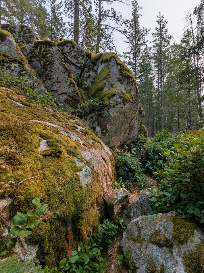
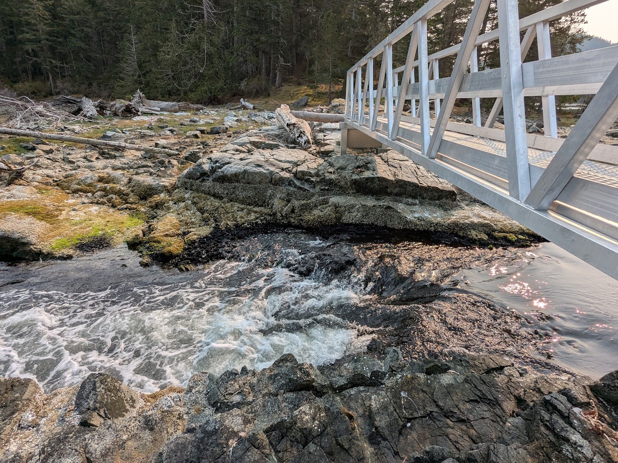
The town of Bella Coola is at one end of a loooooong inlet, giving way to a looooong, skinny valley, which ends in Tweedsmuir Provincial Park, and The Hill. One thing we quickly realized: with so little flat ground, hiking trails for our aging bodies were somewhat limited. But we managed.
This one included extra perks: suspension bridge, whee!
A couple of them I did alone, like Lost Lake:
Found it!
But we didn’t let the lack of long hikes interfere with our awe and delight about the place, from large features…
…to small:
I even got to enjoy a fun cultural scavenger hunt, thanks to a Lopez Island friend who told me her Norwegian great-grandpa was buried at a Lutheran church in Bella Coola. I told her I’d try to find his grave, but all I found was an old-looking church, not Lutheran, with no cemetery, and this (closed) cultural center:
Anybody? Anybody?
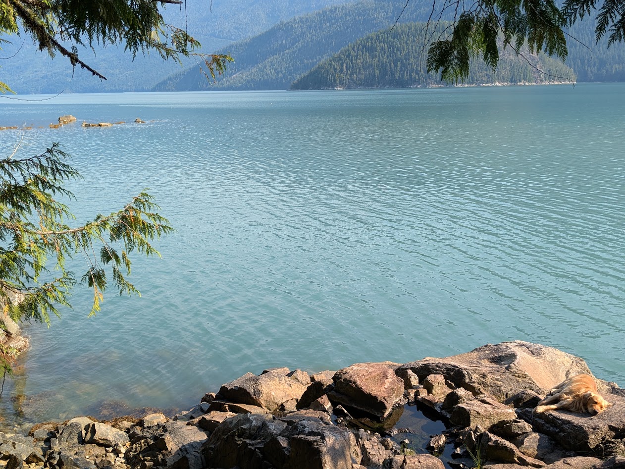
“Sorry,” I told my friend, “I’ll keep looking.” But meanwhile–forget humans, we had bears to find! September is full salmon-run season, so we hoped to see both fish, and fishing bears. Not in the Bella Coola River, which is thick with glacial silt…
(still lovely, especially at sunset)
…but in its clearer tributaries. Nor were we disappointed.
Salmon on the left: alive. Huge, upside-down salmon in the center: Thank you for your service. RIP.
Our first morning, we drove Up Valley to Tweedsmuir PP, and were promptly rewarded by seeing a pretty black fox (not pictured; I was driving), followed by a mama bear with 2 cubs.
I managed to pull over fast enough to capture Cub #2, following her fam into the forest.
The best bear-viewing spot, that first morning, yielded no bears.
Still a pretty good spot to hang out. No complaints!
But the next morning, as everyone was looking upriver at the most obvious fishing spot, a gravel bank, I happened to glance the other direction and spotted this fella, soundlessly swimming from OUR side of the river.
I repeat: he was on OUR side. Just behind us.
We all did like this person here, and activated our cameras. Most of what I took were videos–I wanted to capture sound and movement–but I did get a few stills (apologies for my lack of zoom).
Pointy ears; no hump; flat face = Black, not grizzly. Still a big guy!
Actually, during the salmon run, it’s obvious the bears have zero interest in attacking humans. Nice, oily fish are what they crave. What a gift, to be able to sit and watch them move, without feeling like we should be backing away.
We saw one other bear during our 4 days in the valley. But plenty of other wonders too, especially when we signed up for a boat tour…which also, surprise! solved the mystery of my friend’s great-grampa’s missing grave.
Our boat captain was full of history, with photos. Turns out the Norwegian families who arrived in the late 1800s built their settlement at the north end of the inlet…I’m guessing to get as far away as possible from the Nuxalk People who lived there.
See the old settlement? Nope. Because it’s gone.
Joke was on the white folks. In 1936, about 40 years after building their settlement, the Norwegians saw the whole place flooded away and destroyed by a king tide. All they could save was their church, which they pushed with canoes over to the road, then carried Up Valley…where it sits today.
Photo courtesy of Captain Daniel
No longer Lutheran, and no cemetery, but this was the church I’d been looking at! I was able to share this story with my friend, both of us agreeing her forebear’s bones now rest “full fathom five” in the inlet.
Capt. Daniel also stopped at the site of the Norwegians’ old school, explaining how the kids had to hike along the bluffs above the inlet twice a day to attend.
Far left: site of old school. Far right, not quite in the frame: site of village where kids lived. Yikes.
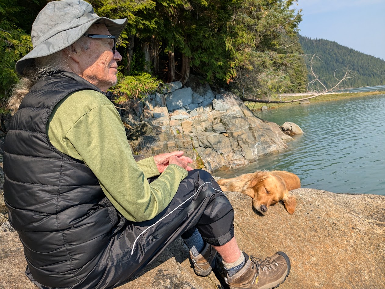
Capt. Daniel, by the way, had the most awesome First Mate: Buck, the Golden Retriever.
Ahoy! Who’s a good boy?
When we arrived at a site, no ramp was lowered: Daniel simply butted the prow against any handy rock…
…and off we clambered. Gingerly.
Buck did it a little quicker.
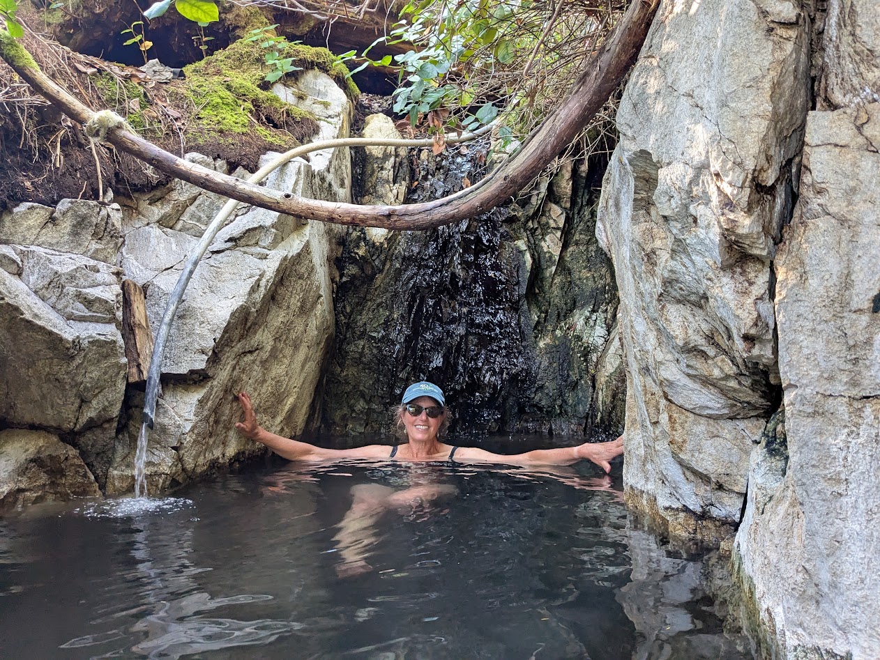
Our first stop was a hot spring. Have you ever sat in one that didn’t smell like sulphur? We hadn’t. It was MAGNIFICENT.
The big curvy thing above me is a cedar branch.
Here’s the view from Nature’s Best Hot Tub:
ahhhh…
Wait. Is that First Mate Buck, asleep on the job?
Tough life.
When we got to the next drop-off site, our guides stayed in their roles: Daniel dropped us off and went fishing; Buck led us to the Big Cedar Tree.
Seriously. Not a guide dog–a dog guide.
“Wait up, Buck!”
Turns out Buck knew the way, all right.
“You’re not even capturing the whole tree in this frame.”
How about this?
That’s better.
Oh, that boat trip. We had waterfalls…
Can we get a little closer?OK, close enough!
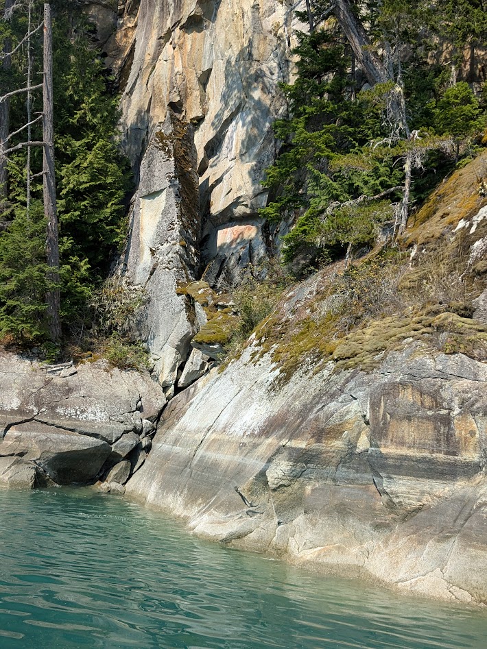
…ancient Nuxhalk pictographs…
See that reddish part of the rock?That’s supposed to be a person. Telling visitors this land is OCCUPIED, thanks.
…and more glaciers, this time from below.
Still can’t get enough.
Before we left the valley, we spent some time in and around the town of Bella Coola itself, where the Nuxhalk culture felt pretty vibrant, at least to us outsiders.
I only wish I could have learned to pronounce that.
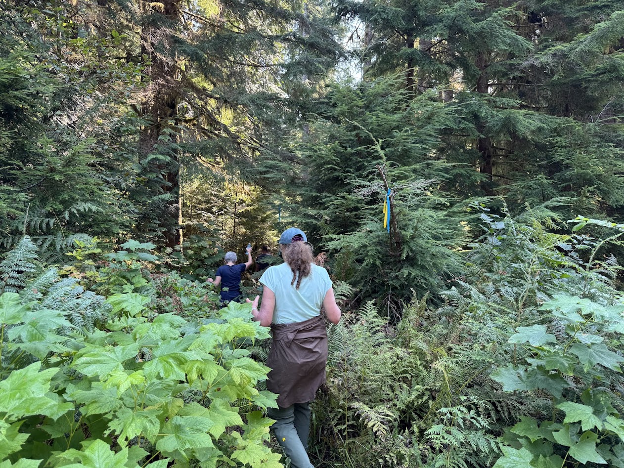
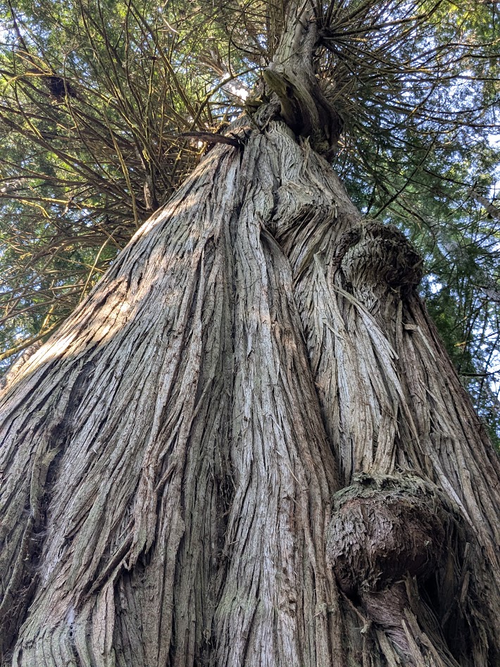
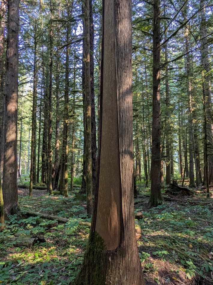
A nearby grove of cedars, some ancient, bears the marks of age-old cultural harvesting, both bark…
Thank you!
…and even wood, all without damaging the tree:
So much to learn here.
The last two days of our trip, the wind shifted and the valley grew smoky. We learned of uncontrolled wildfires to the east; Rt. 20 (The Hill) was closed. When it came time to fly out, this time we stopped in the tiny town of Anahim Lake, and got a good look at the fire-threatened sky for ourselves:
Not pictured: the ash falling from the sky
So after that sobering glimpse of what our planet’s facing, it was doubly gratifying and relieving to see those glaciers from above.
Restraining myself from quoting Robert Frost here…I’ll just say, “Hang in there.”
Next up: More BC! Islands, this time–the littler ones. Thanks for coming along.
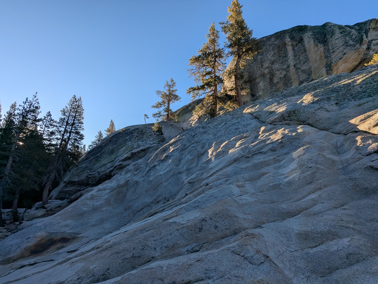
I hereby refuse to apologize for any granite puns. When you’re in Tuolumne (“too-ALL-um-mee”), in the high country of Yosemite National Park, you’ll know why.
That’s why. (Half Dome in the distance)
The Mate and I hadn’t been to Yosemite for–yikes, had it really been 11 years??? But that last trip, in spring of 2014, was only to the Valley. Tuolumne, at 9,000 feet, was still buried deep in snow then.
(with maybe a few peaks, like Cathedral, “peaking” out)
So, really, the last time we’d been in Tuolumne? We realized, to our chagrin, it had been DECADES. Thanks to our California cousins, who scored a couple of tent cabins (thanks to someone else’s cancelled reservations) and invited us to join them…we fixed that.
some cousins swimming in Tenaya Lake
Oh, the backdrop of that swim?
just your average soul-shakingly beautiful mountain lake
Here’s what The Mate & I noticed right away about the contrast between Yosemite Valley and Tuolumne: the Valley makes you look UP–at Yosemite, Bridalveil, Nevada & Vernal Falls; Half Dome, El Capitan. All the beautiful, famous stuff is UP. But it also makes you look OUT: for buses, kids on bikes, tour groups on their phones, gift shop souvenirs…you get the picture.
At Tuolumne, the beautiful stuff may be less famous…but it’s EVERYWHERE. Up, down, all around…with about 1/6 the # of people competing to be in it.
sometimes LITERALLY all around
(Not all potholes were this inviting.)
Not sure I’d be able to climb back out of this one…
Speaking of potholes, one of the best walks I took was right up a modest, 200-foot dome called…Pothole Dome. The view from up there captures the granite world better than words.
Those trees probably feel about as permanent there as I did! We’re all just guests of the stone.
Tuolumne’s famous for plenty besides granite, of course: its meadows, best seen in spring, thick with wildflowers…
…but it’s August, so Tuolumne Creek will have to do!
…and the famous John Muir Trail, the Sierra section of the Pacific Crest Trail.
Thank you, John.
But let’s face it: those granite faces are really what the place is all about.
Cloud Rest…on the way to Half Dome (I wish I were!)
One morning I got up, pre-cousins, and took myself for a stroll along the creek. Something grey caught my eye–a baby dome I hadn’t even noticed–appropriately named (I learned later) Puppy Dome.
Who’s a good dome? YOU are!!
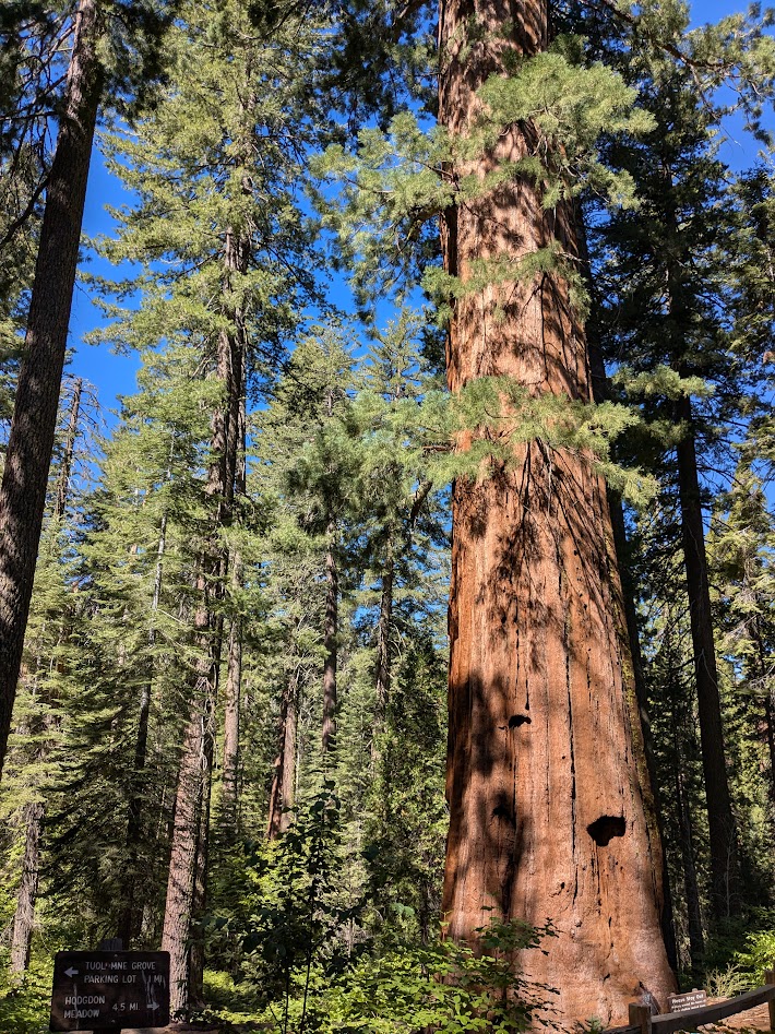
On the way out, we stopped to visit a handful of giant Sequoias, where the high Yosemite slopes down toward the Valley.
They call this one Big Red.
Big trees are always inspiring; I was happy to meet Big Red.
But leaving Tuolumne, it was Big Grey I took with me.I hope it’s not decades till I see these rocks again…but I know they’ll wait for me.
You’ve probably heard of it, even if you haven’t read the memoir Wild, or seen the movie, or hiked part of the PCT yourself. 2,650 miles, it stretches from the Mexican border to the Canadian.
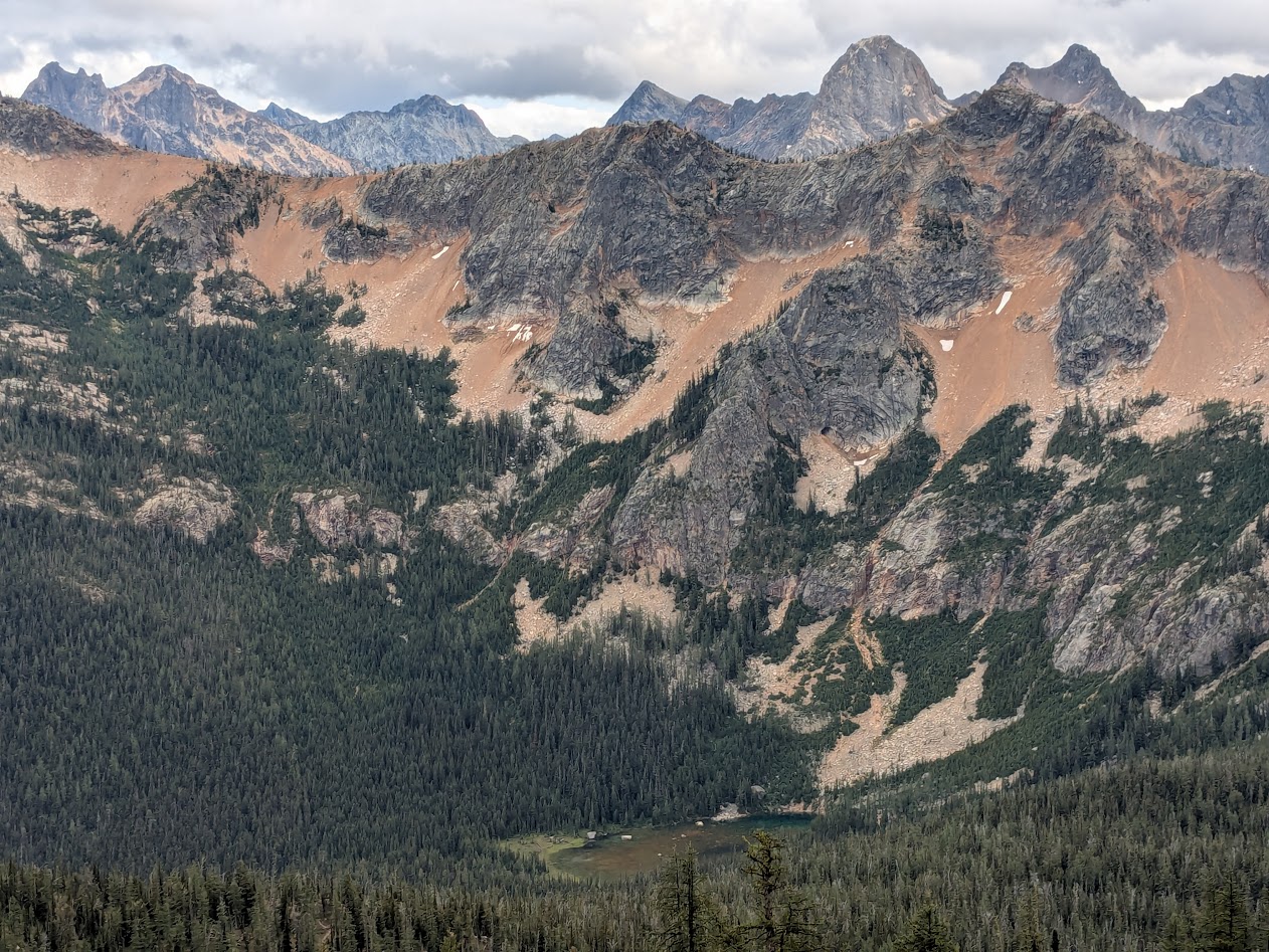
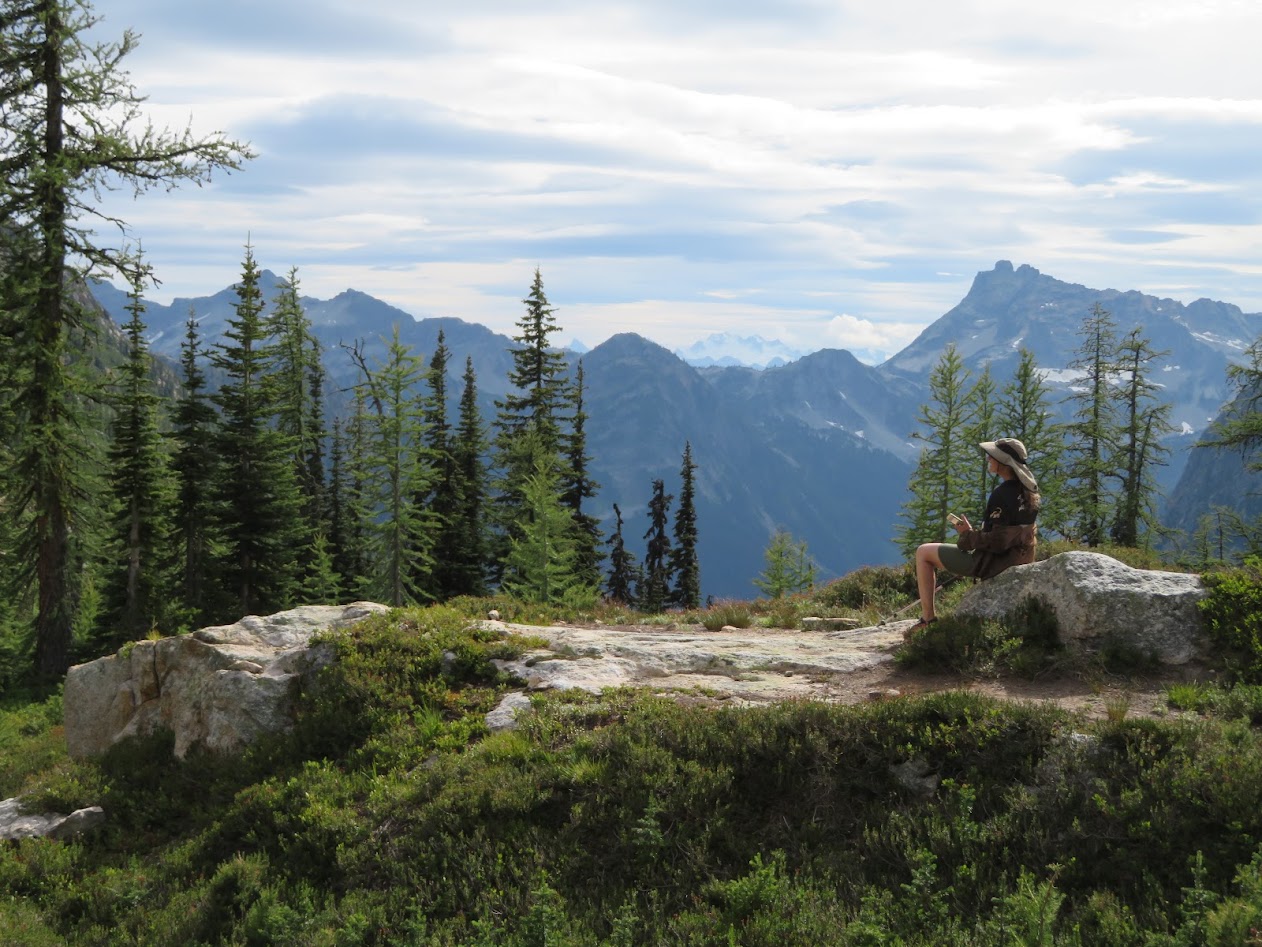
Think this is gorgeous? Wait till the larch trees turn golden and the shrubs turn red!
There’s so much to love about the PCT: it runs deliberately across the most dramatic stretches of western mountain (the “Crest”); it’s pretty accessible in places (like this, the Cutthroat Pass portion); and it’s blessed by a uniform “PCT grade” of 6%, meaning that it’s never too ridiculously steep (looking at YOU, Appalachian Trail!).
Imagine ALL the huckleberry leaves adopting the color of this influencer!
With only two nights, Ironwoman Goddaughter Allison & I opted for Cutthroat Pass, figuring we knew exactly what we’d be up for.
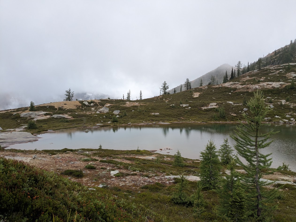
PCT: Perfectly Cute Tarn (i.e., snowmelt lake)
We were mistaken on most counts.
At first, we were thrilled to find ourselves all alone on a brilliant, sunny Tuesday: this enormous campsite, all for us???
PCT: Please, Camp There!
And blueberries? Sure, we expected to find some, but…
PCT: Pancakes! Crepes Too!
We happily took advantage, stuffing our faces like bears…
PCT: Practicing Cramming Technique
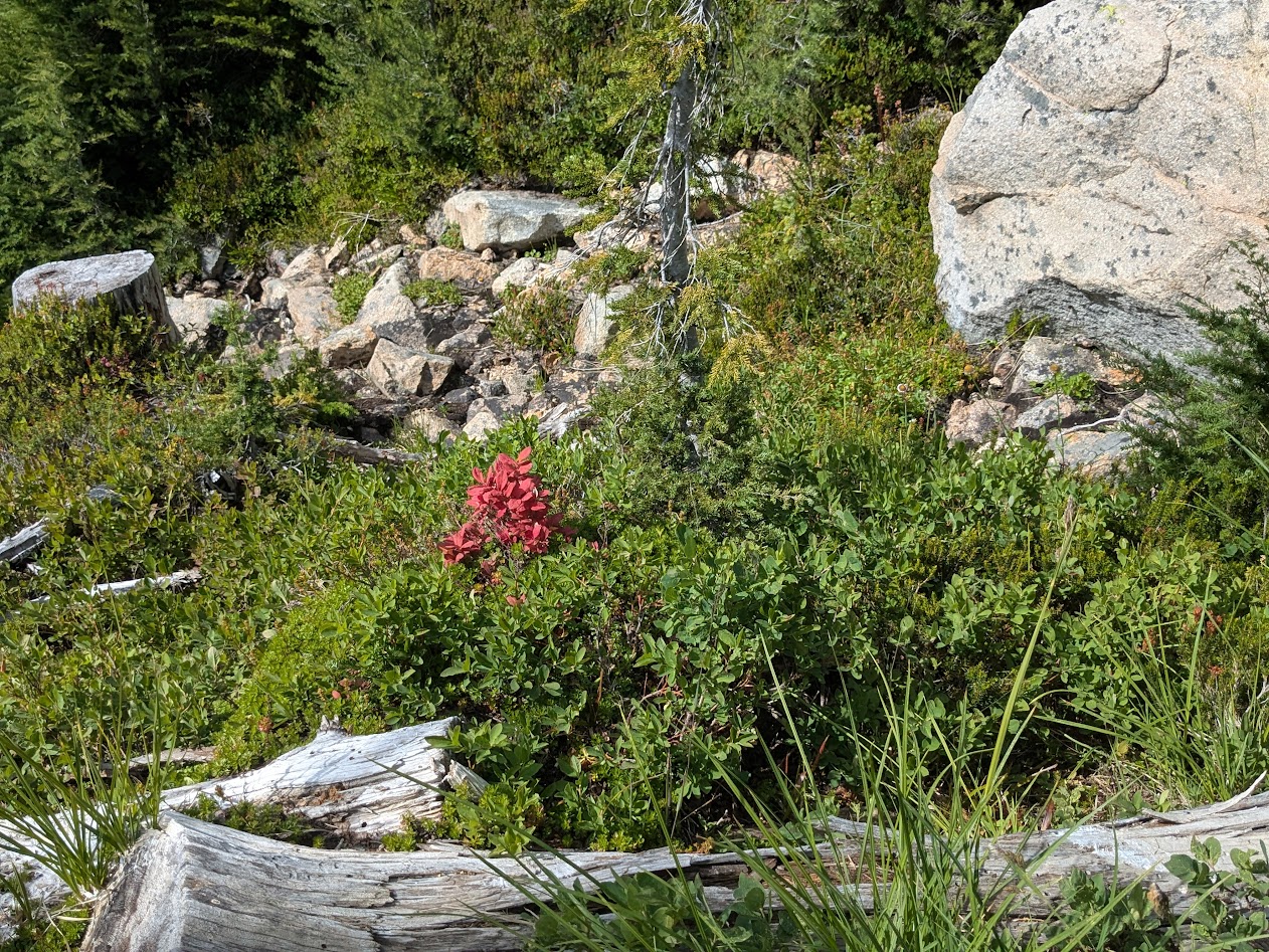
…taking photos of campsite flowers…
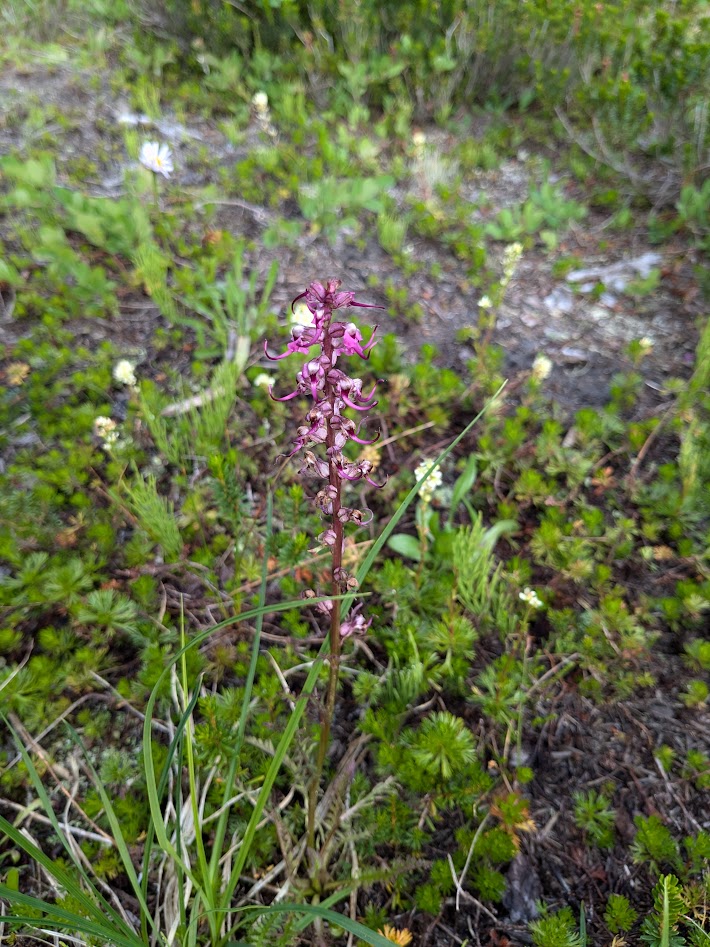
Sorry, no P, C or T: this is a gentian
…and marveling at the spruce cones, which are having themselves a season like I’ve never seen!
We couldn’t decide if they looked more like baby owls, or like glittery Christmas ornaments.
We enjoyed the sun all the more, knowing that the forecast called for “showers” the following afternoon.
But the rain started around 4 a.m. and continued to drizzle on and off all day.
PCT: Pack Cover Time
It was a warm drizzle, not bad at all–but we did have hopes that the sun might reward us for our intrepidness and burst out at our Day 2 destination, a pair of high lakes.
PCT: Partly Cloudy? Tough!
Instead…exactly when we’d finished the climb and were sitting down for lunch and rest…THAT’s when the rain really let loose.
*Not pictured: rain letting loose. Because I didn’t want it letting loose on my phone.
*Also not pictured: Gretchen and Ironwoman Allison enjoying a mid-hike rest, because they didn’t get one.
Well…the forecast DID call for afternoon rain. We just didn’t think that meant morning rain plus afternoon downpour. And we did get that hoped-for sunbreak…after we’d already left the lakes behind, heading back…
PCT: Poorly Conceived Tanning
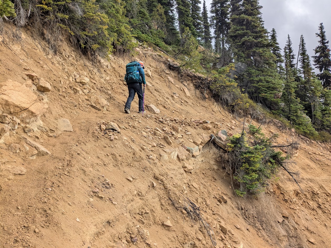
…along a stretch of trail too sketchy to stop and rest on.
PCT: Pretty Crumbly There
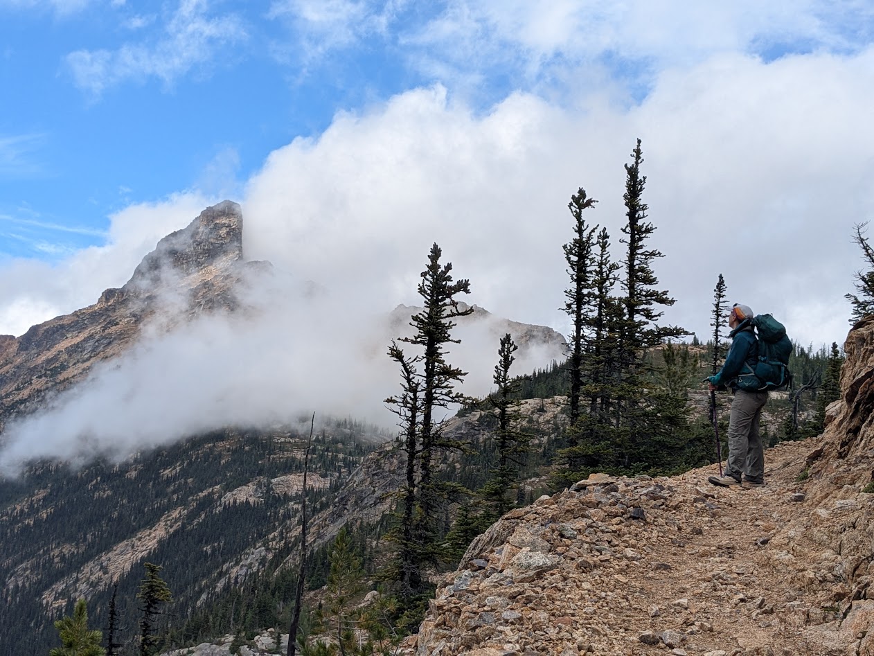
With the rain FINALLY relenting, we were able to enjoy some of the crags we’d hiked past that morning, when they were hidden by clouds.
Like The Temple
…even though that blessed PCT Grade does make for a longer hike sometimes!
Only 4 more switchbacks to go
So, after 13 miles without much of a rest, we were pretty tired by the time we hiked back into camp. And pretty shocked to find our campsite looking like this:
PCT: People Commandeering Tentsites
Understand two things: 1) that olive-colored tent was pitched so close to ours you couldn’t walk between them
2) There were other sites available, just beyond ours! But when we pointed this out to the 4 hikers who’d pitched these, they shrugged us off–literally.
I was too pissed off to speak to them after that, thinking, Who DOES this?? But Allison engaged them in conversation, and that’s how we quickly came to understand: Ah. These are through-hikers, or at least they think of themselves that way. These folks–my age, seemingly–WERE doing the whole PCT, but they were doing it one section at a time–maybe a 10-day trip. Not the 5 months’ journey that would have caused us to feel a little more generous toward their entitled attitude…
…which showed up big time at 5:30 next morning when they all woke up and started using their outdoor voices.
This guy would’ve been a FAR preferable neighbor.
Allison’s winning submission for PCT: Pretentious Campsite Terrorizers!
So we learned a few things. PCT through-hikers seem to think the trail belongs to them, so next time, camp as far away from the trail as possible. And bring earplugs.
That’s what we were told we might see, driving the Cabot Trail around Cape Breton. As it happened, we saw neither. But in our week up there, we never stopped believing we might.
Here’s why:
To left: whale habitat. Center: moose habitat (and The Mate). To right: the road.
For this part of the journey, having said goodbye to Son One and our New England cuzzies, we flew to Halifax, rented a campervan, and drove to Cape Breton Highlands National Park.
For those who followed my saga about Vanna Grey–this is a touch ironic
Here are a few nutshell things we learned about Cape Breton:
It’s actually an island above the lower half of Nova Scotia (where Halifax is)
(image from Wikimedia Commons)
2. One crosses onto that island via (sadly undramatic) causeway, not–as I’d expected–a bridge.
3. It’s home to more fiddlers, per capita, than anywhere in the world (unverified, but I enjoy thinking this!)
4. The authorities there have decided that the moose population has grown too large, threatening to eat down the forests, thus they have culled them…making moose sightings much rarer than they used to be. (sad for us, and the locals we spoke to weren’t very happy about it either)
Closest we got to a moose was this huge, fresh print in the mud. (We also saw some poop, but you don’t need to)
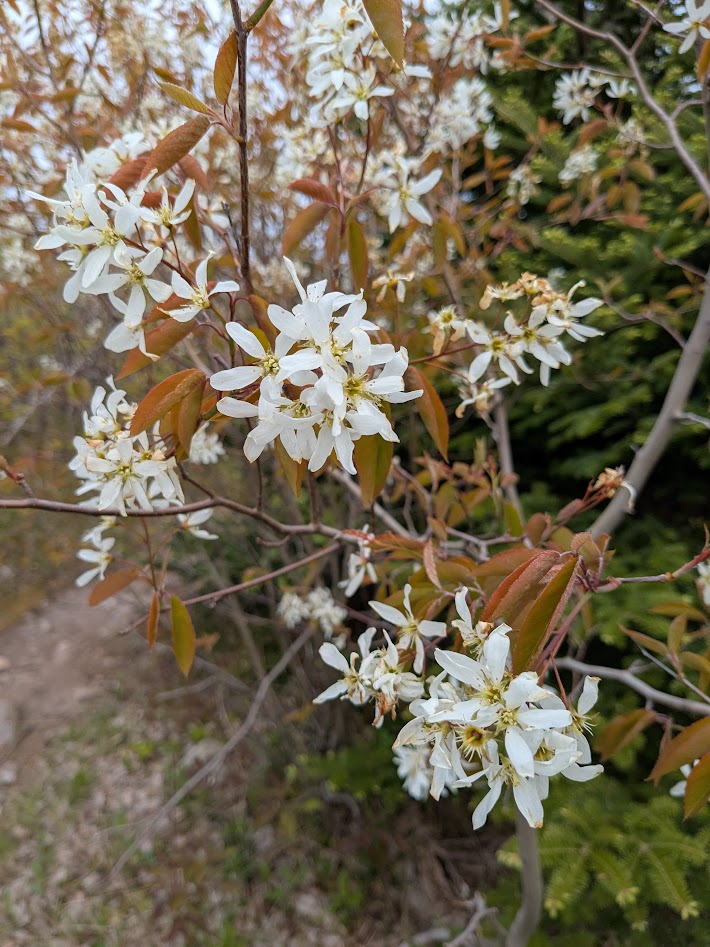
The coastline is quite different on the west side than the east, and the center is also quite distinct. So let me break it down photographically. Two things we did see everywhere: blooming serviceberry…
like wedding decorations for the woods!
…and tea-colored water, colored, I understand, by the tannins in the bogs that dominate the center of the island (and the whole province).
Brown, but clear. And lovely.
That combination really struck us on our first west-side hikes.
See what I mean about that serviceberry?
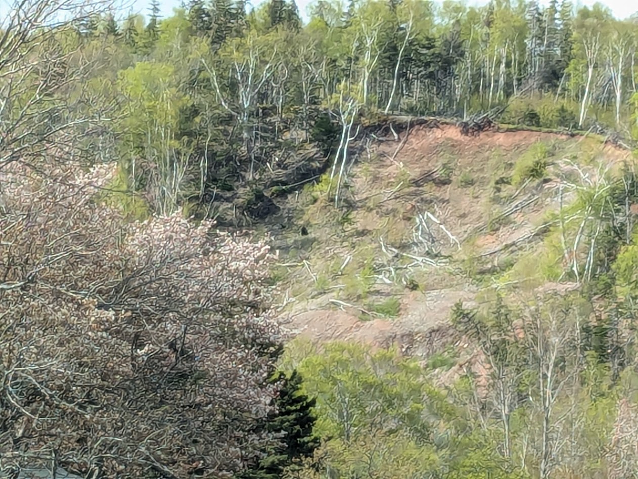
The western coastline is STEEP, with few roads down to the water. So we mostly viewed it from above.
See any whales out there? Or moose?
If you’re wondering about the brown, keep in mind: end of May is still VERY early spring up there. The hardwoods were just beginning to leaf out.
Ditto the ferns. You can tell this area was under snow pretty recently.
Oh, and did I mention the fog?
Here, BTW, you can see an example of a moose-munched forest. Not much there!
Speaking of fog…
looking back down on our road, from the Skyline Trail
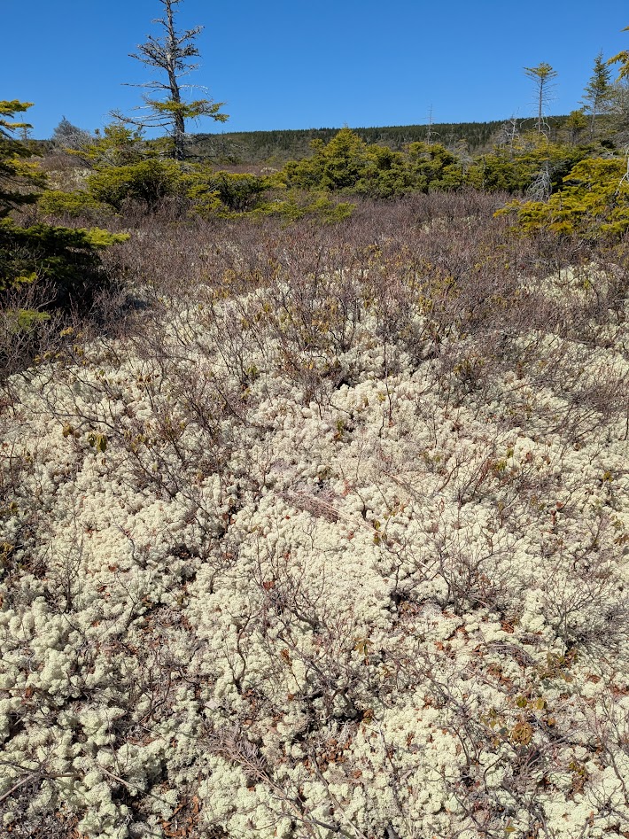
The inland part of Cape Breton looked, to me, like Alaskan taiga (stunted forest) or tundra (no forest at all).
taiga…and tundra.
When I’ve shown folks this picture, their response has been, “Wow–it looks so dry!” Nope. Very wet. Just not leafed out yet.
blueberry plants growing in thick reindeer lichen
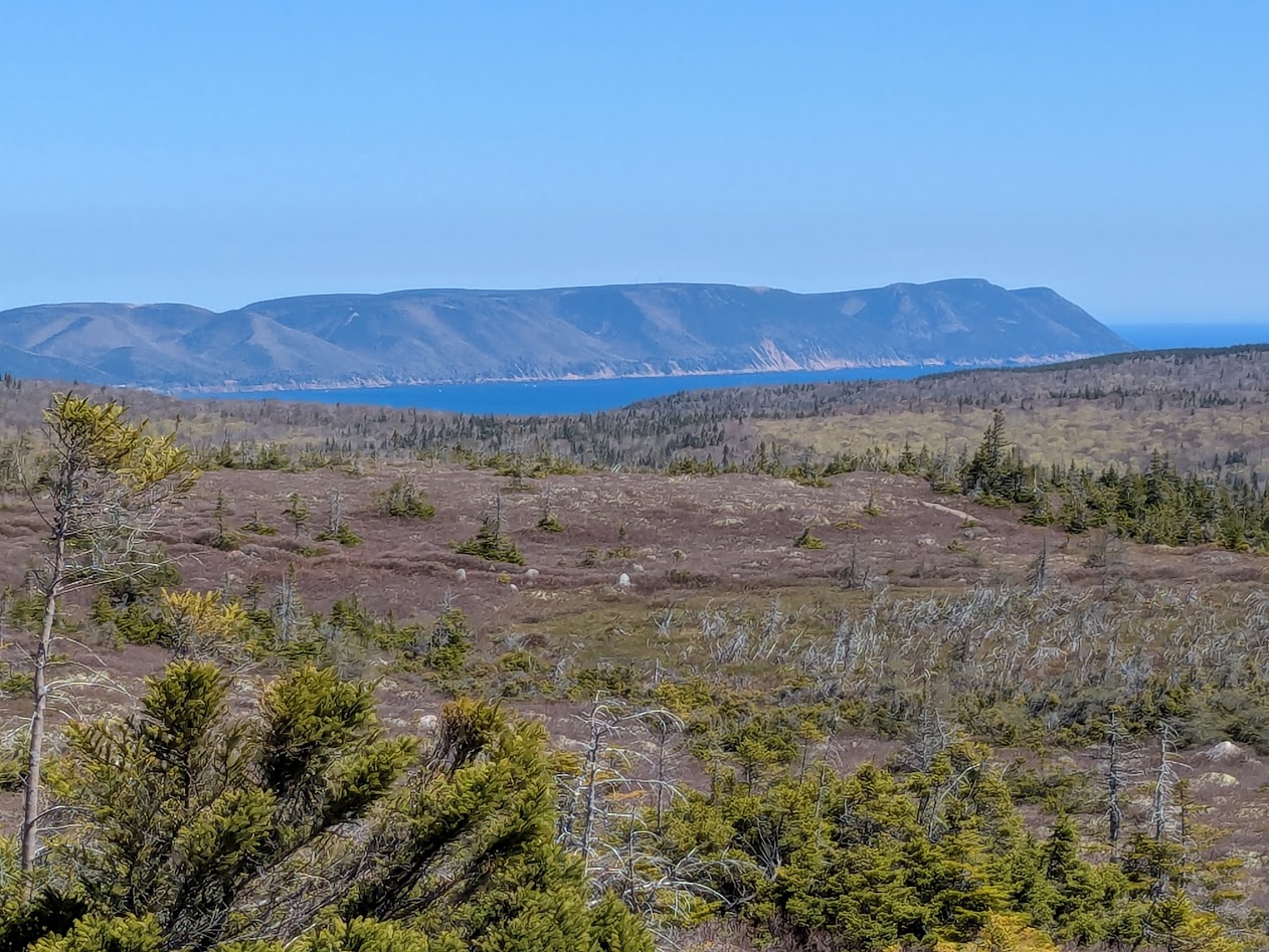
On to the east coast of the island. If the center is Alaska-esque, we thought the east coast looked like Maine:
The granite really is that pink!
And those brown creeks make such a contrast there!
This is my favorite picture from the whole trip.
Closeup of that granite:
Nova Scotia tartan?
We also explored some beautiful inland lakes on the east side…
…starting with this sweet little crossing of the headwaters.
This one shows off the best combo: pink sand, strong-tea water, and a great grey giant from the past:
SURE there’s no moose out there?
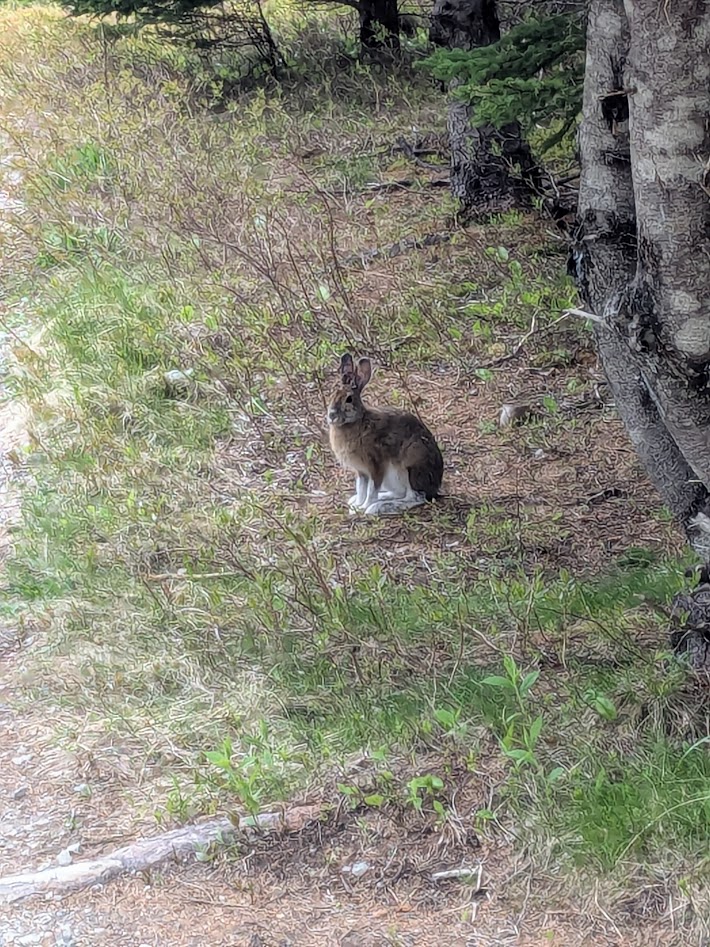
Speaking of the moose we didn’t see…I’ve been totally remiss in discussing the wildlife we DID see! Like this black bear (don’t get too excited–it was mostly visible through binocs):
That black dot in the very center of the shot? Bear. (I did warn you it wasn’t close.)
We also encountered a couple of bunnies, which, we realized by their coloring, were actually Arctic Hares still transitioning from their winter whites.
Our favorite hike followed this skinny spit sticking out into the big blue Atlantic:
Ok, not blue yet…wait till the sun comes out…That’s a little better. But keep your eye on that boat…
The lobster fishermen were busy while we were there, and they got so close we were job-shadowing them from shore!
Literally. I was counting their catch as they hauled it up.
Our last day on Cape Breton Island, we spent on the detached, southeastern part (see map above, near the town of Sydney), which is an island itself…attached by the briefest ferry ride we’ve ever been on:
Any decent ballplayer could throw across this gap! It took less than a minute to cross. Must be cheaper to maintain than a bridge…?
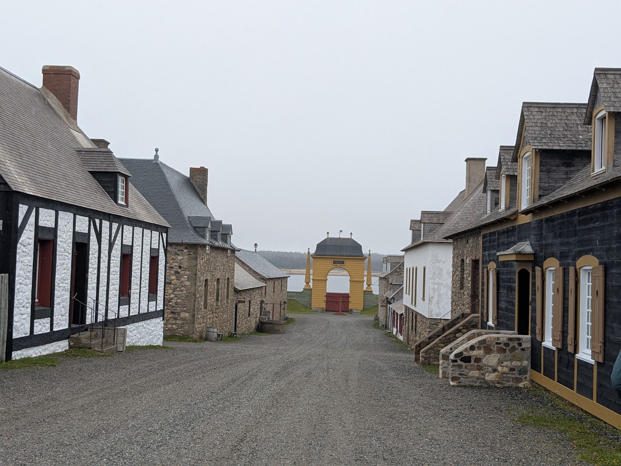
Over there, as the weather chilled down, The Mate & I did something we do very rarely on our trips together: we visited a museum. Make that a LIVING museum, Fort Louisborg.
Did I mention it’s still late May? Apparently nothing much gets going in Nova Scotia till June. We had the place mostly to ourselves.
Built by the French in 1713. Captured by the English. Recaptured by the French. Then finally destroyed by the Brits…all in about 50 years! Oh–and then rebuilt by the Canadian Government in the 1960s. The WHOLE thing.
This lady used the word “we” when describing the French. Good job, Madame.
I commented on how commodious these bunks looked…and was told by a chap in a soldier costume, “We’re three to a bed, you know.”
Oh.
After a week of leisurely wandering–the whole Cape being smaller than I’d expected, so we never had far to drive–we headed back to “mainland” Nova Scotia. First, we enjoyed this rare east-coast sunset over the ocean, from Cape Canso:
Wait–how’d the ocean get onto the west side???
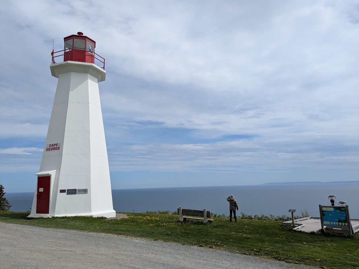
Then, the obligatory lighthouse, in Antigonish:
pronounced Auntie-gon-ISH, we learned…very Scots!
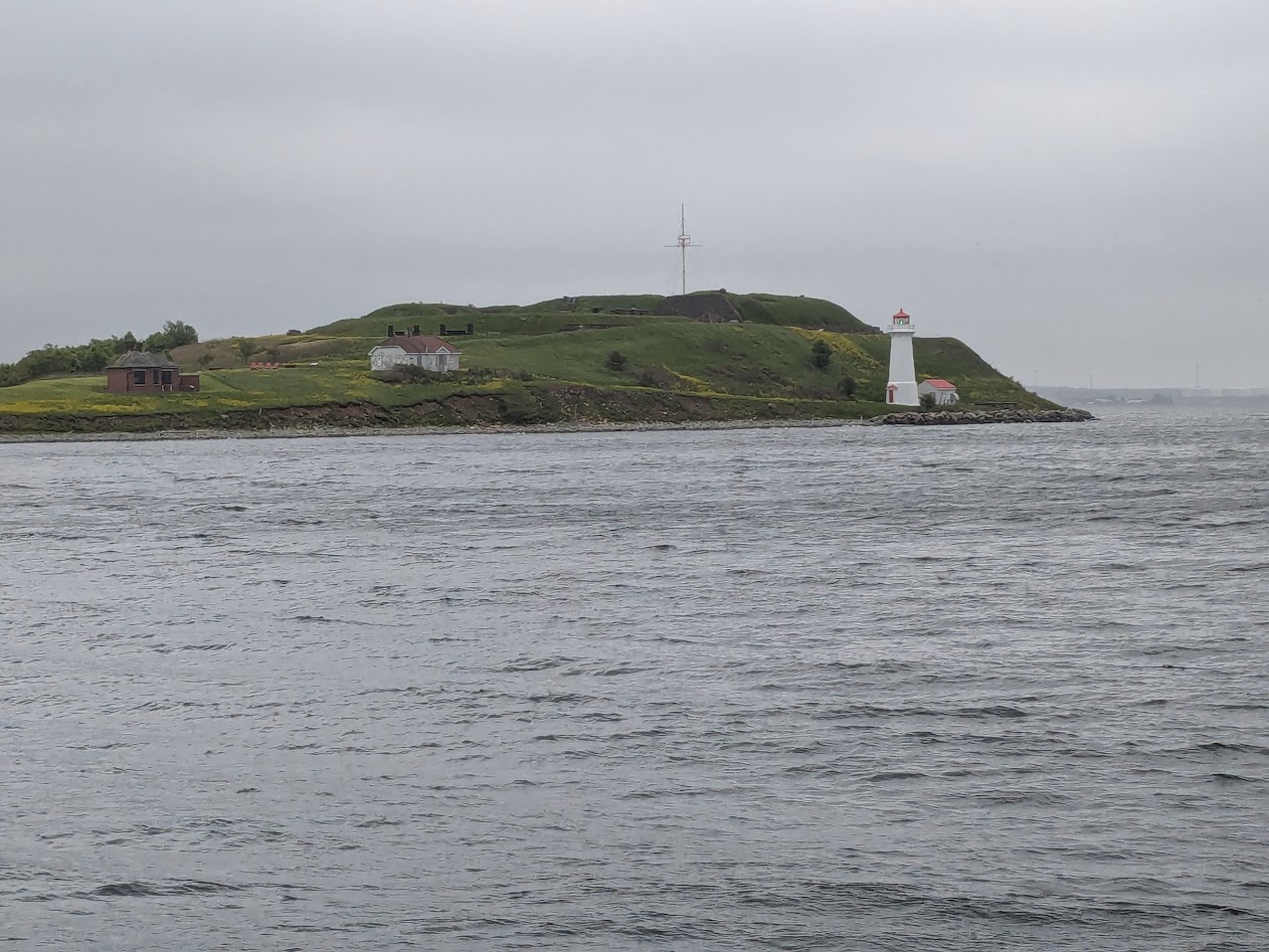
On our last day, we explored Halifax. They have their own Citadel there, in the center of the city…
Yep, that’s a citadel, all right.
…but we had had our fill of forts, so we just peeked over the fence, then spent our time walking from waterfront…
or “harbour,” as they spell it
…to public gardens…
Too cute! (no, I don’t just mean The Mate)
…enjoying Halifax’s many murals…
I’d like a butterfly on my house!
…and back to our hotel, which was full of Europeans.
On our ride to the airport next morning, our cab driver told us he never picked up Americans from that hotel, which made us oddly happy.
We headed home with mixed emotions. On the one hand: Canada has NEVER felt as safe and alluring as it does now, and I’m sure I needn’t explain that statement.
“I have a week’s vacation, use it or lose it,” said Son One from Costa Rica. “But getting to Lopez Island and back would take 2 days out of that. Wanna meet somewhere else?”
“Way too long since we’ve seen our New England cousins,” I mused.
Next thing you know…
NOT an actual cousin…but cousin-adjacent!
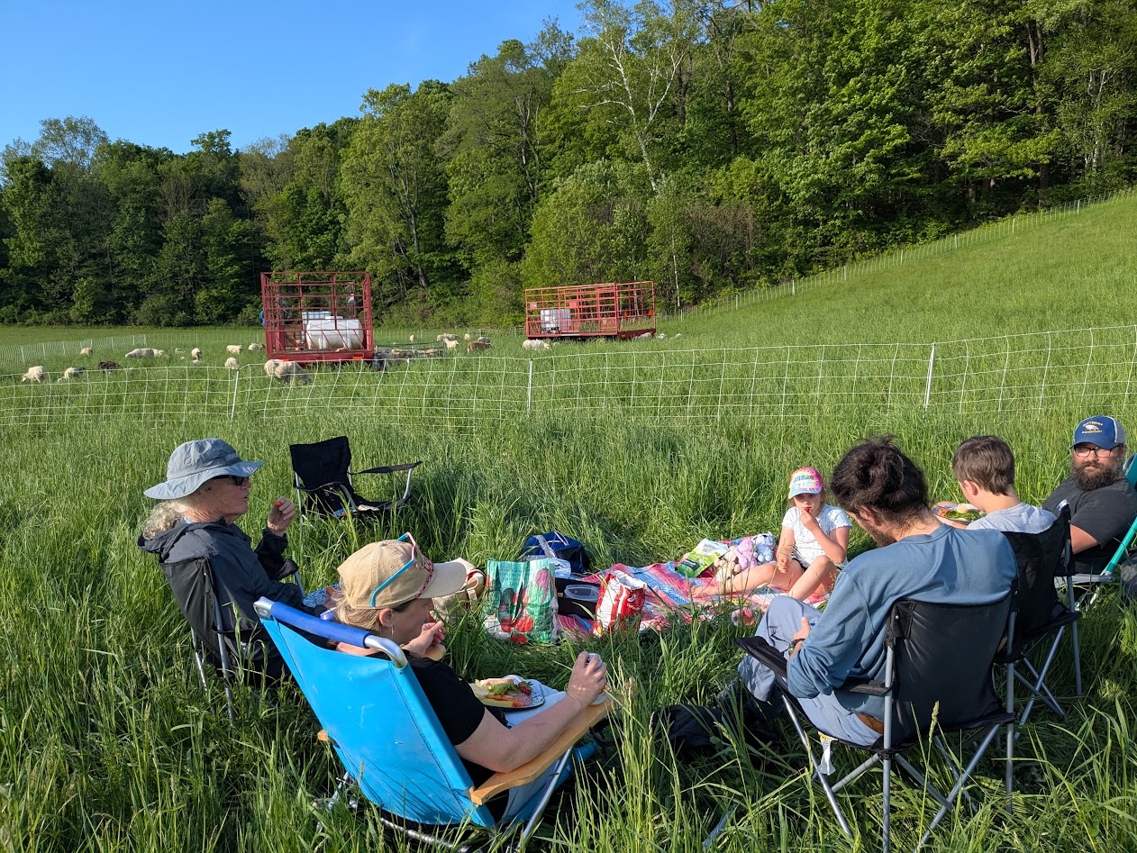
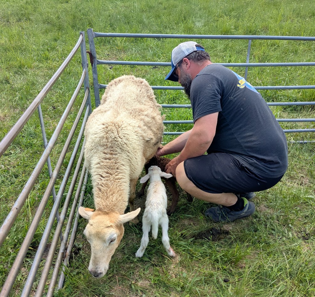
One branch of our family (on The Mate’s side) runs a sheep farm in southwestern Vermont. We love these people dearly. So after meeting Son One at Logan Airport in Boston, we headed over to Shaftsbury, and this:
Pasture picnic!
Cousins Jesse & Cally were deep in lambing season. Lots of triplets this year (sheep usually have twins), and Jesse was concerned about this lil’ brown one who needed help nursing.
“Pretty wobbly,” Jesse said. Meaning: Probably won’t make it.
After two days of sunshine, the weather slid sideways, and our youngest cousin got strep so we couldn’t hang out in a big group. But we helped out as much as possible (I was Lamb Camp Cook), in between soaking up the pure gorgeousness of that part of New England.
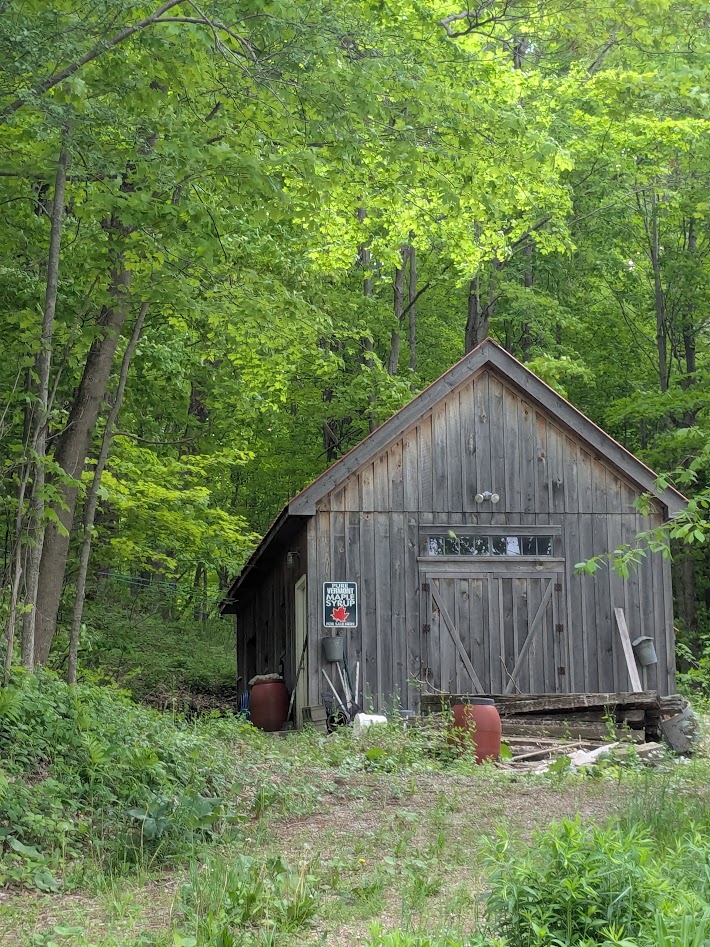
Not to mention the pure Vermontness! Like the neighbors’ sugar shack.
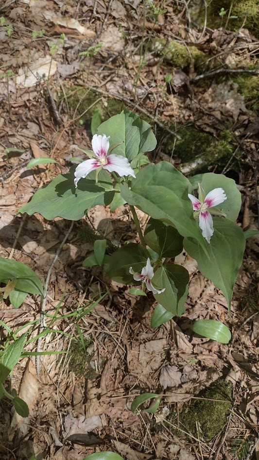
Spring’s later there than here on the North-wet Coast.
They still have trillium blooming!
On our last day, we walked up to Studio Hill, for which the farm is named…
You can see why.
…and stopped to say goodbye to the flock, now more than doubled in size, 130 lambs and counting. Our cousins were hosting a (literal) field trip for their son’s 5th grade class, so we listened in. You gotta love hearing 11 year-olds warning each other, “Look out, don’t step in the placenta.”
Oh, and I learned a neat trick about telling the gender of the lambs! Right ear tag = ram lamb. Left = ewe…
Like our lil’ brown gal! She made it after all!!!!
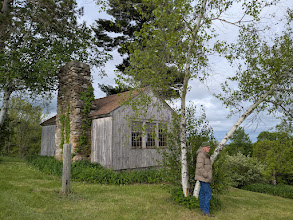
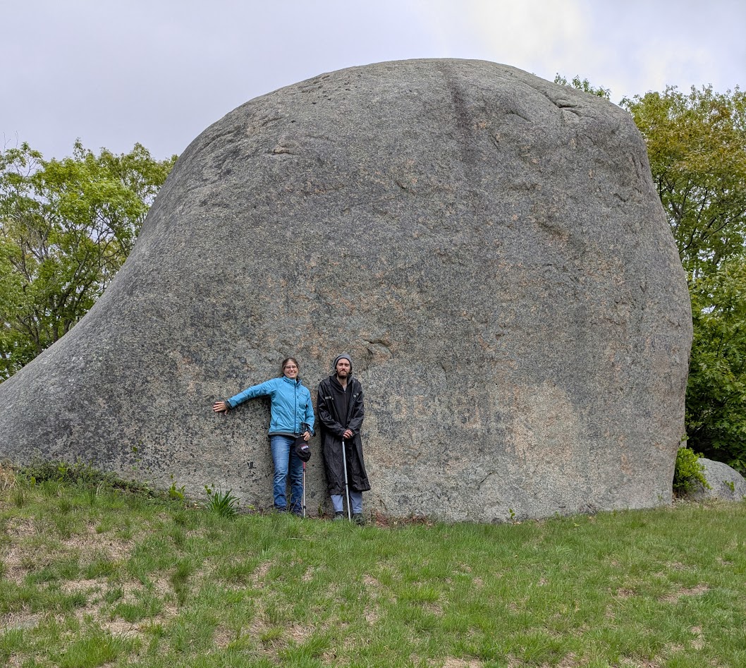
Next up: Gloucester, MA, the home of Cousin Cally’s parents–or more specifically, the village of Annisquam. This place was a second home to me as a college student, back in the early 80s.
I used to sunbathe on Lighthouse Beach. But not today!
I don’t know if “Annis” or “Squam” means Big Honkin’ Rocks, but it should.
Son One and I deciding we’re fine with posing at the bottom instead of the top.
Rocks define the place. Even in the middle of the woods, giant boulders rise like whales, casually, like they own the place.
which they do
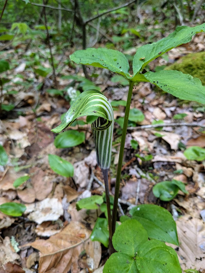
Coastal Massachusetts spring was a little farther along than in Vermont: no more trillium, just this cute lil’ Jack-in-the-pulpit:
Preach on, Jack!
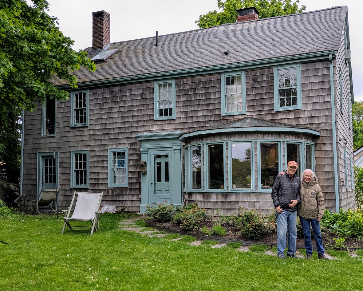
Annisquam is also defined by its AGE. Here’s the (former) home of the Mate’s Aunt Erma (really a cousin, but REALLY more like his adopted mom), built around 1700:
Many’s the bowl of fish chowder served in that blessed kitchen!
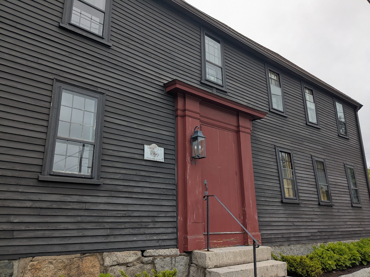
Walking around the neighborhood, I couldn’t help but capture the “official” oldest dwelling:
1690, the sign says. But I still love Erma’s house best.
Son One had to get on back to his beloved jungle, but after dropping him at the airport, we took a last visit of Lobster Cove…
…remembering various leaps off that bridge from the past. Not today, thanks!
Speaking of cold water: from Massachusetts, the Mate & I hopped an eastward-bound plane for Nova Scotia. Call it a bucket list thing. Which I’ll save for the next post.
This was what our departure looked like, ferrying east from Lopez Island:
Red sun in the morning…
If that red sunrise was a bad omen, it was a day late. We’d actually tried to leave the day before, but a) missed the 6:15 ferry b/c we didn’t realize how many trucks depart the island on Thursdays, leaving few overheight spaces for our tall Vanna Grey, and b) they cancelled the 9:30.
So we awarded ourselves a “free day” at home and had one fewer day in BC. Best Choice.
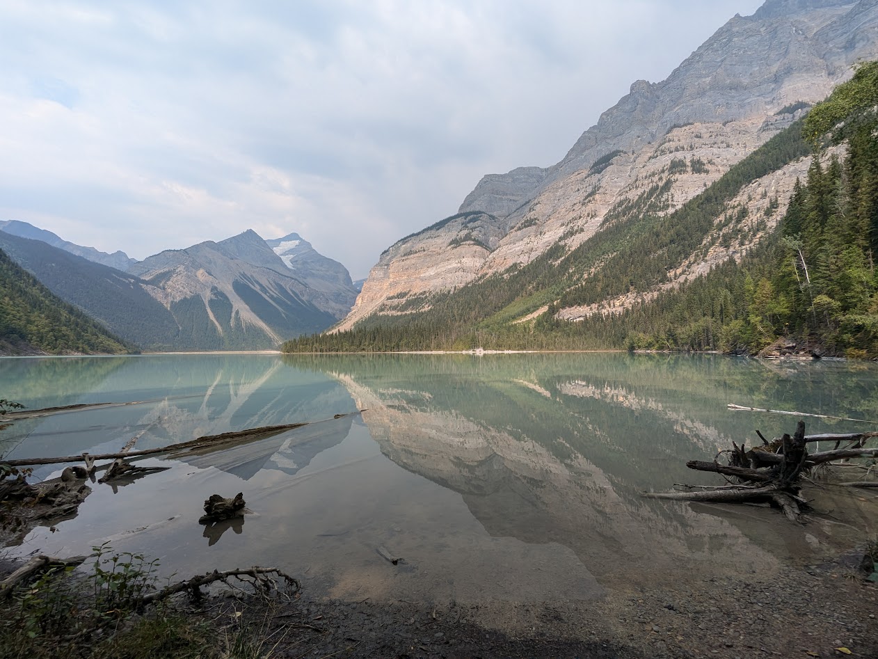
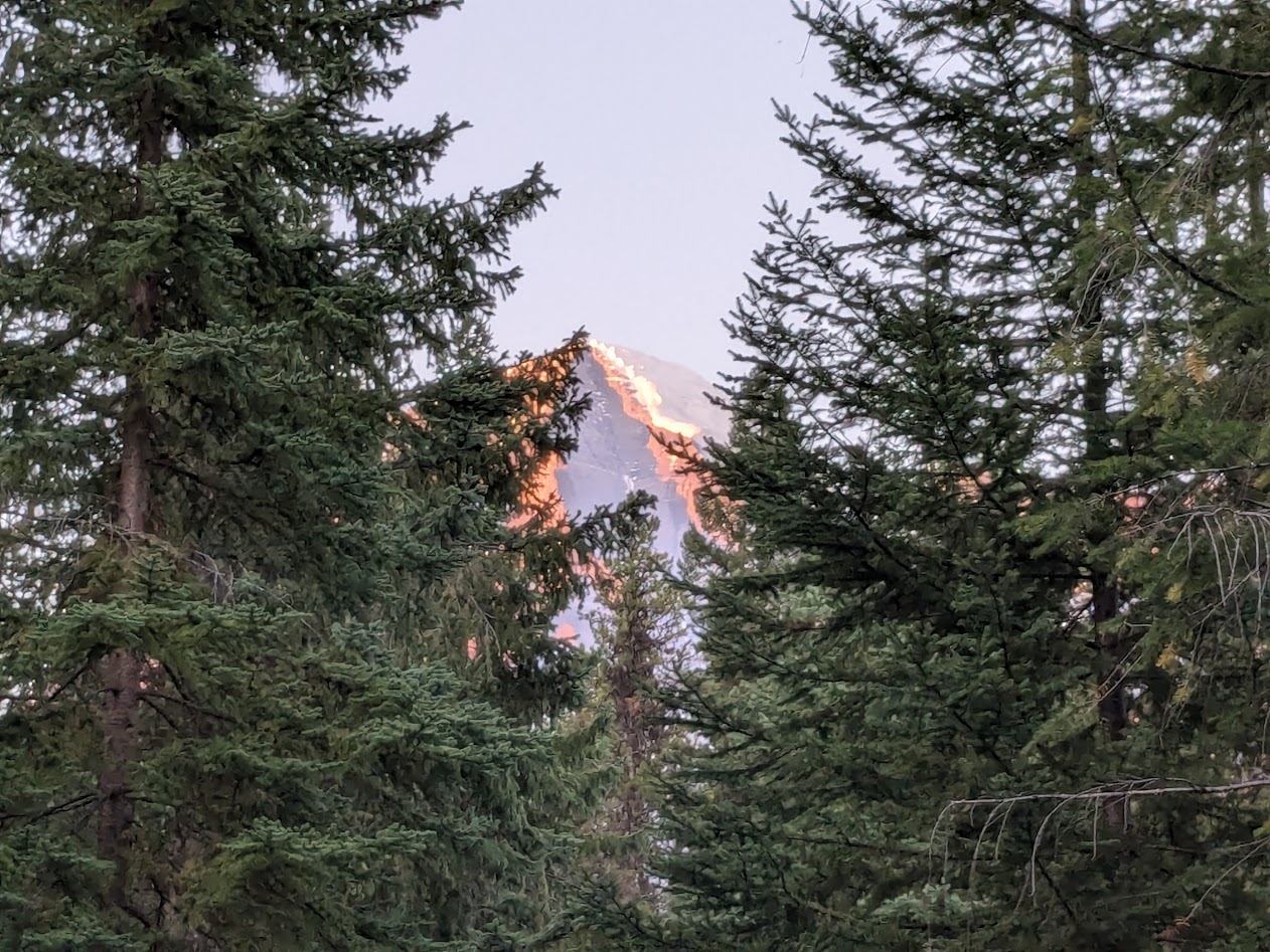
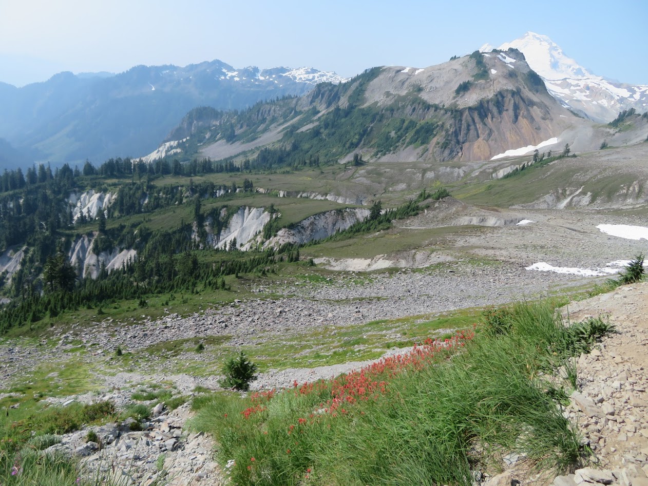
We went straight to a park we’ve usually passed by on our way to the better-known Jasper National Park: Mt. Robson Provincial Park. Named for the tallest of the Canadian Rockies.
Fun fact: Mt. Robson’s glaciers are rare “live” glaciers, meaning they are growing rather than retreating. Go Mt. Rob! Go ice!
Despite our campsite’s thick shelter of trees, we still had a view of the mountain’s peak:
Rob, meet Vanna
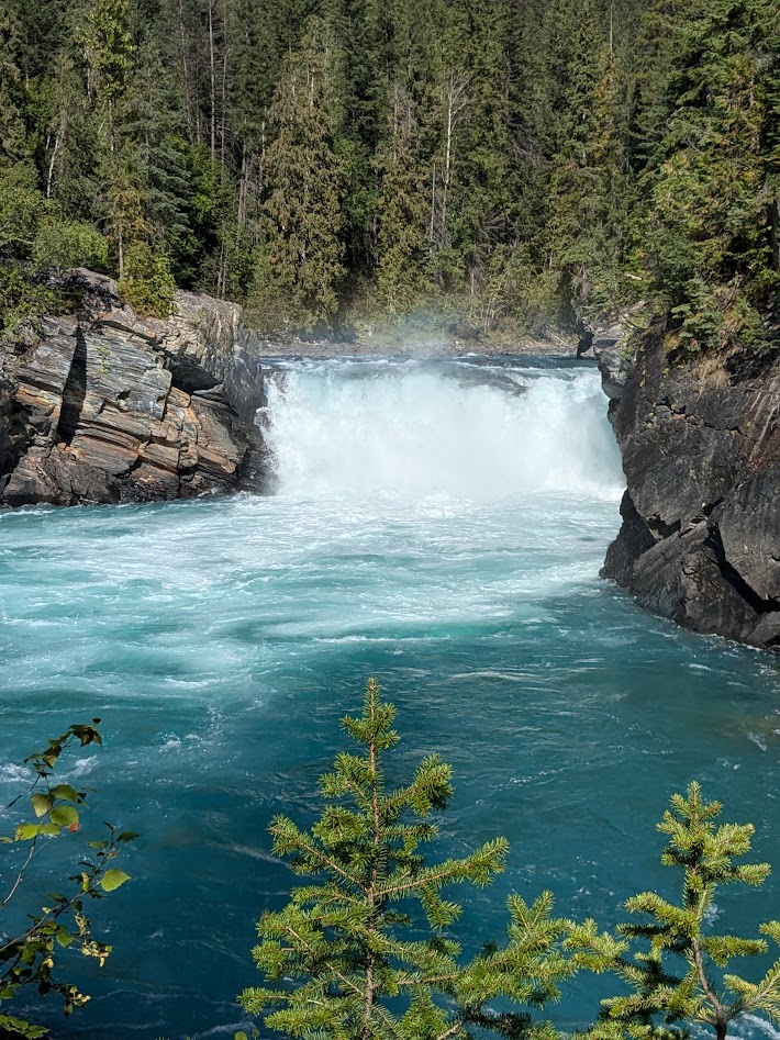
There’s really only one MAIN hike in the park, so, saving it for our longer day, we spent our first afternoon checking out the falls of the Fraser River. Hard to believe something this bright becomes the familiar brown body of water passing by Vancouver.
Oh, this old thing? It’s just something I threw on.
The weather was dry and hot (for Canada, and for The Mate & me), but that didn’t stop the mushrooms.
OK, who ordered the mushroom bagel?
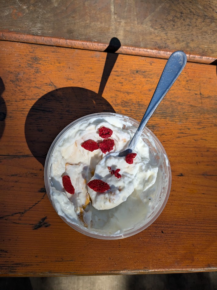
Too late in the season for most wildflowers–but I did manage to find a few ripe thimbleberries to add to my yogurt.
The hot new flavor!
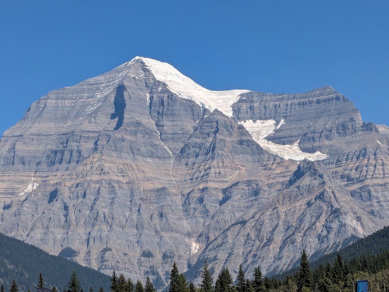
Mt. Robson appeared to soaked up all the sun he could; can you blame him?
“I mean, it’s probably gonna rain tomorrow…”
Next day we headed up the trail, following the Robson River to its source, Kinney Lake.
Kenny at Kinney.
That incredible mountain seemed to follow us every step of the trail, even in what seemed like a pretty dense forest. I guess it’s just THAT tall (just shy of 13,000 ft…close to Mt. Rainier height!).
Up top, the trail skirts the lake in ridiculously postcardy vistas.
…or ridiculously Christmascardy?
It was hard to make ourselves turn around and go back down. But even more impressive to follow that wild river, imagining the calm from which it came.
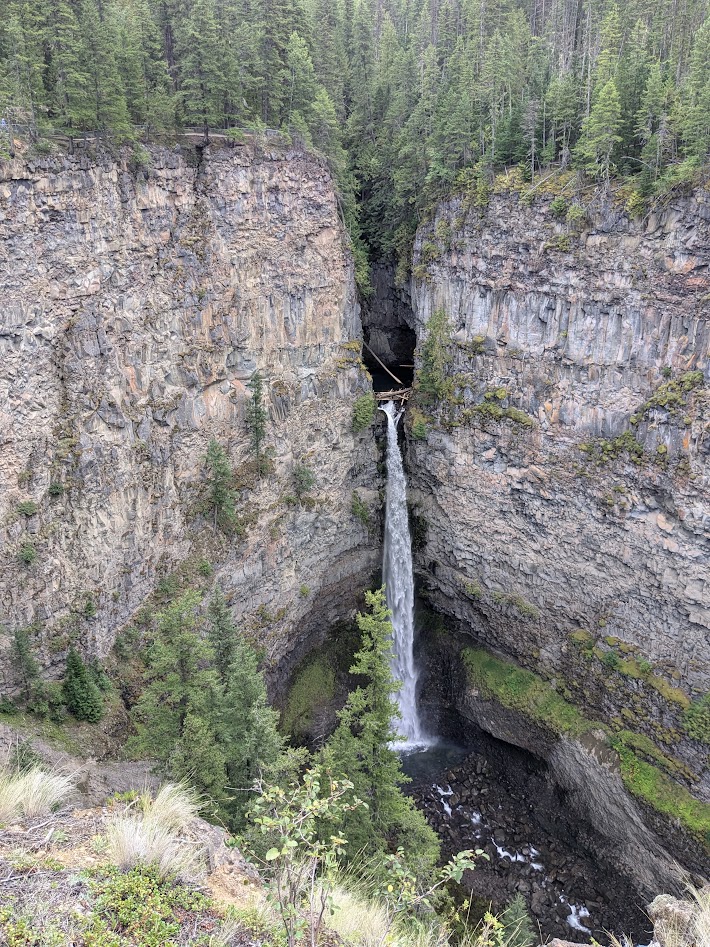
After two full days at Mt. Rob, we headed back south on the Yellowhead Highway (5), stopping to check out the small part of enormous Wells Gray Prov. Park that’s accessible to a big van.
Can I just say, it’s worth seeing? These falls are barely 10 miles from the highway.
Wells Gray’s campground was on a rougher road that we wanted to drive Vanna on, so we opted for a private site down below, in the town of Clearwater.
I guess this will have to do.
Next, we left the boreal forest behind, heading back into BC’s dry region, in the rain shadow of the coastal mountains, west of Kamloops. Some of it bore signs of last year’s terrible wildfires.
I believe the word I’m looking for is “stark.”
Not only did we score a campsite at a rafting company that was preparing to close for the season, but the owner let us camp for free.
We had the place to ourselves…including our own personal canyon.
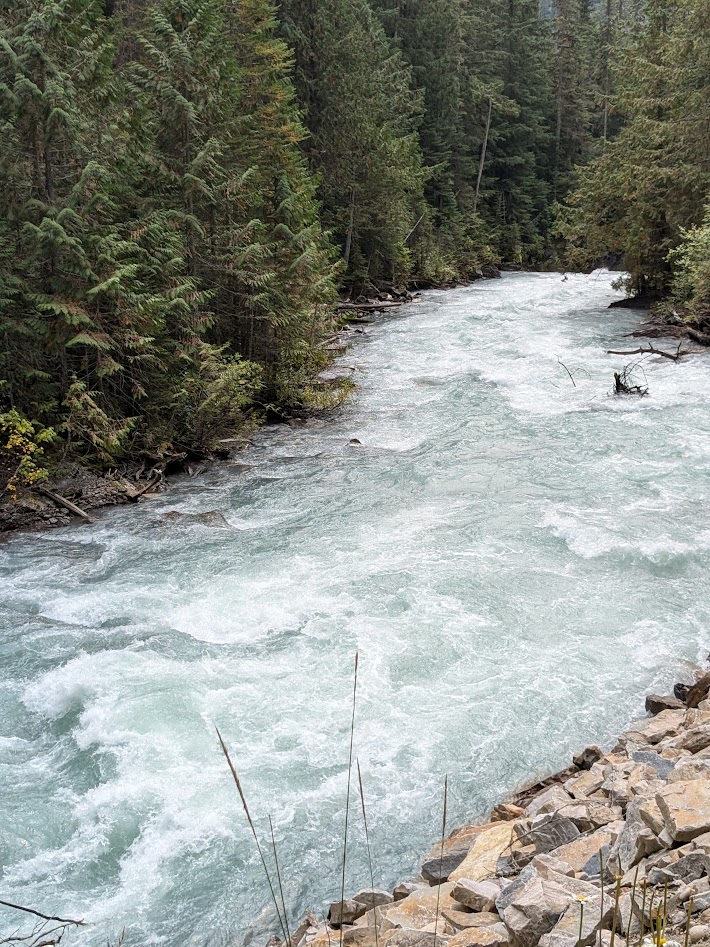
Yes, that’s the same Fraser River as in the waterfall shot, above. Getting a little darker…still blue enough.
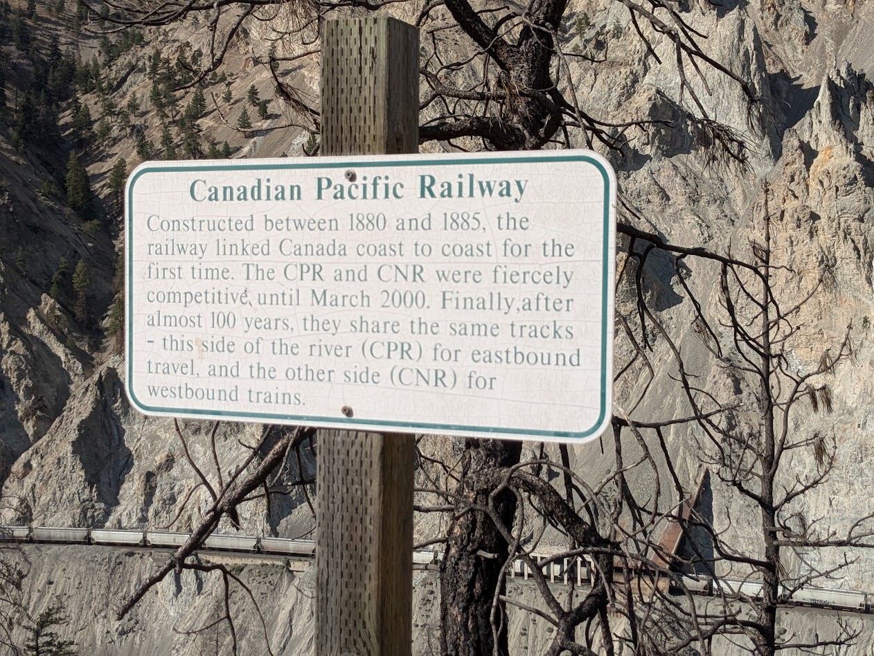
Oh, and those trains? There are tracks on both sides, demonstrating the stubbornness of capitalists, as we learned from this sign:
Well, hey. It only took 100 years for us to learn to share.
Here’s where I should note that those trains did a mighty good job of keeping us company. All night. Both directions. Bad Choice.
But how can you not choose your own personal canyon, at sunset?
Beautiful Canyon
Our last day, it was back to the wet: both in terms of ecosystem, and weather. We went to Hope, close to the US border, just an hour or so east of Vancouver. There we discovered an old friend: the Kettle Valley River rail-trail.
Well hello, buddy!
Unfortunately for us, construction work prevented us from riding all the way over to the Othello Tunnels, which we’d visited on a past trip. But Vanna took us there.
This kind of engineering brings to mind words like “chutzpah”…or “hubris.” Or: “really?”
In under a week, we were back home. Too short a trip? Not at all. Vanna’s whole raisond’etre in our lives these days is to keep us reminded what’s in our big backyard.
Here’s the thing: I ended my last post with a promise to get back to work on my novel.
Here’s the other thing: I did just that. Which is why that last post was almost a month ago.
Which is why I find myself with a teensy dilemma: use my limited non-novel writing time to blog the easy way–basically just “Look at my travel pics, now with witty commentary!”–or do I use this medium to deal more thoughtfully with current events or Big Ideas?
Ooh, did somebody say travel pics?
Then this thought occurred to me: the back-to-back camping trips I most recently took might function as a metaphor for this dilemma of the comfortable, “look, pretty!” vs. the more weight-bearing “let’s think about something” blog post.
Trip One, with The Mate, involved Campering in Vanna Grey.
Vanna, meet Silver Springs Campground, at the base of Mt. Rainier!
Silver Springs Campground proved to be more than hyperbole, as we found this large and yes, silvery spring springing straight out of the mountainside above our campsite.
Cue the Stevie Nicks
We also got an up-close view of where the White River got its name, as some overflow met the clear water of the springs.
On your right, ladies & gentlemen: the White River.
But…you see what I’m doing here? I’m narrating pretty travel pictures. How easy, how convenient! Just like Vanna Grey. Drive, park–congratulations, you’ve arrived. Nothing much to think about.
And this view? We just drove up here. Twice. Because we could.
Don’t get me wrong: I’m not saying campering is shallow. Beauty abounds, even from a camper, and beauty is moving.
Especially at sunrise.
What I am saying…I think…is that campering, by dint of being so easy, does not tap into the kind of thoughts that spring from having one’s body fully committed. Yes, we went on some fabulous day hikes, which made me think about stuff like…
…why do I insist on making The Mate take my picture with flowers all the time?
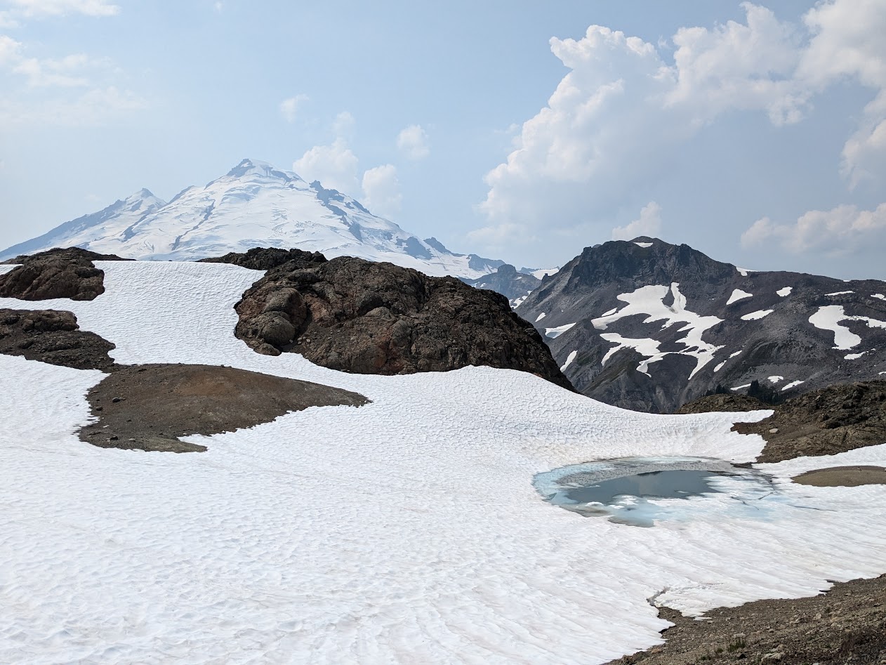
…or even ponder the impact of global warming on the nose of a glacier…
Oh dear…pretty sure last time we were here, the ice reached all the way to that gravelly wall 😦
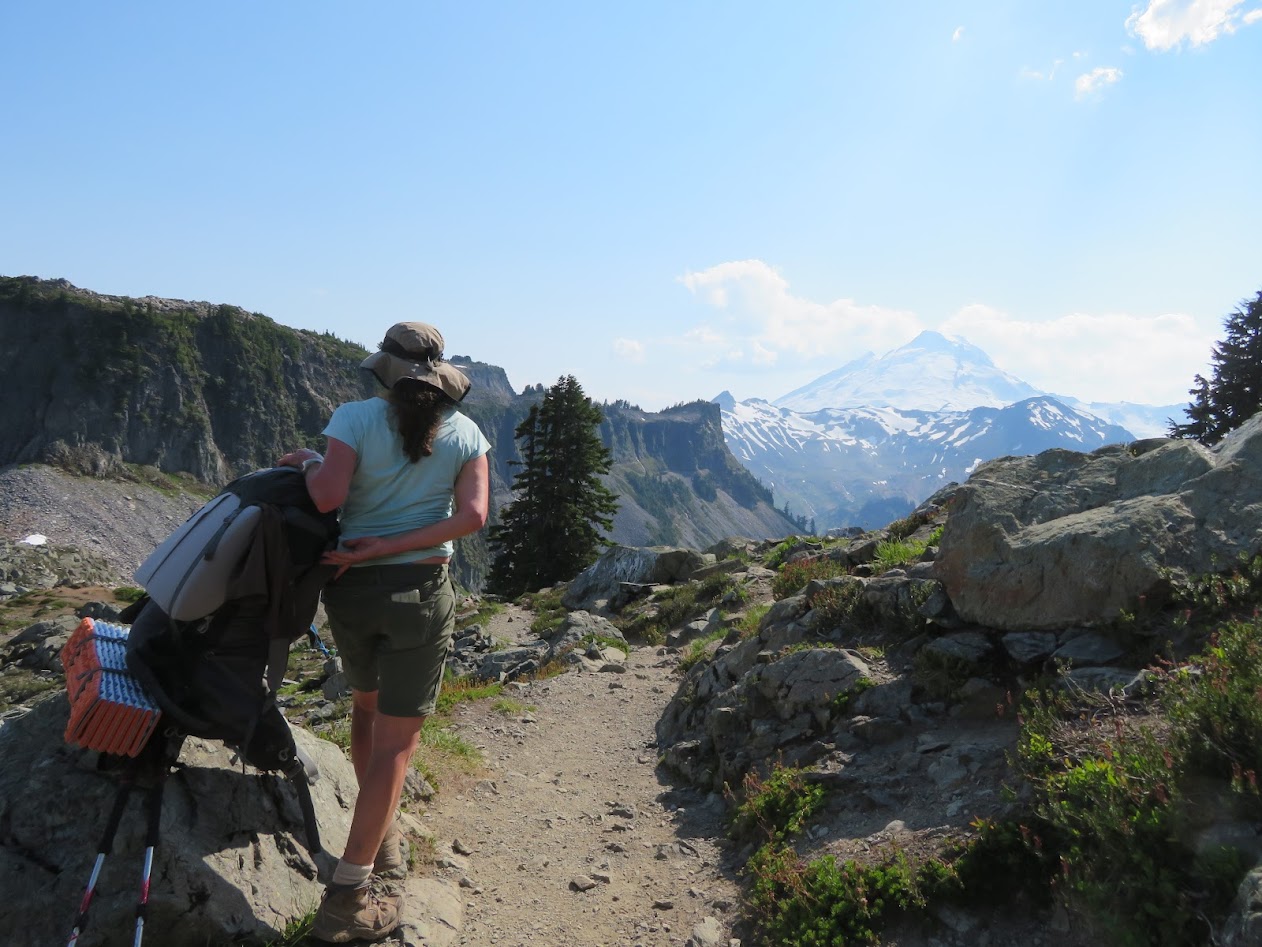
But putting your entire camp + food on your back and humping it up a pass, as I did with my Ironwoman Goddaughter Allison…
…who, lucky for me, takes even more pictures that I do!
…that kind of effort delves into a whole different level of thought. (Which does indeed feature a good deal of “what’s for dinner?”)
Why is this? I wonder. Is it that being away from vehicles leads to deeper, more stripped-down conversation?
Hayes Lake, near Kulshan (Mt. Baker). Allison pumping water in the background
Is it the braggadocious joy of thinking “I got myself to this beautiful place!”?
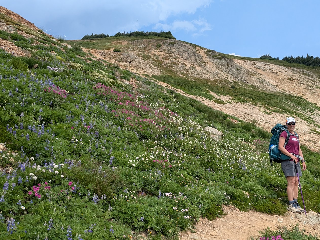
…where your Ironman T-shirt matches the wildflowers?
Is it the relative quiet of roadlessness that allows one to sink more deeply into the stark reality of melting glaciers?
…which still look so stinkin’ pretty as they melt
It’s not like you can’t see cute animals while campering.
Someone say cute animals?
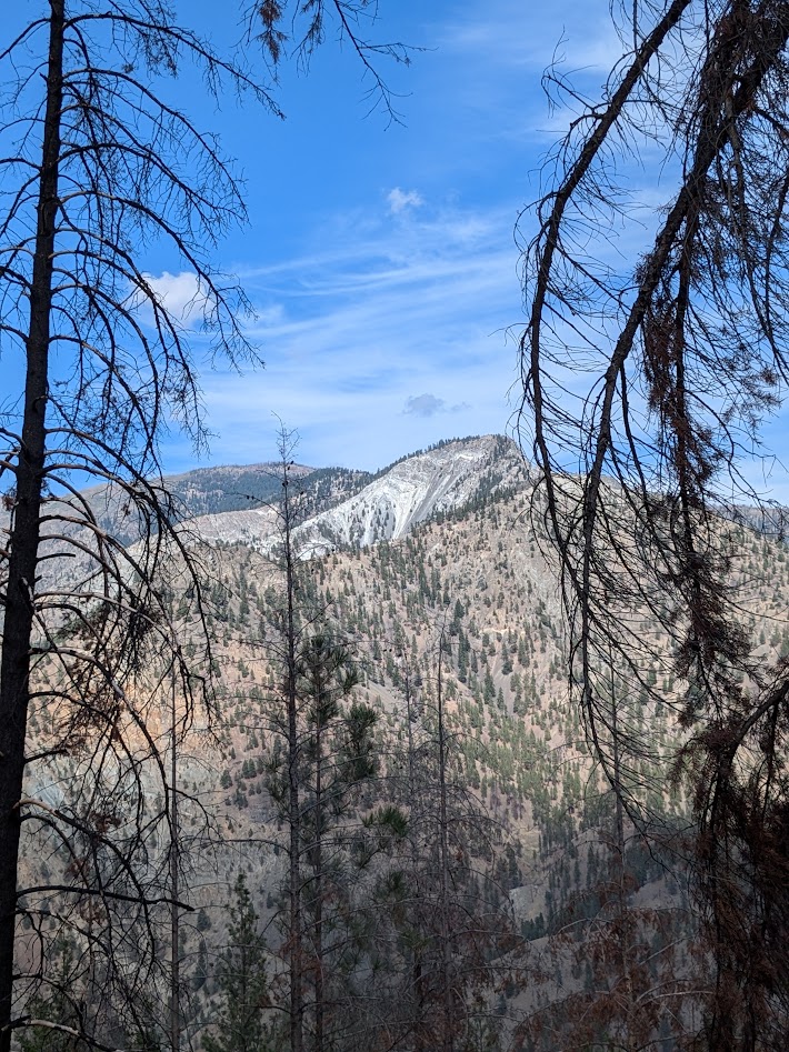
Of course, it IS true that some wild animals are generally further out of reach than others. We were actually pretty shocked to meet this many mountain goats only a few miles away from the Mt. Baker ski area parking lot.
But generally speaking, while I spent nearly equal time campering as backpacking a couple weeks ago, the backpacking trip felt more CONSEQUENTIAL.
Meaningful. Harder but more rewarding.
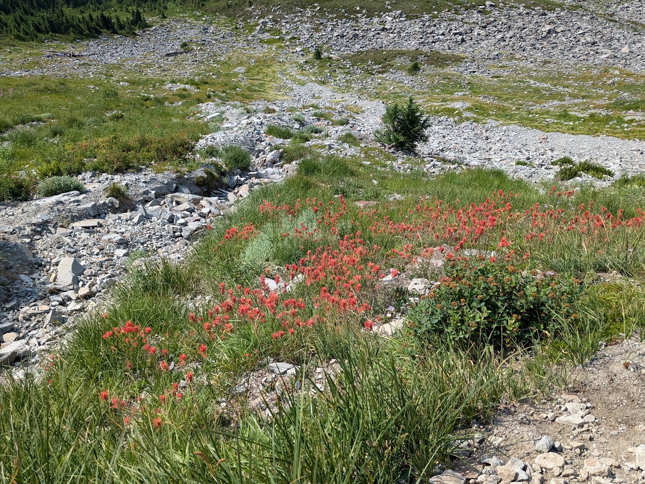
Yes, this patch of paintbrush was easily accessible from the parking lot……but this half-frozen tarn was not.
Now, August is coming to a close, and so, for me, is backpacking season. Because we now own Vanna Grey, The Mate and I will continue to “camper” as the weather turns harsher.
Hopefully with occasional vistas like this of Mt. Shuksan. Look carefully: you can actually see the road & parking lot in the background!
But as the political season enters its autumnal stretch, I feel the need to use this blog for more than showing off trip pictures. (Even though I LOVE showing off trip pictures.)
So much is happening in this country. So much to think about, talk about, work for. What joy to throw some of that in my blog-pack and see where we end up.See you down the trail!