“Tramp,” actually–not walk. Kiwis don’t hike trails, they tramp tracks. And we’re going to New Zealand now, where I’ve been for most of the past month, and still am, mentally, for the past week since coming home. This blog entry will allow me to stay a while longer. Thanks for that.
January 30, with our tidy, heavy backpacks, we hopped a bus in Te Anau (in Fiordland, on the southwest of the South Island) to a boat which took us to the top of (beautiful, 40-mile long, 1,200 ft-deep) Lake Te Anau and dropped us off at the start of the track. I was filled with that childlike sense of “I can’t believe this is finally happening!”–a feeling which never wore off, as a matter of fact, during the whole five days. (That’s what you get for wanting to do something for 20 years, I guess. I’ve always enjoyed the extra boost of joy I get from anticipation, and this was extra-extra.)

Let’s go let’s go let’s go!
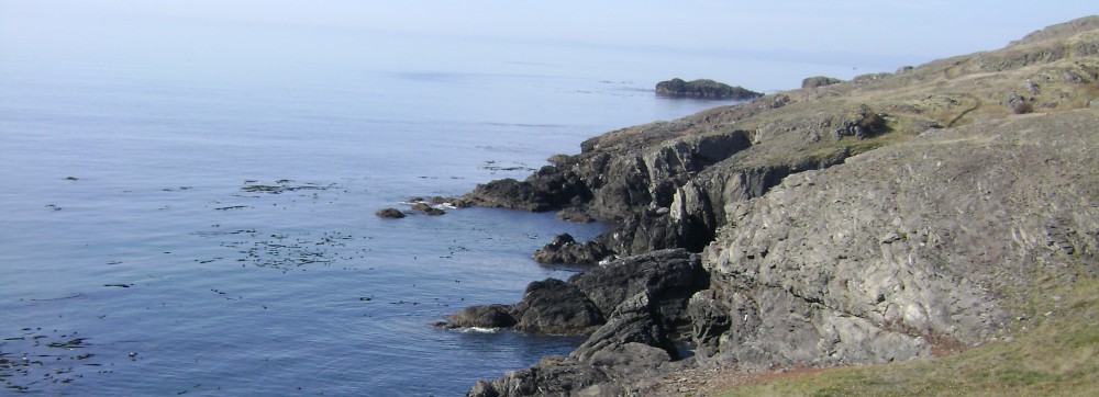
The boat dropped us off. Every tramper had to step carefully through a pair of tubs filled with bleach solution, to kill an invasive algae that’s plaguing NZ waters. Milford’s rivers are still blessedly pure.

After 20 years…we’re on our way.
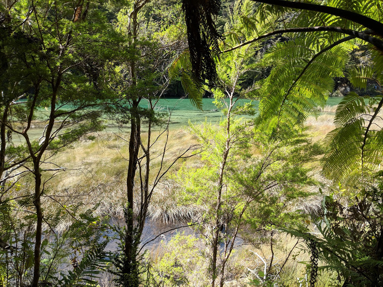
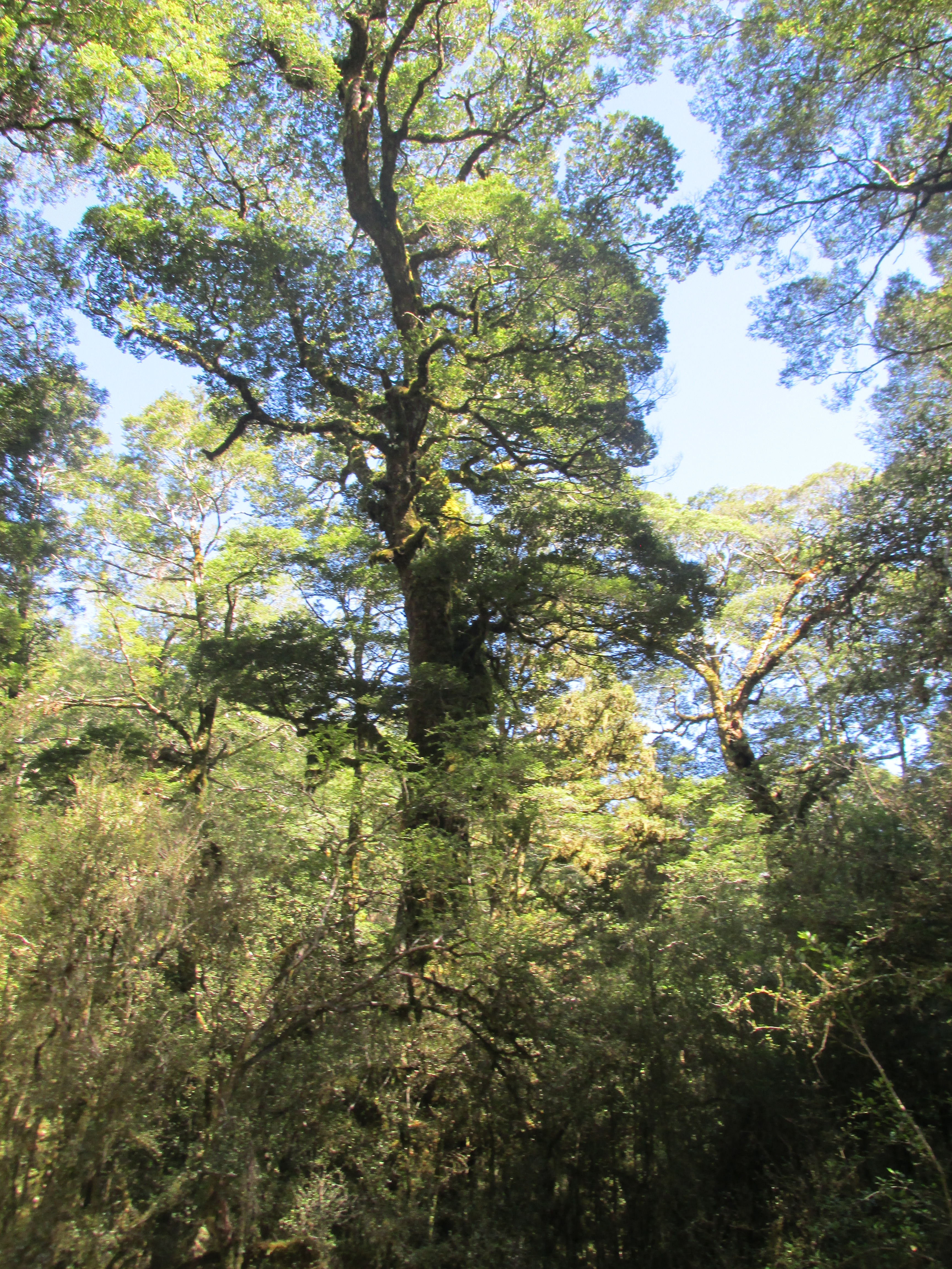
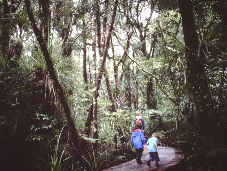
Off we tramped into mature beech forest, those giant Lord Of The Rings southern beeches with tiny, dark leaves and craggy, ferny, rainforesty trunks. Huge. Immersed in silence, with occasional blasts from tiny fantails and black robins with outsized voices, I could not wipe the smile off my face.

Imagine birdsong…

Mountain Beech
The first hut was only 5k away and the day was fine. (In NZ, food is “nice” and weather is “fine”–the opposite of how we say it.) So we took our time, stopping for lunch and photos. We both wished the first hut had been further in, making the next day shorter, but I guess the public huts are spaced carefully apart from the lodges of the paying trampers (who have their packs carried and meals prepared), and those lodges seem to have been built first.

The irony of this river’s name was inescapable, as we hiked along it only 10 days after the other guy’s inauguration…
At Clinton Hut (on the Clinton River) we had plenty of leisure time. I covered myself up from sandflies and found a mossy log to lounge upon and write in my journal, and a sweet little black robin came and sat on my feet! I think it was eating my sandflies. (No pictures of that–I didn’t want to scare the lil’ guy off.)
***Not pictured: black robin eating Gretchen’s sandflies***
That night it started to rain. We’d seen the weather reports; the next day looked horrible, and we fully expected to be hiking in torrential rain and wind. Our Hut Warden, Rose, warned us, “It’ll be like walking into the shower with the spray pointed at your face.” But we took comfort in the hope that the following day would be clear to crest the pass.

OK, I see what they mean about trail washouts…
Rain it did–where we were, yes, but even more above us, and on the other side of the pass. We apparently received 9 inches; I’m not sure what they got, but it was more. Which was a problem. That first morning, all packed up and ready to roll, we 40 trampers listened to Rose telling usthat the track would become impassible up ahead. (Neck-deep, in fact, is what it turned out to be on the other side of the pass!) So the 40 trampers in the next hut couldn’t move on, which meant that we couldn’t either. Having already spent a full afternoon in Clinton Hut, we were now officially forbidden to leave it for another 24 hours. (Rose actually put a rope across the track–never seen that before.)

Clinton Hut wasn’t my favorite, especially after being trapped there an extra 24 hrs. This is Mintaro, Hut #2–so happy to be there!
***Not pictured: rainy, rainy Clinton Hut***
As we were digesting this, feeling dismayed, it dawned on us that the hikers scheduled one day after us were having their entire trip CANCELLED. No way to double up folks in those huts, or at least no way the orderly Kiwis wanted to try. Wouldn’t that SUCK, to get all that way and have your tramp denied? So we counted our blessings: hey, an extra day on the Milford!

But hey, it’s a RAINforest. It’s just doing its job.
It was a long 24 hours, especially for the Mate, who hadn’t brought a book or cards, but all our fellow trampers were pleasant, so we got to know some folks from Israel, South Africa, England, Germany, the Netherlands, Australia, Malaysia, Japan, Thailand… (Only one other American; nice.)

Kotukutuku (Fuchsia tree)
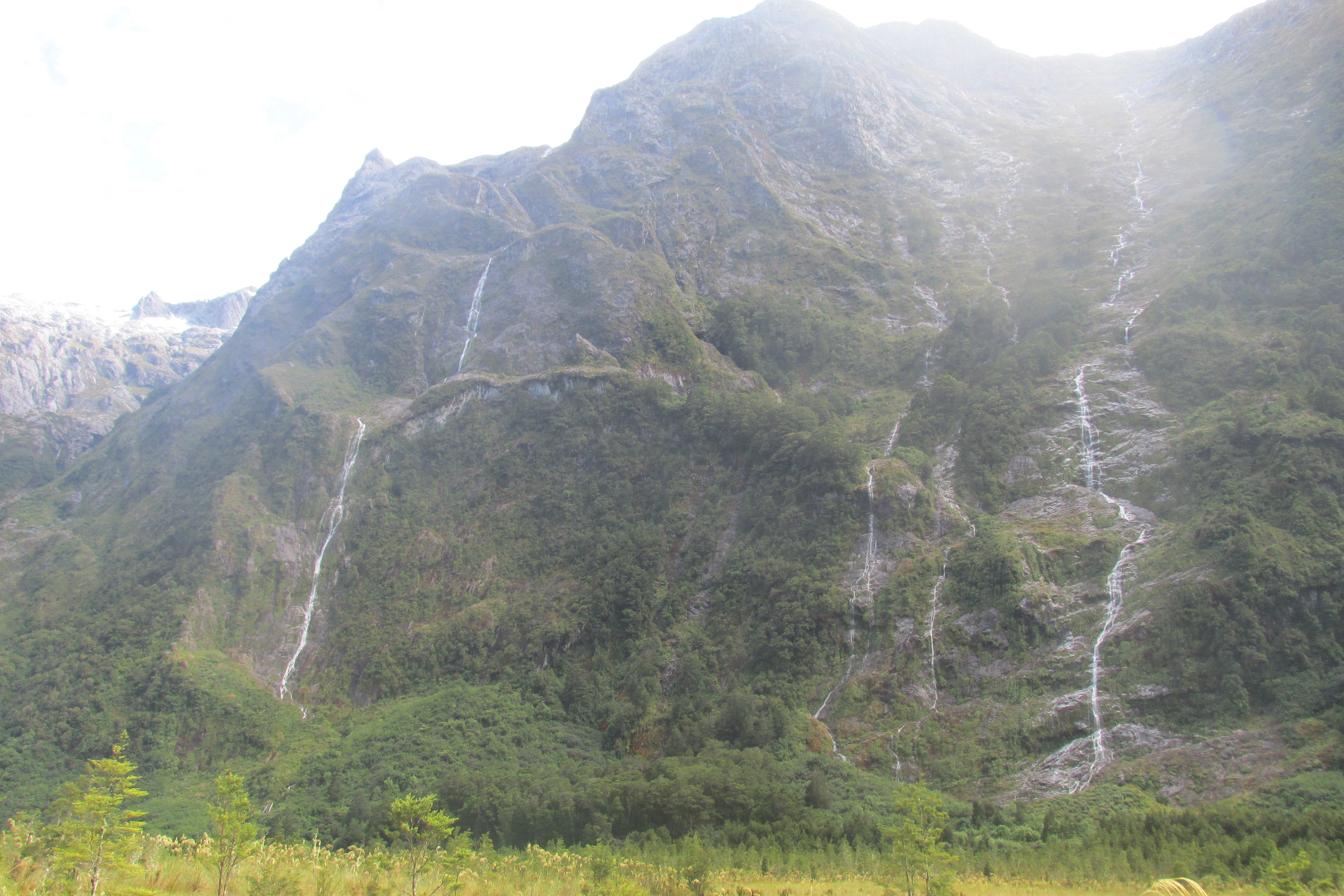
Our official Day 2 (actually Day 3) took us 8.5 miles, still only gently uphill, to Mintaro Hut in the fuchsia (kotukutuku) forest favored by bellbirds, so the birdsong got even better. The river valley narrowed there as we approached the river’s source, and of course there were waterfalls everywhere.

Waterfalls EVERYWHERE.
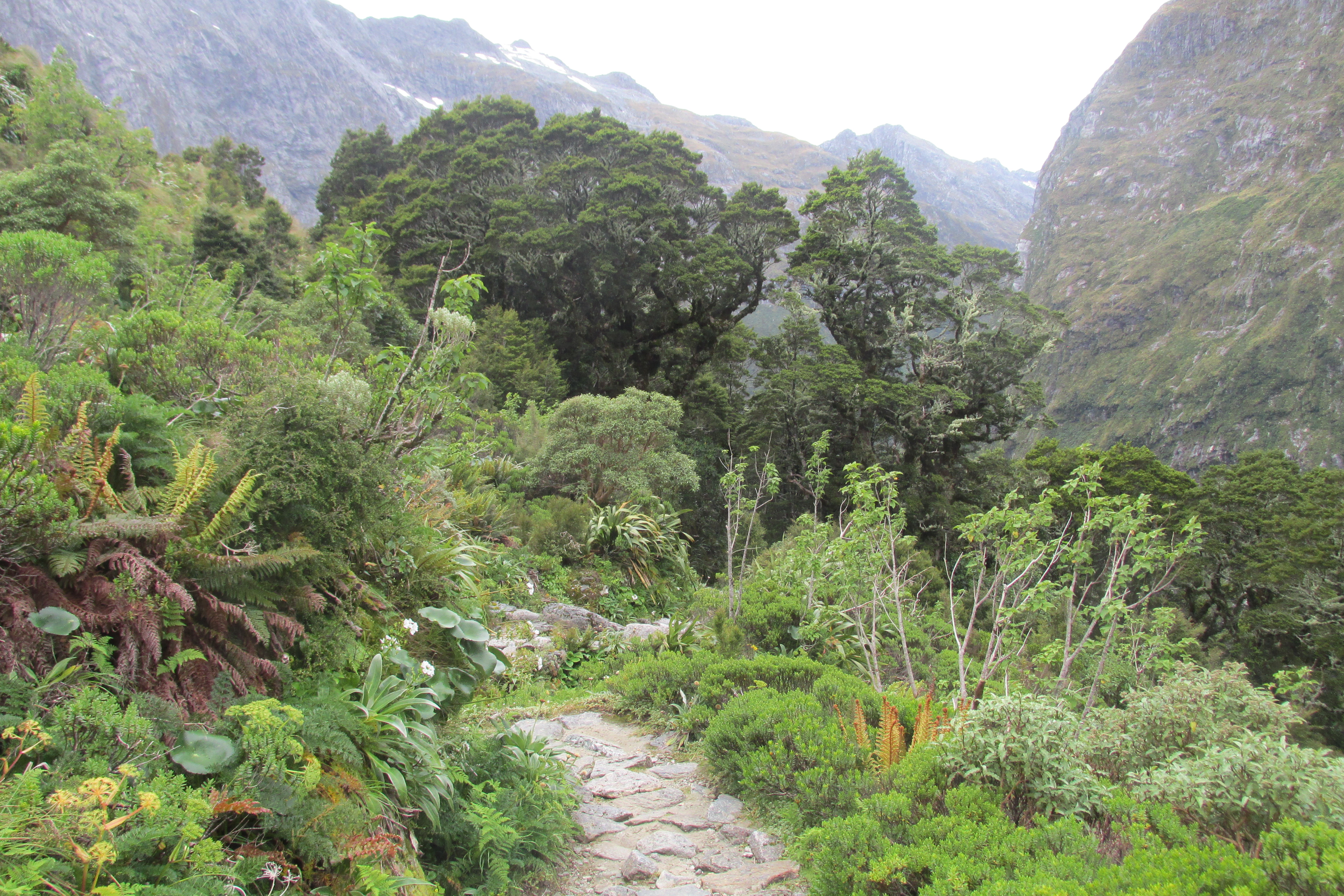
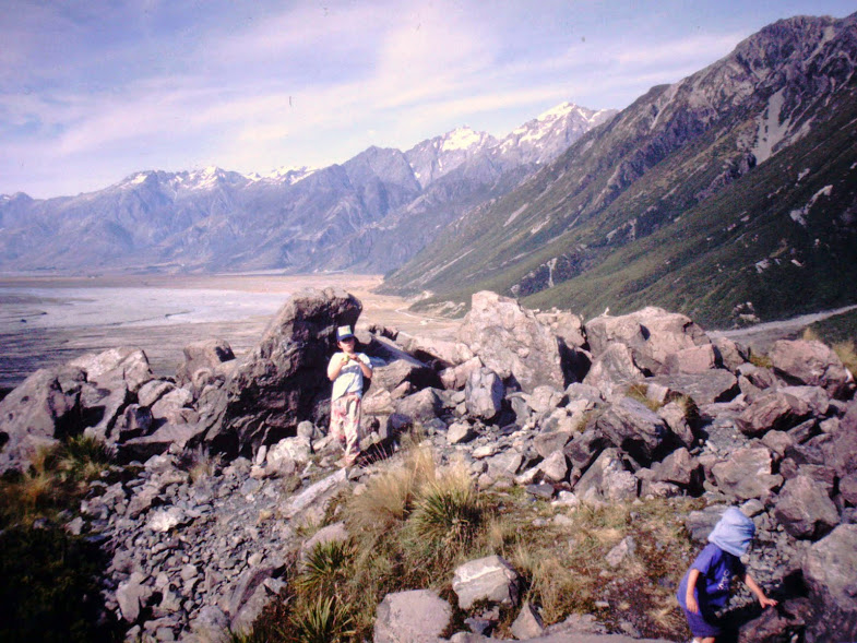
Day 4 was the highlight: MacKinnon Pass. It’s only about 3,500 ft, but considering that we started at sea level, we were not taking it lightly. To our pleasure, most of the climb was graded so gently that we made it much more easily than expected.

Passing the source of the Clinton River, on our way to the pass
From beech/fuchsia to flax/shrub to red tussock grass/bare rock/tarns we climbed, more wildflowers and more interesting lichens at every switchback.

We’ve reached treeline!

Really nicely graded trail, if a bit rocky.

Rare mountain buttercups (as if the scenery needed embellishment)
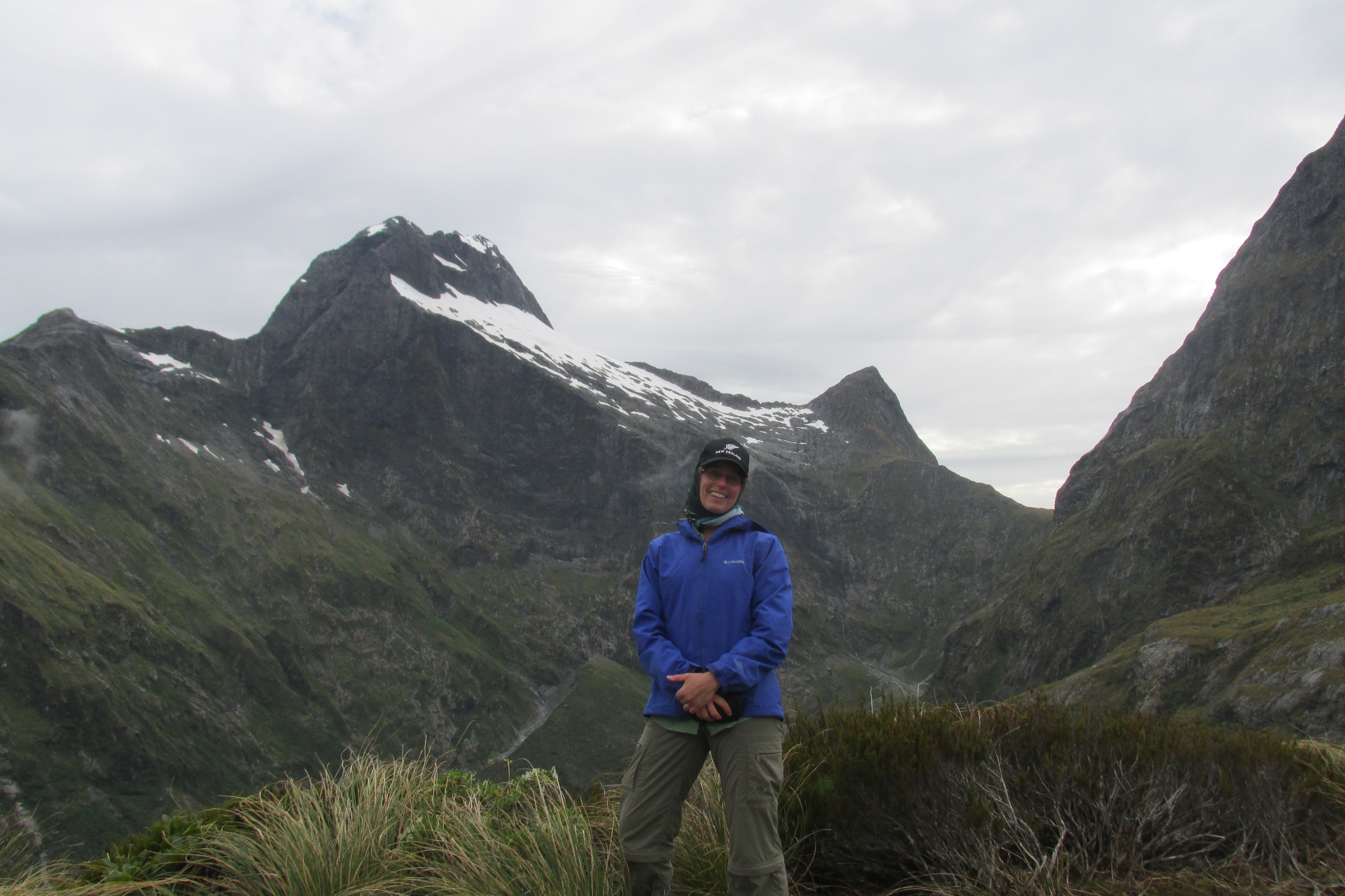
Up on the pass, looking over the drop on the other side (typical lack of fence–New Zealand does not have tort law, thus doesn’t appear to share the US’s preoccupation with saving people from their own stupidity), my “hallelujah I’m really HERE” sense swelled almost to painful proportions.

almost…there…
It was cold up there, though, and the weather threatened a change as I guess it always does. So no lingering.

…except for the obligatory We Made It shots! Gotta linger for those.

Gretchen in her happy place
Of course there was a hut up there and of course it had a gas cooker, so of course I had a celebratory cuppa, then gave the Mate a head start for the “down” walk (he has a metal hip, so down is harder than up). I took a few more pictures.

But I don’t WANNA go back down!
Then, OH so reluctantly, I headed after him. (What is it about high alpine that thrills me so? Must be a past life thing.)

Looking back at the Clinton Valley: World’s Best Latrine View?
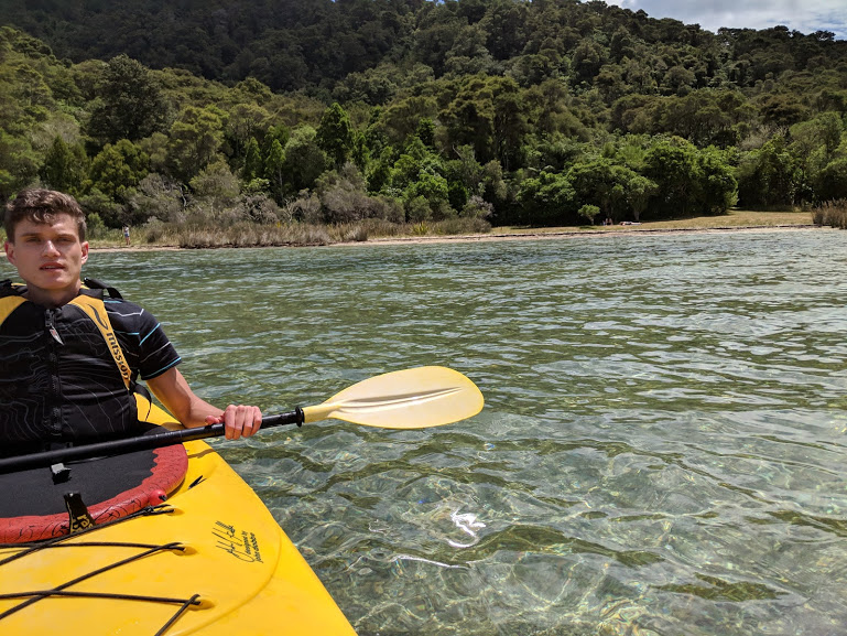
The ecozone was different enough on that side that I couldn’t stop taking pictures–look, tree ferns!! Blue waterfalls!–so I didn’t catch the Mate till nearly the bottom.


I love me some tree ferns.

Thanks, Dept. of Conservation, for building a LONG staircase to allow us to follow this waterfall in relative ease.
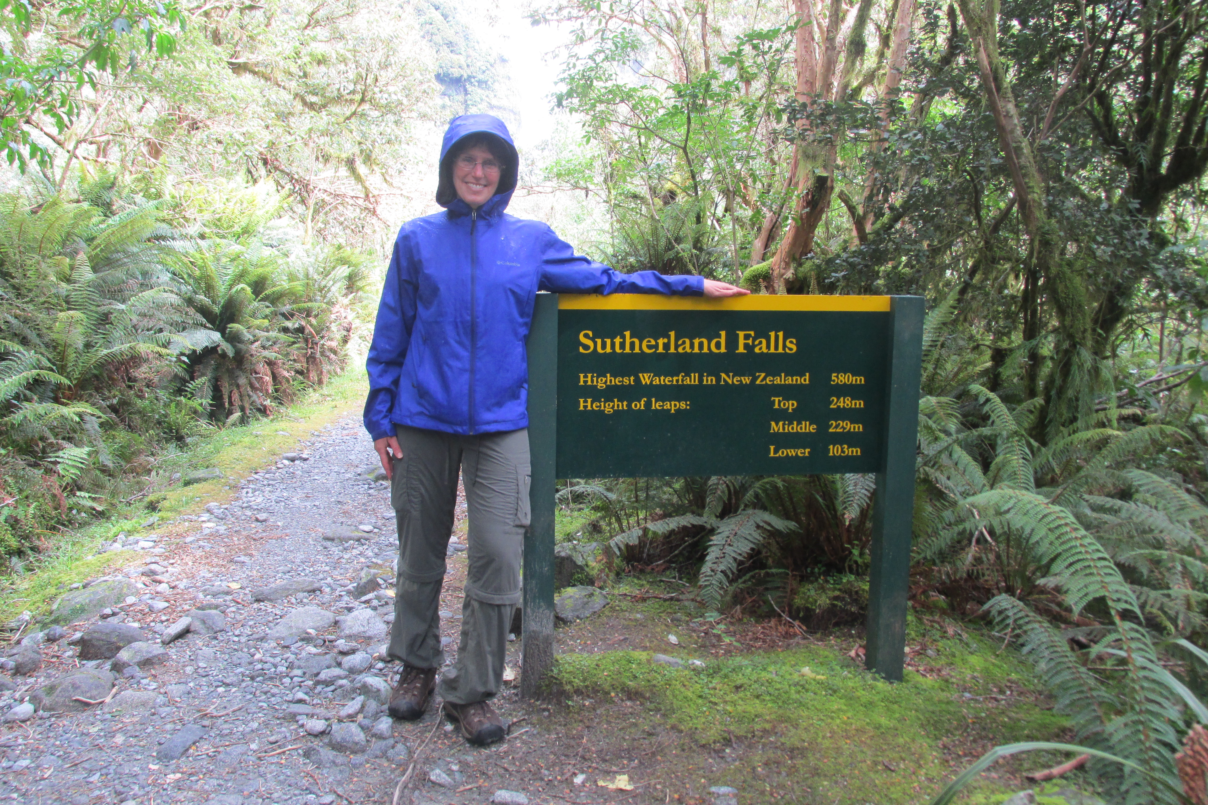
The trail down was way steeper than the climb, with a rough portion that required big, jolting steps, so the Mate was really feeling it. (Me too, but my legs are 15 years younger and contain no metal parts.) He rested a while, then headed down the last portion of the 10+ mile day; I took a brief, packless side trip to NZ’s highest permanent waterfall.

All you need to know…

As close a picture as I could manage. Approaching Sutherland Falls, one gets absolutely drenched.
When I joined the Mate at the last hut (called, for some reason, Dumpling Hut), the sandflies were so thick there was no question of sitting outside. We pretty much ran from bunkhouse to loo or dining hut. Shades of things to come.
***Not pictured: sandflies (use your imagination)***
But the last night was still sweet. Everyone felt great about making those steep miles, especially us retired or less in-shape types (which was most everyone; the young Israeli guys, of course, could probably have done the whole 34 mile track in a day if allowed). Everyone had rationed their food enough to to make do even with the extra set of meals. (Actually, the Mate and I had been kinda hoping that we’d all end up with a big potluck on that last dinner, but nothing that organized needed to happen.) And everyone, even the Israelis, was SORE from that long downhill.
***also not pictured: interior of a hut. Imagine a Boy Scout Camp bunkroom.***
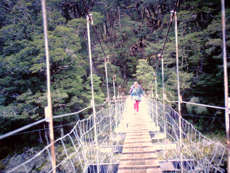
But not as sore as the next day. Which was the longest: 12+ miles. Gently downhill, so not a problem, but the sandflies were so thick one couldn’t stop without being swarmed. The only way to hike was to keep moving, exactly what our poor tired legs didn’t need. Once again I gave the Mate a head start, but I never caught him. For the most part I enjoyed the solitude, writing songs in my head and stopping as much as I could to take pictures…

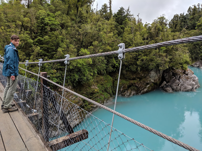
Oh look, another swing bridge!

Giant’s Gate Falls–and another half-dozen sandfly bites.
But, man–I sure could’ve used his company for the last 3 miles or so. Uff da. “When’s the last time we hiked 12 miles with packs?” we asked each other afterward. “Right.”

GIANT beech just off the track–redwood-sized.
Despite sore legs and shoulders, though, I refused to wish the track to end. I soaked that last day up, sandflies and all. New sights: a huge black river eel, four feet long at least. A tui–my favorite NZ bird! A rimu, my favorite tree–just a small one, saying hi. It rained, and I said, “Oh, good, we’re in the rain forest, this is what’s supposed to happen,” and then it stopped raining and I said, “Oh, good, we can dry out now.” I drank from little waterfalls. (All the water’s drinkable there.) And yes, of course I cursed those little sandfly fuckers.
***not pictured: all my bites***
The pickup spot at the end of the track, where a boat whisks the trampers ten minutes across what is suddenly salt water to Milford Sound village, is called Sandfly Point. The only thing that made it bearable was the fact that the shelter there had a door on it, and also the boat driver was a good guy and just kept picking folks up, regardless of reservation times, as fast as he could shuttle them. So we didn’t have long to suffer.

Hurry up, boat!
Too bad we couldn’t stay longer in beautiful Milford Sound.

Iconic Mitre Peak–goodbye, Milford!
But the good news: a bus whisked us back to Te Anau, so we were able to enjoy the still-just-as-jaw-dropping scenery.
***not pictured: scenery as seen from bus windows. But my jaw stayed dropped.***
I’m not much of a “bucket list” person. But this trip has been urging me along for 20 years. Was it as good as I’d been dreaming? No. It was better.