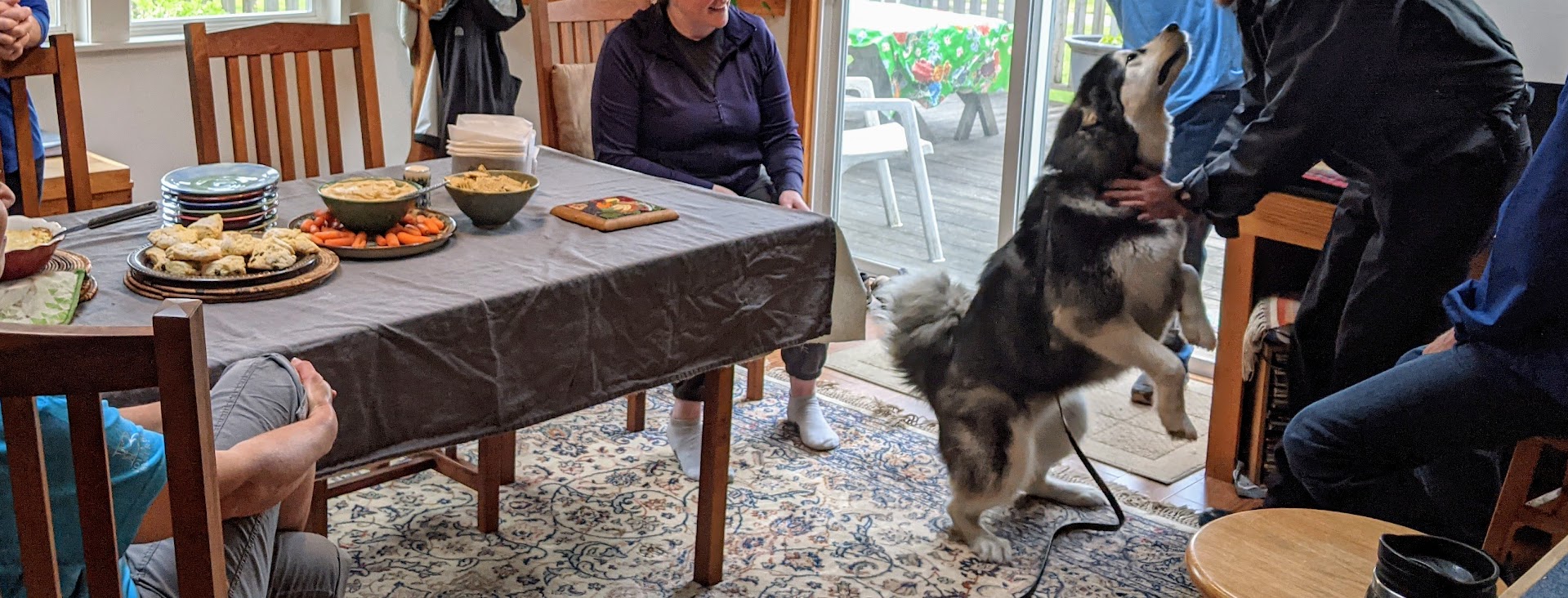
When it comes to vehicles–hell, when it comes to MOST things except politics–The Mate and I are pretty conservative. Comfy with routine. Change-averse. Sure, we have our “ooh, shiny!” moments…but they’re mostly about stuff like new rain gear or boots. Maybe lawn mowers and nice casserole dishes.
But not cars.
“Who, me? Your devoted Red Rover who just got passed from Son One to Son Two?”
We’ve owned a good number in our nearly 45 years as a couple, and we’ve usually hated every minute of buying them. Our favorite moments come when our car hits that comfy-old-shoe phase. That’s our sweet spot.
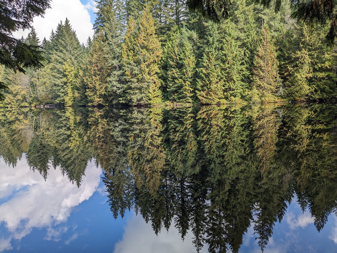
Pictured: a sweet spot (Road Trip VIII, Great Basin NP, Nevada)
Since 2011, when we began our annual Road Trips from Lopez Island, WA to Durham/Chapel Hill, N.C. (where I grew up and where The Mate and I met), any car we buy becomes our official Road Trip vehicle. Starting with our then-car, Kiwi the Ford Escape hybrid:
R.T. I, hangin’ out at Jumbo Rocks in Joshua Tree NP…
She served us well.
It was cold enough in Zion NP, back in 2012, we considered sleeping inside Kiwi!
At the end of 2012, Son One’s hand-me-down car broke down once too often, so he inherited Kiwi, and we treated ourselves to the first-model Subaru Crosstrek. Who knew what trendsetters we were! You’ve already met Red Rover, but here’s one more look at her doing her Road Trip thing:
“Road-tripping to Vermont in March, REALLY? Who ARE these people?”
Lil’ Red drove us faithfully every year from 2013 to 2020–the year we headed home super-quick, in the middle of the first wave of COVID lockdowns, fearing our island might be quarantined by the time we got home. Later that year, Son One had to leave Costa Rica and refugeed on Lopez near us, so we used him as an excuse to hand-me-down Red Rover to him…and told ourselves we were doing our part to boost the economy by buying a Toyota RAV4 hybrid.
In 2021, of course, RAVie didn’t get out much. Vaccinations were just beginning. Her first road trip had to wait till 2022. But she got there!
RAVie in the Badlands: “So THAT’s what this road-trip gig is all about. I’m in!”
Today, RAVie is a sprightly four years old, roomy, running great–the perfect road-trip car. What’s NOT perfect: my back. Even after surgery, sitting hour after hour has proven to be…a challenge. Add to that the fact that, road-tripping in February and March, our camping gear only gets used a handful of days despite being lugged around the country for 6-7 weeks, and you get…
...the great Camper Search. Yes. Once The Mate and I decided a campervan would be the best solution to keeping cross-country road trips in our life, and once we’d gotten over our sticker shock of even USED vans (forget new ones!), I started looking at vans. So many vans. Van porn, it felt like. Facebook Marketplace and TheVanCamper.com never had such a faithful viewer.
And that’s how we met Vanna Grey. But! Before I introduce you, I just want to underscore how incredibly off-brand she is for The Mate and me. I don’t mean brand as in Chevy Roadtrek–which she is. I mean “brand” as in habit.
Example. Here’s the pair of new slippers The Mate got me for my birthday, because I specifically asked for them:
They’re Tevas, and they’re amazing.
But now go ahead and ask me: “Gretchen, for WHICH birthday did you receive those slippers?” I will tell you: “2021.” And if you follow up with, “So WHY haven’t you worn them yet???” I’ll respond:
“Because my old ones haven’t actually worn out yet.” Yep–over 2 years after I thought I’d need new ones, these are still going strong.
NOW you’re ready to meet Vanna Grey. NOW you’ll understand just what a momentous life change this is for me & The Mate.
Vanna Grey: more than a new car. SO much more.
To say we are a little intimidated is putting it mildly. We’ve never been RVers; our learning curve is STEEP. Bring on that comfy-shoe feeling!
“Just remember, if Vanna’s too much for you…you can always come back to me! Unless one of the Sons gets there first…”
But we’re also conscious of our incredible good fortune to be taking this step, and so very grateful to all the help we’ve had along the way. See you on the road!
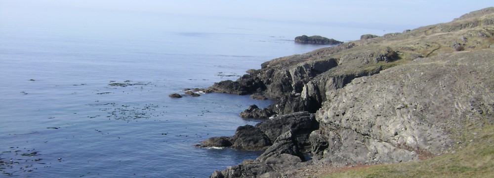
The second half of our BC road trip reminded me of that old children’s book, “Fortunately, Unfortunately.” Except the other way ’round.
Unfortunately, the mid-part of BC that we had to drive through, East-West from Revelstoke to Pemberton, is very dry (which is why it’s so vulnerable to wildfires).
Fortunately, it’s also lovely.
Unfortunately, when we got to Pemberton, so did the rain.
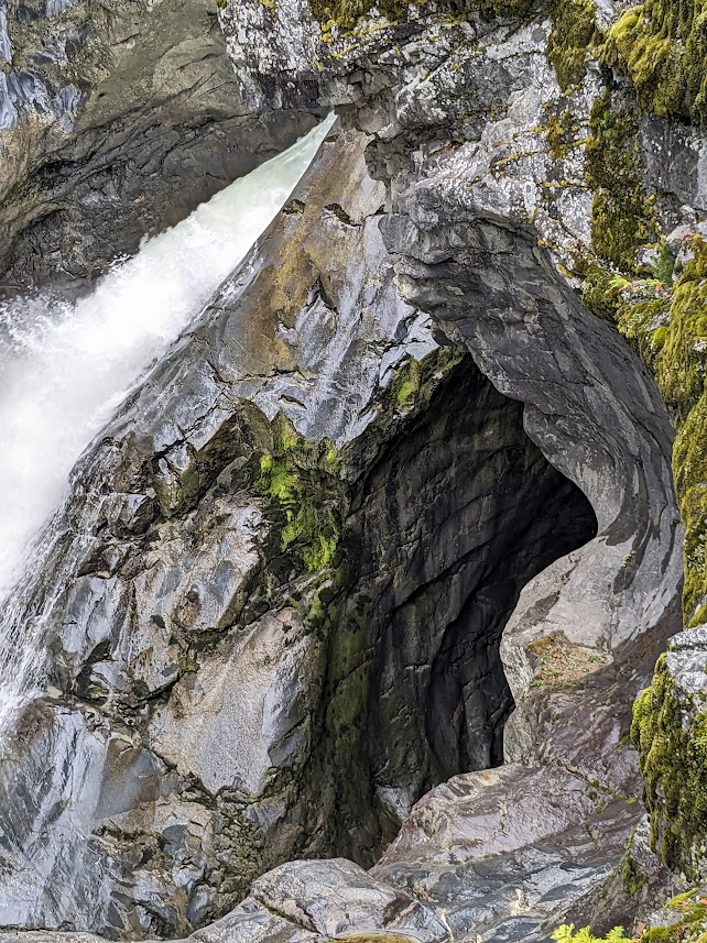
Fortunately, waterfalls don’t care much about rain.
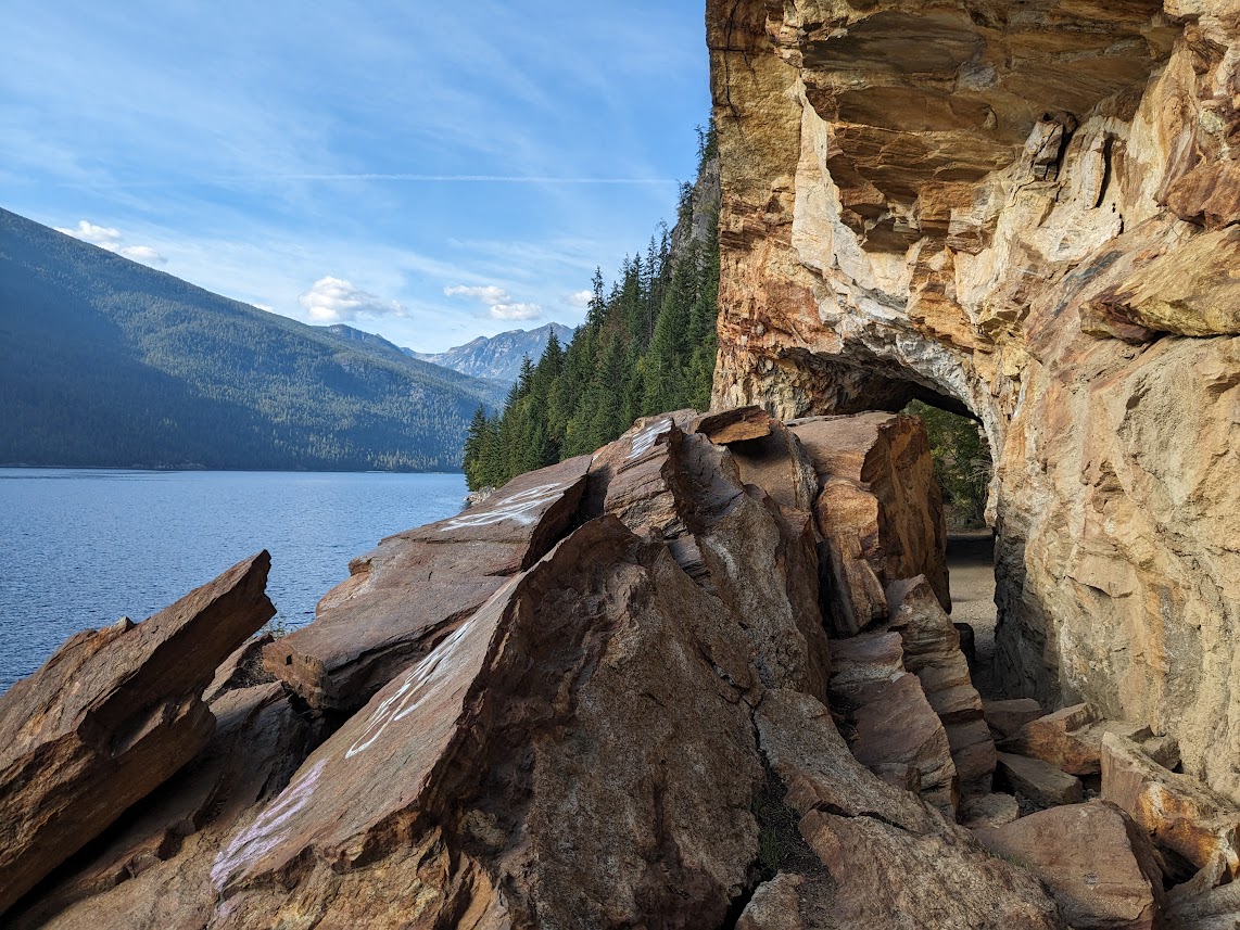
And I thought this hole was just as intriguing as Nairn Falls.Ditto for the mosses, and the river “potholes” in the rock!
Just above Pemberton is Joffre Lakes Prov. Park, which I’d heard was special, so I decided to make the drive up there. Unfortunately, this meant 20 miles up an evilly steep and twisty road. Fortunately, I learned ahead of time that you can’t even peek down the trail without an online reservation.
Oh…maybe that’s why the reservation?
Unfortunately, it was still raining. But fortunately, that meant fewer people competing for reservations, so I was able to get one. (And they’re free.)
Unfortunately, the hike is STEEP. But fortunately…I’ll let the photos do the talking now.
Middle LakeLil’ ol’ waterfall you pass on your way to Upper LakeFirst glimpse of Upper LakeHoly cow, am I looking right at a glacier?!Yep. Glacier. How else does that water get that color?
Unfortunately, I had to hike back down, and next day we had to leave BC and head homewards.
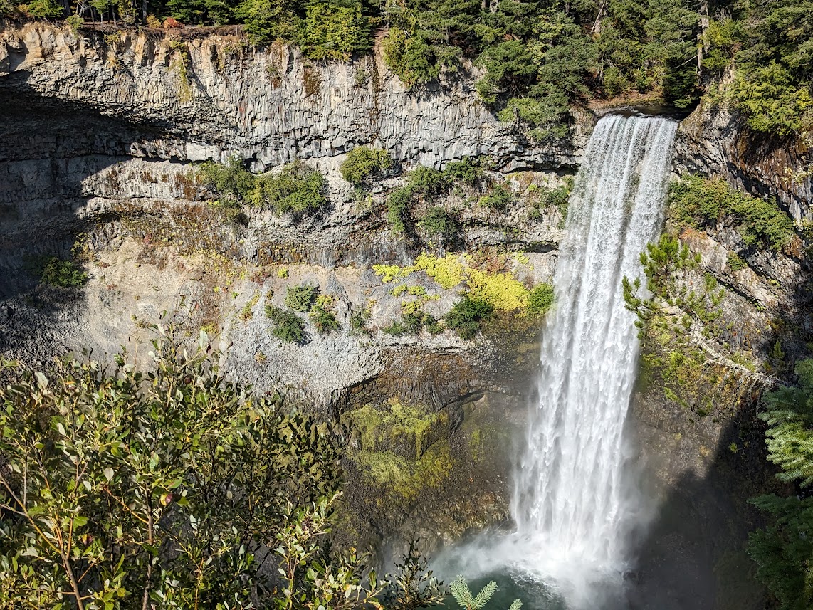
But fortunately, we hit a couple more pretty Provincial Parks on the way down Rt. 99, past Whistler, toward Vancouver: Brandywine Falls…
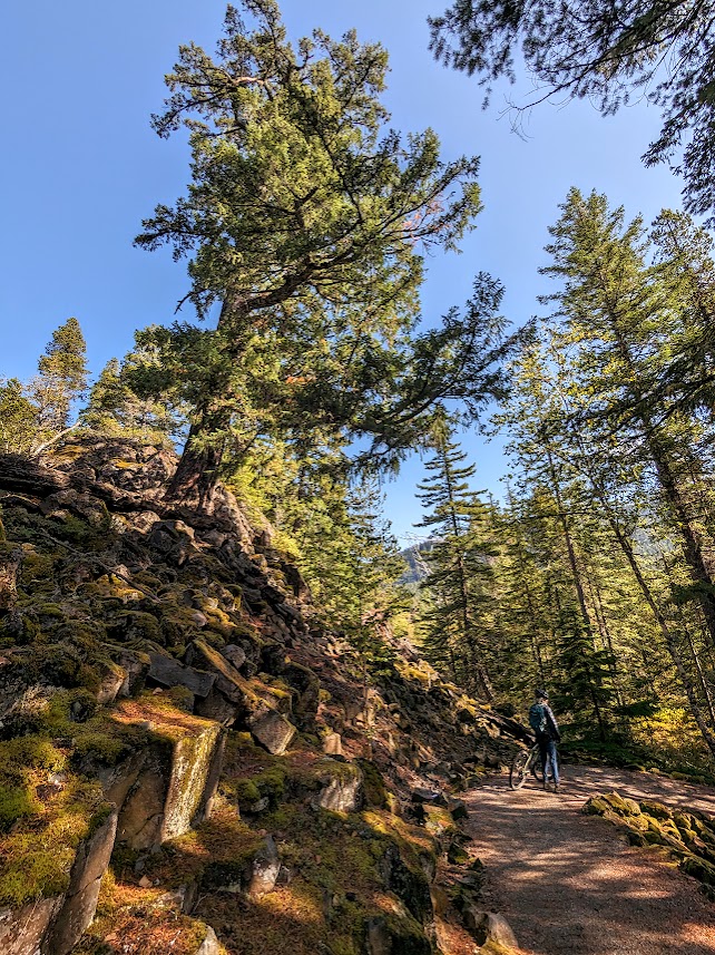
…which is also an easy hop-on spot for Canada’s exciting Sea to Sky multi-use trail.
Unfortunately the trail was a bit too steep and mountain-bikey for us,
but Fortunately walking your bike is good exercise…and it was still gorgeous!
Or make that “gorge-ous,” as in this one, which hosts a bungee-jumping bridge!
Unfortunately we accidentally drove past Garibaldi Prov. Park, one of the biggest in the province, because we didn’t think its raggedy access road could actually be the right road, and then turning around on the freeway got complicated.
But fortunately I got a nice consolation walk at Alice Lake, the definition of serenity:
So, yeah, unfortunately we finally had to leave “Beyond Compare” BC,
but fortunately I brought THIS image home with me, so I can transport myself with a glance…like right now.
O Canada–thanks for being! O BC–thanks for being the bestest, closest part to us!
The Mate and I have always had a huge crush on British Columbia. We’ve meandered up the Sunshine Coast, used Harrison Hot Springs as a base camp for checking out multiple provincial parks, thrilled ourselves with the Discovery Islands, and last September, spent two weeks exploring the lower half of Vancouver Island. And that’s not even counting the many times we’ve driven through on our way to the Rockies, murmuring, “Why aren’t we stopping here?“
Pictured: “Here,” a.k.a. some throwaway lil’ waterfall along Rt. 23
This trip was all about stopping here. Not traveling too far in any direction. Going in circles, even. Exploring parks we’ve never heard of. All in the name of soaking up the wonders of a place that REALLY needs a better name.
Beautiful Coastline? Best Countryside?
We started in Manning Prov. Park, especially of interest to me because it’s the terminus of the Pacific Crest Trail, of which I’ve hiked many sections.
Note the “You are Here” triangle up top
Since we were camped at Lightning Lakes, it seemed only fair to hike around them.
“2,400 miles–no thanks. 4 is fine.”
Bear Country? Bewitching Conifers?
The weather window started closing behind us at Manning, with snow predicted the next night, so we kept moving, down toward the flat(ter) Okanagan. We’d heard of the famous Kettle Valley rail trail, and in Princeton we did ride a section of it, but we also checked out trails in the community reserve of China Ridge, just above the town.
Thanks to the lovely woman at the Info Centre who sent us here! We’d never have found it.
The trails were more mountain-bikey than we usually ride, but we enjoyed our short stint up there.
Aspens! LOVE aspens.
Biking Country? Best Camping?
Next night we camped by the Kettle River, right where the rail trail crosses. Having had two rides that day, we just strolled some of it; the river was the best part. Notice the burned area in the back left? That’s from a 2015 fire. We were hyper-aware, this whole trip, of the fires still burning near Kelowna, and made sure to avoid the area.
Burning Cruelly? (unfortunately that “BC” could apply many place)
Following lovely Rt. 3 (the Crowsnest Highway) to Castlegar, we once again met up with the Kettle Valley River Trail, and rode another section…along the Columbia River. Yes, THE Columbia River–what we Washingtonians, and probably some Oregonians too, tend to think of as OUR Columbia River.
Horribly lowered by drought, dammed to within an inch of its life, clogged with industry…”Roll On, Columbia,” and good luck!
Behold Columbia? (That one at least makes some sense!)
After that ride, we swung north on little Rt. 6 to the tiny town of Slocan. We’d chosen Slocan because of its proximity to Valhalla Prov. Park, whose photos looked more national-park level than provincial.
Zooming in on Gibli Peak–gorgeous, but pretty inaccessible
But we soon discovered how hard it is to get INTO Valhalla.
It’s really a backpackers’ park, and we hadn’t come to backpack.
We ended up just hiking the bottom left portion of the lakeside trail, and that was PLENTY.
Big Cop-out? Maybe. But luckily for us, Slocan boasts its own rail-trail, which follows the Slocan River as it flows out of Slocan Lake.
Oh, OK. We’ll settle for this.
Slocan itself is a sweet, quirky little town with rainbow crosswalks and helpful volunteers in the library. We’d go back there in a minute, and maybe ride all the way down to some other simpatico towns on Rt. 6 with hippy-sounding cafes and bakeries.
Bakery Central? (I guess that applies to lots of places too) Biking Capital?
Even rockslides don’t stop these folks. You can hike right through this one.
Leaving Slocan, we decided to loop around a bit. The plan HAD been to camp 2 nights at Glacier National Park…but that weather window slammed shut, and we didn’t want to camp in snow. With an extra day before our hotel reservation in Revelstoke, we followed Rt. 6 back west in a squiggly semi-circle that took us back to–ta dah! The Columbia.
Or more accurately, ACROSS the Columbia, by FERRY.
They don’t even call it a river there, they call it Arrow Lake! Seeing that mighty river so abused brought us no joy. OK, a little joy. It was still fun ferrying across.
Burdened Columbia?
But that afternoon cheered us right up. First we got to ride yet another rail trail (Okanagon) along Laka Kalamalka, an honest-to-gods, true-blue, undammed stretch of watery glory…
On & on, just like this!
Looking across at another Prov. Park I wish we’d stayed in
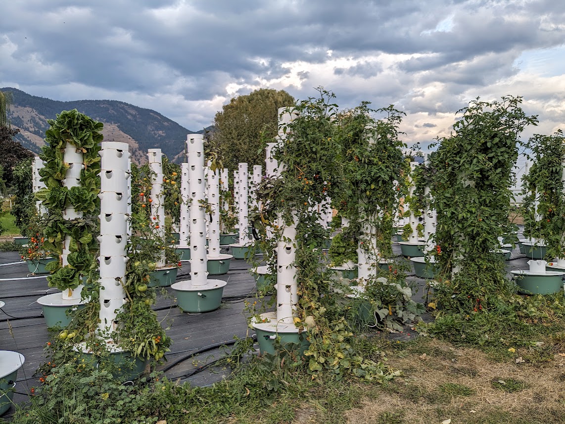
…and then, that evening, near the lake, the Mate and I got our first Glamping experience, on a hydroponic farm!
Don’t worry, I didn’t know what a hydroponic farm was either.
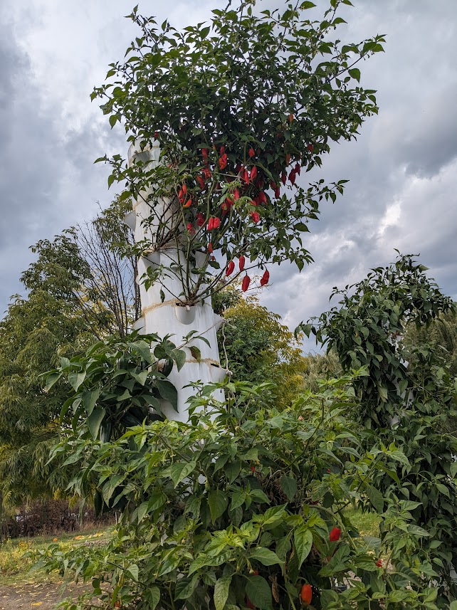
Doug, the friendly owner of Utopia Feels glamping, gave us the full tour, including veggies:
Inside that white tube-tower, it’s raining!
…critters:
Silly & Billy, the goats, and Bad Bunny, enjoying veggie trimmings
…and of course, the glamping tents!
If anyone’s looking for an AMAZING wedding venue, I highly recommend this place!
I can’t say we’ll ever do this again, but it was a hoot and a half to do once!
And this is a SMALL tent. Some sleep up to six!!
Bountiful Campgrounds? Bodacious Comfort?
Bunny Cuddles?
Leaving the Okanagan behind, we turned north and east again, as if heading for the grand Rockies. But this time we stopped short, in the town of Revelstoke, home of…
…Columbia?! Is that really you?
…you guessed it: the Columbia River. Still dammed (just upstream from town), but looking closer to a real mountain river than I ever dreamed it could.
Beautiful Clarity!
Revelstoke nestles into a whole batch of mountains, including Mt. Revelstoke, which has its own national park. Clear skies were in short supply when we drove the single road in and up to hike toward the summit:
…but we got the idea.
Over the next couple of days, as the rains moved in, we took advantage of little breaks to revel in local awe (Revel? in Revelstoke? See what I did there?).
Creek showing glacial siltglaciers of Mt. Begbie, part of where that silt comes from
Just up the road (literally, up) from Revelstoke is Canada’s Glacier National Park, and it KILLED me to be so close and not go. But we were disinclined to drive in possible snow & ice. So…next time, B.C.
Best Choice?
But Revelstoke was quirky enough for us. Examples: Woodenhead, apparently carved decades ago by some dude for the fun of it, and adopted by the town:
Not creepy at all!
…and this Indian-German fusion restaurant we found.
Curry mit spaetzle? Jawohl!
After Revelstoke, stymied by weather to the east, we turned west. I’ll save that for Part II, because that part was
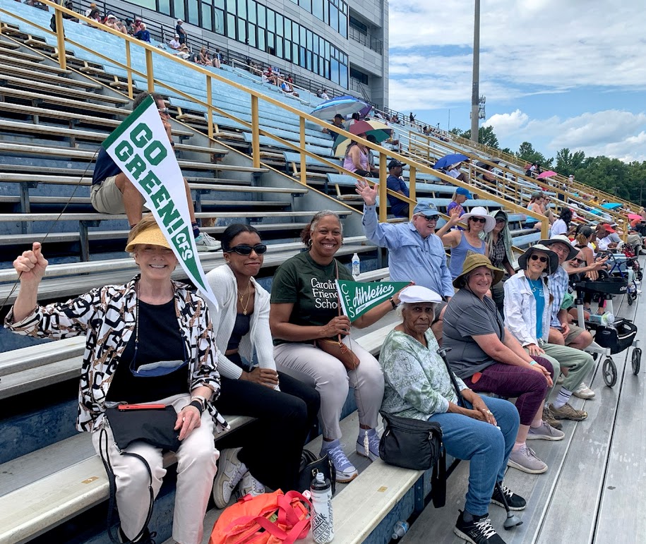
“That’s amazing!” said most folks, hearing of my sisters and I road-tripping to cheer on our mother as she raced the 800 meters and the 1500 at the international Masters meet.
I disagree with that assessment. Admirable? Definitely. Humbling? Yes. Pride-inducing? Hugely. But amazing…no. If you know my mom, Martha Klopfer, you would not be at all AMAZED at her racing. You would EXPECT it.
True to form (finishing the 1500)
Martha’s been running since the late 1960s. So have I, for that matter; our whole family formed early part of that first big Fitness Wave. But MY knees called for retirement about four years ago, in my late 50s. Hers still work just fine. My mom has literally outrun me.
Since COVID interfered with my 60th Birthday Sisters Weekend a couple of years ago, I lit on the idea of turning Mom’s race into a way to spend quality time with my sisters. So my Texas sister & I both flew to my Michigan sister, and from there we three “girls” drove down to North Carolina…
Did someone say ROAD TRIP?? Quick stop in the lovely Hocking Hills of southern Ohio
…via Ohio, West Virginia and Virginia…
Another quick stop: New River Gorge in WV (& highest suspension bridge in the western hemisphere, we learned)
…for 48 hours of family…
Family always includes dogs
…and track. While Martha did her stretches in the shade…
her fans braved a sweaty July afternoon to cheer her…
Carolina Friends School Principal Karen Cumberbatch (in CFS tee) brought family members, showing their support for one of CFS’s founders!
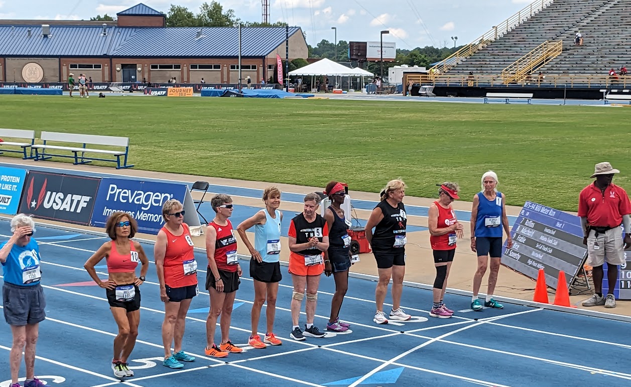
through the 800 meters (2 laps)…
They combined all the age groups from 70 up. The woman second from left set a world record for 75 y/o’s in the 5k the day before, 22:41!!!
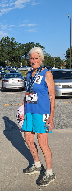
When she finished (in 5:49), I was so proud I did something I almost never do: took a selfie.
But Mom? She and Dad watched the video I took of her race, then watched it again, like coach and player, and both agreed: Not enough up on my toes. Better try a different pair of shoes.
Believe me, this man would be out there too if his legs would let him.
The result, for a race less than 18 hours later and nearly twice as long: a 1500 meters in 11:06, which translates to a proportionately faster pace than the 800.
I didn’t need to take a selfie for pride this time. I had Mom with Medals.
Can I get some pancakes now?
If this were a different blog post, I might write more about my first-ever Sisters Road Trip. I might even mention the buffets we hit in West Virginia, both south- and northbound.
Or the bath I gave my hot feet in the Huron River in Ann Arbor
But this blog is about how our Amazing Mom isn’t really that amazing, in the sense that she’s trained us not to be amazed at the things she’s still able to do.
Like my new word? I was trying to find a way to describe the way The Mate and I tend to travel, and it occurred to me: pretty much all we do, wherever we are, is look for trails to walk or paths to bike (or vice-versa).
Cathedral Grove, near Port Alberni
Leaving Tofino, we drove less than 20 miles down the road to Pacific Rim National Park, a thin strip of forest and beach that runs a good length down Vancouver Island’s Wild West Coast. The hiking trails are all short, but the longest of them is run by the Nuu-chah-nulth people, whose land it occupies.
It’s hard to get The Mate to turn around for a photo.
Along with offering some moments in the best parts of the forest, the trail tries to deepen one’s awareness of that culture, like this:
If only I knew how to pronounce those words…
This totem pole along the trail is maybe the most beautiful I’ve ever beheld.
I had a hard time leaving this.
Everywhere you go in that park, signs remind you whose land you are on–a convention our US parks would do well to emulate.
That sign, by the way, greets walkers and bikers for MILES as they traverse the longest path of all: the bike path that runs the entire 20+ miles of the park. The Mate & I LIVED on this path during our camping days there, using it to move from one beach or hiking trail to the next. And, given the number of poop-piles we counted, the local bears live on this path too!
Does the bear shit in the woods? Actually, no…not when there’s pavement available. (Not sure why someone placed a rock on this batch)
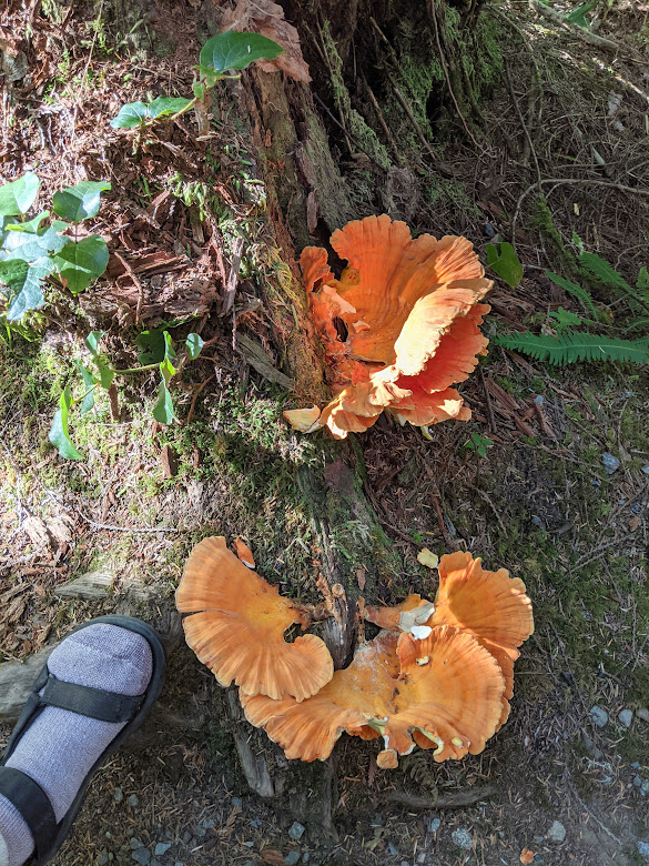
Of course we didn’t spend ALL our camping time on the move.
Not when there’s giant fungus to groove on! (foot included just for scale)
I’m not a “beach person” in the sense of lying on them for hours, but give me a beach with tidepools and I’m good–at least till the next mealtime! 🙂 PRNP has some AMAZING rocks and tide pools.
This one comes with its own window.
In one pool, I was amazed to discover an eating-sized fish who appeared trapped, as if in an aquarium. I vowed to come back next morning to try to save him if the tide hadn’t come in far enough…
Hang in there, dude!
…only to discover him, to my chagrin, still there…along with an even larger buddy…both of them attached through the gills by a nylon line, and the fisherman who’d caught them still trying to augment his catch. Apparently he was using this tide pool as his bucket to stash his fish, even overnight!
[Not pictured: pathetic caught fish in tide pool. I’m a terrible hypocrite; I just like to eat ’em.]
Seriously, though, I can’t say enough about this part of Canada. Come for the big trees…
…stay for the big trees at sunset!
Leaving the Wild West (regretfully), we moved slowly back through the center of the island, spending the night in Port Alberni. Not much pathing nor trailing there–but I did fall deeply in love with their bakery. If you want to know more about this very blue-collar town at the far end of the LOOOONG inlet which bisects the west coast, let me refer you to my friends’ blog–they do a good bit more than pathing and trailing when they travel.
[Not pictured: Port Alberni. Nothing really grabbed me there, visually; probably due to lack of trails & paths.]
On the way out, however, we walked in the Cathedral Grove (pictured at top), and later stopped at Little Qualicum Falls Provincial Park, where we vowed to come back sometime and camp. Here’s why.
Any salmon in there?
Luckily, we’d already had our leaping-salmon experience the week before at Stamp River, because…
Yeah, no.
…these falls were not exactly leap-able. Ridiculously gorgeous, yes. We had some of our best “trailing” around this river, seeing its falls from all angles.
Our final stop was Lake Cowichan, where I’d attempted to take The Mate on last fall’s ill-fated Mystery Birthday Trip (see previous post). The Trans Canada Trail runs through there, so we had high hopes of pathing it on our bikes.
But it was closed for construction. So we had to make do with the lake.
Oh darn.
Lake Cowichan looked even better from above, although the trail itself led mostly through the scruffy results of clearcutting.
The scenery finally got pretty just about when we were ready to turn around. Oh well.
We spent our final Vancouver Island night near Nanaimo, where we’d be boarding the ferry next morning. Yes, we did manage to find a couple more trails & paths nearby, but by this time we were starting to feel all that mileage in our legs. So we kept the walks short, and fell gratefully into the bed which took up our entire tiny room in this adorable pub/hotel.
Did I order the poutine for dinner? Yes I did.
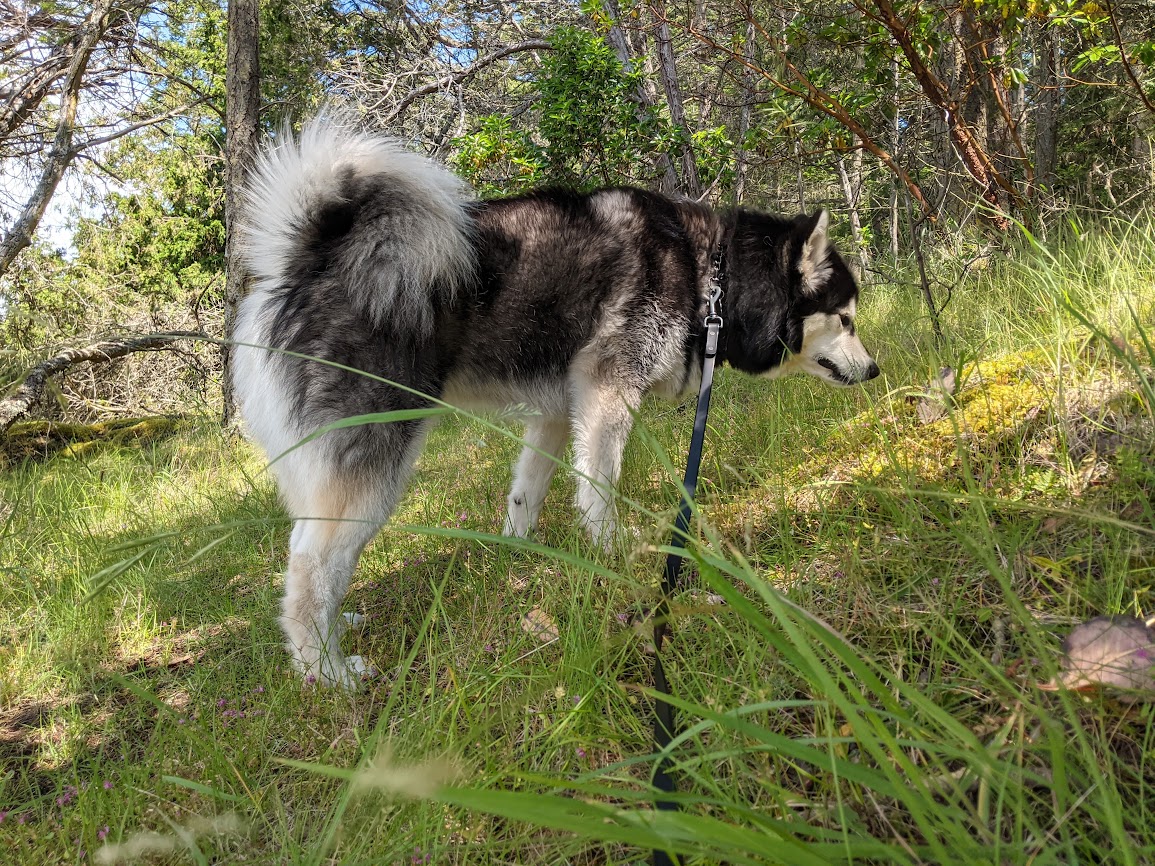
We arrived home to find the Cascade skies still hazy with wildfire smoke. Happy as I am to be reunited with Maya the Malamute, I’ll end with this photo from the ferry back to the Canadian mainland, because…
[not pictured: the orcas we saw splashing along the way]
…see all those mountains out there? Can you imagine how many paths and trails they’re hoarding?
Thanks, Canada. With or without the doggone excuse, we’ll be back, eh?
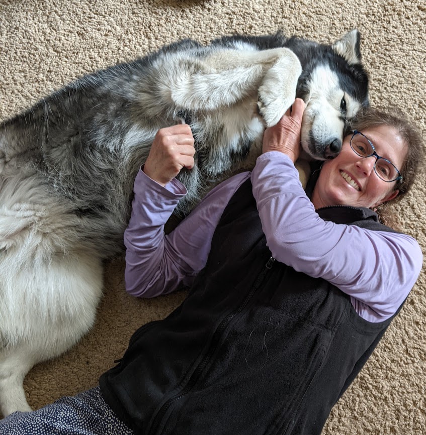
After coming to grips with our sweet Maya’s need for intensive training to ease her reactivity to other dogs, the Mate and I booked her a two-week stay with local dog whisperer Stephanie Vallejo (highly recommended, but get in line: she’s very much in demand!). Then we looked at each other.
“You thinking what I’m thinking? If our dog is already being cared for…”
Washington State Ferries hasn’t resumed its service to Sidney, British Columbia, so we had to take the long way round. Oh darn.
Our first stop was the town of Sooke, just west of Victoria, where most tourists go. We’re not really into cities–particularly very Anglophile cities like Victoria immediately following the death of the Queen. Plus Sooke is known for its glorious rail-trail, the Galloping Goose, which the Mate & I have been eager to try out.
You can see why.
“The Goose” stretches 55 kilometers, much of which is as gorgeous as this part (where I saw a bear the next day). With a few exceptions, it’s perfectly level, and includes fun little additions like…some VERY high trestle bridges…
Don’t look down
…mixed forests, and shoreline, like this part fronted by what Canadians call Arbutus, and we call Madrona (or Madrone, in California).
Beautiful, eh
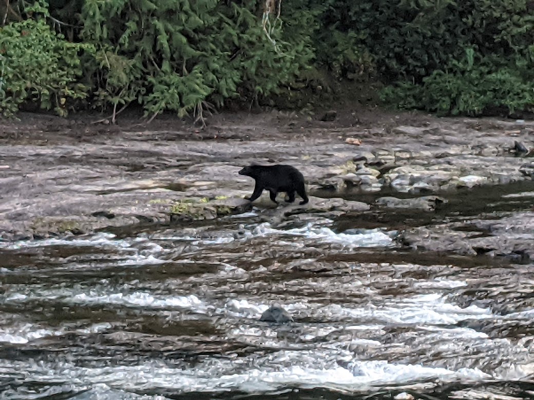
From Sooke we headed back toward Victoria, then followed the main highway north to not-quite-halfway up this INCREDIBLY big island, where we entered its mountainous middle. I was on a mission. I wanted to see bears, and leaping salmon. Maybe even together!
I got my wish. Sorry about the poor zoom quality on my phone.
That bear’s two cubs showed up a moment later, but I took a video of them instead of stills, so you just have to imagine. Were we nervous about the bears being only one river away from our campsite? Well…we would have been, had the ranger not assured us that these particular bears had been coming every evening, checking for fish and leaving, without seeming to care about crossing over.
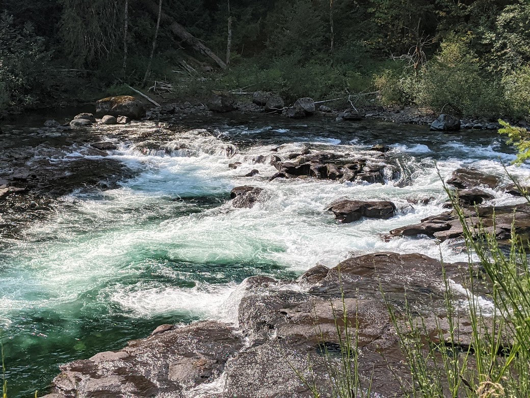
Good enough for us to sleep well. We happened to know that the fish were just downriver…
…nope, further downriver…
…where the BIG falls are, summoning the energy to leap. As with the bears, I took videos of the salmon doing their thing and forgot to take stills. But if you look very closely…
VERY closely!
…you can see them massing in the canyon just below the falls. Dozens of them. Hundreds. Several specials. Getting ready for the big push. (But they also have a fish ladder to fall back on, in case they give up after 80 or 90 tries.)
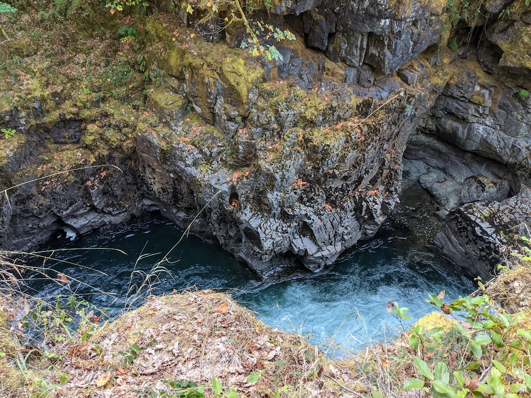
Our next night of camping was on Sproat Lake, where the scenery was nice but not breathtaking. However, following my nose and some truly baffling maps, I stumbled upon one of the most magical waterfall pools I’ve ever encountered.
Did I skinny dip? Are you kidding? Of COURSE.
What’s weird is, I accessed this place via an ugly logging road under a power line, then had to climb down a bluff using a VERY scary rope “ladder”–to find this lil’ piece of Narnia waiting below.
Oh, and then climb back up again.
Good job, Vancouver Island–make us work a little for your treasures.
One of our two weeks is now behind us, and The Mate and I are at the end of the world, or what feels like it: the towns of Ucluelet and Tofino, one at each end of a peninsula hanging off the Big Island.
Image courtesy of VisitTofino.ca
Tofino’s where the kayak photo came from. “But Gretchen,” you may ask, “don’t you already live on an island? Why would you vacation somewhere so similar to your regular ol’ life?”
Could this photo have been taken in the San Juan Islands? Possibly.
But my answer is:
Nothing “regular” about THIS…
…or THIS: the First Nations village of Opitsat, which our kayak guide told us was the oldest continuously-inhabited settlement in North America, dating back at least 5,000 years (but more likely, he had learned, 10,000). Seeing it gave me goose bumps. (again–apologies for poor zoom lens)
The background snowy peaks of the mountains in Strathcona Provincial Park are just…extra.
And I’ll let Ucluelet speak for itself:
Just a teensy bit wilder than where I live.And so are the trees.
One more thing The Mate and I are really enjoying about this part of B.C.: its quirkiness. For example, our rented room is in the lower part of this…structure?
Home, sweet whatever you want to call this.
And their official control-your-dogs-at-the-beach signs are hilarious:
Wait, did somebody say Good Dog? Oh, we sure hope so. But meanwhile–thanks for the vacation, Maya! See you in a week!
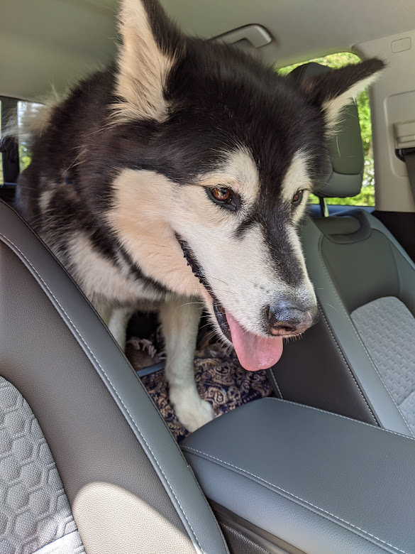
Maya the Malamute here again, with my report on What I Did On My Summer Vacation. It’s a very short report. Ready?
Ahem: It. Was. LAME.
Here’s me, heading out last month in the car of this new hooman Gretchen said was coming to “take me home”…or was it “re-home me”?
Whatever, as long as there’s treats in here somewhere.
Sometime this spring she started taking lots of pretty pictures of me, saying stuff like, “I feel like a Picture Bride agent.”(Whatever that meant.) I even got to pose with wildflowers in the rain!
Doesn’t matter. I’m beautiful even when I’m wet, and I smell even beautifuller.
Then she threw a party for me. EVERYONE got treats. But I gotta say, it did seem like I got more attention than usual.
Kisses too!
Next day: new hooman. Walkies. Talkies. Car. I noticed my old hooman Gretchen making funny faces and sounds as we drove away.
What happened next isn’t worth writing about. The new hooman took me on walks but then he had to “go to work,” and there wasn’t anyone else. I may have howled. A lot.
Some time passed. Not really sure how to describe that part. Two demolished stuffies’ worth of time? One very uncertain new hooman? I was definitely getting BORED.
So we got back in his car. We drove and drove. And then I got out of his car and there was Gretchen again. She was happy to see me. I got back into her car. We drove and drove. We stopped at a park for walkies. It was a hot day. Gretchen had a nap. I had a salad.
Definitely missed the flavor of the coast!
When we finally got back on the ferry, we both felt like we were right where we were supposed to be.
Don’t ever send me to that summer camp again! They didn’t even have a pool!
So now I’m back home with my main hoomans. They still talk about showing my pictures to other people, but like, of course they do! ‘Cause I’m gorgeous.
And a little bit cuddly. Who needs a stuffie when you have me?
…although, come to think, if you do have any extra stuffies? I’m feeling a little peckish.
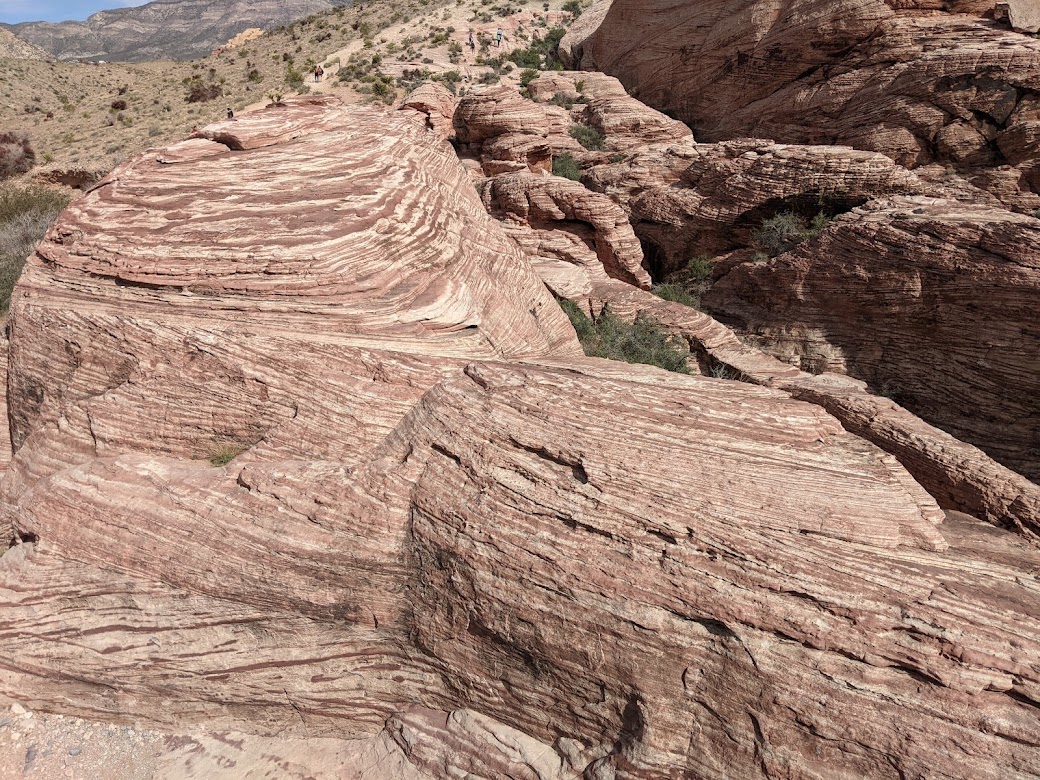
Road Trip XI …by the numbers: 8 weeks. 10,000 miles (best guess). 26 states. 62 far-and-dear friends and family members. 14 national parks/monuments. 20 state parks. 6 post-season Tarheel men’s basketball games (5 victories + 1 almost!)
One of these was waiting for us in our pile of mail. Order yours at johnnytshirt.com 🙂
…and by the category:
Best hike: Custer State Park, South Dakota, Needles region
My kind of needles
Best bike ride: Colorado National Monument rim road
Wheeeee!
(Honorable mention: Bizz Johnson trail in Susanville, CA …but it doesn’t win because it gave The Mate a flat tire)
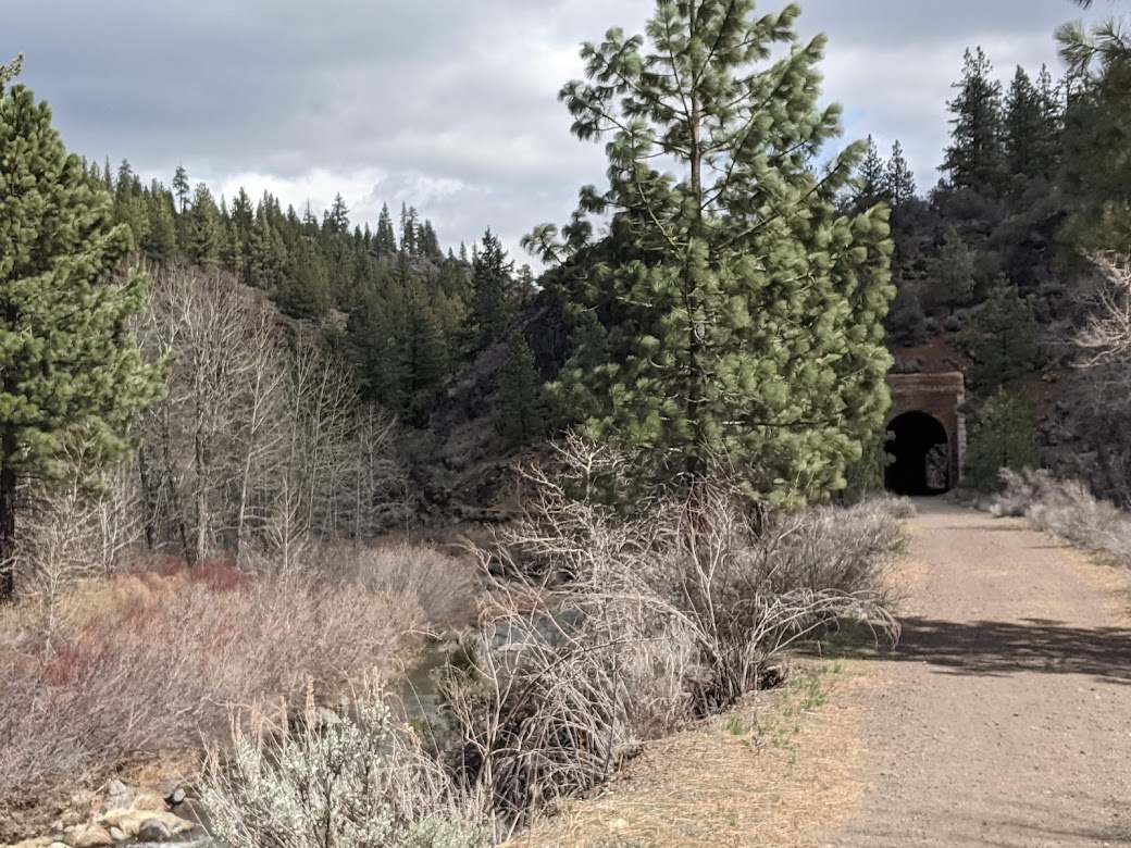
The tunnels are part of its charm.
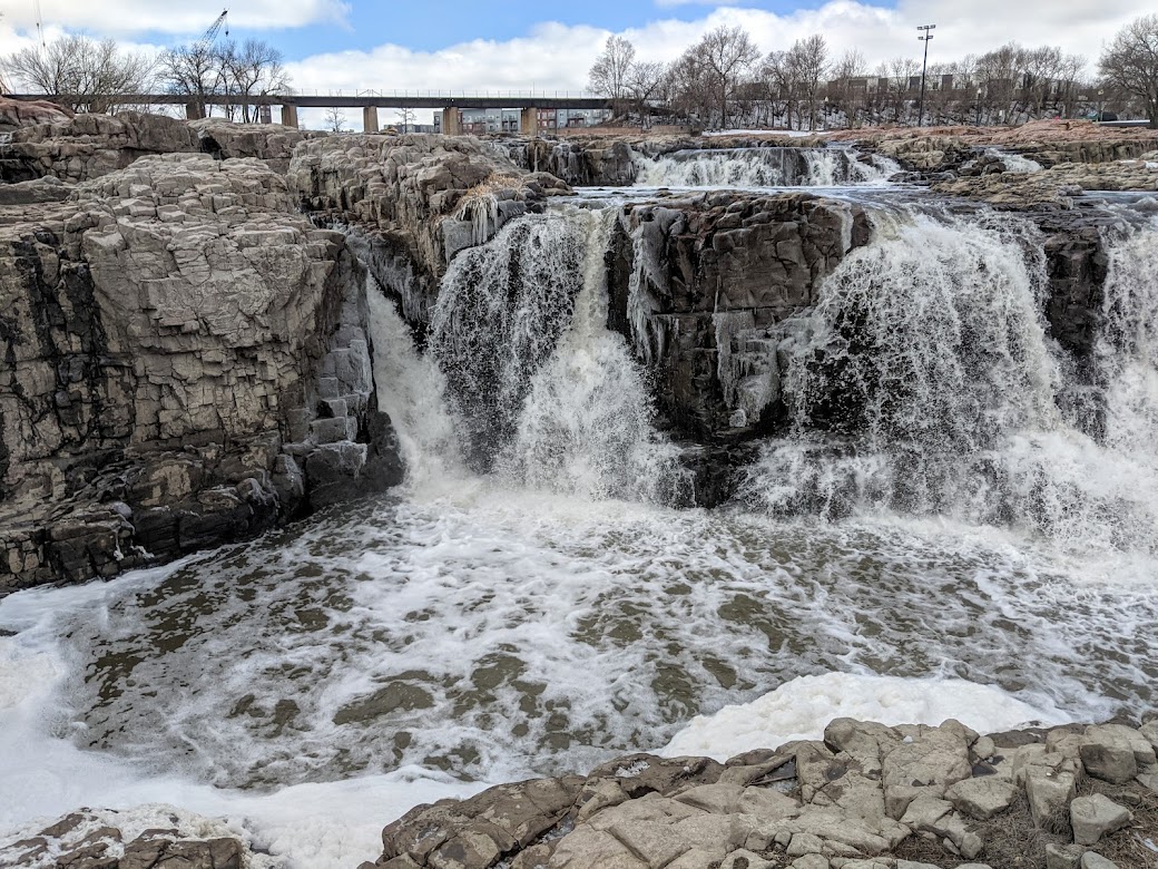
Best waterfall: Sioux Falls…even though conflicted feelings arose when I read about its blasted, quarried history
So it used to be MORE beautiful???
Best trees: California redwoods
I mean…c’mon. What’s going to beat a redwood?
Best wildflowers: Rogue River National Recreation Trail, near Merlin, Oregon
I didn’t even know larkspurs came in scarlet!Mariposa Lily!!
Best wildlife: tie between javelinas in Arizona…
piggie!!!
…and [not pictured] wild burros spotted in Utah off I-70 (a first for us)
Best sunset: outside our Virginia motel on our loversary
When God says, “Happy anniversary, y’all!”
Best restaurant meal: sushi in Chapel Hill with my parents
Mom, in her natural habitat [not pictured: sushi]
Best home-cooked dinner: our friend Ben’s roast lamb with chimichurri
Our friends Lynn & Ben in the Blue Ridge [not pictured: lamb w/ chimichurri]
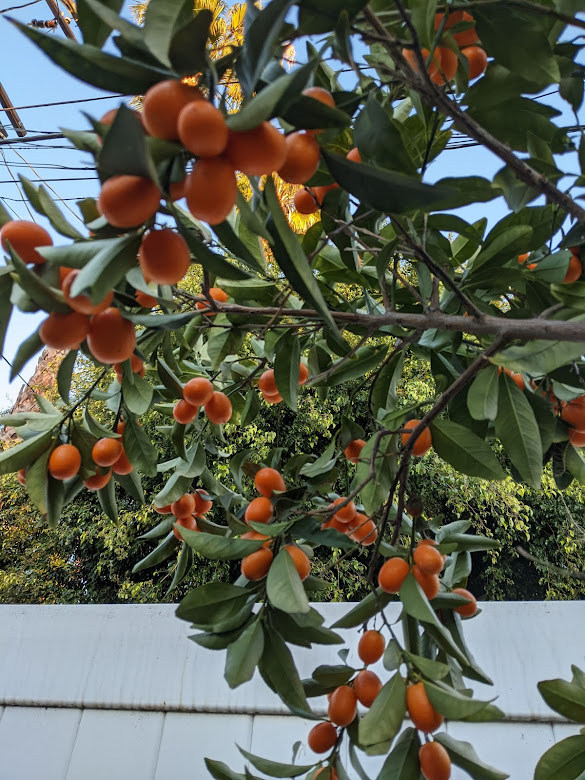
Best gift from our hosts: kumquats/avocados/oranges from our Hollywood cousins’ trees
Best car snack ever! Thanks, Cuzzies!
Biggest detour: dropping south all the way to Las Vegas in order to avoid dangerous, truck-toppling winds
The sand-filled sky, seen from our motel room, blotting out the mountains [not pictured: 2 toppled semi trucks we passed on Rt. 395 when we finally escaped the winds]
Best silver lining: getting to hike & clamber in Red Rocks National Preservation Area (or whatever it’s called) just outside of Vegas, just before the winds hit
Some people like casinos. I prefer rocks.
additional bonus to silver lining: the desert in bloom!
Yucca? Should be called yumma!
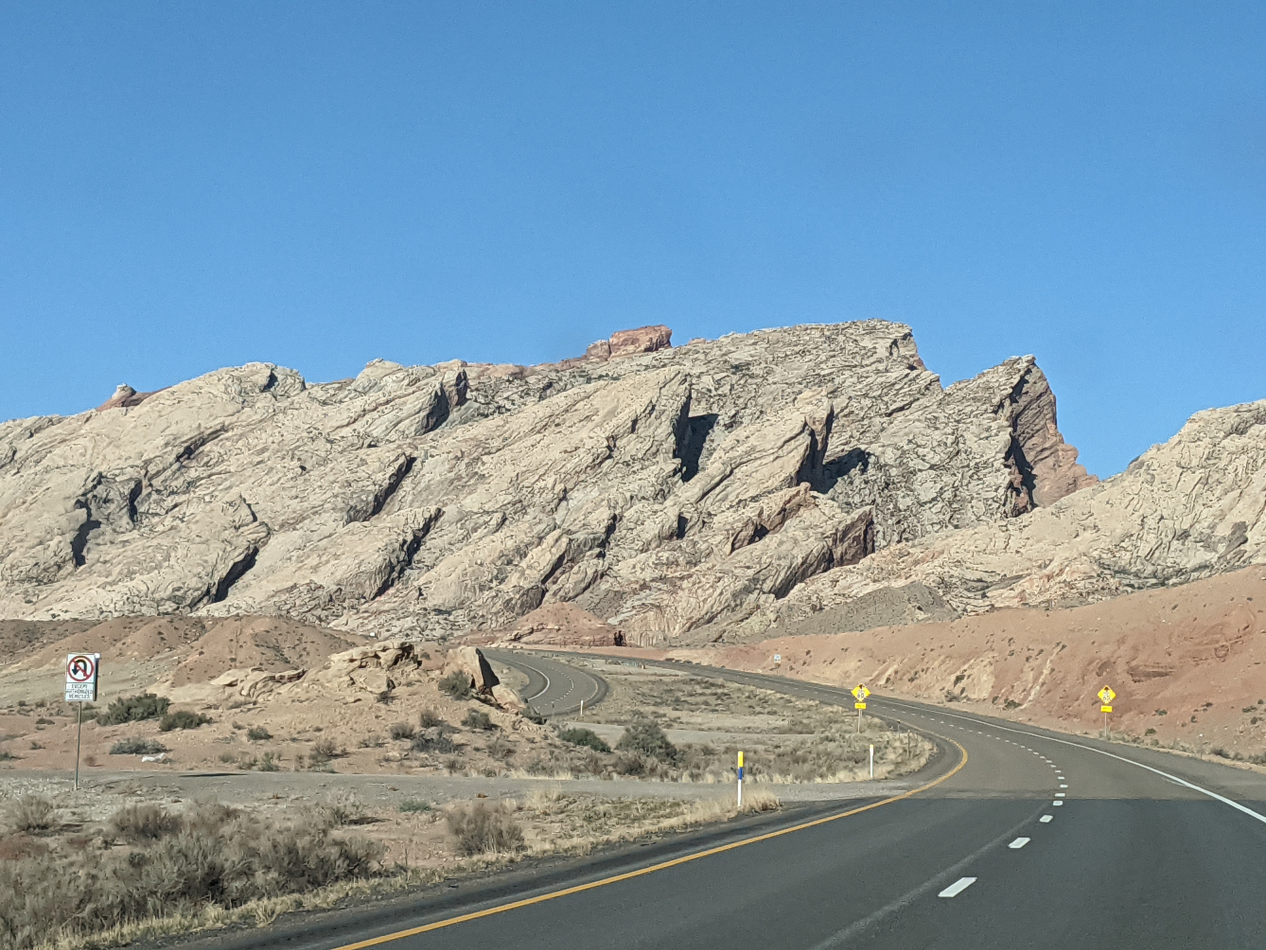
Longest day’s drive: Moab to Las Vegas (460 miles)
good excuse for one more Canyonlands picture!
Scariest drive: crossing the Cascades on snowy lil’ Rt. 89 past Mt. Lassen in California
The cute lil’ motel we stayed in at Old Station, CA [not pictured: next morning’s snow; too busy helping The Mate watch for ice patches]]
And now for a couple of less-traditional categories.
Best basketball game: UNC vs. Duke in the national semifinal (81-77)
South Dakota Black Hills, I’ll always associate you with that game!
Best dog: Ramses in Olympia
Also best-DRESSED dog–thanks to Dia Tornatore for the photo & the hospitality!
And finally, the Grand Travel Blog Award for Best New Discovery goes to…Oregon’s Rogue River Trail!
I never could catch my breath on this hike–just too much beauty!
We’re already talking about how to get back there.
See what I mean?Waterfall over the trail? Eh…time for a photo.New favorite place, old favorite person
…but for now, oh my goodness–it’s good to be home, safe and sound and grateful as all get-out for this long, LONG getting-out.And now, as Wing’s World morphs back into its non-travel mode…thanks for traveling with me anyway!
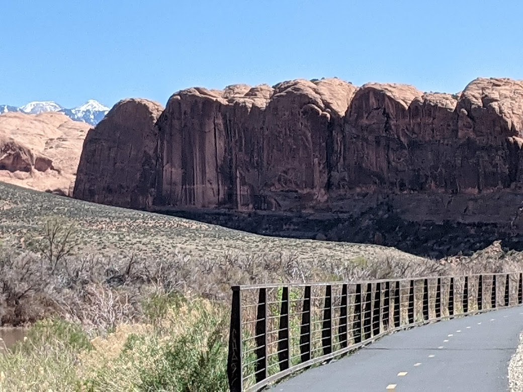
What camping enthusiast wouldn’t enthuse to camp near this?
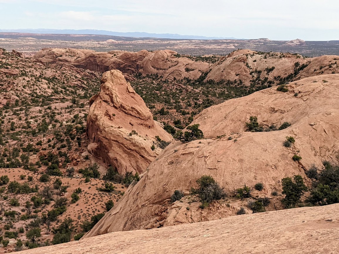
Meet Canyonlands National Park!
That’s exactly the problem, as The Mate and I began to learn a few years ago, and now, in the post-COVID travel boom, multiplied by ever more active Boomers actively booming around the same places we like, we’ve discovered a basic flaw with our mode of road trippin’: it doesn’t work any more.
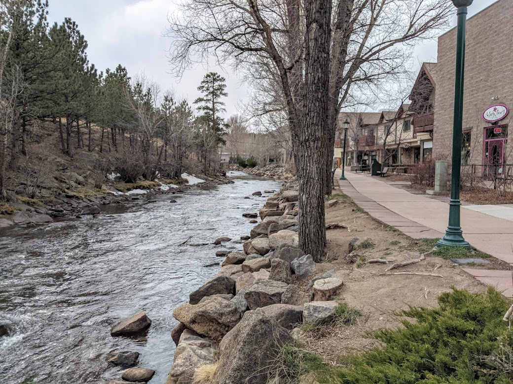
But let me back up to where I left off a week ago. Knowing we were in for some dangerous winds, we veered south from the Black Hills and holed up in one of our favorite mountain towns, Estes Park, CO.
I took this photo entering town because I knew the Rockies would soon disappear in the winter storm. They did.
Estes Park is uber-cute, and probably a complete zoo in high season, which we vowed always to miss.
Riverwalk, with a lil’ snow still…but hardly any people. Score!
EP is so cool, it has its own elk herd!
I biked right past; they never stopped grazing.
While the trails of Rocky Mt. National Park (just up the road) remained inaccessible to folks without snowshoes, we were able to traipse up to my favorite Gem Lake with only a little bit of scary ice & blow-you-down wind.
a gem indeed
After two days in Estes–which included watching our beloved Carolina Tarheels come within inches and seconds of winning a national championship they were never supposed to be in the running for, taking the game down to the wire and giving it their full hearts and ankles (so proud of those guys, can you tell?)–we decided to move our trip a little further on, while still waiting one more day for the winds to abate before crossing the Rockies.
Luckily for us, we have friends in Denver (one of whom had just returned from watching the Final Four in New Orleans!). They invited us to stay. We enjoyed them nearly as much as we enjoyed their charismatic dogs.
Meet Sherlock.
Thursday, when it finally felt safe, we joined the semis crossing the 11,000-foot pass on I-70, marveling as ever at the peaks and wishing that downhill skiing had less of an impact on them. [Not pictured: marvelous Rocky peaks]
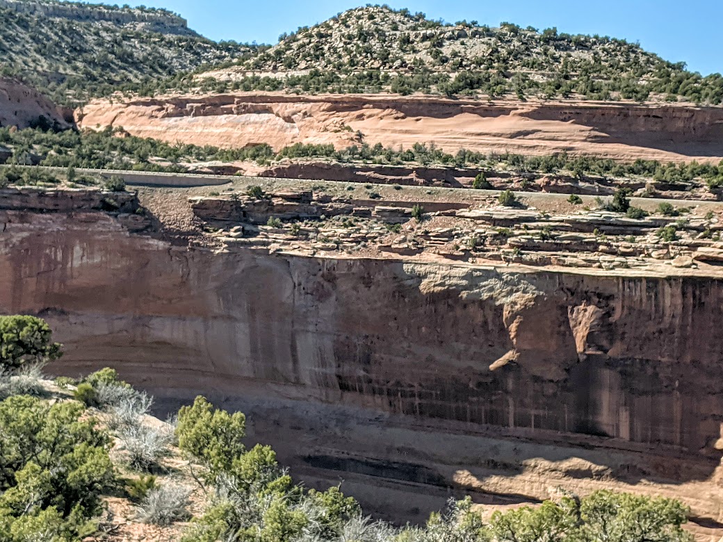
After dropping down, down, down, down, we aimed for Colorado National Monument, a gorgeous hunk of sculpted rock erupting above the town of Grand Junction. Knowing we had no reservation for a campsite, I kept my fingers crossed: Please let there be one! Please let there be one!
There was.
We got lucky that time–thanks to having a tent, not an RV, and arriving on a Thursday, and, oh yeah–it’s the Colorado National Monument, NOT National Park. Huge difference.
Still completely stunning–especially riding the Rim Road, which goes right along this cliff. I adore cliffs.
It’s always hard to stop taking pictures of rock formations; bear with me.
They call these “The Coke Ovens.”
Of course you can’t put railings around an entire canyon, but this particular railing seemed designed just for me…because OF COURSE all I wanted to do was crawl out onto that ledge, a.k.a. that flat-topped, nearly free-standing pillar of red stone.
Did I mention that I love cliffs? It’s not an entirely healthy affection, I’m afraid.
After a happy camping night–first time since early March that we’ve been able to camp on this trip!–we continued on down toward the town of Moab. Again: no reservations, so we had no hope of camping in either Arches or Canyonlands N.P. BUT we knew there were several BLM campgrounds strung along the Colorado River, which operate on a first-come, first-served basis. It was Friday; we didn’t love our chances. But once more…
SCORE!!!
We got the very last one, at 10:45 in the morning. (Then we spent the afternoon & evening hours watching disappointed would-be campers like ourselves drive by, turn around, and move sadly on. We felt for them; we were them. There are so many of us now!) [Not pictured: dust from cars of disappointed would-be campers.]
Because who doesn’t want to cuddle up to this???
Since we only had a half-day to recreate, we opted for Moab’s famous bike trails, saving the hiking for next day.
I imagine this is what the Ten Commandments would have looked like had God given Thirty instead of Ten.
We celebrated our special spot that night by sharing an enormous microbrew from the Black Hills.
First come, first served all right!
We could have opted to stay another night. One of the curses of the BLM system is also its blessing: once you’ve pitched your tent, you can stay up to two weeks, $20/night or $10 for seniors with passes. (Two more years till I get mine!) No wonder there are never any spots during high season.
By “high season” I mean spring. June-August, this place is WAY too hot.
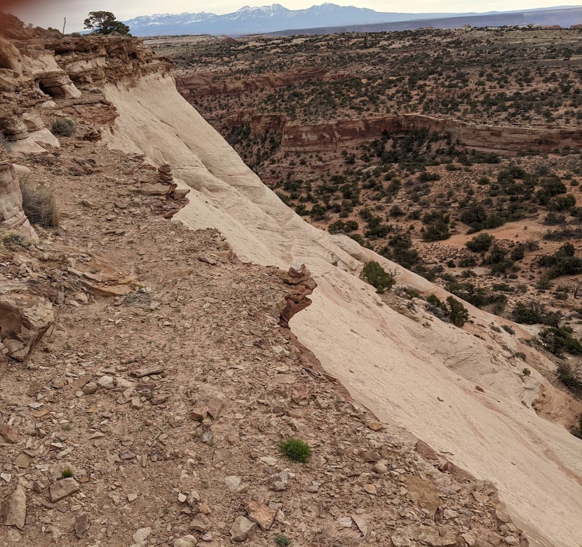
But the winds were picking up again, and we wanted wifi & showers (BLM sites are pit-toilet only, and BYO water). So we reserved ourselves a basic cabin in town, and took ourselves to Canyonlands–the 30-miles-distant part, not the 85-miles-distant; Canyonlands is VERY spread out!–for a day of hiking.
Because there are too many types of rock to choose from, we opted for several shorter hikes. First up: Aztez Mesa. Yep–right up to the tippy-top…
…looks easy-peasy from here…
I love cliffs, remember? And ledges? Turns out I DON’T love ledges that look like they could crumble beneath your feet. This trail sent me scrambling to the left.
Seriously??!!
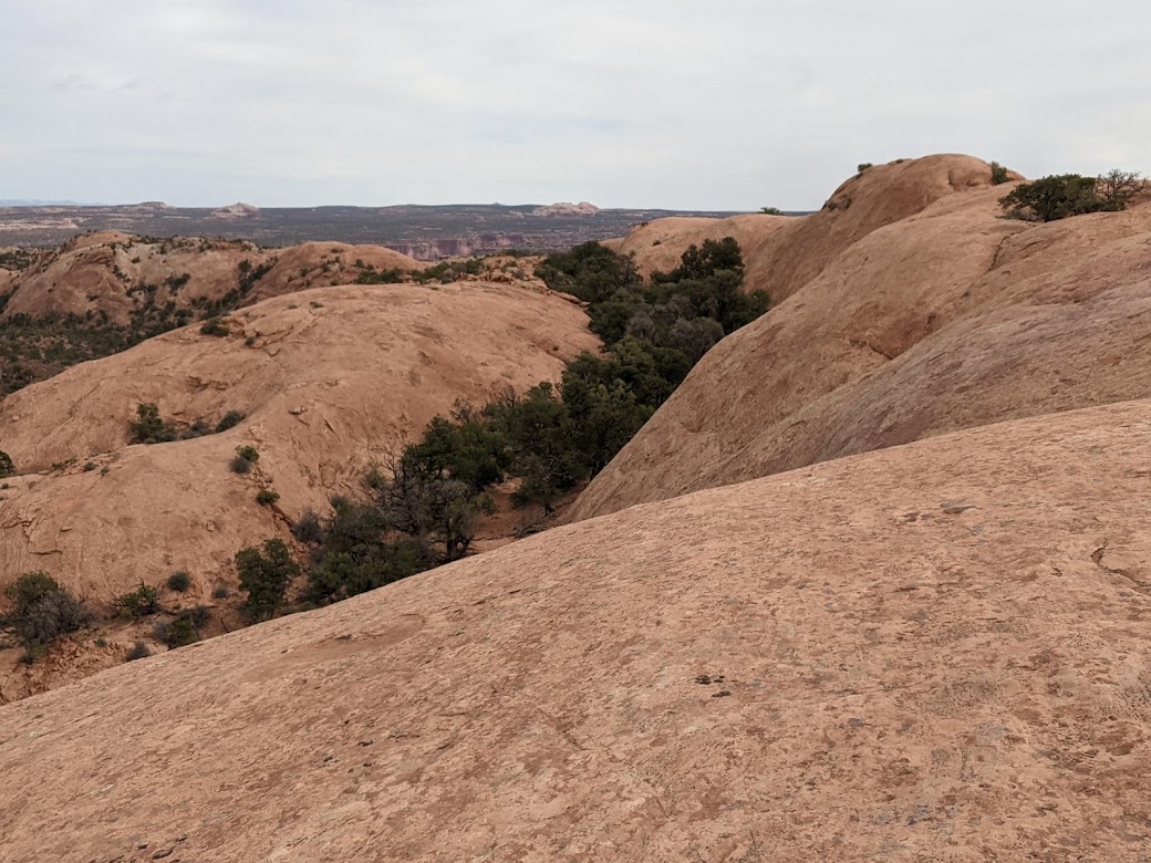
Next up: smooth red slickrock.
They call this one The Whale.How many blowholes does a whale need? And shouldn’t they be up top?
From the up-close to the faraway, this view of the Green River’s work, etching itself through layers of time:
Same theme, different view:
Totally happy to stand on that cliff! (Just don’t ask me to CLIMB it. I’m unhealthy, not completely nuts.)
One last look…just not quite believing it’s real:
The Mate would not hear of me hopping onto those flat, tempting red tower-tops. Can’t blame him; I actually don’t care to look at OTHER people on cliffs, even while I enjoy being there myself. Weird.
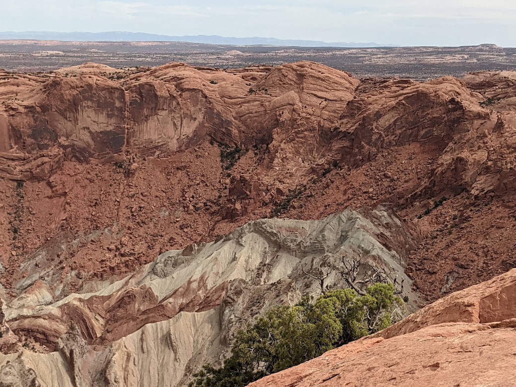
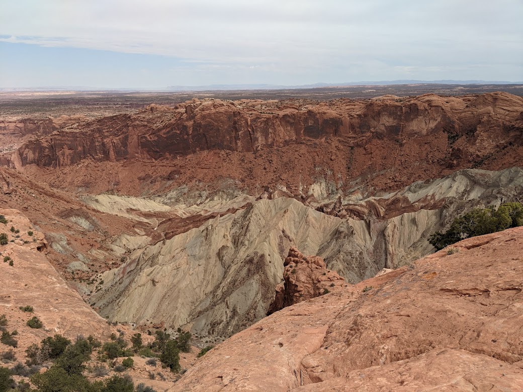
And just to throw one other rock formation into the mix, here’s Upheaval Dome, a mysterious , rainbow-colored pile inside a crater that geologists are still arguing over.
Slow uprising, or meteor crater? I like the latter hypothesis. Wish the colors had come out better; some of that sand is actually GREEN. Much of it, we learned, is salt.
Need a break from all the red rock? How about some red Paintbrush?
Go guys, go–you can do it!
We left Moab feeling both grateful and a bit deflated. Now we know that, if we want to nestle into that amazing habitat anywhere closer than a commercial room, we’re going to have to do the P-word: PLAN. Plan WAY ahead, like 6 months at least. One of the best parts of our road-trippin’ is its haphazardness, but that luxury seems to be evaporating.
But we found a silver lining.
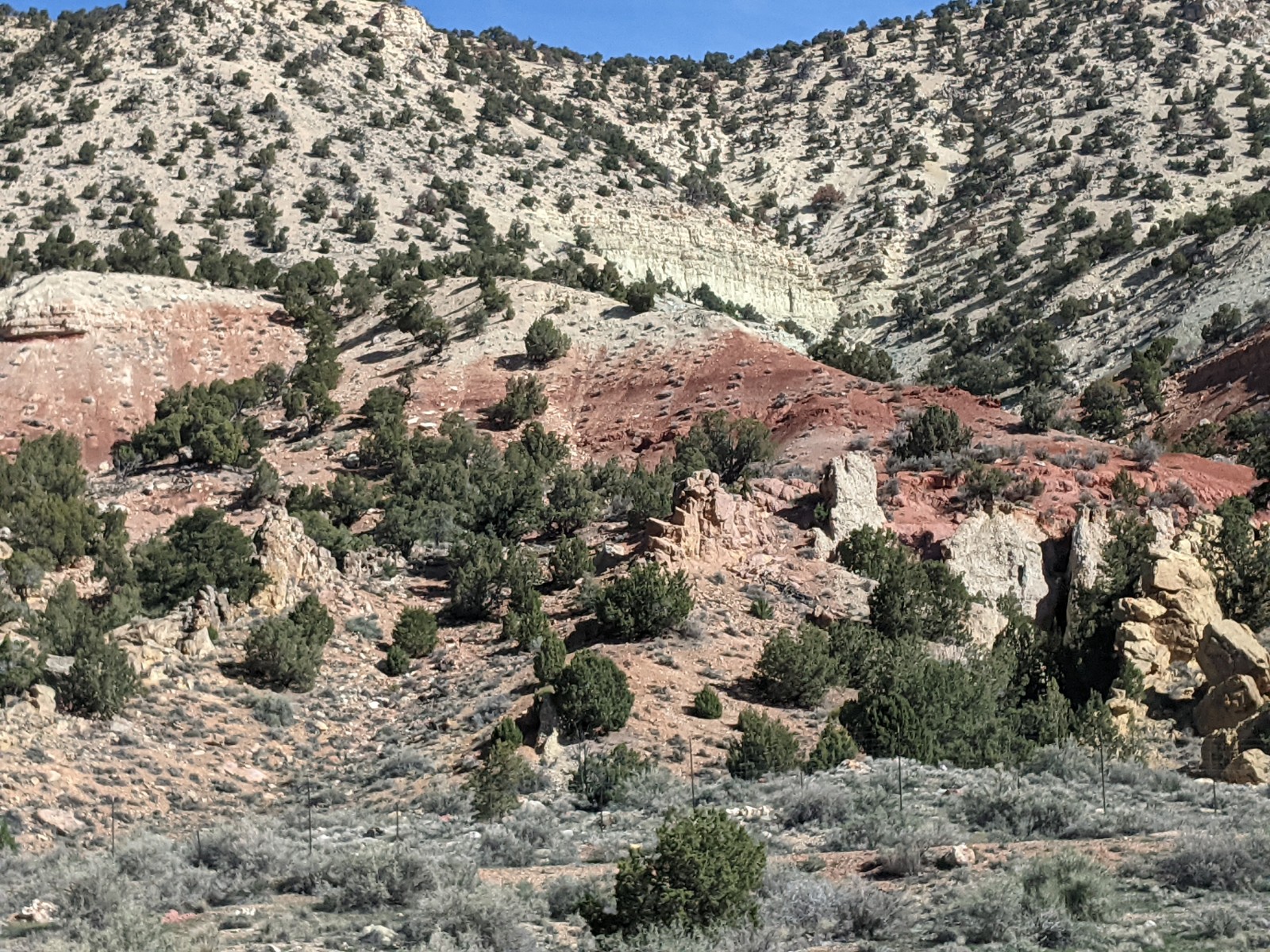
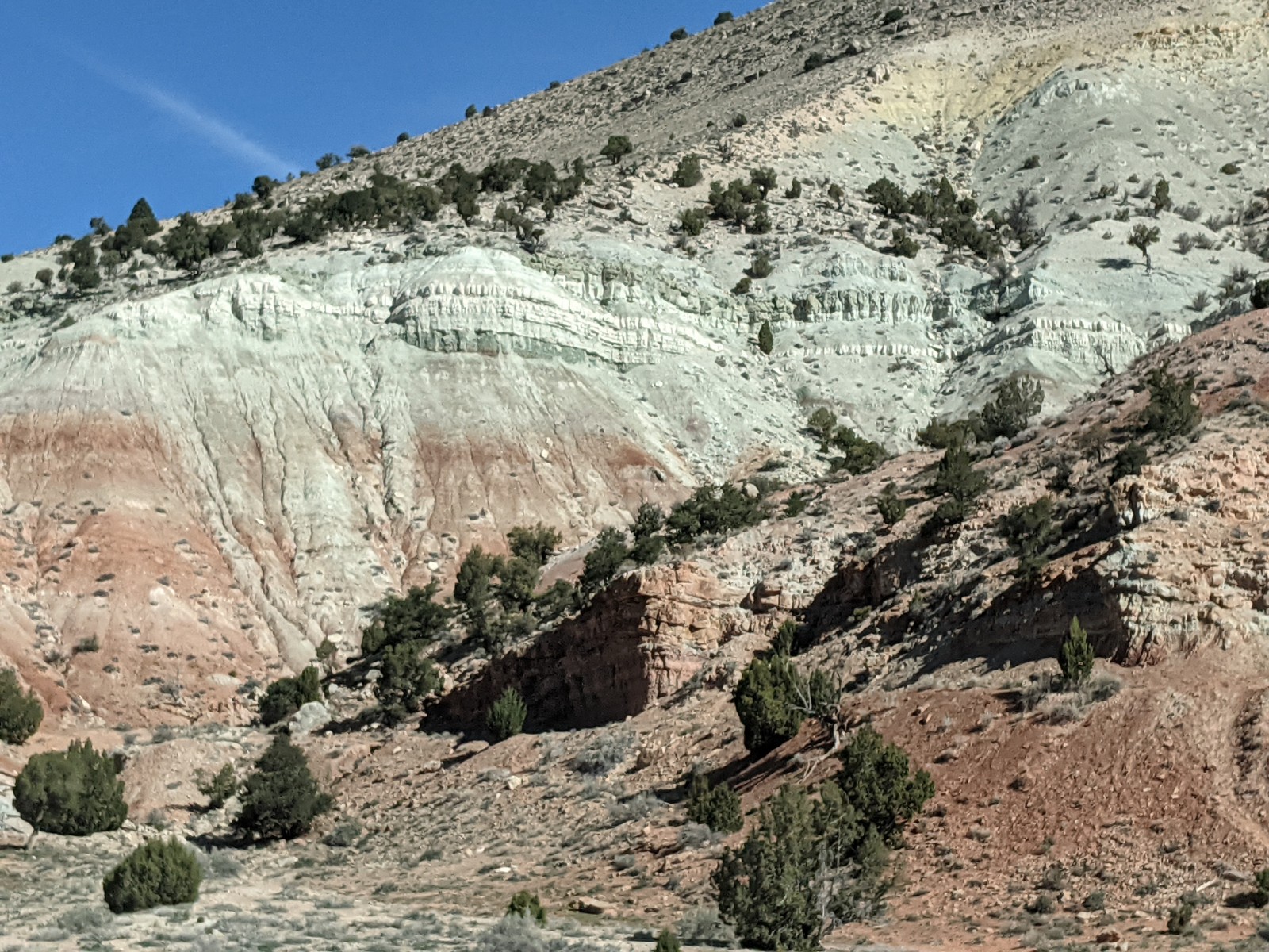
Next morning, hopping back onto Interstate 70 West, The Mate & I were treated to three and a half hours of almost nonstop geological wonder. Starting with…
Wait–who put THESE here?
We kept turning to each other in confusion: Hold on. Have we not driven this stretch before? Wouldn’t we remember this if we had?
Yes. Yes we would.
The above photo I took at a viewpoint, where we parked. All the following, I simply snapped as we drove past.
Not a park. Just a bunch of roadside rocks.
The colors changed with every curve or hill.
Raspberry mint? What would you call this?
I think we saw every color except blue. Even black got into the mix.
Not my fault the black rock was on The Mate’s side! So yep, that’s his schnozz.
The colors and formations simply Did. Not. Stop…till eventually we bumped into I-15, and that, my friends, is where I-70 ends (after starting in Baltimore; we looked it up).
Mint raspberry? Give yourself a hand, I-70. I’m sorry I ever dissed you as boring!
So my takeaway from the past week is this: if you find yourself one of those disappointed, non-planning-ahead would-be campers…don’t whine; find your blessings where you can. Take a hike, and then go drive the interstate! #silverlinings #redrocks #istilladorecliffs
In case it has, ahem, escaped your attention, last week (March 29) marked the 40th anniversary of the Carolina Tarheels’ first national championship, in 1982. That date matters quite a bit to The Mate, and even more to me, because that’s the day Michael Jordan baptized me into Tarheel fandom with what’s known as “The Shot.”
The rest is history. (Photo courtesy NCAA.com)
Up till then I had been more of a Duke fan if anything, but being back in Chapel Hill, on spring break from college, when The Shot fell–that was total immersion. I’ve never lapsed.
Fast-forward 40 years and six days, and guess what: our team is once more playing for the national title…in the same exact city where MJ helped them win in 1982.
Now, in case you’re someone for whom college sports means little or nothing, I’ll just briefly refer to a certain rivalry game that occurred last night, where a certain 42-years-tenured coach of a certain rival school to UNC ended his career–or rather, had it ended–by those selfsame Tarheels. Not sure if I speak for all Carolina fans, but truly, for me, if “we” lose tomorrow, I won’t care so much, because “we” already beat Duke twice on the most blaringly national stage possible.
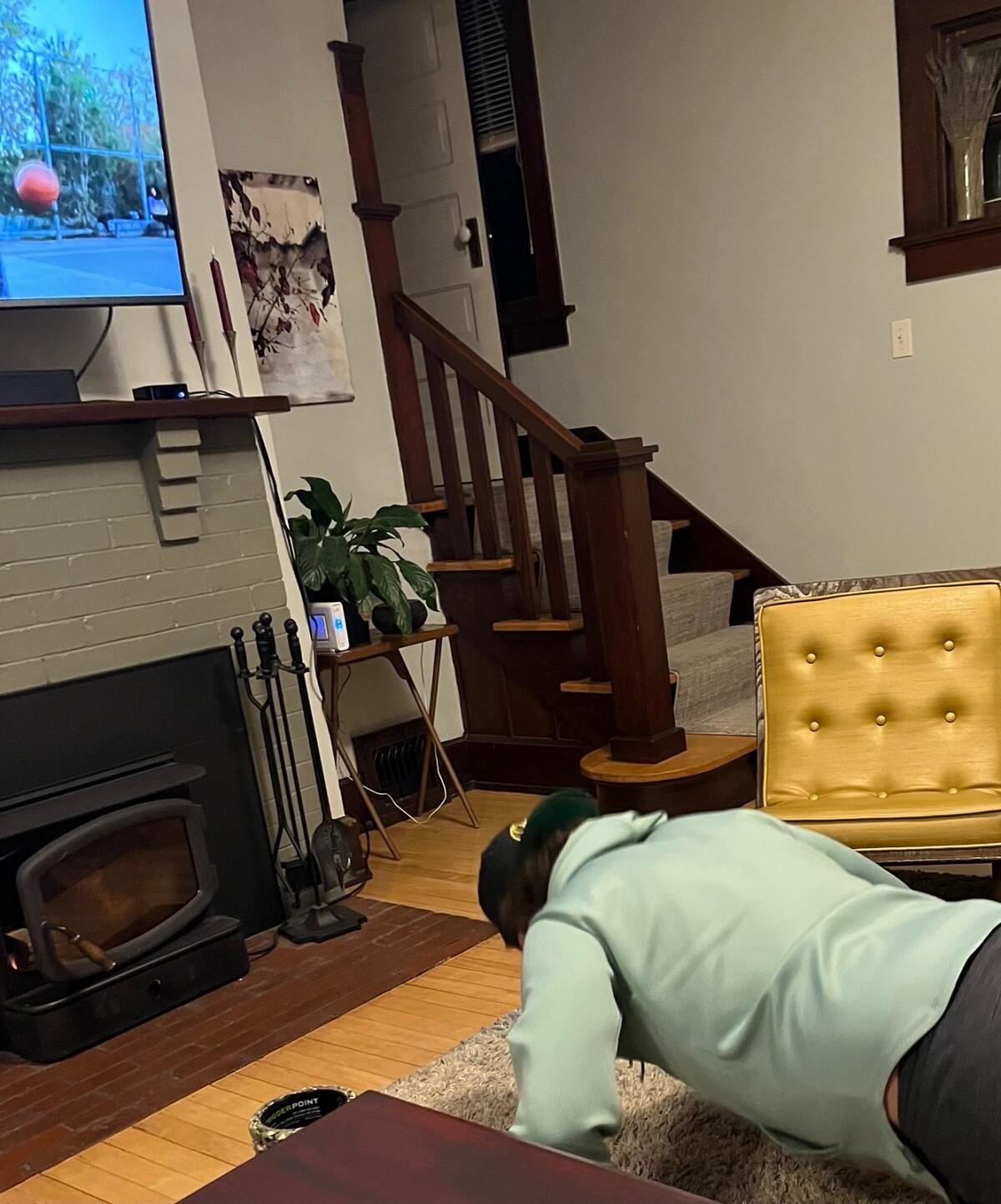
But I’m still looking forward to one more day of sports babble, one more evening of texting far-flung fellow fans while alternately cheering and doing calisthenics for extra mojo.
We’ve even taught some of our friends this trick. Pushups work best!
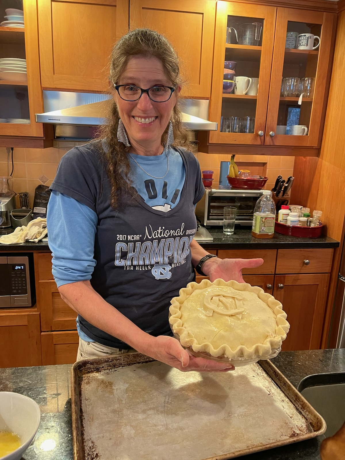
Amidst the madness, however, Road Trip XI continues! We left Milwaukee last Tuesday, and spent two cold & dank but otherwise VERY happy days at the home of old friends with lots of dogs and cats. The Mate & I managed one uncomfortably windy ride along the Mississippi, and then relaxed with critters and pie.
UNC pie!
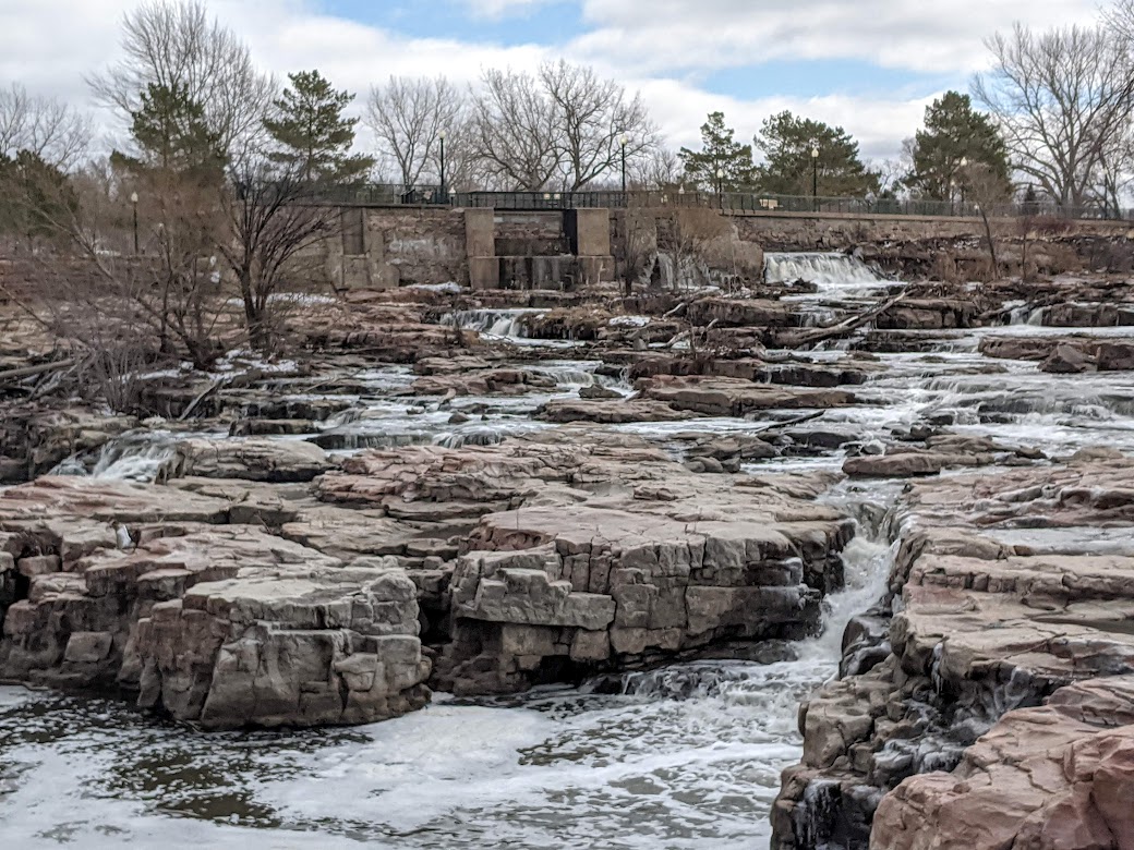
Leaving the frozen north for the slightly-less-frozen latitude of I-90, we crossed into South Dakota and chose Sioux Falls for a recreation stop. It was too windy to ride, so we decided on a walk–till our first glimpse of the falls stopped us in our tracks.
Seriously??? How have I gone so long without knowing about this place?
The more you explore, the more waterfalls you find.
RiDICulously intricate: like a flattened, pinkish Rivendell
However, when I stopped to read the signage, my awe changed to sorrow. Turns out that incredible sight is actually a remnant, blasted and quarried to a shadow of its former self. A view from the observation tower provided the gritty perspective of the whole scene, surrounded by the ugliness of industry.
“But can I blame those white folks from 140 years ago?” I thought. “They were so excited about electricity. How are they any different from me, driving across the country using fossil fuel even when I know better too?”
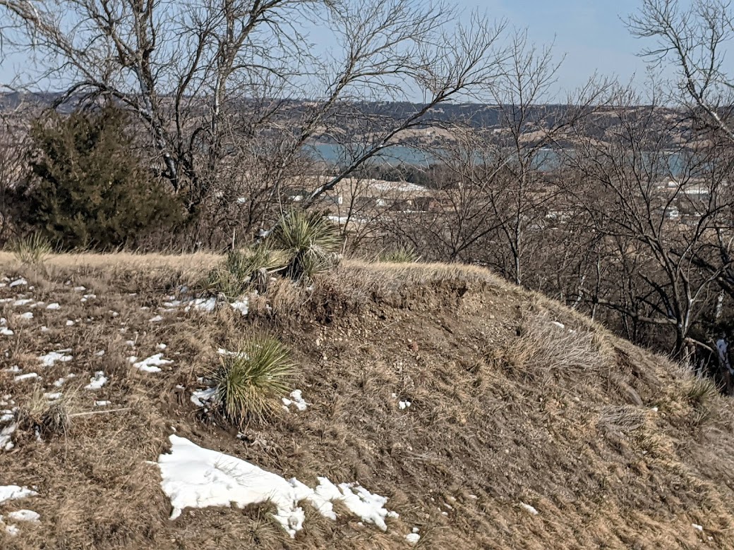
We drove on, sobered by these thoughts despite the thrill of that beautiful pink water garden. Crossing the Missouri River, I glimpsed yucca plants, and decided: It’s official–we’re back in the west!
Missouri + yucca = West!
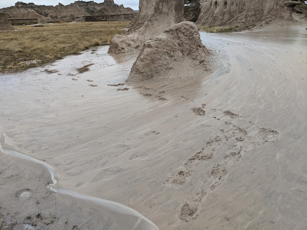
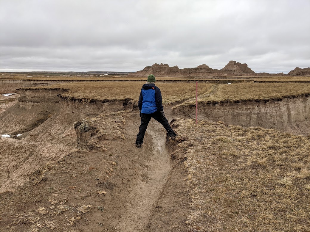
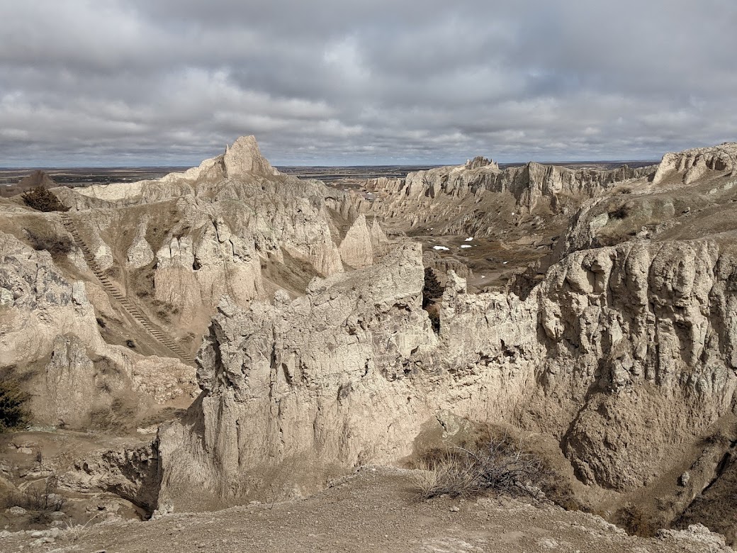
But from there, the land got REAL western. As in bad. As in Badlands.
RAVie posing for her car commercial
We’d driven through the Badlands decades ago, in the summer. This time, entering under rainy skies, we made a startling discovery: those jaw-dropping crags aren’t made of natural cement, as they appear. They’re made of MUD.
This kind of mud.
So every drop of rain simply reduces each elegant, striated mountain into, eventually, something like this:
I’m mellllting!
Trying to hike across this stuff was like trying to hike on oiled ice. I’ve never felt any substance so slick. The Mate & I managed a couple of miles, hiking as much sideways as forward, trying to stay on grasses…
…with limited success…Somehow it never looks like this in those Westerns!
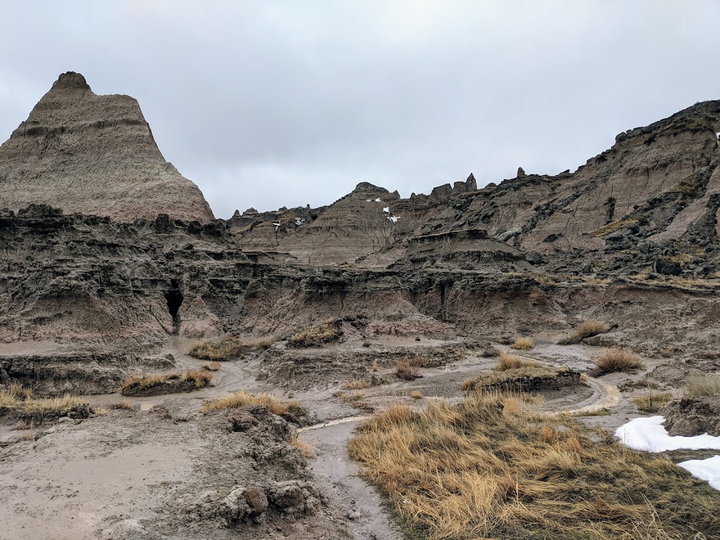
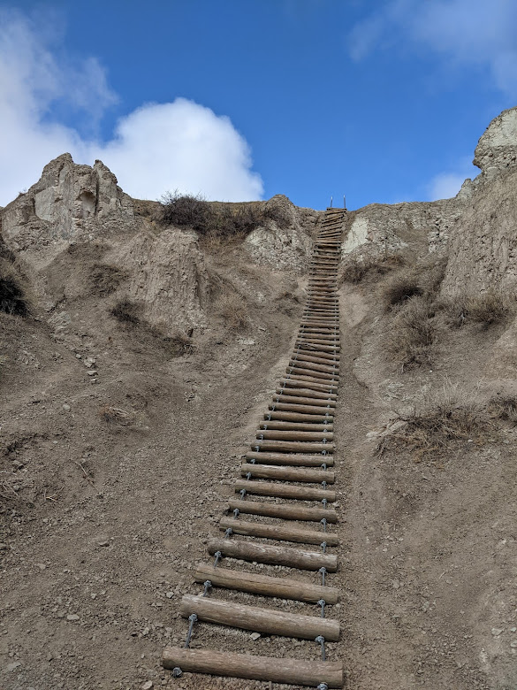
…but eventually we gave up and tried a shorter, drier trail. This one featured some fun obstacles, like
Yikes. Even more so coming down.
…but also some amazing color.
What’s so bad about this?
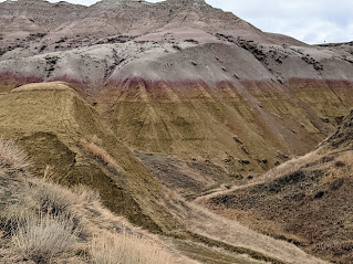
Speaking of color, just a glimpse at the Yellow Mounds on our way out:
Makes me want to eat a popsicle
Seriously, this park is one of the most accessible in the country: just a stone’s throw off the interstate, and entirely driveable.
But on foot–so much the better!
And oh yeah, it comes with bighorn sheep.
I did not photograph what happened next.
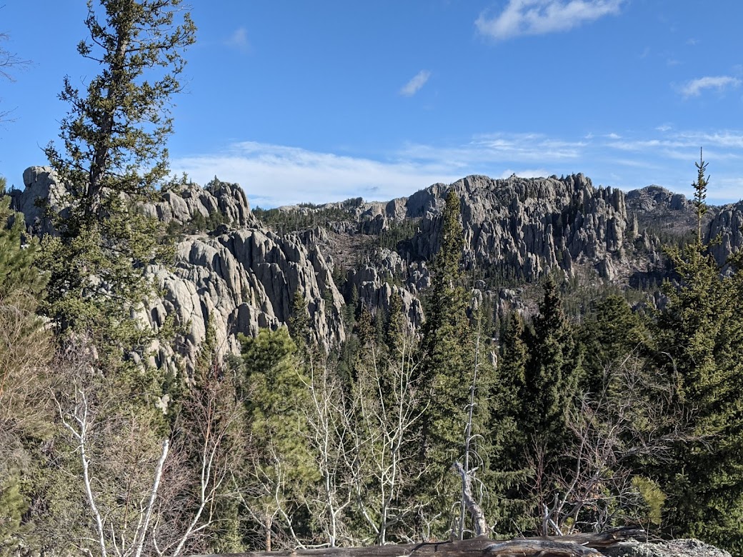
We finished up that day by driving into South Dakota’s Black Hills. Since we knew nothing about this area, I booked a motel with full kitchen for three days so we could explore. And oh my goodness, did we ever.
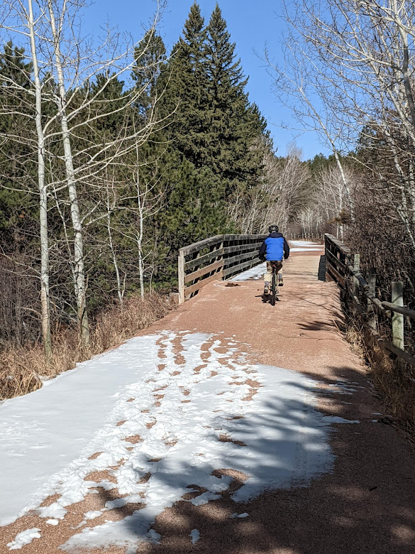
We started with the George Mickleson Trail, a state-run, 109-mile rail-trail that winds through some of the most amazing scenery any bike trail gets to boast of.
Yeah.
Unfortunately, the snow patches kept increasing in size as we rode, making me nervous. Liza’s tires did great, but she’s no mountain bike, and I really didn’t want to fall. So we called it quits after 90 minutes of so, but 100% we’ll be back in a warmer season if we’re ever able.
Although leafy aspens can’t be any prettier than this, can they?
The Black Hills are most famous for Mt. Rushmore, but we didn’t care to visit. That’s just no way to treat a mountain, in my opinion. We did glimpse the Crazy Horse work-in-progress from a ways off…
a LONG ways off!
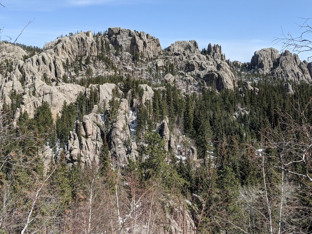
…but didn’t opt for the tour. I do feel better about that monument, since a Lakota leader commissioned it, but still…I prefer my mountains whole, thank you. Which is why I fell deeply in love with nearby Custer State Park.
If only it weren’t named after a war criminal! But that’s not the mountains’ fault.
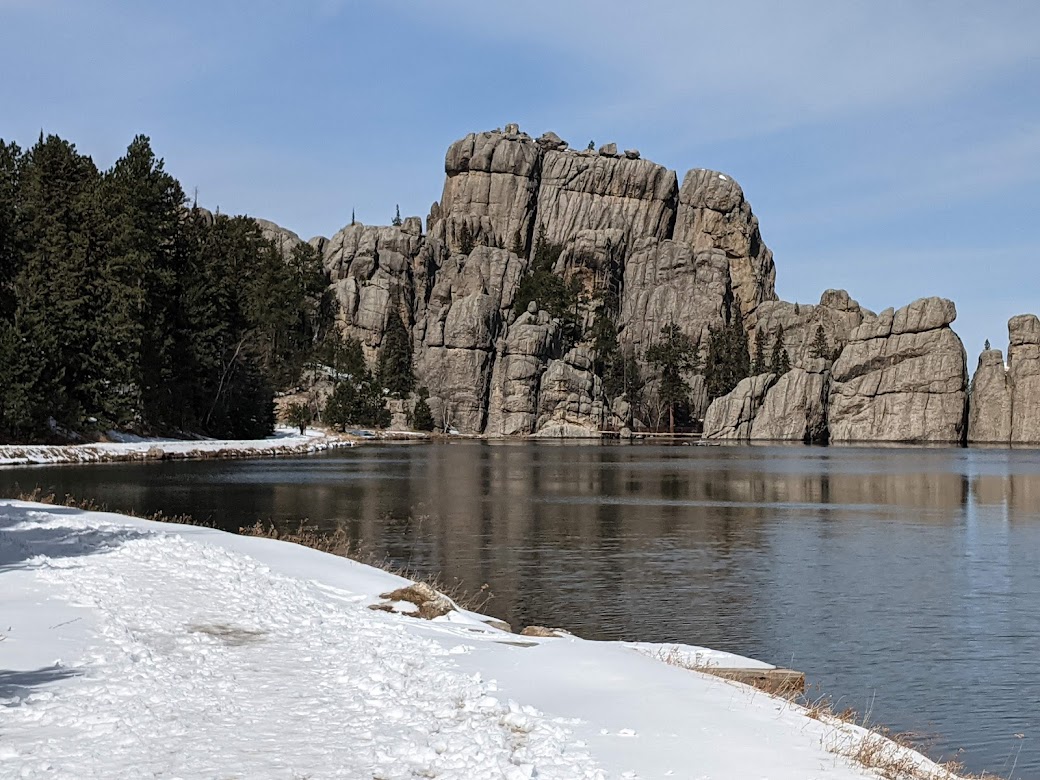
Sylvan Lake is dammed, but that’s not its fault either.The dam itself is breathtaking to walk out onto. But…where does the trail go?Oh. Gonna need a sharper set of hiking poles.
Heading out of the park, I snapped a shot of the single-car “tunnel” which gives some indication of the ultra-mountainy road up to the park. And lo and behold, what does that dashcam shot show but…
…our Tarheels, journeying with us through all the mountain beauty.
So…go mountains. Go Heels. Go tradition, and marriage, and teamwork, and the Church of the Great Outdoors.
But Monday night, in New Orleans? Especially, Go Heels!!!!!