Road Trip IX, Days 23-26: The Appalachian Ocean

Consider this post a small gravel-chunk in the stretch of road that constitutes the travelogue of Road Trip IX. The Mate and I just spent four days and nights in Appalachian Trail country—northern Georgia, western North Carolina—and I want to capture my musings on these mountains before we arrive back in Tarheel Territory the Piedmont and give ourselves over to a week of screaming at the TV, eating BBQ and fried chicken, raising our arms for luck on free throws catching up with old friends over the ACC basketball tournament.

Amicalola Falls State Park, Georgia…near the southern terminus of the Appalachian Trail.

Fellow native east coasters, I must confess to you: since moving to Washington in 1990, I’ve become a horrible Western Chauvinist. One of those people who comments that the tallest mountain in the east—Mt. Mitchell, 6,683—comes up to less than halfway up our Mt. Rainier (14,110).

Shame on me.

Height doesn’t matter.

Four days of hiking and riding around the Appalachians has reminded me of this simple truth: you can’t compare them to western mountains.

Western mountains are formidable ranges, awesome volcanoes, places of raw wilderness and dazzling danger. But the Appalachians are a sea.

Sometimes a sea of fog.

There are two reasons for this contrast, two interconnected reasons. The great age of the Appalachians has subjected them to forces of erosion and plate-stretching that have created mountains in the shape of waves.

Waves at sunrise (taken through the window of Amicalola Lodge)

A wave is a crest and a trough. In the Appalachians, the myriad valleys and hollers are as much a part of the mountains as the peaks…because people can live there. They’ve been living there for millennia. Even European settlers have been there for over 250 years!

Waves at sunset

Of course people live high up in the Rockies and the Cascades, here and there. But the very steepness and height of those ranges rendered them inhospitable to permanent settlement back when Europeans first got there. That’s why they have no equivalent culture, identity, or musical heritage to Appalachia. (Sorry–John Denver doesn’t count.)

Here’s where I ought to have some pictures of good ol’ Appalachians doing good ol’ Appalachian things like playing bluegrass or drinking ‘shine. But since I wasn’t thinking about a blog post when we were hiking and biking and driving through, all I have is pictures of The Mate with some friends.

“Foggy Mountain Breakdown,” anyone?

So thanks, Appalachians, for slapping me upside the head with this reminder. If they’re lucky, all those gorgeous western mountains will look like you in a few million (billion?) years. 

Till then–stay warm!

Thanks. You too.

Road Trip IX, Days 17-22, Dallas to North Georgia: Crossing the South While Reading U.S. History

If I had titled this post, “The Confederates Actually Won,” I wonder how many of my white readers would be shocked?

I’m a Southerner born and bred—a Tarheel, as many of y’all know. But by true Southern standards, I’m also not. My mom was born and raised in LA, my dad born in Germany and raised in a weird immigrant/Quaker/Jewish/freethinking mishmash in Philadelphia and LA. They created their own mishmash of Quaker education/ back-to-the-land farm life/ world travel for me to grow up in. So…not REALLY a Southerner.

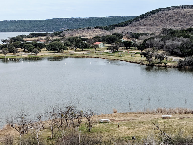
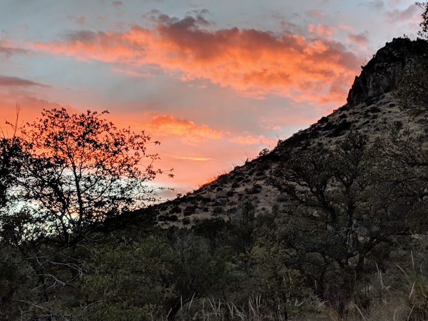
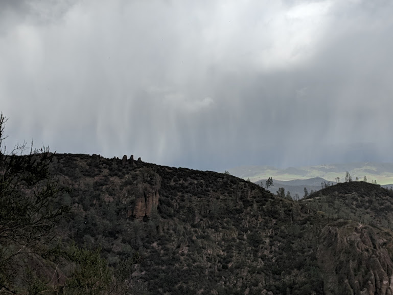
Our first night in one of the original 7 states of the Confederacy: Texas…in the wonderfully-named Possum Kingdom State Park

Except when I’m not in the South. Starting with college, up north, that’s when the nostalgia kicked in–and living now in the northwest, it still kicks. I find myself longing for the soul food my mom never cooked; when I speak to a fellow Southerner, my vowels lengthen on words like, “I’m fine.”

And that’s not even to mention the great passion The Mate and I share for the Carolina Tarheels.

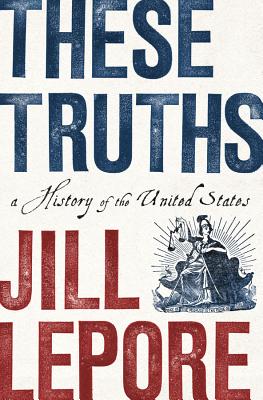
But now we’re here, crossing the Lower South on our way to NC. And I’m reading These Truths by Jill Lepore.

Even thicker than it looks.

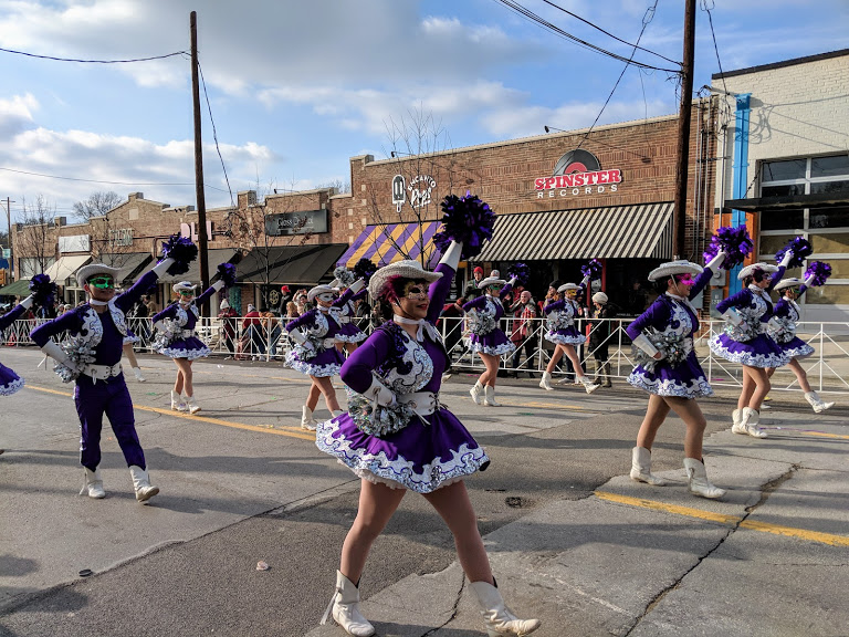
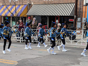
Hold that thought for a sec. First I have to give a shout-out to Dallas, or rather, to the Dallas neighborhood of Oak Cliff, where we spent three days with friends. This part of Texas is really into Mardi Gras.

Masked dinner! Not pictured: dinner (jambalaya, cheese grits & greens, etc…)

Maybe it always was, maybe the influx of New Orleans refugees from Hurricane Katrina played a role, but whatever–laissez les bon temps roulez!

Really fun parade, despite near-freezing temps

I was touched and heartened by the mix of races and ethnicities out celebrating together.

“Old” Texas lives…

…with “New” Texas!

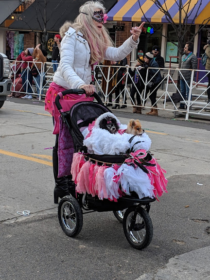
And don’t forget Pomeranian Texas! (These guys were part of a whole group of “Recycled Poms”!!)

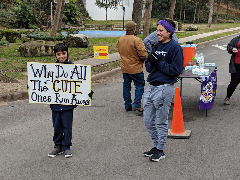
With my friend, I also walked the Fun Run (note to self: Fun Runs really are fun when you’re not racing! Who knew?). These adorable girls spontaneously danced in front of the start line when their favorite song came on…

They had great moves!

And then there was this little guy, along the course:

Why, indeed? Love it!!!

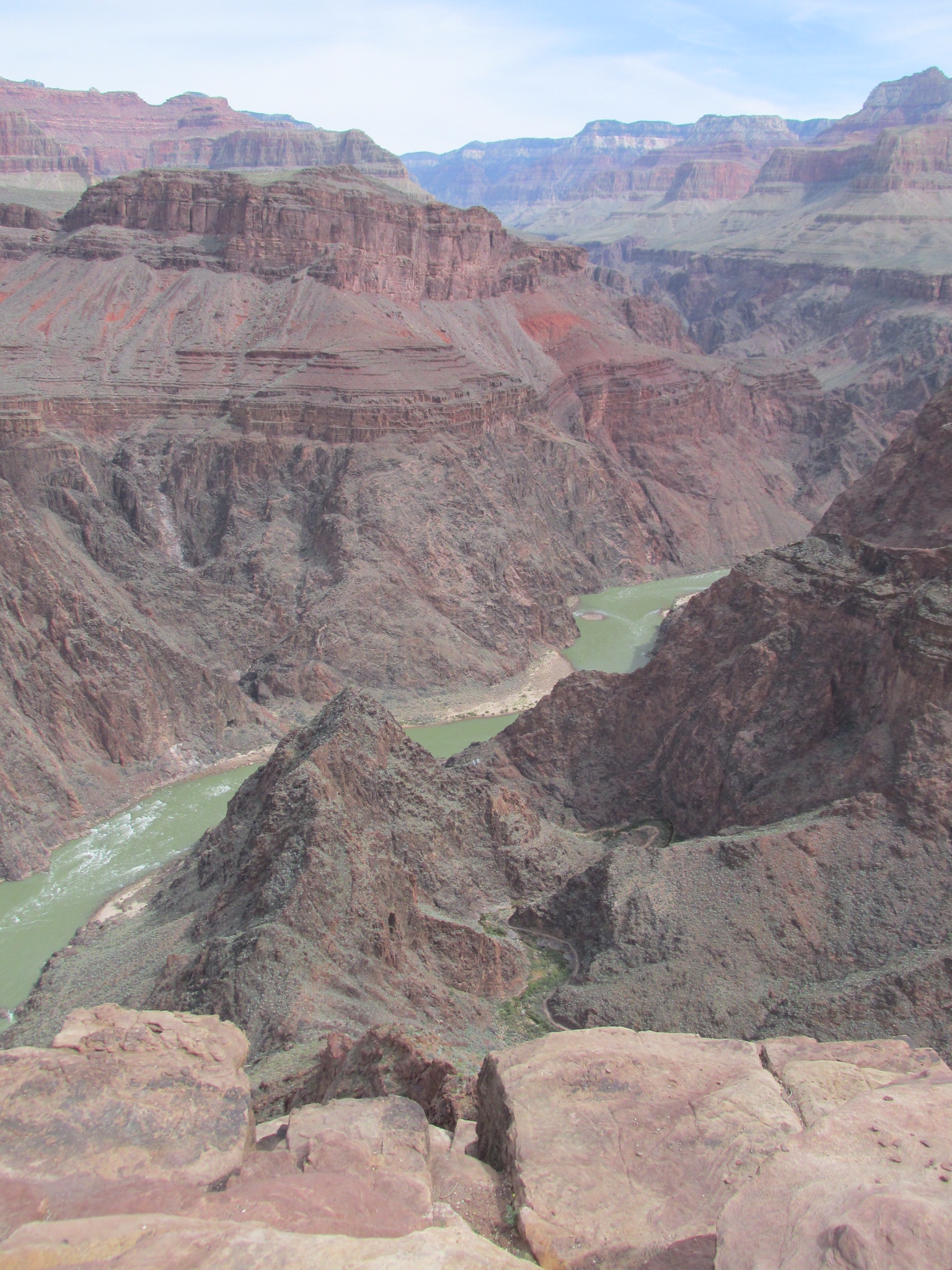
But the day after we left oh-so-cool Oak Cliff, we found ourselves in Vicksburg. Not often drawn to historical attractions on our road trips, we decided to pay our respects to the Vicksburg National Military Park–site of the Union’s 18-month campaign to capture this all-important center of control over the Mississippi River.

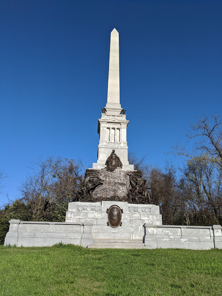
Monument to fallen Confederate soldiers–both sides have many monuments, but I only captured this one’s image

In the past, such a reminder of the viciousness of the Civil War (nearly 4,000 men died on these hills and vales, with thousands more wounded, captured or missing) would just reawaken all the complexity of my feelings about being Southern. As I’ve written in the past, I’m very conflicted. One of my songs tries to express that conflict:

If my old neighbors have their way, I’ll be burning down in Hell

But just ’cause I’m a sinner–it’s nothing personal.

They hate everything I stand for, but I know who they are

So don’t you ridicule their accent when they talk about hellfire.

But, as I mentioned, I’ve been reading Jill Lepore’s book. Let’s get back to that, shall we? It’s a comprehensive history of this country. I have a Master’s in U.S. History, and I’ve taught it to teenagers. These Truths both reminded me of things I knew, and taught me things I didn’t.

Things I knew: 

–The Supreme Court–of the whole country!–ruled in Dred Scott, 1857, that “a black man has no rights that a white man is bound to respect.”

–The Radical Republicans’ compromise with the ex-Confederates to end Reconstruction left millions of Southern Blacks at the mercy of Southern Whites..who showed none. (Radical Republicans were NORTHERNERS.)

–The Supreme Court–of the whole country!– in Plessy v. Ferguson, 1896, ruled that “separate but equal” was constitutional.

–Following the Great Migration of Black Southerners to the North and West to escape Southern terrorism, NORTHERN real estate laws and other restrictions trapped them into segregated neighborhoods

Things I didn’t know, or at least didn’t know enough:

–The People’s Party (the most successful third party in US history), “rested on a deep and abiding commitment to exclude from full citizenship anyone from or descended from anyone from Africa or Asia.” (p. 343)

–“By one estimate, someone in the South was hanged or burned alive every four days” in the first few years of the 20th century (p. 369)

–The 50th anniversary of the Battle of Gettysburg included none of the Black soldiers who had fought there. (p. 389)

–The enlightened Woodrow Wilson? “…like other Progressives, Wilson not only failed to offer an remedy of racial inequality; he endorsed it…’Mr. Wilson bears the discreditable distinction of being the first President of the United States, since Emancipation, who openly condoned and vindicated prejudice against the Negro.'” (James Weldon Johnson, quoted on p. 389)

.Given that the entire country ended up committing itself, legally, to the values the Confederacy fought for, Lepore concludes, “the Confederacy had lost the war, but it had won the peace.” (p. 360)

LOOKING AT OUR COUNTRY TODAY, I CAN’T HELP BUT AGREE. 

But then we spent a day and a night in Alabama, at Oak Mountain State Park, near Birmingham.

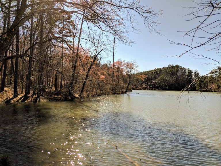
Lake Tranquility, with blooming maple

Can’t get more Southern than that. We rented a cabin.

You can just barely make out our cabin & car in the trees.

It came with our very own ducks on the doorstep.

Got any bread you’re not using?

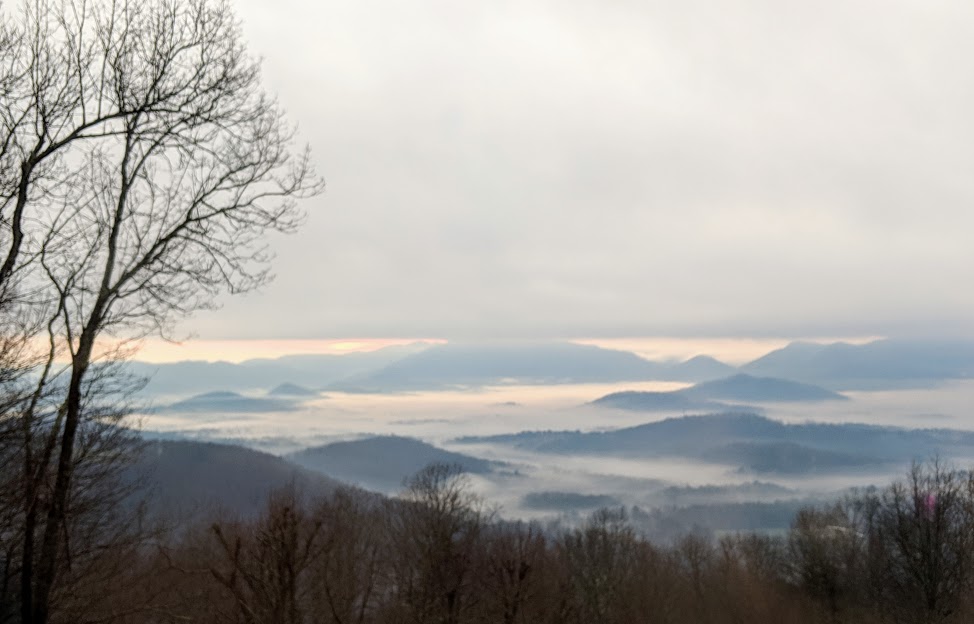
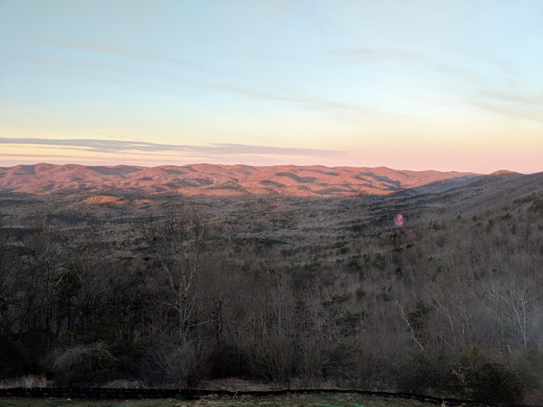
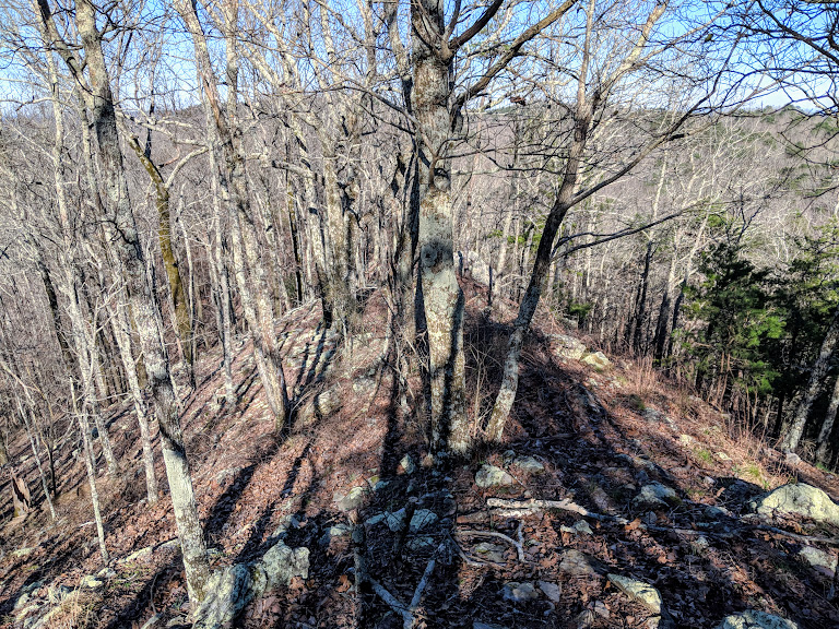
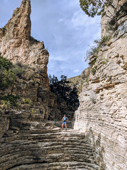
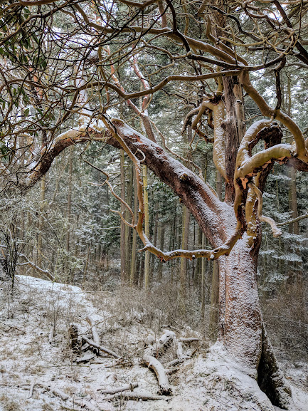
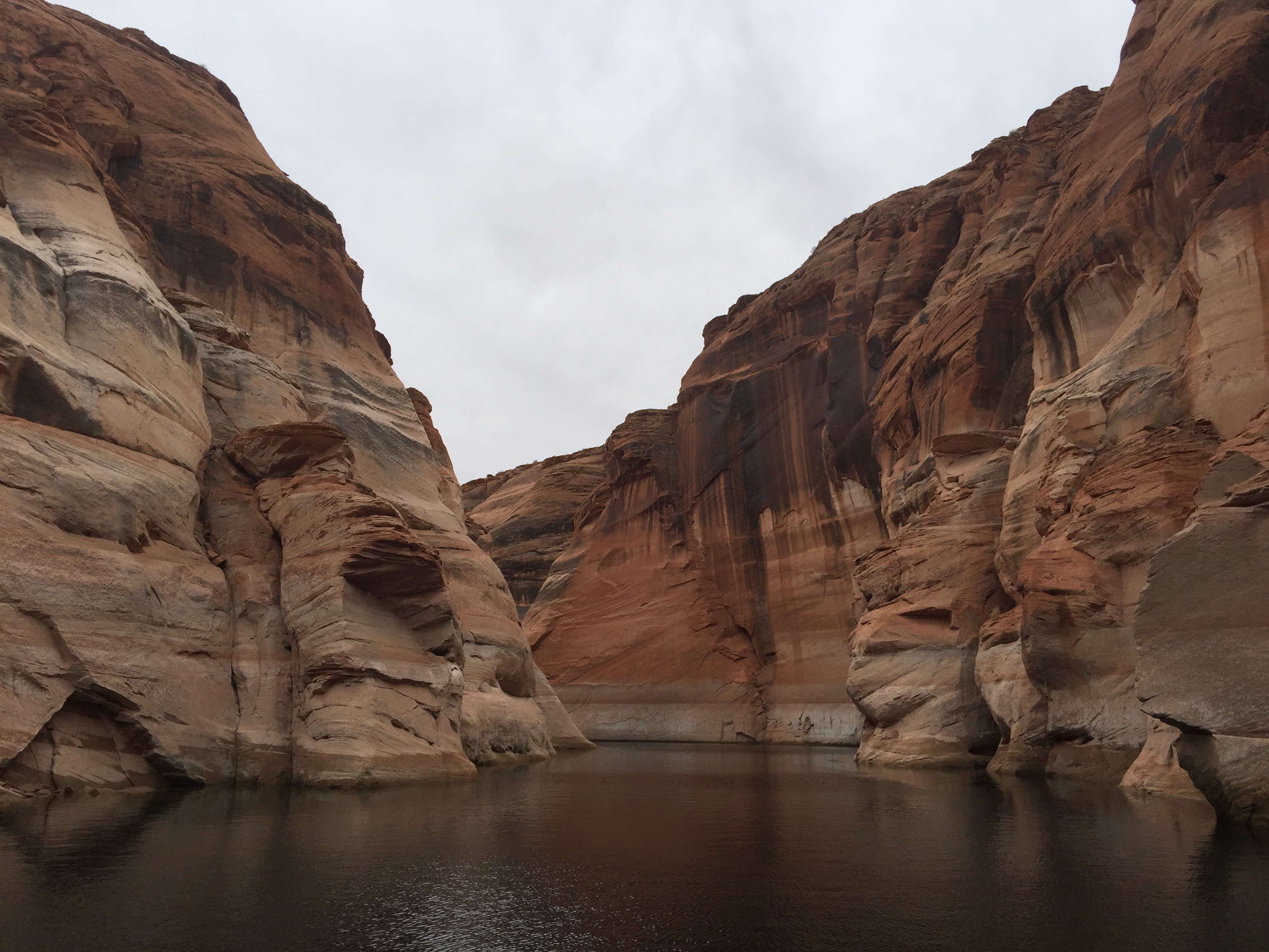
We went for a hike. The winter woods were starkly beautiful.

Steep ridges!

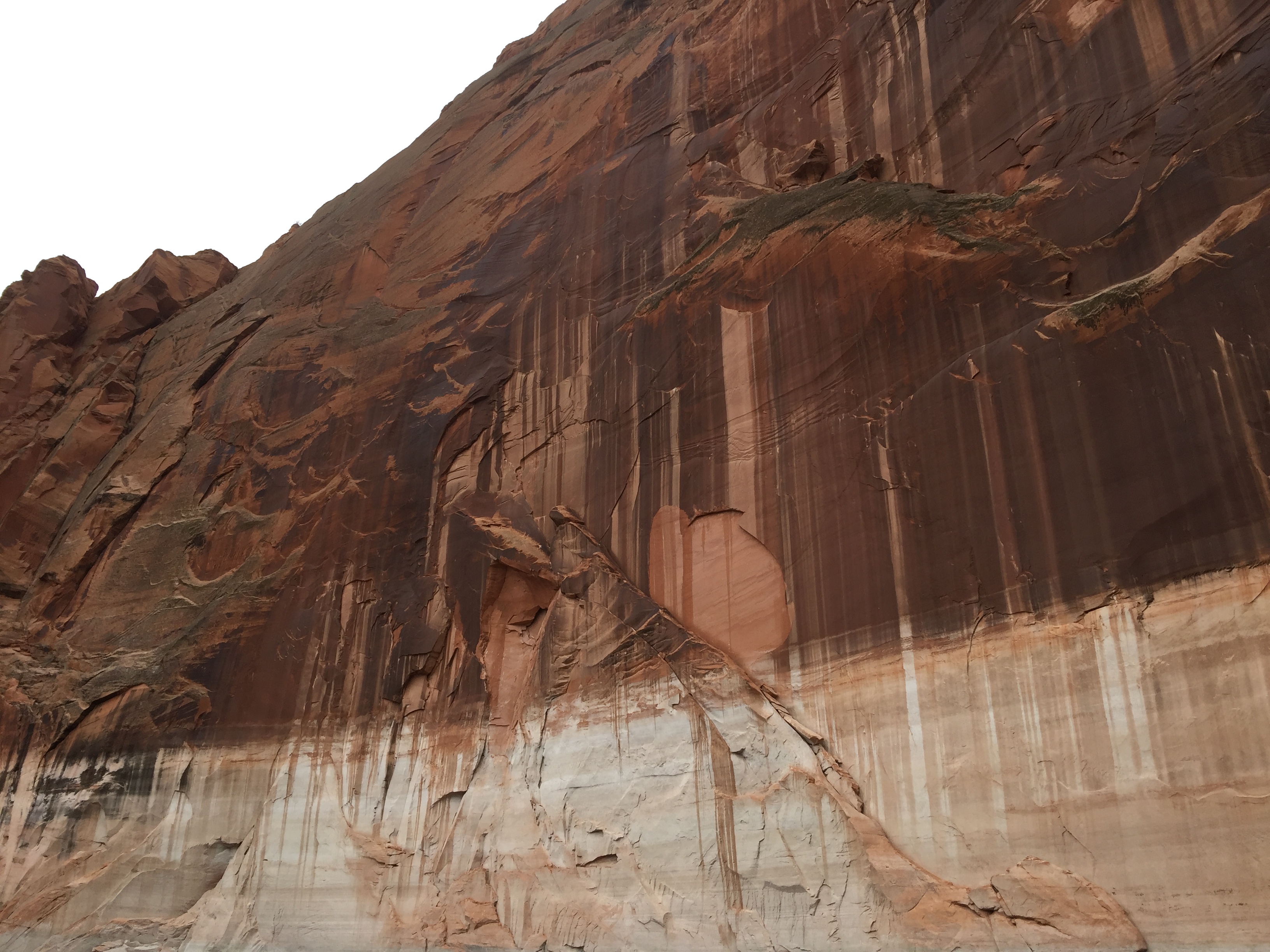
The rocks were craggy.

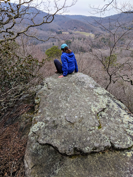
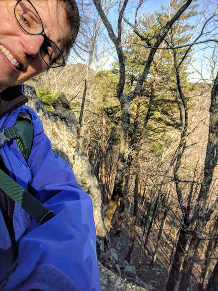
Me trying to show how steep the drop is

The crags were rocky.

You get the idea.

And my soul was full. Because, as my song goes,

It’s another song about the South, y’all–

trying to sort my feelings out, once and for all.

How can someone feel so in and out of place?
That sweet, sunny South where I first saw the light,

if she’s my ol’ Mama, I’m a teenager in flight:

do I want to hug her neck, or slap her face?

I am a Southerner, even if I’m not. I get it. People love their culture. That Confederate statue, above? When you zero in on it, you see the soldiers’ suffering. You understand.

Notice the dead man at lower right. Not too glorious.

I hate the white supremacy the South stood for, and I hate that a lot of the South still stands for that. But I also know that our WHOLE COUNTRY stands for exactly the same–de facto. So I guess it’s my whole country I want to hug and slap at the same time.


Road Trip IX, Days 11-16, Tucson to Central Texas: Why Have I Never Heard Of This Park Before?

Disclaimer: some of the pictures from this stretch of our trip come from parks that are very well known indeed. Like Saguaro National Park, whose two sections frame Tucson. We love Saguaro, but we have fallen into a rut the last few times through, opting to ride our bikes around the wonderful 8-mile loop of the eastern chunk of park. This time, we went west.

Now THIS is winter desert. Right?

But that glorious sunshine didn’t greet us till the second day. What did? THIS. 

Really, Tucson? Really?!

There’s a reason I have no pictures of Tucson’s sweet downtown, as we were too busy avoiding frozen puddles and hunkering down in coffee shops to sightsee.

But when it came to snowy cactus, my camera couldn’t get enough.

Ocotillo…which ought to be blooming this time of year!

I really need to stop clicking and start hiking.

Okay, okay…one more!

Also on the west side is the Desert Museum, one of the best put-together set of exhibits we’ve ever come across to interpret the desert environment.

Really cool sculpture there, tracing the evolution of animal life from protozoan on up.

It happens to include a zoo, made up of animals rescued from injury or abandonment.

Like Cruz the puma, who gave us the death-stare from three feet away (behind glass).

The greater Tucson area also includes a good network of bike paths, but the section we rode was more about exercise and visiting with an old friend, so no photos there either. Ditto on the tacos.

After three days of civil, though, we were eager to revisit one our favorite and least-known parks: Chiricahua National Monument.

Hoodoos in my happy place!

We’re pretty sure the only people who know about this park in Arizona’s extreme southeast corner are friends of ours we’ve raved to, or birders. Birders know the Chiricahuas, because they rear up to 10,000 feet, create their own riparian system in the desert, and act like an oasis for bird species you’d otherwise have to go to Mexico to spot.

The Mate and I aren’t birders, or we wouldn’t have been there in February. We’re hikers. And once again, having arrived just after a snowstorm, I couldn’t stop taking pictures of big rocks in snow.

Enough of these to make giant mushroom soup.

Different flavor of mushroom?

The Mate above Echo Canyon

Me in The Grotto

Or just big rocks.

Can’t…stop…taking…pics!!

Camping was cold: 28 degrees.

With faithful Red Rover in the background

We’ve slept through colder, though, and it was so worth it to be there at sunset…

G’night…

…and under starlight, and sunrise (even though my fingers were too chilled for photos by then).

Next stop: Las Cruces, NM, a town we’ve driven past multiple times. This time we met a friend there and, unusually for us, stayed in an artsy inn.

VERY artsy.

We also hiked, twice, in a section of another park we’ve never bothered to notice: Organ Mountains Desert Peaks National Monument.

Heading for Dripping Springs…which were actually dripping.

I kept thinking, “This is just as cool as the Pinnacles! Where has this park been all my life?” No condors, true, but…

This! (and the ruins of an old TB sanatorium. This place would heal me!)

There was also a cave, which came with intriguing stories from the 1700s about a murdered priest/hermit.

No disrespect, Father What-was-your-name.

Made of volcanic tuff…ancient, petrified ash.

Before heading out across the dismally flat and featureless West Texas plain, we hit one more park. Guadalupe Mountains National Park was first introduced to us via the mystery writer Nevada Barr, whose park ranger protagonist, Anna Pigeon, worked there in Barr’s first book. While hiking solo, I kept that book cover in mind: it featured a puma print. (Puma attacks have been in the news lately…)

But pretty soon the scenery seized hold of my attention.

Hey, wow–a madrona tree! Like a hello wave from the Pacific Northwest!

The Guadalupes are part of the same range as the hollowed-out mountain which we know as Carlsbad Caverns. They are an ancient reef of limestone, uplifted 6-8,000 feet and eroded from within by water.

You can see how much this stuff wants to be hollowed out.

I saw plenty of evidence of that geology on my speed-hike (racing sunset).

On the right: pure, smooth limestone–probably full of fossils. On the left, an aggregate of loose rock glued back together somehow. Oh, why aren’t I a geologist???

The real “prize” of that hike was this formation, Devil’s Hall:

Ever notice how the Devil gets all the cool stuff named after him?

But the whole hike was cool. We’ll definitely be back to the Guadalupes, hopefully to camp!

After spending the night in the town of Carlsbad, we put on our big-kid panties and headed out across West Texas.

Sighhhh.

Now THIS scenery we can all be forgiven for not knowing about.

While we’re on the topic, though, I’ll ask my annual Road Trip Question: does anyone have any special, little-known beauty spots of their own to tell about?

Road Trip IX, Day 6-10, LA to Tucson: Climate Change And Other Extremes

THIS was our gateway to sunny SoCal, on I-5 South just above LA:

Tejon Pass. The northbound highway was closed.

Once there, in the city where my mom was born & raised, where my grandparents & uncle are buried, we holed up for a few days with my dear college housemate & her husband, visiting with them as well as some of my cousins AND a dear almost-sister of the Mate’s, Rhonda.

I’ve been to LA more times than I can count, since childhood. Since I can no longer visit my grandparents, this time I chose to notice contrasts and extremes. For example…LA is this:

Looking south from Will Rogers State Park

and this.

The LA River, with trees full of garbage and the former belongings of homeless people, flooded out

It’s the 100 year-old avocado tree whose fruit my wonderful cousins gifted us with

We got a whole bag full! Thanks, guys!

and it’s the Woolsey Fire, which spared Rhonda’s house (and chickens–a miracle) but destroyed the art studio where she and her late husband Alisha made and kept all their creations (she’s a metal artist; Alisha did glass).

That slab is all that’s left of the 2-storey studio.

Part of one of Alisha’s pieces that survived the fire

If you think about it, that fire from last November–California’s largest ever–is itself a symbol of extremes. Too much drought mixed with too many people = misery. It burned nearly 100,000 acres and over 16,000 structures…including these, Rhonda’s neighbors across the road:

I’d seen it on TV. But it’s so different when it’s all around you.

I can only hope these folks can recover their lives. Their mailbox has a personal note to “George,” their mailman.

Leaving LA for what we call The Big Left Turn to cross the rest of the continent, we made our recreational stop in one of our favorite, accessible national parks, Joshua Tree. The first set of trails is only 8 miles (but a world away) from the interstate.

We are so lucky to be able to walk so safely into the desert like this. Think of all the people for whom the desert means danger.

Since I have so many pictures of rocks, this time I focused on flowers.

These pool little golden poppies are too cold to open!

There were a lot of them! Ah, blessed spring.

Isn’t this gorgeous? Anyone know what it is?

But what’s up with those dark clouds?

Ocotillo cactus blossoming

Hmmm. Getting colder by the minute.

Last little blob of sunshine…

By the time the Mate took this, snowflakes had begun to fall.

Hurry up, my legs are freezing.

Let’s get out of here! Dropping back down to I-10, we left the white stuff behind…

…until next morning, driving into Tucson. Seriously?!

Seriously.

I don’t know if this is just Climate Change, or Nature’s way of reminding me I need to include “Snow Falling On Saguaro” in my photo gallery. I saw that, all right, but unfortunately I didn’t capture it…’cause I was too cold and wet to take off my gloves.

Sun’s supposed to come out tomorrow. It would be nice to have something non-extreme to notice for a change.


Road Trip IX, Day 1-5: Making the Familiar Strange, from Lopez Island to Coast Redwoods to Oakland to Pinnacles National Monument

We can’t help it–but it isn’t all our fault that all our road trips begin by heading straight south to California. The Mate and I have too many loved ones in the Golden State, but Mother Nature sends us that way too. Only once have we dared heading straight east to Montana in February, and we were as lucky as we were stupid, that year.

Waiting for the ferry: “Get me out of this slush!”

Anyone who’s driven repeatedly over the same route knows it can be a challenge to find new things to focus on. Blogging simply ups the ante.

I have to admit, I completely punted at our first stop, Eugene. We were too glad to be off the road, too happy to see our dear friends, and too warm and dry to want to venture back out into the cold and damp to take any pictures. I got a little exercise walking around and around the ferry boat when we left, and that was it for the day.

But the next day, we were back in one of our favorite environments: the coastal redwoods of Prairie Creek State/National Park. On Valentine’s Day! Because it was too yucky to tent-camp (the only kind we do), we treated ourselves to one of the little, bare-bones cabins there.

I cooked dinner on that porch in the middle of a hailstorm!

That way we got both a hike AND a bike ride in the big trees. Now, I’ve taken a zillion pictures of redwoods. They’re each so unique, so irresistible! So this time, I tried to focus on other things, like the effects of weather. You always see those old, fallen giants…but we met a newfallen one!

TIMBERRRRRR!!!!!

When the sun did finally break through, it drew my lens even more than the trees did.

Aaaaaalelujahhhh….

But I still couldn’t resist this old beauty, just for itself:

Ready for my closeup

Next morning, we had the world’s best bike ride down the closed-off Drury Parkway: 13 miles all to ourselves, riding down the middle of the road, looking up at the gorgeous giants spanning every bit of space around us…

Wheeee!

Later that day, with our cousins in Oakland (when the sun finally came out!), I did my usual walk-through  of the Temescal neighborhood, but this time I focused on character. Literally. You know these signs, right?

Should go without saying, but, since apparently it doesn’t…

In Oakland, there are several of that type on each block. Then there’s the totally cool-looking Oakland International School (public), dedicated to immigrants.

More of this, please, America!

And out front, this enticing “golden box,” which, upon closer inspection, proved to be a tiny studio where they connect kids with people from all over the world to share stories.

And this

Next stop: Pinnacles National Park. Since we’ve been here before, I tried to make myself take pictures of things besides, well, the Pinnacles. Less obvious things.

Like…moss! Vertical moss.

Pretty sure I have a picture of The Mate in this trail-tunnel…so now it’s my turn.

Don’t know why tunnels are so fun, but they are.

What kind of pine tree IS that? I really should look it up. And look at that light on the rocks!

Whoa.

Okay, I probably have this exact same picture from 3 years ago. But he was probably wearing a T-shirt then!

Did I mention this is the High Peaks Trail?

Turns out there was a reason for the brightness of the light: contrast with the approaching black clouds.

Uh-oh.

And when they arrived, all that lovely sun went bye-bye, and we were suddenly being pummeled by hail.

Oh HAIL yes.

Then snow.

I feel ya, flowers! Hang in there!

At this point, I put on gloves and traded photography for swift walking. Time to get DOWN and get WARM. Are we in Southern California or what?

But despite–or perhaps because of?–the weather, I really enjoyed finding alternative foci for this entry…and hopefully you’ve enjoyed it with me. Happy February! See you down the road.

Road Trip IX: Let’s Get This…Brrrr!…Party Started

If you’ve been following Wing’s World for a while, you know that The Mate and I take a 6 to 7-week pilgrimage this time of year, from our little island in Washington’s Salish Sea, all the way across the country, back to our former lives (and my folks, and Tarheel basketball) in North Carolina.

If you’re new to this blog–well, now you know. Welcome! This is the only time Wing’s World morphs into a travel blog; please join me!

The Mate cleared out our bike garage in order to load up Red Rover without getting snowy.

That is, if we ever get going. When driving across the country in February and March, weather is always in charge of your route. Every year we’ve diverted around something. But we’ve never found ourselves stopped in our own driveway! We were planning to leave on February 12, but now it’s snowing like crazy, so that is NOT gonna happen.

I’m pretty much packed. Cleaned out the fridge. Nothing to do but go for a walk!

Snow falling on cedars…and salal…and bracken…

…and moss…

…and reindeer lichen…

…and even kelp!

You know what, though? This extraneous walk gave me exactly what I needed: the reassurance that, no matter where we go, there is no more special place than where we already live.

G’bye, Gorgeous…see you in the spring!

The rest of y’all? See you on the road…whenever we get there!

“Go on, already…we’ll take care of this place while you’re gone.”

Road Trip VIII, Days 43-45, Page, AZ to Provo, UT: (Lake) Powell to the People?

I have always hated Lake Powell. But it was my idea to meet our Adventure Buddies in Page, Arizona, because it’s such a great jumping-off spot for nearby red-rock wonders. And one of those wonders is that dammed lake…the one that drowned a canyon every bit as grand as my beloved Grand Canyon.

What the Colorado is supposed to look like, running through a canyon.

I know all the arguments in favor of the dam, which is almost as old as I am (1963—though it took the lake another 7 years to fill completely). It protects cities like LA and Phoenix from the ravages of drought. It provides jobs. And it provides close-up access to the beautiful canyon walls, otherwise accessible only by hiking or rafting.

But should LA and Phoenix ever have been given the illusion of water security enough to grow as they have?

Could Glen Canyon not have provided jobs in its natural state, like Grand Canyon? (They’re really the same super-grand canyon. Only the dam gives them two names.)

And as to that access argument, I keep thinking about that old anti-dam slogan from back when Glen Canyon was still a fight: “Would you flood the Sistine Chapel in order to let people have a closer look at its ceiling?”

Close enough to touch. Except this wall should be hundreds of feet above.

So we went straight into the belly of the beast. We took a boat tour on the lake.

Talk about conflicted feelings!

Look at all these people having fun, I thought. Most don’t look like hikers; this could be their only glance deep into this red-rock world.

Shouldn’t everyone have access to this? Why does this view make me so sad?

Look at the Navajo Nation, running a marina full of million-dollar houseboats. Better than a casino, right?

LOTS of houseboats.

Listen to the tour recording. It’s telling about Navajo (Diné) History, about the Long Walk—their terrible forced removal in the 1860s. Would boatloads of people learn about this on their own?

But throughout the tour, I couldn’t stop thinking about the Colorado River lying drowned, 500 feet below our boat. And wondering…what would have been so terrible, to have left it alone?

Dam.

Road Trip VIII, Days 39-42, Colorado Springs, Durango, Page, AZ: Big Rocks Rock. Don’t Ask Me Why.

WHY are giant rocks so irresistible???? I’ve been pondering this for three days now.

From these breathtaking, knife-edged monoliths casually lounging practically in our friends’ Colorado Springs backyard…

The Garden of the Gods is just a city park!

…to the gloriously tempting caprock ledges of Mesa Verde…

The Mate skirts the edge…

But I gotta go right to it!

…to the hopelessly delicious sandstone of Navajo Country…

Must…climb!

…I am in awe. There are these Rockies…

Pikes’s Peak at sunrise, from our friends’ window

Looking back toward Durango from atop Mesa Verde National Park

and then there are these, and what they do to me I’m still trying to understand.

Is it their smoothness? Their age? Their color? Their…? I give up.

Road Trip VIII, Days 36-38, Cincinnati, St. Louis, Salinas, Kansas: Bike-Pathing Across America—Thank You, Trail Link!

Planning a drive across the country? Planning on staying in shape as you go? Does this look like a nice break from the highway?

Pedestrian/bike bridge on the Louisville Loop

Consider this post a full-on advertisement. Luckily, it’s for a non-profit organization. Also I’m not being paid. I just want anyone out there who travels across the US with a bike, or with a pair of good legs which like to stretch themselves on trails, to know about Trail Link.

Trail Link is a service provided by the Rails-to-Trails Conservancy, “a nonprofit organization dedicated to creating a nationwide network of trails from former rail lines and connecting corridors to build healthier places for healthier people.”

For a small subscription you get access to a website with an incredibly well annotated national map of trails, everything from small nature trails to strolls in parks to converted rail trails stretching hundreds of miles. Here’s an example:

One of our favorite trails ever—it goes through tunnels!

Clicking on any of those icons gives you directions to parking, plus more info, although Trail Notes sections are already as thorough as any well-written guidebook, complete with photos and reviews.

The Mate and I are dedicated Trail Linkers. When possible, we plan our routes through areas with inviting trails. Often we find these in out of the way places like Susanville, California—one of our favorites—but also near quite urban places like Atlanta.

Susanville! A destination trail. And the town’s pretty cool too.

The reason? Trains go everywhere, and when they are retired and organizations like … get on the case, then the trails go everywhere too. It’s a beautiful thing.

Our most recent example: the terrific Louisville Loop, a series of wonderfully curvy, hilly, bridge-studded trails that will eventually encircle the entire city by connecting its greenways. Easy access, a fantastic workout, your daily hit of natural beauty—what else does a road-tripper need?

Just look at those whoopy, swoopy, woodsy curves!

Here’s one from last year’s trip—a trail along the Illinois River.

Ahhhh…no pavement.

We’ve even found trails in Canada using Trail Link, like this amazing one around a lake on BC’s Sunshine Coast:

LOVED this trail.

Just because you’re driving purposefully without a lot of time to meander, does not mean you have to sacrifice your needs for exercise, beauty and adventure. Check out the Rails-to-Trails Conservancy for yourself, and happy riding/walking!


Road Trip VIII, Days 32-35, Wilkes-Barre, PA to Shaftsbury, VT, and Back to Central PA: Oh, Yeah—Winter. That’s a Thing.

Most years in the Pacific Northwest, winter is no more than an intriguing concept viewed on screens, or listened to sympathetically over telephones. (Summer too, for that matter.) We are a mild people in a mild climate. So say I, who moved there for that very mildness. So it’s been kind of fun this week, remembering what winter is all about. See how many of these wintry facets you can relate to.
Wonderful: snow sports. We never were downhill skiers and these days we don’t XC much either, but hey—we didn’t schlep these snowshoes across the country for nothing!

Let’s go, let’s go, let’s go!

Annoying: all those LAYERS you have to put on just to go outside! Fleece vest, parka, waterproof pants, gaiters, gloves, hat, scarf…all of which makes coming back in for a quick pee a matter of deep thought.

The Mate, wondering if taking a pee stop is even worth the trouble.

Wonderful: eating snow.

Annoying: digging out your car.

Can you tell I took this from indoors? I mean, why should both of us freeze our butts? (Thanks, babe.)

Wonderful: being snowed in when being snowed in costs you nothing at all. On our cousins’ farm in southern Vermont, even the chickens seemed to agree.

Nope, still don’t feel like going for a walk. Not till they invent chicken snowshoes.

Sheep are tougher than chickens. And people.

Annoying: avoiding ice, whether on foot, ski or wheel.
(Speaking of ice, here was our first reminded of how rough winter could be: these mountainous chunks of river ice flooded up by the Susquehanna in Wilkes-Barre):

Freezing AND flooding? Rough life.

I could add some other sweet memories from childhood: making molasses candy in the snow; cuddling up with hot water bottles, and of course—snowmen and snowball fights! But since this particular snowstorm refused to let up enough for those latter activities, sorry; they are pictured only in my brain.

As we make the Big Right a Turn to begin our westward, homeward journey,I’ll end with the last verse of a song I wrote last year after visiting snowy Vermont:

I’m going back to the land of wet,
No winter wonderland regret.
They don’t sell postcards of the rain,
But what you see is what you get.