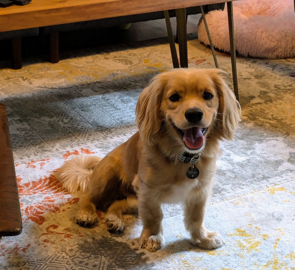
No, The Mate and I were not touring a college campus in a fit of nostalgia for our parenting days. We had someone to visit.
Meeeee!
No, Oliver–Ollie to his friends, which we now are!–did not invite us to Vancouver. But Ollie’s “dad”, a former student of The Mate’s, now practically family–just took an important job @ UBC. Apart from all the other good reasons to, um, get away to Canada just now…we couldn’t WAIT to come visit and see firsthand the new Canadian life of our friends.
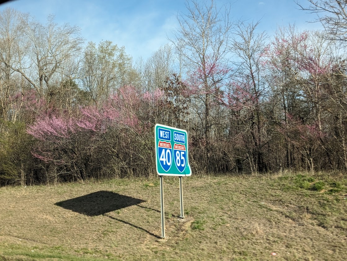
…Exhibit A
But of course we HAD to wait. Bust in on a newly-hired student dean in the first week of his new job? Eh…we’ll go visit Bella Coola and Vancouver Island and come back, OK?
So we did that (see 2 previous posts). Now: UBC.
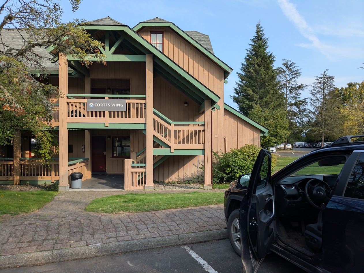
Thanks to their University connections (and their small apartment), our friends housed us in UBC’s own on-campus hotel.
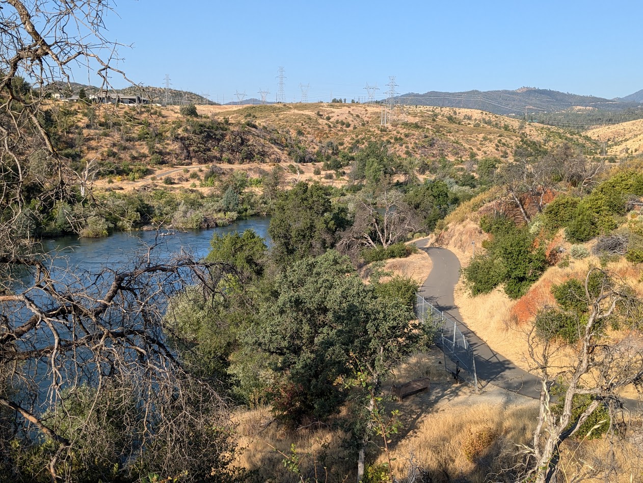
View of campus, from up on the 8th floor!
In case you don’t know–as I did not–UBC is ENORMOUS. 60,000 undergrads, 30,000 grads. A beautiful tapestry of (mostly youthful) humanity to walk through every morning. We only had two days, but I made the most of it, re-visiting two sites I’d spent time in, lo, nearly 30 years ago, when I took our small kids up to Vancouver for a visit.
I well remembered their famous Anthropology Museum…
A wry note: on a nearby trashcan I found these words spray-painted: “Land Back!”
Back then, since my kids’ museum stamina lasted barely an hour (and frankly, that’s about all I can usually manage before sloowwwwing dowwwwwnnn), we went outside to explore. Found a mysterious staircase disappearing down the side of a forested bluff.
“Ooh, where does this lead?” It led to a nude beach–right on the edge of campus! I was so impressed by that, I had to see if the place was still there.
Yep
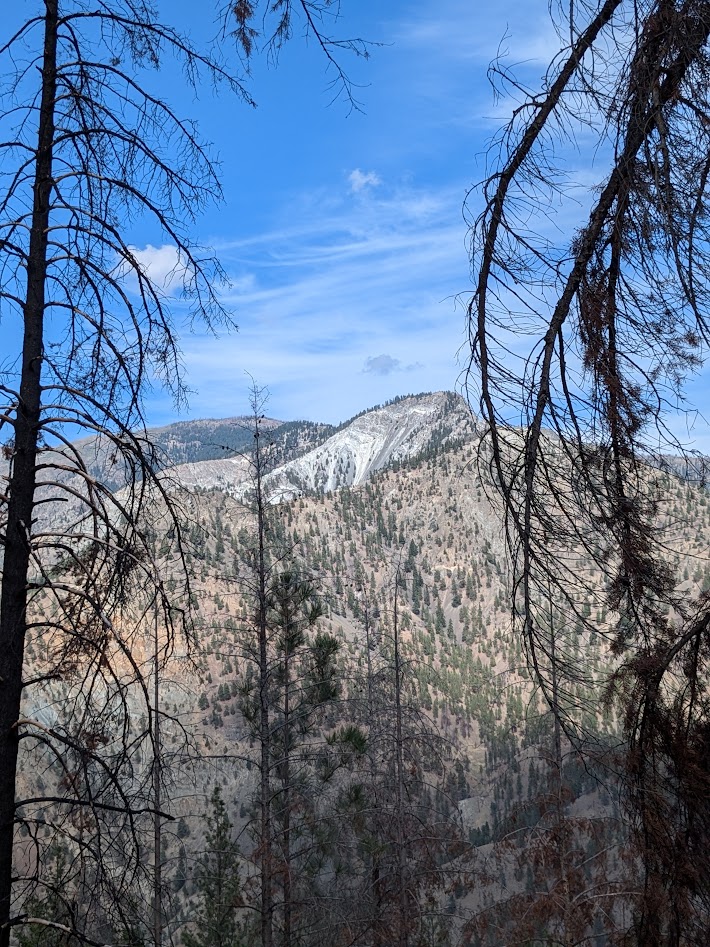
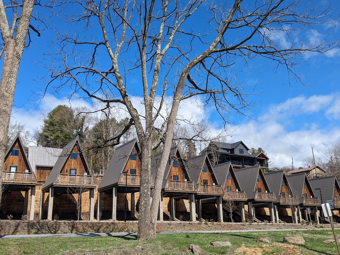
Of course, being brand-new British Columbians, our friends were as eager to explore Vancouver’s environs as we were. So we planned a half-day trip up the road to the town of Squamish, which is halfway between the city and the Whistler ski area. But that description doesn’t do the place justice.
Hopefully this does. The parking lot just shows how integrated this mountain is to the town.
We didn’t do much there–just ate lunch, took a walk to the base of the inlet…
Mountain. Construction lot. Inlet. Y’know, just regular town stuff.
…remembering to turn around occasionally to appreciate the town’s background:
Behold Mt. Garibaldi
…and noticing inviting little quirks, like this sign:
Canada, you are so stinkin’ adorable!
Don’t know if this will be the death of that cute little town or just its next iteration, but I do have to note the presence of an ENORMOUS development of apartments (or condos?) just getting going, behind this pretty mural…
CanNOT blame anyone who wants to live here!
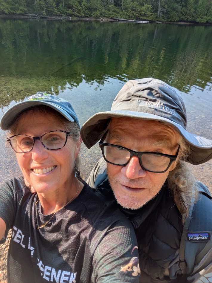
Back in Vancouver, we spent one last evening with our friends, feeling SUCH gratitude for being able to sip from their overflowing, British Columbian cup.
Me, right? I’m the cup!
Yeah, Ollie, you kind of are. But I feel like I should close this final B.C. post with something a little more…conclusive-feeling, eh?
like this
So that’s it for BC, this time around! The Mate & I are applying for Nexus, though, so we can travel back & forth more often to see Ollie our friends.
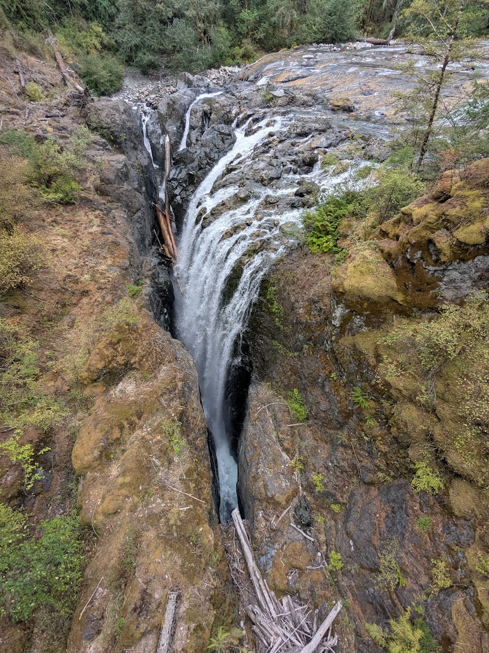
You’re halfway up Vancouver Island. You only have a few days before heading back to the mainland–not enough time to get out to the Wild West Coast, nor down to Victoria. Where do you go?
How ’bout here?
This is Englishman Falls Provincial Park, just a hop & skip off the main highway between Campbell River and Nanaimo. And yes, that disappearing waterfall is even more insane in real life. Here’s what it looks like face-on:
Hold up–WHERE is that river going??
…and from the top, just above the drop:
Who, me? Just a boring old clear Canadian river…
That little park was one of several blips on the map of east-central Vancouver Island that, in classic Canadian fashion, fail to call attention to themselves…until you are standing there with your jaw a-drop.
Campbell River–the actual river for which the town is named–is dammed, but not only does it offer the salmon a big side-channel to bypass the dam, it provides guardians for those fish on their passage:
Not as good as a wild, free river–but way better than nothing
Further inland, Strathcona Provincial Park certainly shows up on the map, but this little waterfall? We only found it when directed there by a volunteer docent we happened to meet.
No one else was around. Just me and that pool.
We’d intended to camp in Strathcona, but the weather went sideways. No problem backpacking in the rain, but wet car camping? That just feels stupid. So we got in a short hike…
(I can just imagine that trail repair crew going, “Eh…good enough! Let ’em climb.”)(forcing myself to resist the biggest Chicken-of-the-Woods mushrooms I’ve ever seen!)
…and rode our bikes along the 14-mile long (and unfortunately-named) Buttle Lake…
Bit wet; still pretty
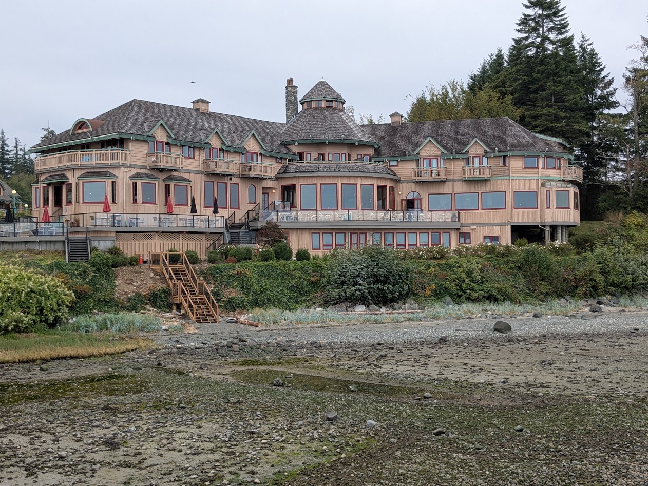
…before heading back to Campbell River, where we’d scored one of those cheap hotel deals at a NOT-cheap hotel, Painter’s Lodge.
as seen from the lodge’s dock, at very low tide
On that dock we found this map–WONDERFULLY helpful for orienting ourselves in BC’s bewildering array of islands:
Not our usual type of stay, but we took full advantage. Especially because the part we stayed in seemed to be a mashup of our last name & our favorite BC island:
Of course the rain stopped when we got there. But then it came back. Phew.
Luckily for us, they let us cook our cheeseburgers out in the patio area!
“This counts as camping, right?” (Quadra Island in the background)
Our last day, after those amazing Englishman Falls, we found a very cool bike path–along the highway, yes, but screened by bushes & trees, with plenty of curves and hills giving it a very adventurous feel.
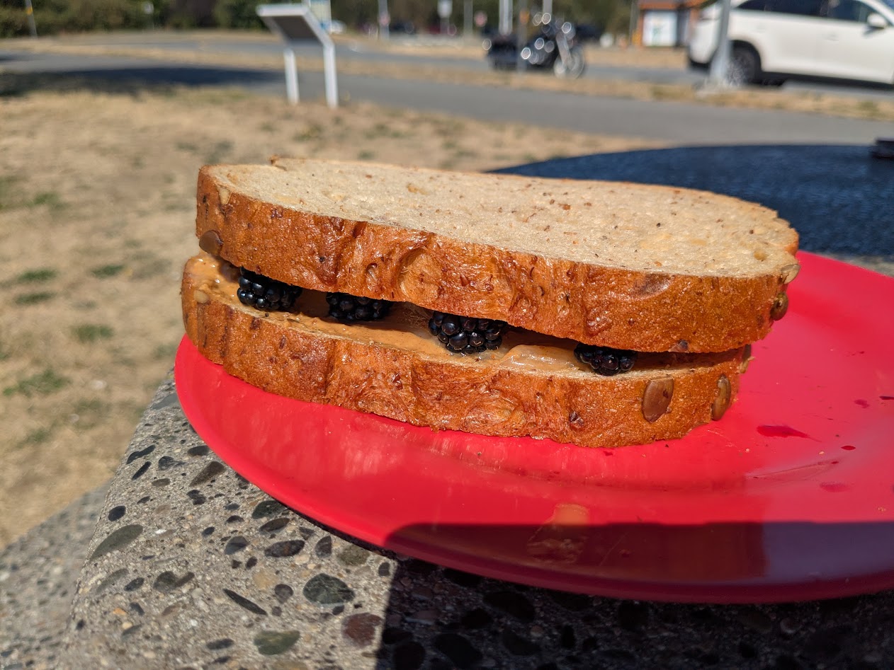
Some of those bushes had blackberries on them, and I was shocked at how sweet they still were, in September! So: lunch.
Peanut Butter, Honey & Blackberry Sammy!
Our final night on the Big Island (move over, Hawai’i–actually, never mind, you’re already pretty far over) we spent in Nanaimo, in order to catch our ferry next morning. I walked all over, discovering the best kind of quirks, like this Flower Wall:
Just an apartment building, far as I could tell
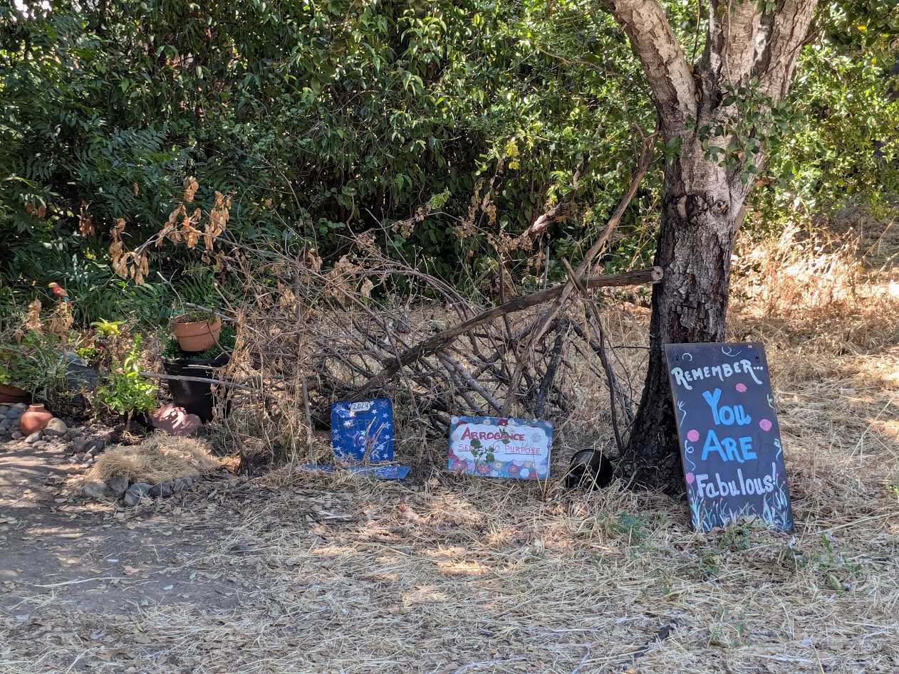
Along with flowers, Nanaimo boasted its own poster-of-random affirmations, because I found a number of these type of signs, here and there:
Why thanks, Nanaimo. I’ll try!
Next week, the exciting BC conclusion: University of! Thanks for riding along.
Actually, Cortes Islanders would probably prefer that “quirky” label, while we found Quadrans (Quadrants?) plenty cordial. Either way, both islands, between BC’s mainland and big Vancouver Island, became big highlights of our British Columbia wanderings in 2018, and we were overjoyed to wander back.
Whale-com back to Quadra!
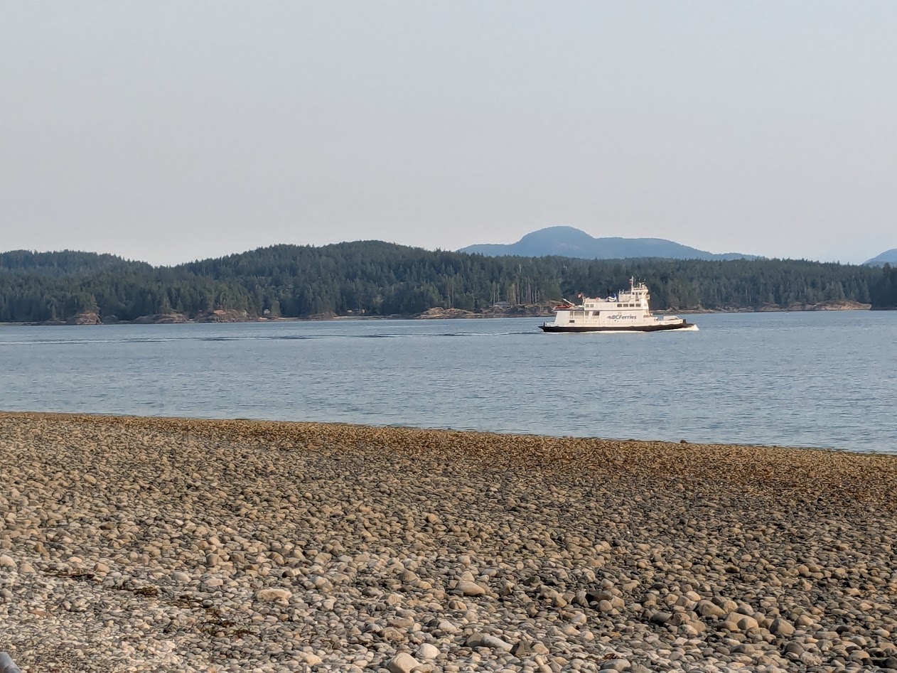
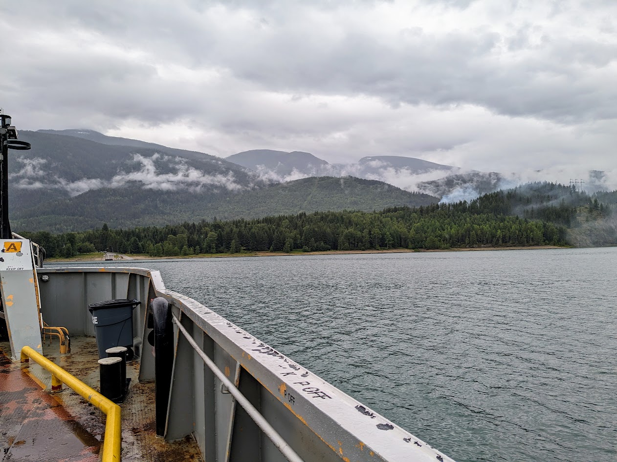
With a week to spend, between our Bella Coola adventures and our visit with our friends in Vancouver, we headed over to Horseshoe Bay for the big ferry to Nanaimo. BC ferries are SO nice. And, unlike Washington State’s they run on time. And they actually run! (#ferryEnvy).
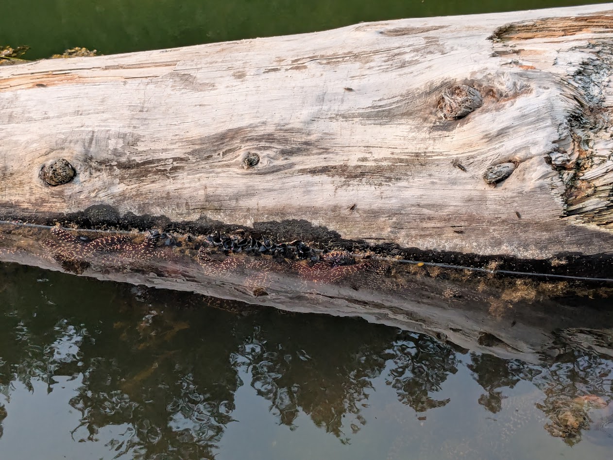
In Horseshoe Bay I was thrilled to see a healthy batch of young purple sea stars.
Since these critters have been suffering through a terrible die-off in the Salish Sea, I was super encouraged by these guys.
…and super thrilled by these Horseshoe Bay treats: seriously the best doughnut I’ve ever eaten!
After our 90-minute ride to Nanaimo, we drove a couple of hours north to Campbell River for groceries, then a much shorter crossing on a much smaller boat to Quadra Island. The We-Wai-Kai Campsite there is run by the First Nations People of the same name. Pleasant place, and pleasantly close to Rebecca Spit, a Provincial Park perfect for short bike rides and strolling.
Why do we call long, skinny points of land “spits”? Anyone?
Much of Quadra, we came to remember, is a bit steep for biking, at least for a couple whose combined age is edging close to 143 years. Since we’d be passing back from Quadra automatically on our return from Cortes…
(Courtesy Wikimedia) Ferry goes: Vancouver Is. to Quadra, then from the opposite side of QI to Cortes
…we put a pin on some hikes for our return , and headed over to our old Cordial friend…
…on an even smaller ferry!
On this 40-minute ride (reminiscent of our Lopez Island commute), we were treated to a pair of humpback whales. (Too far for good photos, but great views through binoculars.)
For our picnic lunch, we defaulted back to Manson’s Landing, remembered from 7 years ago.
This time the tide was out. WAY out.
Such healthy-looking tidal creatures! No sea stars…
…but I’ll settle for sand dollars. Worth every sand penny.
This trip, instead of springing for the extraordinary, but expensive Hollyhock Retreat Center, The Mate and I stayed in a modest motel with a kitchen. It was a stone’s throw from a set of community trails we’d missed last time…
Steep but worth it!
…not to mention an enormous, clear lake, shallow & warm enough for real swimming.
not pictured: swimming Wings
That huge log and those background cliffs, speak of Cortes’ drama. But its Friday Market, complete with music, homemade treats and upcycled clothing, speaks of its community. “Cordial” indeed. I didn’t want to interrupt the vibe by taking photos.
…we found purple sea stars! So many healthy specimens!
Recovering from Pisaster Disaster (#LatinNamePun)
Returning to Quadra–the ferry workers kindly squeeeeeezed us onto the boat–
Phew! Thanks!
…we determined to find an extra-special way to spend the day, because it was our wedding anniversary.
#38, since you asked! 🙂
First we found a fairly level hike to a lake; later, we drove to a deserted cove for another picnic. I could write a whole blog post about Peanut Butter & Honey sandwiches…
…but I won’t. This maple leaf caught my eye, though–emblematic of all the Canadian flags we saw flying across BC (#IWouldTooIfIWereThem)
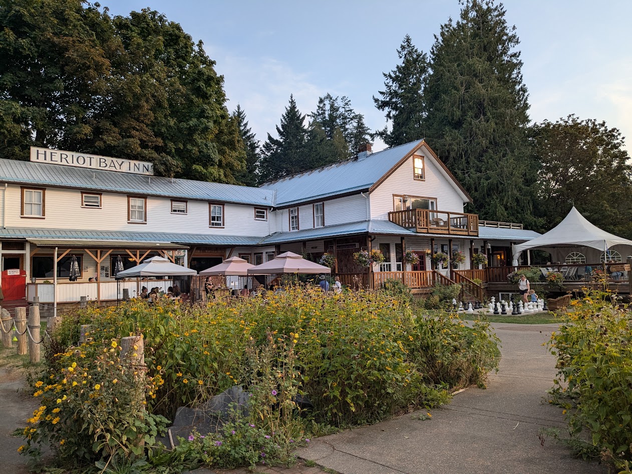
We’d hoped to spend our anniversary night at the sweet inn we stayed in in 2018, but they were full. So we settled for dinner there.
Happy #38, babe.
Meanwhile–on that quirkiness question? Look what we found lurking around the parking lot of our Quadra motel!
“Clever girl.”
There were about a dozen of these, obviously by the same artist who made that campground whale…
…not quite life-size, but close! That’s a LOT of driftwood.
The final piece of “quirk” that caught my eye on Quadra was this sign outside an ice cream parlor:
When you consider that Bowie died in January 2016…well…hard to argue w/ this, eh?
Thanks for traveling along! Next time: back to the Big Island–Canadian version. Keep those maple leaves flying!
This was what our departure looked like, ferrying east from Lopez Island:
Red sun in the morning…
If that red sunrise was a bad omen, it was a day late. We’d actually tried to leave the day before, but a) missed the 6:15 ferry b/c we didn’t realize how many trucks depart the island on Thursdays, leaving few overheight spaces for our tall Vanna Grey, and b) they cancelled the 9:30.
So we awarded ourselves a “free day” at home and had one fewer day in BC. Best Choice.
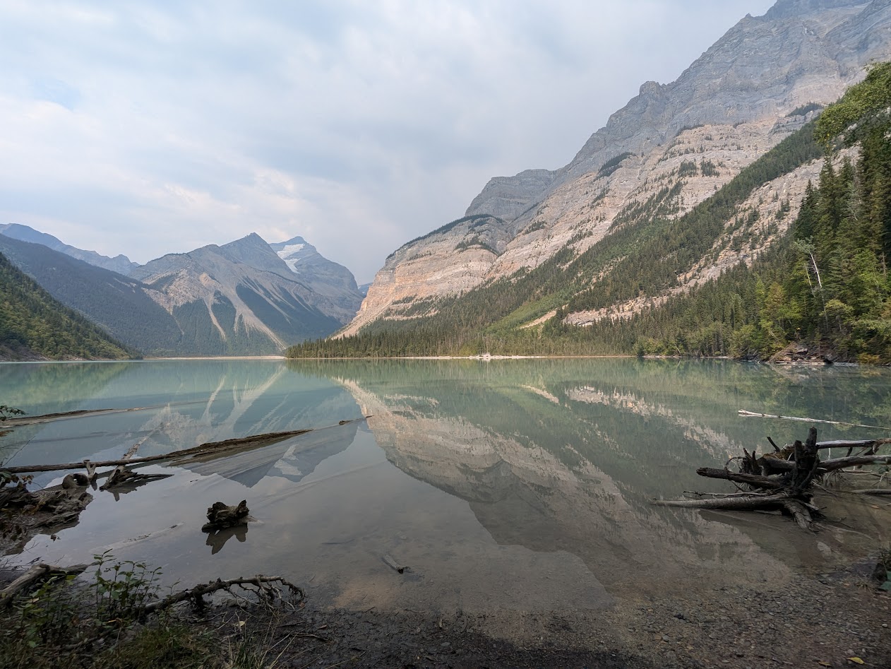
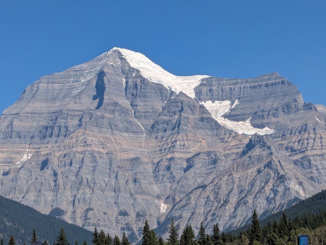
We went straight to a park we’ve usually passed by on our way to the better-known Jasper National Park: Mt. Robson Provincial Park. Named for the tallest of the Canadian Rockies.
Fun fact: Mt. Robson’s glaciers are rare “live” glaciers, meaning they are growing rather than retreating. Go Mt. Rob! Go ice!
Despite our campsite’s thick shelter of trees, we still had a view of the mountain’s peak:
Rob, meet Vanna
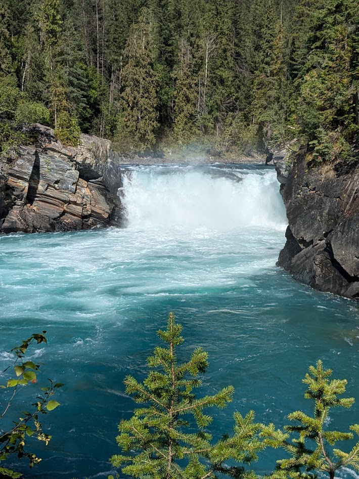
There’s really only one MAIN hike in the park, so, saving it for our longer day, we spent our first afternoon checking out the falls of the Fraser River. Hard to believe something this bright becomes the familiar brown body of water passing by Vancouver.
Oh, this old thing? It’s just something I threw on.
The weather was dry and hot (for Canada, and for The Mate & me), but that didn’t stop the mushrooms.
OK, who ordered the mushroom bagel?
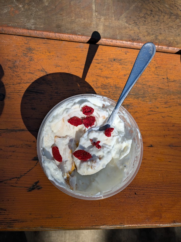
Too late in the season for most wildflowers–but I did manage to find a few ripe thimbleberries to add to my yogurt.
The hot new flavor!
Mt. Robson appeared to soaked up all the sun he could; can you blame him?
“I mean, it’s probably gonna rain tomorrow…”
Next day we headed up the trail, following the Robson River to its source, Kinney Lake.
Kenny at Kinney.
That incredible mountain seemed to follow us every step of the trail, even in what seemed like a pretty dense forest. I guess it’s just THAT tall (just shy of 13,000 ft…close to Mt. Rainier height!).
Up top, the trail skirts the lake in ridiculously postcardy vistas.
…or ridiculously Christmascardy?
It was hard to make ourselves turn around and go back down. But even more impressive to follow that wild river, imagining the calm from which it came.
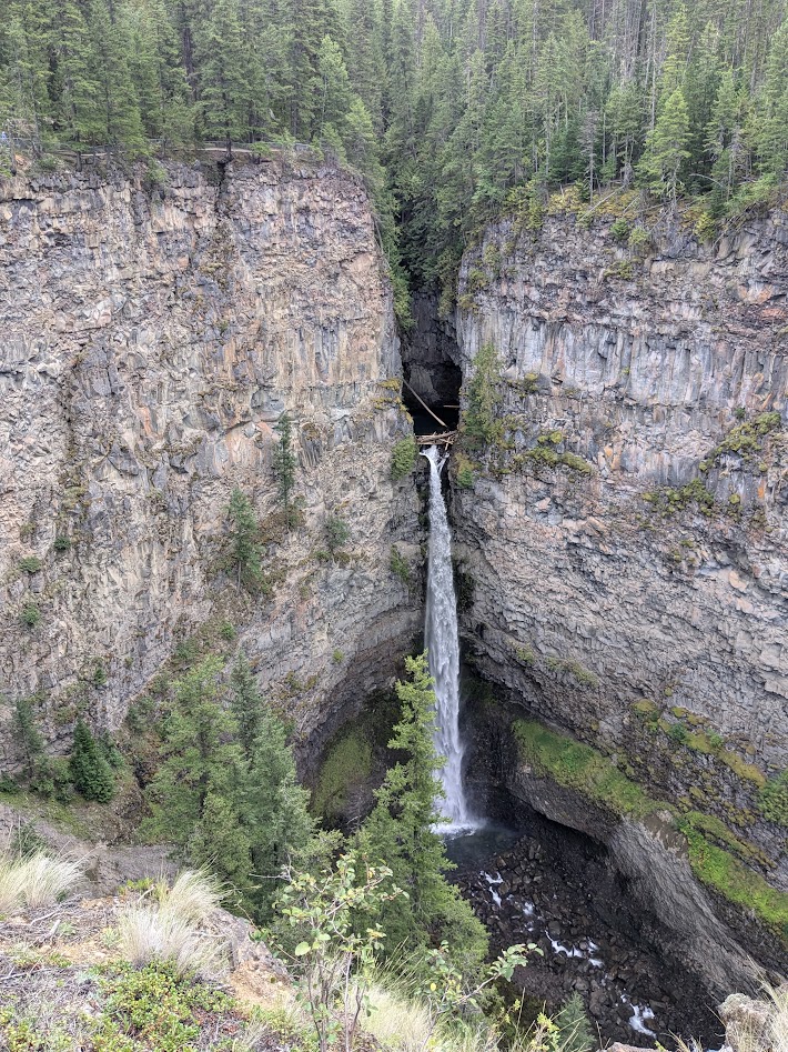
After two full days at Mt. Rob, we headed back south on the Yellowhead Highway (5), stopping to check out the small part of enormous Wells Gray Prov. Park that’s accessible to a big van.
Can I just say, it’s worth seeing? These falls are barely 10 miles from the highway.
Wells Gray’s campground was on a rougher road that we wanted to drive Vanna on, so we opted for a private site down below, in the town of Clearwater.
I guess this will have to do.
Next, we left the boreal forest behind, heading back into BC’s dry region, in the rain shadow of the coastal mountains, west of Kamloops. Some of it bore signs of last year’s terrible wildfires.
I believe the word I’m looking for is “stark.”
Not only did we score a campsite at a rafting company that was preparing to close for the season, but the owner let us camp for free.
We had the place to ourselves…including our own personal canyon.
Yes, that’s the same Fraser River as in the waterfall shot, above. Getting a little darker…still blue enough.
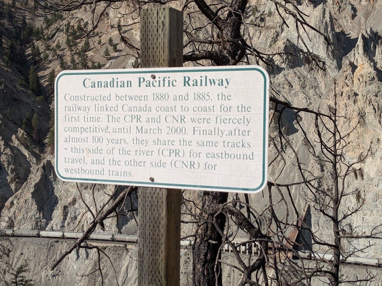
Oh, and those trains? There are tracks on both sides, demonstrating the stubbornness of capitalists, as we learned from this sign:
Well, hey. It only took 100 years for us to learn to share.
Here’s where I should note that those trains did a mighty good job of keeping us company. All night. Both directions. Bad Choice.
But how can you not choose your own personal canyon, at sunset?
Beautiful Canyon
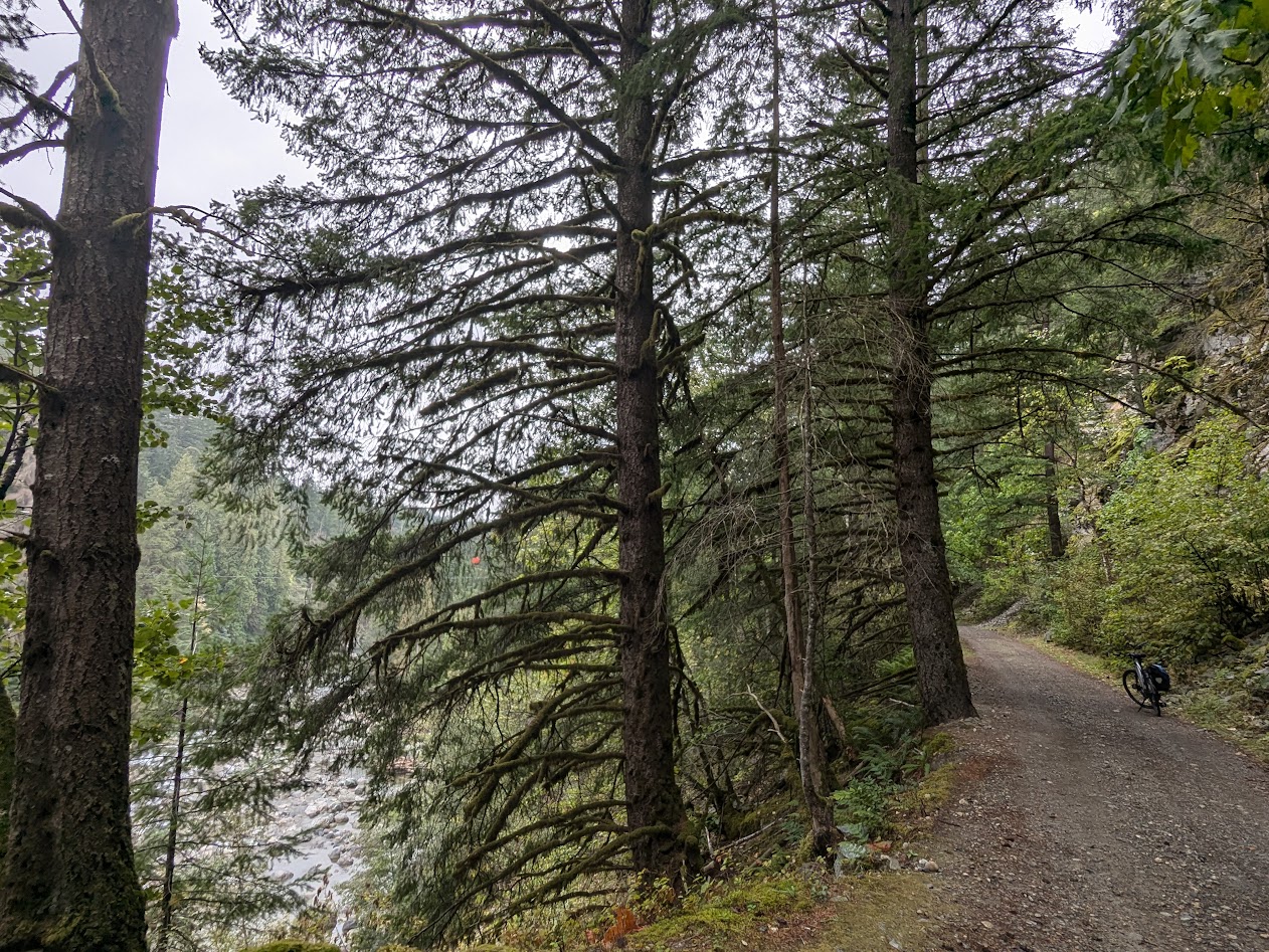
Our last day, it was back to the wet: both in terms of ecosystem, and weather. We went to Hope, close to the US border, just an hour or so east of Vancouver. There we discovered an old friend: the Kettle Valley River rail-trail.
Well hello, buddy!
Unfortunately for us, construction work prevented us from riding all the way over to the Othello Tunnels, which we’d visited on a past trip. But Vanna took us there.
This kind of engineering brings to mind words like “chutzpah”…or “hubris.” Or: “really?”
In under a week, we were back home. Too short a trip? Not at all. Vanna’s whole raisond’etre in our lives these days is to keep us reminded what’s in our big backyard.
It was hot. That SO goes without saying…except for people like me & The Mate, who live on an island surrounded by a nice, chilly Salish Sea. On Lopez, our summer temps rarely make it into the 90s. So this drive was a bit of a shock to our systems.
First stop, seeing old friends in Eugene…where it was a mere 94.
I resisted the urge to plunge into the Willamette, but later I regretted that choice.
As we drove, The Mate & I made use of our Toyota’s A/C. Again: DUH. But again: We are NOT summer road-trippers. We haven’t used A/C regularly in DECADES. I can see how that stuff might catch on.
Next up: Redding, CA.
Our favorite bike path along the Sacramento River, which we rode @ 7:30 am, due to the 104-degrees we’d driven into town on.
Down in San Jose (more old friends), the mercury fell to a blessed 80 or so. Thanks, San Francisco Bay! We rode along Los Gatos Creek, where I was heartened by this sign at a homeless encampment:
Of course I wouldn’t violate the privacy of the inhabitant, but she didn’t mind me sharing her sign.
California never ceases to offer up visual encapsulations of itself. Like these citrus fruits left to be picked up by the San Jose Sanitation Department:
When life gives you lemons…have them driven to the landfill???!!
From San Jose, we made our way up to Marin County, where our Oakland cousins scored a dog-sitting gig for the summer. Well…we THOUGHT it was a score, till we learned that Marin is actually a good 10 degrees hotter than the northeast side of the Bay. Guess all that water really does the trick.
Pretty, yes…but pretty HOT, being so far from that nice big body of water!
Walking was better in the evening, we found.
…especially with a full moon rising next to Mt. Tam
Next up, of course: Sacramento, and Mom’s meet, which you’ve probably already read about. Thank GOODNESS her final event ran @ 7:30 in the morning…after which we hugged, took pictures, made sure her plans were secure, and hit the road before the sun could get too high.
Quick, back to Redding!
the famous Sundial Bridge, where the bike path takes off from
Get the bikes out, there might still be some shade!
Amazing how much difference shade makes when it’s 100 out.
This time I played it smarter, hopping off my bike to stand in the nice cold Sacramento before riding on.
Ahhhh….
In the week between our southbound & northbound rides on this path, though, wildfires had ballooned. Compare the sky in this picture with the one near the start of this blog post:
Oh jeez. Get me back to my island!
Worn out from a hot day of driving (but energized by a certain lightning bolt of political news, July 21), we spent the night in Roseburg.
*not pictured: Roseburg & their darn good pizza
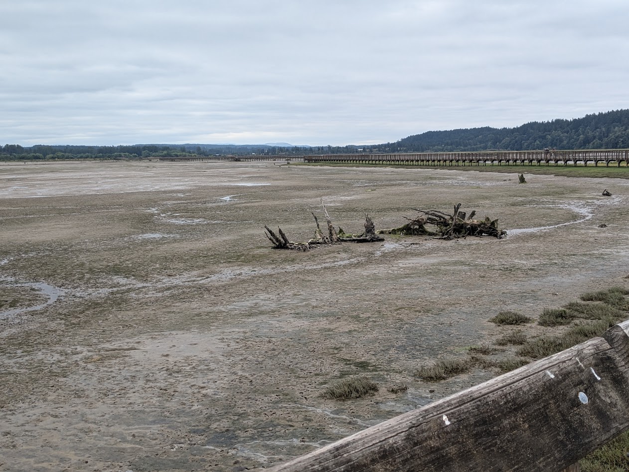
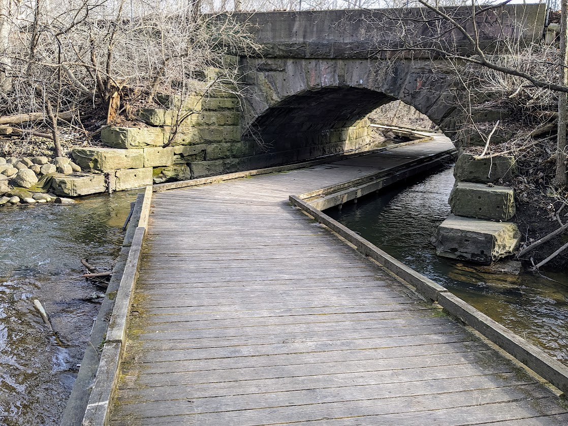
Our final day took us back into Washington, where the sky clouded up, the temperature sank back to a nice, “normal” high 60s…and we celebrated by going for a long walk down the incredible boardwalk of the Nisqually Delta.
Well yes, that’s the Delta (reclaimed for Nature, from previous dikes)…but what’s that about a boardwalk?
Oh, you mean THIS boardwalk.
We spent that night catching up with Son Two, enjoying wearing shirts with sleeves again, and snacking on quintessential Pacific Northwest snackage in his Seattle-area neighborhood:
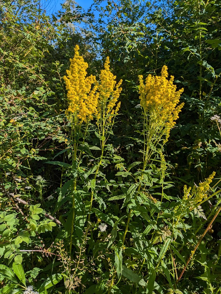
Waiting for the ferry to take us back to Lopez, I took a walk along the shore, where I was greeted by these stunning goldenrods. Since “Goldenrods” is the name given to my graduating cohort at Antioch (they’re doing flower names now–Hydrangea, Iris, Lilac, etc.), I took these flowers as a sign.
Get back to work, Gretchen!
This blog post is a down payment. Back to the novel tomorrow! But good luck out there, all y’all non-islanders out there dealing with “normal” summer heat. Stay safe, stay cool. (Go wading!) And thanks for riding with me.
Canada, that is—where the colour grey is spelt the English way. Especially in British Columbia.
Vanna and I both felt most at home–and so did Liza, my bike, who got to enjoy this view.
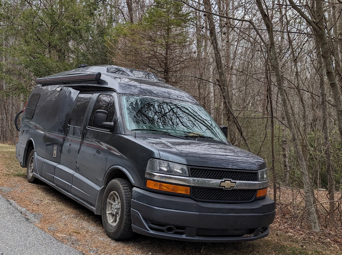
In the week following Memorial Day, The Mate and I had a nice free chunk of days between various commitments and appointments. Perfect timing to introduce Vanna to our favorite portion of North America…starting with a quick visit to the auto glass shop to fix her poor rear window.
I love when The Mate mows the lawn…but this time the mower threw out a chunk of gravel. Owie.
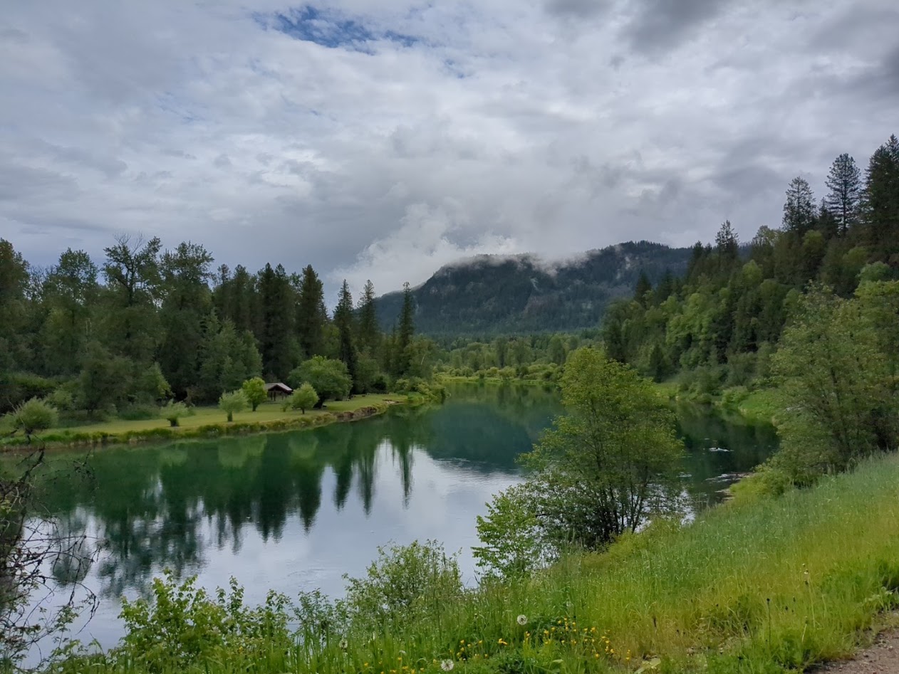
Heading for the eastern portion of the province, we crossed Washington’s Cascades and spent our first night in Twisp, right next to the Methow River.
Vanna’s-eye view of river
Thanks to the window glass, it was late afternoon when we arrived, but also so windy we were just as happy to skip the bike ride we’d normally look forward to there.
Next morning, the Methow got its turn in the sun’s spotlight.
Crossing the border into Osoyoos, the gazillion not-yet-open fruit stands made us regret being there so early in the season. On the other hand, given the fires of recent summers, we felt just as happy to experience lush greenery and cooler temps around Penticton, a region we’d had to skip last fall due to…see the opening words of this sentence.
Our campsite above Lake Skaha used to be an apricot orchard, and the poor ol’ trees were still trying to leaf out.
We were happy to finally poke around Penticton, given its reputation as a bike-trail nexus.
They even have special traffic lights for bikes!!
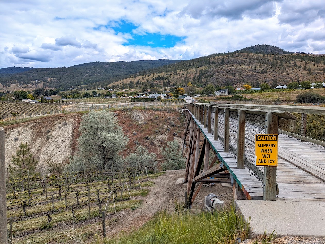
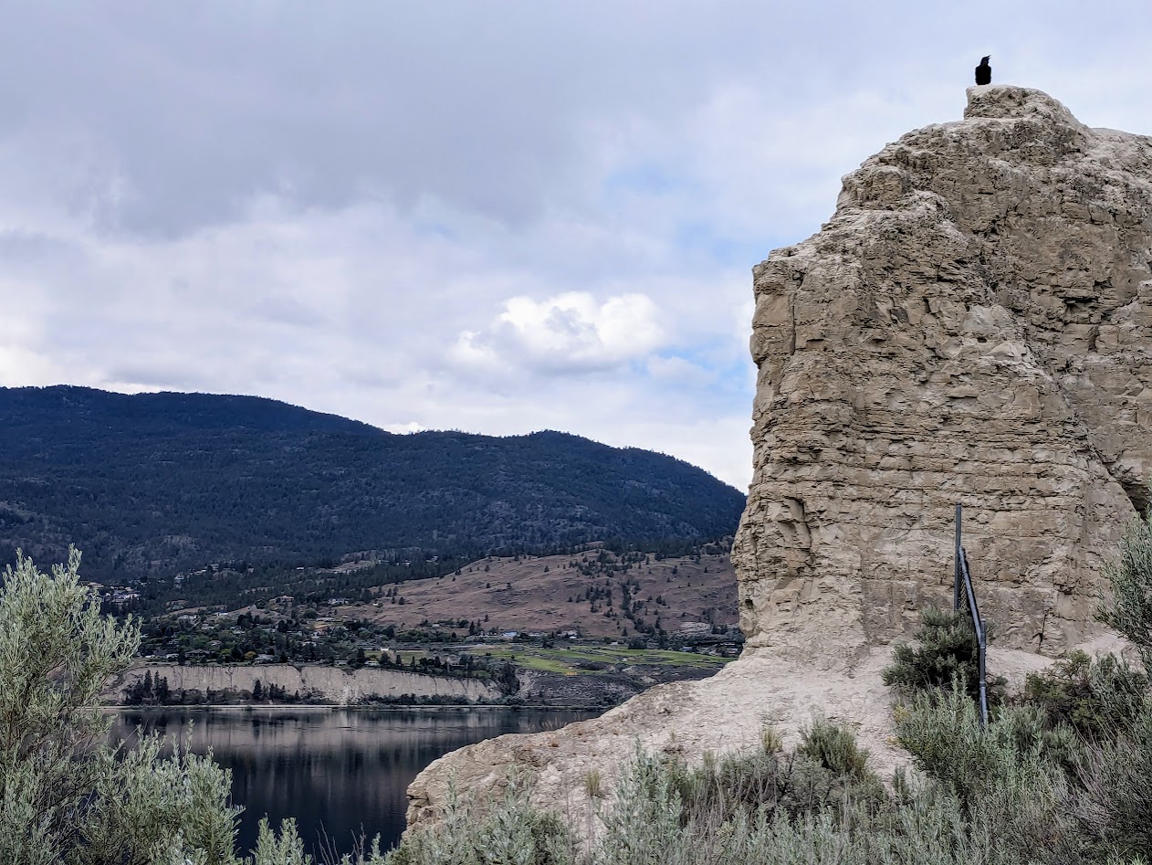
The Kettle Valley River Trail goes right around Okanagan Lake, through town, and up the other shore…
…with fun add-ons like this trestle, traveling through vineyards…
…and this raven, guarding its throne:
Oh, and speaking of guarding: I also met this guy along the path:
when you’re rich enough to own your own house-sized T-Rex
Can I just say, Okanagan Lake is RIDICULOUS? 84 miles long (135 km), 2.5 – 3.1 miles wide (4-5 km)…it just goes and goes and goes. [thanks, Wikipedia]
Who wouldn’t want to sit and look? Pairs of red Adirondack chairs are kind of a Canadian thing. Haven’t looked that one up yet.
Midway up this endless, snaky lake is the town–city?–of Kelowna. It was very close to Ground Zero in last year’s fire, so we were glad to see it seemed to have survived…but we found it too big and trafficky for the vibe we were in. After riding a short piece of rail-trail, we got out of town. (Might go back in a non-Vanna-sized car someday; tons more trail there.)
[Not pictured: Kelowna traffic jam. But also not pictured, to be fair, the 3-foot long gopher snake we met on the bike path.]
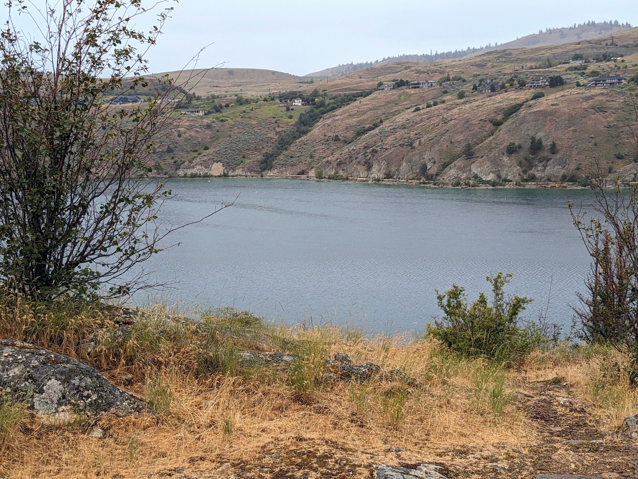
One ridge over from Okanagan, though, is a lake we fell in love with last fall: Kalamalka. Also ringed by a bike path…but right along the shore, zero roads involved.
Not a car in sight!
Tiny in comparison to the endless Okanagan, Kalamalka is twice as deep (over 400 feet in places) and famously color-changing (colour-changing) thanks to molecules from limestone deposits which are temperature-sensitive. I learned all this from a kiosk I had ridden past last year…but I was still more fascinated by the scenery along the ride.
Like this mama grebe and her grebelings. Greeblings? Greebettes? So CUTE.
The water’s so clear I even found myself taking pictures of fish.
See ’em? Eating size!
But, just as last year, I found myself focused on the parkland across the water, which includes no campgrounds–day use only.
But I want to go over THERE!
Instead, we spent the night in Dutch’s Campground, a funky old place at the head of the lake. Not a park–but for campering, just our speed.
Vanna and Liza chilling by the creek
Next morning broke drizzly but warm, and I was thrilled to finally experience the land across the lake I’d been staring at: Kalamalka Lake Provincial Park.
On the promontory, looking right back at the place from which I’d taken its picture the day before
SO satisfying to finally get in there and hike all through its uppy-downy trails.
Ahhhh.
From Kalamalka P.P. we turned right and headed straight east, reversing our route from last fall. Truth be told, any road driven in Vanna vs. our Toyota feels like a completely different road. (As in, “Who put all these curves and steep downgrades in here?!”)
The steepest downgrade–12 percent!–took us to the ferry across the Columbia. Did this last year, but it still weirds me out, ferrying over a river.
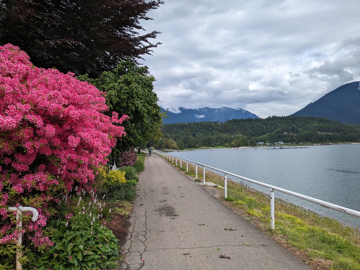
But we also stopped in places we skipped past last year. Like the town of Nakusp (na-CUSP).
Nakusp’s waterfront, along Arrow Lake (aka the Columbia, dammed up). To be fair, everything’s gorgeous in azalea season, right?
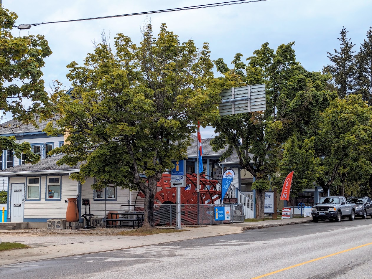
Travel Tip: wherever you go in Canada, look for the Information Centres. Even the smallest towns have them, and we’ve always found them to be staffed by the FRIENDLIEST, most helpful folks. Which might be redundant when describing Canadians.
Nakusp Info Centre–look for the yellow “i” on blue background.
At the RV campground in Nakusp, it wasn’t only the people who were friendly.
These gals were ready to hop right into Vanna!
[not pictured: Gretchen cleaning the floormats next morning from what we’d tracked in. Turns out camping around free-range chickens isn’t the best idea.]
Now in the Slocan River Valley, where we’d spent two nights last year, we treated ourselves to an easy walk along the rail-trail, digging the peace.
At the end of this day, we decided to treat ourselves to a night in a hotel, with restaurant food and everything. But I’ll catch up about that in my next installment, OK? Right now I’m going to leave you with these peaceful flowers (…and extra credit if you can name them for me, because Google apparently can’t).
Before spending the penultimate night of my 6-week circuit of this immense nation of ours in Seattle, I encountered this show-stopping rainbow over Lake Washington.
Who knew the I-90 bridge could look so magical?
I also encountered a woman taking the same photo. We smiled at each other, and she said, “You know, you really remind me of my sister in Michigan.”
My response: “This is going to sound funny, but I just arrived here…with MY sister…from Michigan.” We both smiled and shook our heads. Whoa.
That’s how this final week of Road Trip XII has gone–the Seester Week. (See previous post for explanation.) Full of kismet, full of symmetry. For example, our 7 nights together went like this: Stay with friend; camp; camp; motel; camp; camp; stay with friend.
But let me break it down a little. We left “Michigan in the rear view” a week ago, with one final walk in a park with these amazing black squirrels who refused to hold still for their photo.
I really need to get a zoom lens for my phone.
Night #1 we spent with a friend of mine from college, in Evanston, IL (pretty much Chicago). He & his family showed us wonderful hospitality, complete with chicken pie from a local bakery.
Yes, I know Hoosiers are from Indiana, not Illinois. Still a great pun.
It snowed a little that night, but Vanna shrugged it off.
Note the open compartment near the rear: one bad curb and the locker door was hanging by a hinge. But that happened before Illinois.
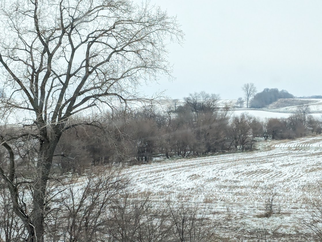
We headed out into the Iowa landscape. Iowa does NOT deserve its reputation for flatness. I found its curves especially beautiful in snow.
taken from Vanna in passing
We hoped to camp at this park outside of Des Moines, but the campground wasn’t yet open. We settled for a walk…of which the most memorable part was the MUD.
like cement + glue, but slick as ice
Night #2: the campground we settled into didn’t merit a photo. At least the snow melted!
Next day, we hit the jackpot with a lovely park outside of Lincoln, Nebraska.
Never did catch the name of this creek.
During our walk, snow fell, turning everything miraculous.
“Oh, man…snowflakes for dinner, AGAIN?”
But the biggest miracle of the day came later, approaching the center of the state (along I-80): we met the migrating Sandhill Cranes.
This is only a TEENY FRACTION of all we saw–so hard to capture as we whizzed by! But imagine each bird standing 4 feet tall. That’s what you’re looking at here. I tried capturing them in flight…
Again, may I remind you: each of those specks is a 4-foot-tall bird!
Night #3, we bedded Vanna down at a nearly-deserted campground by the North Platte River…
“What does she mean, she bedded ME down? I’m the one with the bed!”
Before darkness fell, though, I spent most of my time nervously pacing by the river as I listened to the Tarheels successfully grit their way back into the Sweet 16.
Does this mean I have to come back to the North Platte for every game now?
On into Wyoming! We made a walk-stop at Laramie…
Cactus? Yep–we’re in the WEST now, baby!
…but the weather was becoming worrisome.
Hmmm…
Knowing we might well have to delay our start next morning for snow & ice, we opted to spend Night #4 in a motel in Rock Springs.
“Sure, and just leave us out here to freeze our seats off!”
But Wyoming was good to us. Snow & ice, yes–but nothing that didn’t melt away by the time we got to the steep parts of the highway. So we were relaxed enough to enjoy gorgeous Bear River State Park, just before crossing into Utah.
Bear River
The park has its own wee herd of bison, including some albinos.
They look so cuddly! Except for the horns. And, y’know, the thousand-pound bodies.
We hated to leave that park. But most of the trail was snowed over, and Seester didn’t bring boots.
So we just watched the magpies a bit, and went on our way.
‘Bye, Wyoming–ya done right by us.
Not saying I want to LIVE there…but it is beautiful.
Along our route, Utah plays the tiniest part:
Taken from the car. Next time for you, Wasatch Range! We’re kind of done with snow for now, thanks.
Night #5: Twin Falls, Idaho. Not pictured: the actual falls. It was terribly windy & late when we arrived, so we just glimpsed the Snake River Canyon in passing and called it good.
But the moon was pretty wowza that night, rising over the campground.
Next day we stopped for our walk in Boise, along the Boise River. I’m used to riding a bike there, so it was nice to go slow and appreciate the greenbelt.
Good job, Boise.
Crossing into Oregon, I celebrated: finally, back on Pacific Time!
hills of eastern OR
Night #6, our campground view, in Pendleton, OR, looked much the same…
…with the additional reminder that SOMEbody’s still getting snowed on!
The last full day of driving, through Oregon and back into my dear Washington, I took zero pictures, mostly because it was RAINING the whole time. These song lyrics kept running through my head:
“I’m going back to the land of wet/ No winter wonderland regret/ They don’t sell postcards of the rain/ But what you see is what you get.”
(Not pictured: rain. But check out that rainbow at the top of the page!)
That symmetry I mentioned? Night #7 we spent with an old friend of my Seester’s, just as #1 was with an old friend of mine. A lovely palindrome of evenings: friend-van-van-motel-van-van-friend. And to top it all off, while I was gone, lo these many weeks…spring arrived!
I am feeling so FULL of gratitude for this almost-safely-concluded trip. It was so good to travel with my Sees! And now? I get a couple more days before she flies back to Michigan. I get to reunite with The Mate on Lopez Island, and we get to cheer the Tarheels as they try to move on in the tournament.
And Vanna gets some well-earned rest. Because, you know what? I think we’re going to stay home for a bit now. I may check in later about What I Learned On My First Van-cation. But for now…thanks for riding along with us!
But by the time we’d crossed the northern border into Virginia, our plans were already changing. Our lovely recreational plans: stop at West Virginia’s New River Gorge State Park, camp there, then on the next day to the beautiful Hocking Hills of southern Ohio.
We only did one of those things.
Stop, yes. Camp–no.
It’s not that Vanna can’t keep us warm in sub-freezing temperatures, which is where the mercury was headed by the time we got to WV. It’s just that the campsites on offer there didn’t involve electricity, and we didn’t want to be running our generator to stay warm. Too high of a learning curve there for me & The Mate.
But I got a good hike in.
Knowing this would be our last with eastern mountains for another year, I made the most of their easternness, like my favorite: rhododendron thickets!
If there’s a better word for this than “thicket,” I’d like to hear it.
The woods seemed to know as well as we did that winter wasn’t quite ready to release its grip.
Hang in there, lil’ buddy!
Faced with blowing snow as we pressed northeast, we opted to spend the night in a motel. Gretchen was SAD…until she discovered this motel offered FREE SOUP and a COOKIE.
[not pictured: soup, nor cookie. But you can imagine: it was creamy chicken with big, fat noodles. Not quite enough to make up for not camping…but close.]
Next day dawned colder, with wind gusts closing in on 30 mph. Not a day for recreatin’. These through-the-window pictures are all I got of Ohio, for now.
Cute…but COLD.Near this farm, an Amish horse-and-buggy trotted past, but I wasn’t swift enough to capture them.
The wind was HORRIBLE. The Mate & I agreed it was time to get in touch with my Seester in Ann Arbor and ask if we could arrive a day early. She said sure, so we arrived that afternoon.
[not pictured: Seester]
Seester moved her car so Vanna could take her spot.. She BARELY fit. Who’s a big girl?
Being my Seester, she understands about the importance of the Daily Workout, so she & The Mate went to the gym while I went for walk along the Huron River.
Huron the right track now! (sorry)
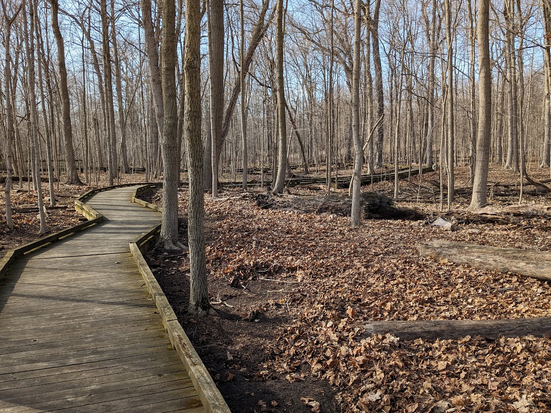
Always before I’ve been on my bike there, so for the first time I walked on this WONDERFUL pedestrian–only boardwalk trail down in the river’s flood zone wetlands.
The woods are full of bluebirds now!
Isn’t it the coolest? It even goes under the railroad bed.
“Adventure awaits” is what this picture says to me.
Not many signs of spring yet, other than the bluebirds…but this pitcher plant looked hopeful.
My favorite, though, was this MASSIVE oak, which called to me through the woods. Oaks like these are one of the Five Things I Miss about the east (yes, Michigan still counts as east to me).
All hail.
As of today, Road Trip XII is undergoing a change I should probably mention. The Mate has an important commitment in Seattle next Monday, and given Vanna + weather, we knew trying to get home that fast was a terrible idea. That’s where my Seester comes in. This morning I put The Mate on a plane from Detroit to Seattle, and Seester’s going to take his place helping me drive Vanna home.
No matter the weather when we get to Tierreich Farm, where I grew up in the Piedmont of North Carolina, we always go find the trout lilies.
Who, me?
Warm as this year is, they were past their peak, though we still found plenty down at New Hope Creek. And, as with almost every constant-seeming aspect of our stay here, they got me musing on how much continues, 6 decades on…and how that background throws into relief anything new.
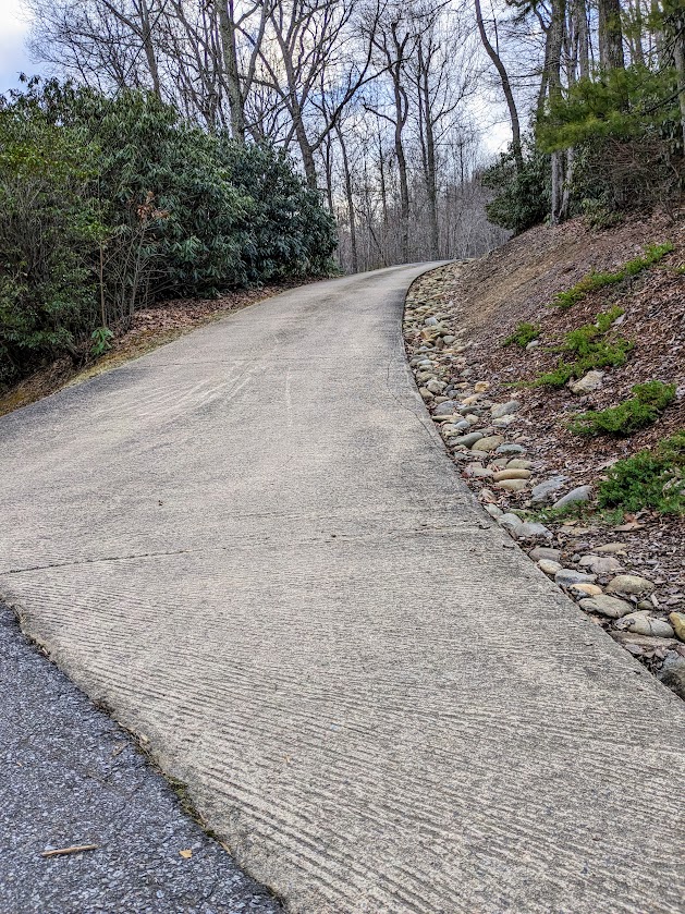
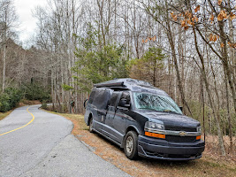
Constant: my folks’ ridiculous driveway, which never bothered me before I drove a 22-foot-long van.
Vanna sez, “I’m driving over THAT?”
Don’t worry, Vanna. We’re parking you on this side and walking across. Because of…
…this drop. Yep.
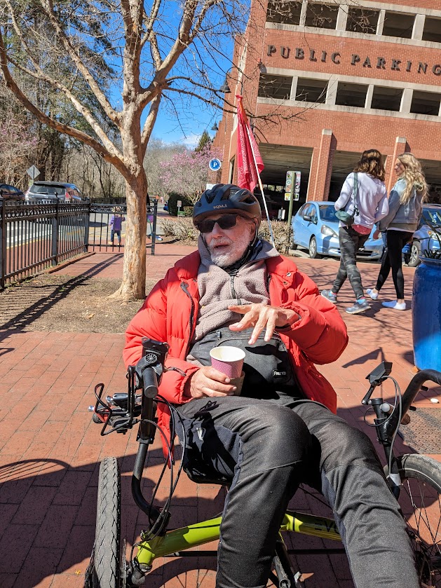
Constant: my 93-year-old dad’s enthusiastic curiosity about ALL new gadgets, including Vanna herself. New: these days he needs a golf cart to go see things.
Dad & Mom, meet Vanna.
Actually, Dad’s a perfect combo of constancy and novelty. The fact that he had a stair-elevator installed in our basement stairs = a surprise. The fact that he really enjoys it = not at all a surprise.
I tried it. It is kind of fun.
Another example: he was one of the first I know to avail himself of the amazing technology in electric-assist tricycles (new). And he uses his just as he used to use his legs when he was marathon training: 20+ mile loop, with stop for a treat along the way.
I had to work hard to keep up with this guy!
My 88 year-old mom’s constancy exhibits itself in her physical fitness, her dedication to the woodsy life, and, I have to say, her beauty.
These tiny bluets, also known as Quaker Ladies, always reminded me of Mom, for their simplicity and lack of ego. (Though “Women” would work better than “Ladies.”)
Hi Mom!
Speaking of Quakers, something new at the farm is this track, built into what used to be our back pasture. Slowly, my folks are donating the remainder of their land to Carolina Friends School; this track is just the latest piece of that evolution.
If you’d like to understand why this land is going to a Quaker school instead of to me and my sisters, click here for a little history.
But Stevie, World’s Cutest Ass, remains as constant (and cute) as ever–thank goodness!
Pushing 40! There’s a reason people say “donkeys’ years”. (Unless they mean donkeys’ ears?)
I adore the ability to know a stretch of woods so well, I can look up into a huge old oak and know that the thick-looking middle part used to be a hole…which, over the decades, I have seen grow in, and close up.
You’ll have to trust me on this one.
Off course, the most constant part of The Mate’s and my Road Trips is their raison d’etre: worshipping at the altar of watching Tarheel basketball with our fellow Tarheel fanatics. Again, for those of you new to Wing’s World, click here for a brief recap.
Some food is also involved. (NC-style BBQ; collards; slaw; hush puppies & fried okra.)
One new thing I noticed, in DURHAM, of all places–home of arch-enemy -rival Duke: this supermarket display, featuring Carolina’s AND Duke’s colors.
How open-minded! Maybe this diversity stuff is taking hold after all. Or maybe they just want to sell more soda.
Another new thing, on the disturbing end of the scale: the heat here. 70-degree weather in March is quite common in this part of the state (as is snow and ice storms…click here on that topic). But 80 degrees? When the woods haven’t leafed out yet? That just feels WEIRD.
Pictured here: Gretchen trying to make the most out of too much sun in trees.
Unsettling as climate change is for all of us, I still take heart in this single tiny flower I met down at the creek. Not only is it persevering in the heat…it’s also just about the right shade of blue.
The Mate and I know already what fortunate folks we are. But when we come back to the Blueridge of NC, we REALLY know it.
Our friends’ big blue backyard
Thanks to accidents of history and confluence of taste, we have an embarrassment of dear friends in these mountains, and this year we were able to spend time with most of them.
Vanna, not so much. Our first set of friends live up at 3,500 feet; the drive up was only half as terrifying as the drive down. And their driveway?
fugeddaboutit
Because they’re wonderful people, our friends were able to secure a parking spot for Vanna at the edge of a neighbor’s property. We left her there for 3 days, schlepping our stuff the remaining 1/4 mile up the mountain on foot.
What happened to dancing w/ her what brung ya?!
This mountaintop neighborhood is a wealthy one. Some of the houses are, in my opinion, ridiculously large–especially when I learned that this one is empty more often than not.
But I have to admit, it’s pretty enough that I took its picture.
The lots up there are large enough to protect the sense of mountain-ness, and care was clearly taken in building the road.
Shouldn’t all roads be like this?
Aside from the fact that we adore our friends and they spoil us rotten, this was simply a very peaceful spot to hang out. It’s always hard to leave Butler Mountain.
Yes, that is the moon hanging out, waiting to say Good Morning to the sun. Honestly.
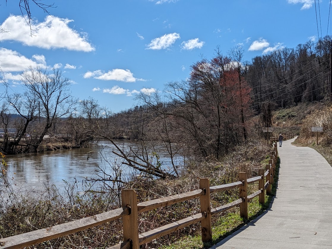
But our next stop was a picnic date with one of my VERY oldest friends (from Middle School) + husband + sister, down a few thousand feet at the French Broad River, which flows through Asheville. We chose this spot because we knew we couldn’t get Vanna into our friends’ driveway either. (slightly embarrassed eyeroll)
Lucky for us, the French Broad boasts a terrific bike path! And it was a gorgeous day. All this plus good friends & a picnic too.
Asheville is super trendy right now, and expensive, but I did find myself intrigued by this row of what I take to be “Tiny houses” down by the river.
Cute, right? But probably not a Tiny Price Tag.
From there we journeyed an hour to the northeast, to the South Toe River valley, home of the Celo Community and the Arthur Morgan School. I wrote about my Celo history two years ago; you can read about it here if you’d like some background (or just to learn more about this cool place).
South Toe River
THIS friend’s driveway was, finally, fully Vanna-accessible…as long as we took it slowly.
Also magically mossy. Believe it or not, our friend is not an Elf.
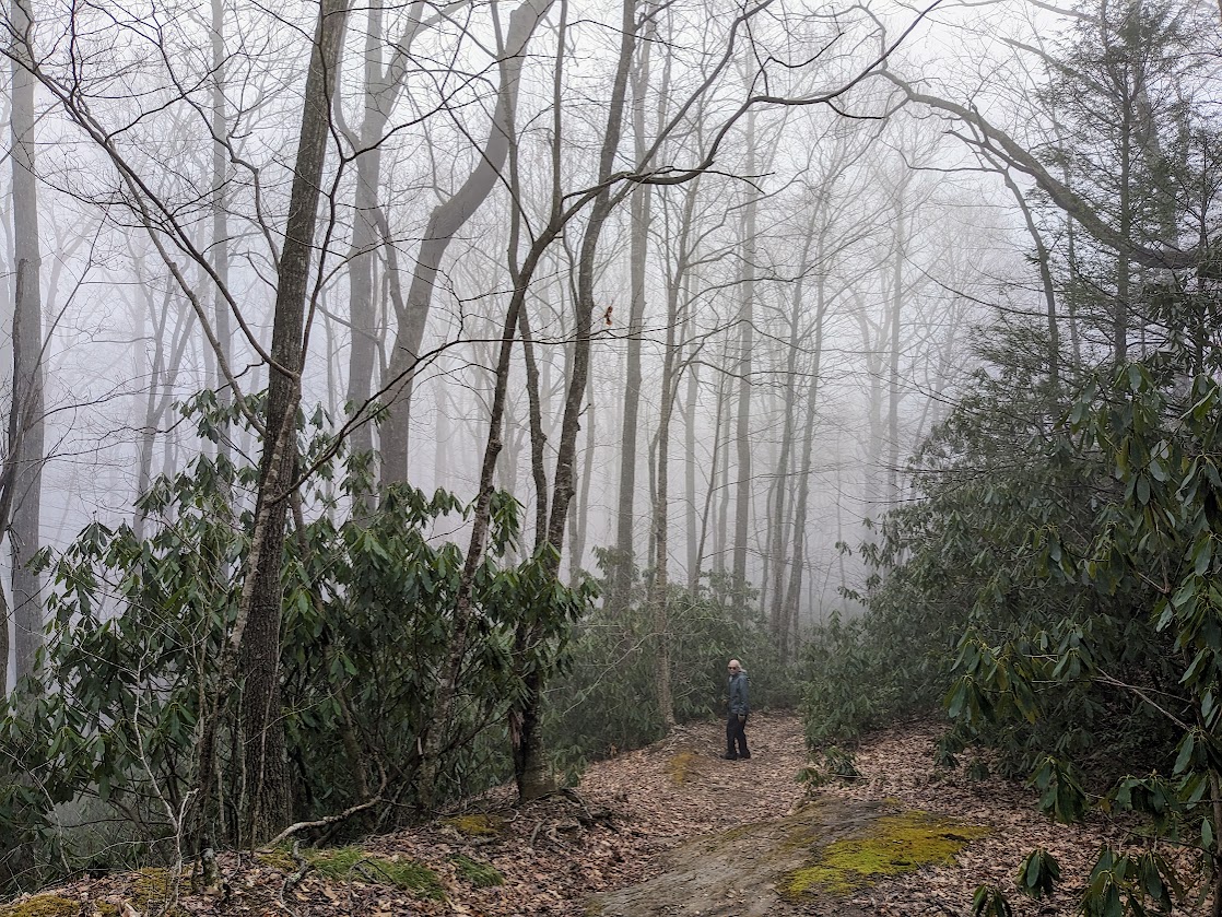
The sunny blue of Asheville departed at Celo, but the wintry woods are just as beautiful in fog.
The Mate doing his best impression of a rhododendron
To know these woods with such intimacy…to stare at them from a kitchen window or a sofa, to walk right out the door, to say the names of the creeks and the peaks…this, to me, is a privilege far beyond the simple joy of SEEING this place. That is our greatest gratitude, to the friends who have sunk roots here, allowing us to return again and again.
Till next time, White Oak Creek! Don’t you change.