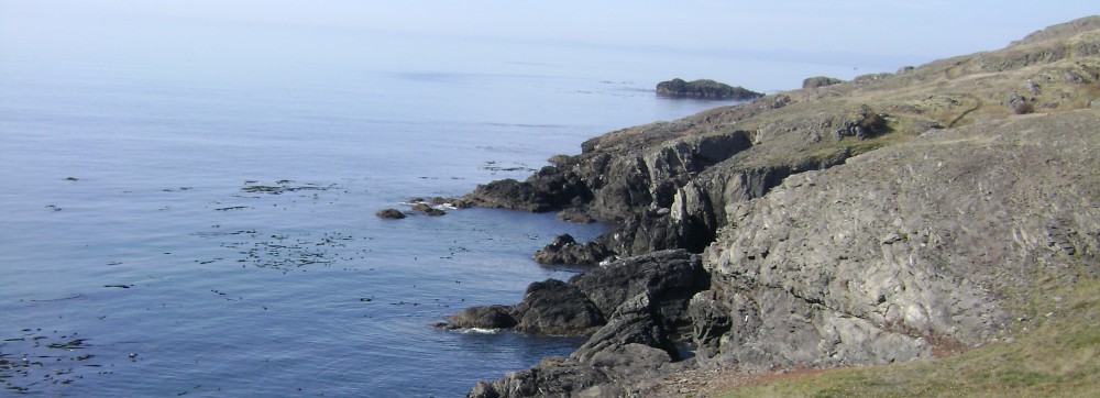
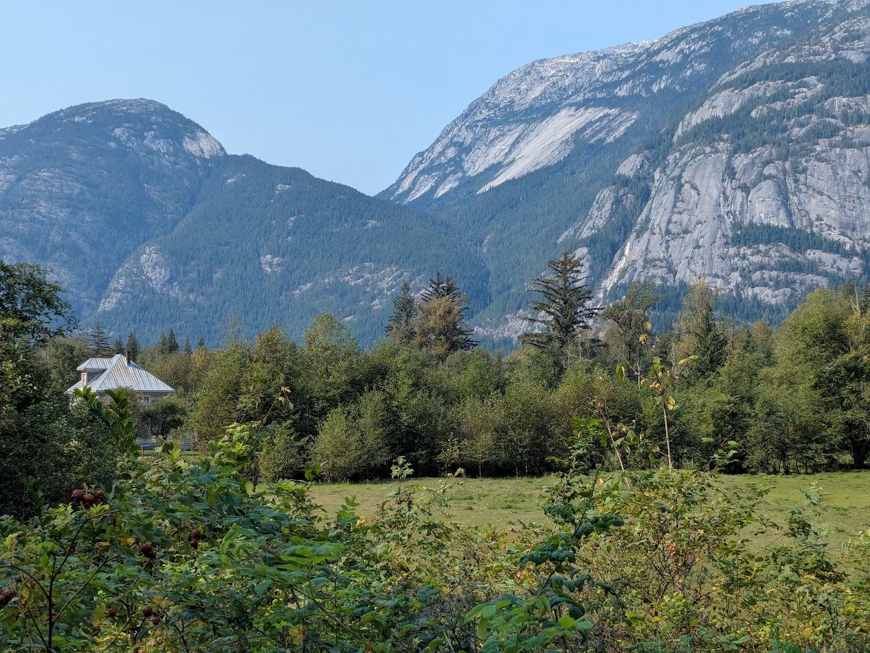
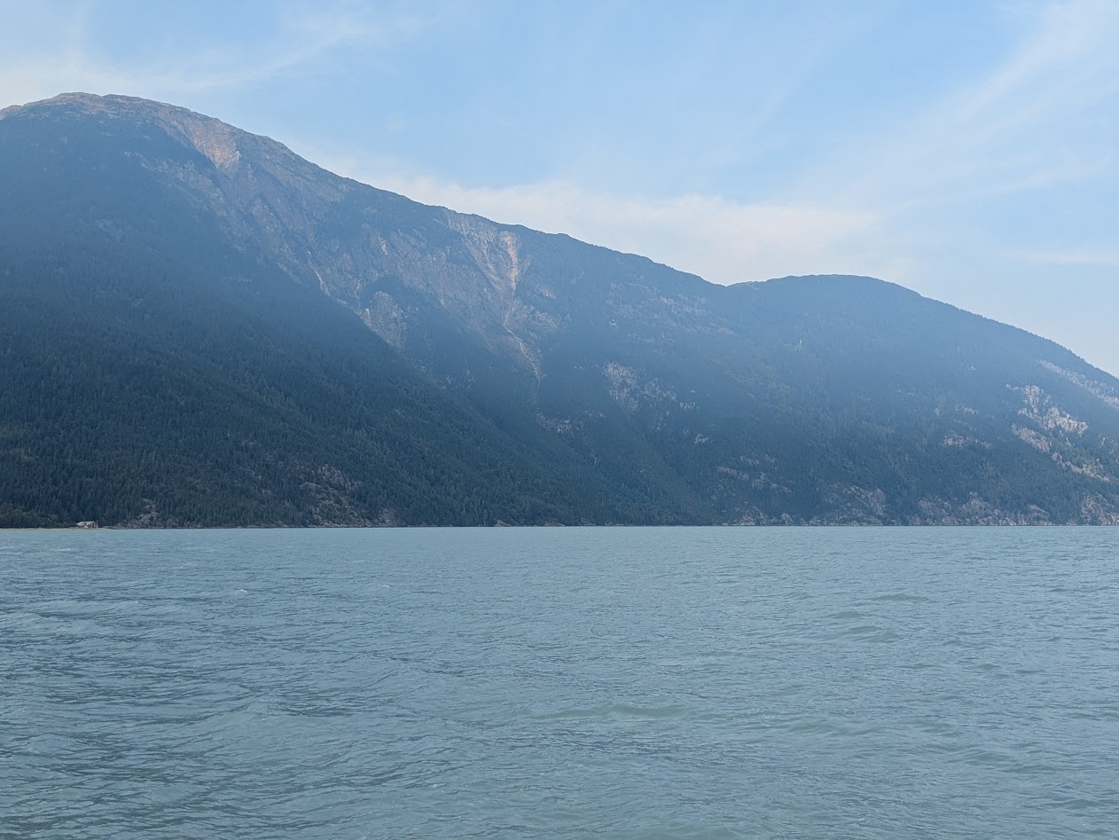
You’re halfway up Vancouver Island. You only have a few days before heading back to the mainland–not enough time to get out to the Wild West Coast, nor down to Victoria. Where do you go?
How ’bout here?
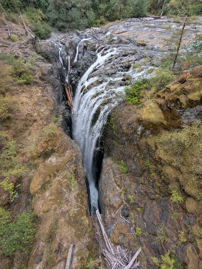
This is Englishman Falls Provincial Park, just a hop & skip off the main highway between Campbell River and Nanaimo. And yes, that disappearing waterfall is even more insane in real life. Here’s what it looks like face-on:
Hold up–WHERE is that river going??
…and from the top, just above the drop:
Who, me? Just a boring old clear Canadian river…
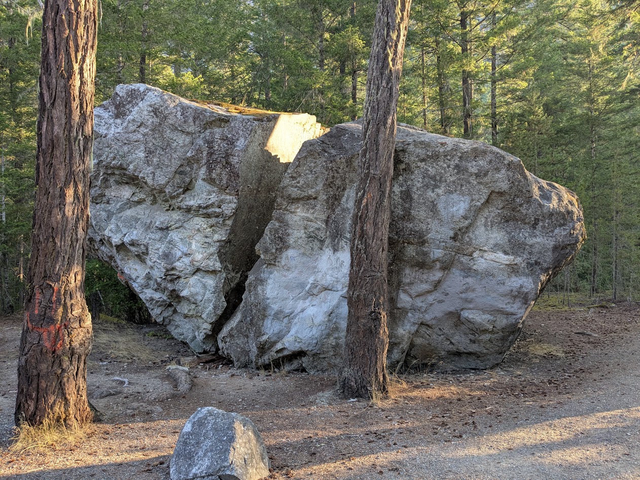
That little park was one of several blips on the map of east-central Vancouver Island that, in classic Canadian fashion, fail to call attention to themselves…until you are standing there with your jaw a-drop.
Campbell River–the actual river for which the town is named–is dammed, but not only does it offer the salmon a big side-channel to bypass the dam, it provides guardians for those fish on their passage:
Not as good as a wild, free river–but way better than nothing
Further inland, Strathcona Provincial Park certainly shows up on the map, but this little waterfall? We only found it when directed there by a volunteer docent we happened to meet.
No one else was around. Just me and that pool.
We’d intended to camp in Strathcona, but the weather went sideways. No problem backpacking in the rain, but wet car camping? That just feels stupid. So we got in a short hike…
(I can just imagine that trail repair crew going, “Eh…good enough! Let ’em climb.”)(forcing myself to resist the biggest Chicken-of-the-Woods mushrooms I’ve ever seen!)
…and rode our bikes along the 14-mile long (and unfortunately-named) Buttle Lake…
Bit wet; still pretty
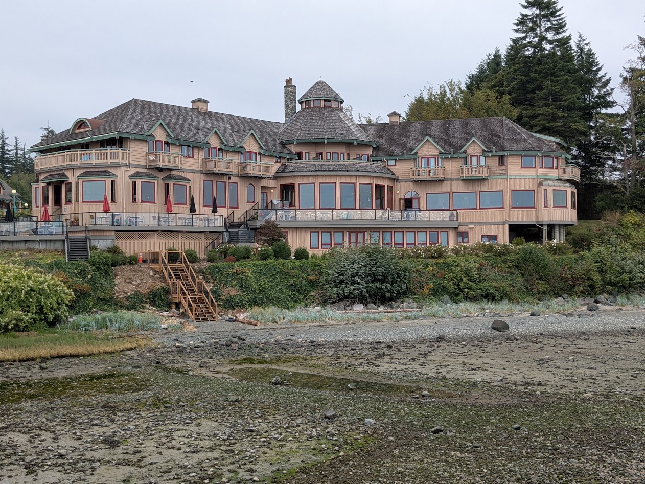
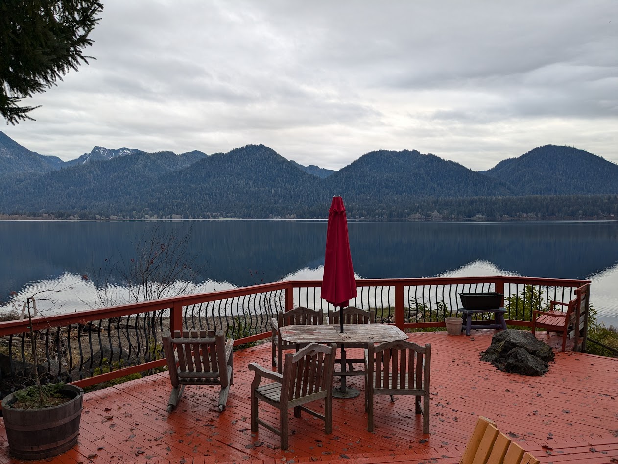
…before heading back to Campbell River, where we’d scored one of those cheap hotel deals at a NOT-cheap hotel, Painter’s Lodge.
as seen from the lodge’s dock, at very low tide
On that dock we found this map–WONDERFULLY helpful for orienting ourselves in BC’s bewildering array of islands:
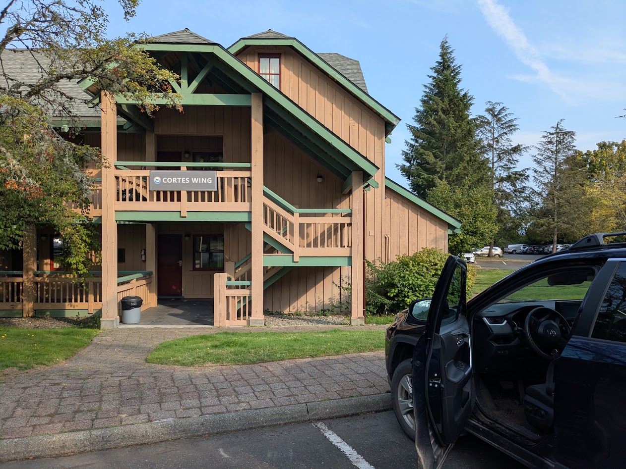
Not our usual type of stay, but we took full advantage. Especially because the part we stayed in seemed to be a mashup of our last name & our favorite BC island:
Of course the rain stopped when we got there. But then it came back. Phew.
Luckily for us, they let us cook our cheeseburgers out in the patio area!
“This counts as camping, right?” (Quadra Island in the background)
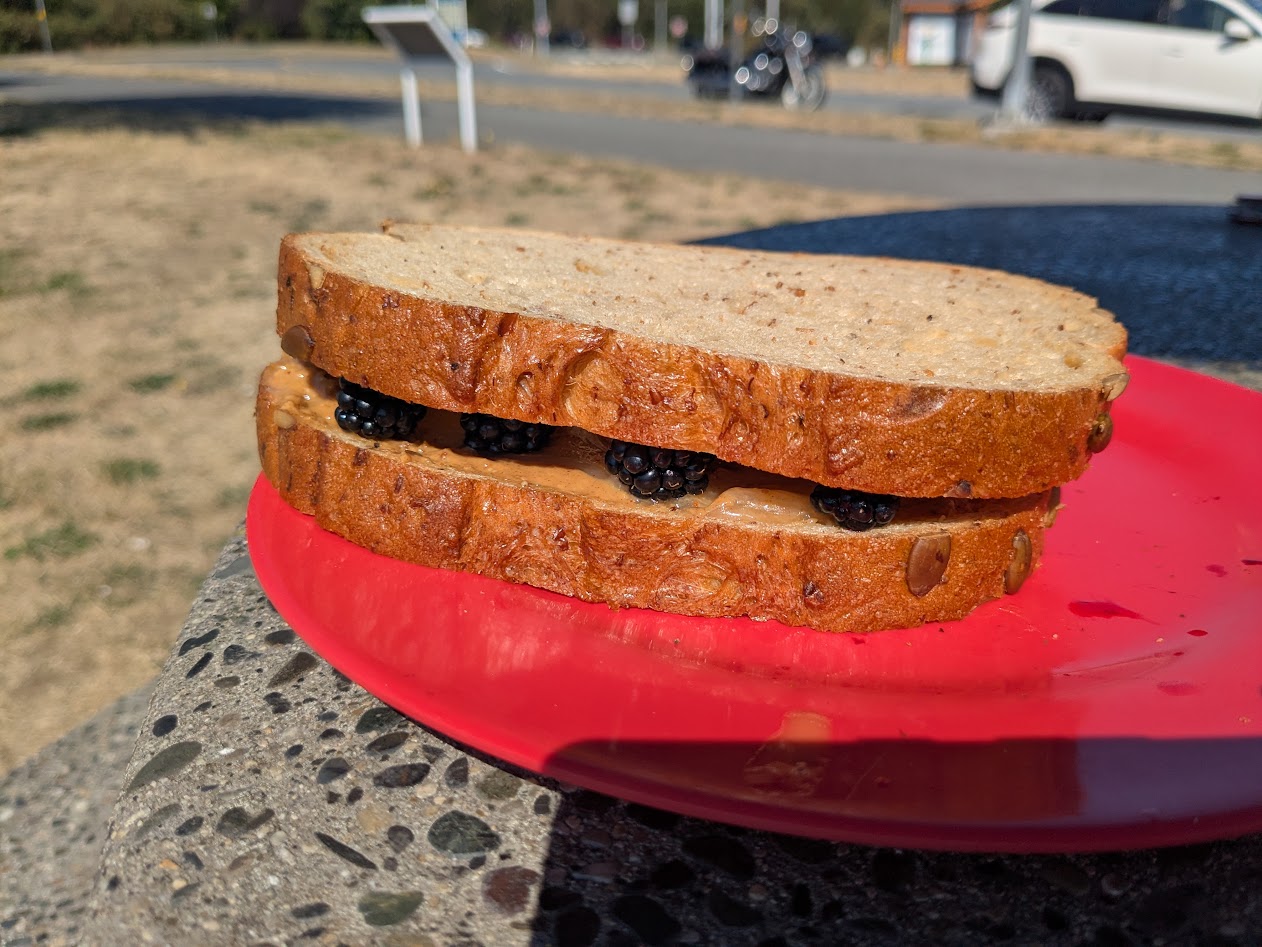
Our last day, after those amazing Englishman Falls, we found a very cool bike path–along the highway, yes, but screened by bushes & trees, with plenty of curves and hills giving it a very adventurous feel.
Some of those bushes had blackberries on them, and I was shocked at how sweet they still were, in September! So: lunch.
Peanut Butter, Honey & Blackberry Sammy!
Our final night on the Big Island (move over, Hawai’i–actually, never mind, you’re already pretty far over) we spent in Nanaimo, in order to catch our ferry next morning. I walked all over, discovering the best kind of quirks, like this Flower Wall:
Just an apartment building, far as I could tell
Along with flowers, Nanaimo boasted its own poster-of-random affirmations, because I found a number of these type of signs, here and there:
Why thanks, Nanaimo. I’ll try!
Next week, the exciting BC conclusion: University of! Thanks for riding along.
For those of you who read my 2023 post on the various meanings of “BC”–don’t worry, I won’t subject you to more of that. I just couldn’t resist a nod to one more extraordinary BC discovery.
This place: Bella Coola, BC
Since The Mate & I learned that a close friend got an amazing admin job at UBC in Vancouver–just up the road from us–we’ve been itching to go visit. Of course, since said friend’s job is just starting, we realized we needed to give him a little time before popping by…but by then our fires were lit. Maps were out. Venues were calling.
So we heeded the call.
Yes, that’s a glacier, as seen from an airplane. I’ll explain.
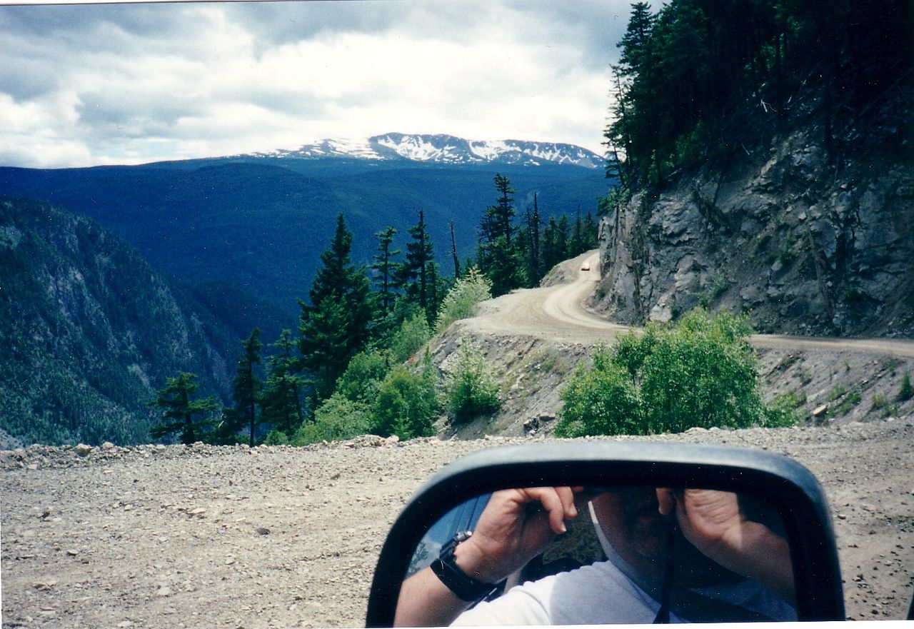
Bella Coola is accessible three ways: by ferryboat–if you go to Vancouver Island, drive all the way up to Port Hardy, and ride the ferry for 16 hours. By car–if you drive 350 miles north from Vancouver, then turn left and drive another 250, 60 of which is gravel, including a super-sketchy portion known as “The Hill.”
photo courtesy Wikimedia, by some driver braver than I am!
Or you can fly. That’s the option we chose, and, despite the expense, we were SO glad we did. The sight of so many still-healthy-looking glaciers filled me with joy (despite my very scratchy window). And our descent…!!!
Not for the faint of heart…but worth the ticket if you love thrills. And peaks.
I grabbed this shot of the cockpit of our 20-seater plane, just to show the narrowness of the valley we descended into:
Green = safe. Yellow = LOOKOUTFORTHATMOUNTAIN!!!
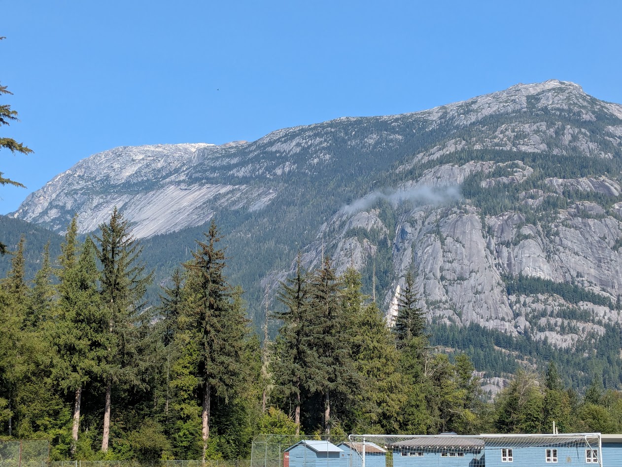
Once down, The Mate and I looked around, then looked at each other and said the same thing: “Didn’t we just see this in Yosemite?”
Only this is no national park; this is where folks LIVE. That building? It’s an elementary school.
The town of Bella Coola is at one end of a loooooong inlet, giving way to a looooong, skinny valley, which ends in Tweedsmuir Provincial Park, and The Hill. One thing we quickly realized: with so little flat ground, hiking trails for our aging bodies were somewhat limited. But we managed.
This one included extra perks: suspension bridge, whee!
A couple of them I did alone, like Lost Lake:
Found it!
But we didn’t let the lack of long hikes interfere with our awe and delight about the place, from large features…
…to small:
I even got to enjoy a fun cultural scavenger hunt, thanks to a Lopez Island friend who told me her Norwegian great-grandpa was buried at a Lutheran church in Bella Coola. I told her I’d try to find his grave, but all I found was an old-looking church, not Lutheran, with no cemetery, and this (closed) cultural center:
Anybody? Anybody?
“Sorry,” I told my friend, “I’ll keep looking.” But meanwhile–forget humans, we had bears to find! September is full salmon-run season, so we hoped to see both fish, and fishing bears. Not in the Bella Coola River, which is thick with glacial silt…
(still lovely, especially at sunset)
…but in its clearer tributaries. Nor were we disappointed.
Salmon on the left: alive. Huge, upside-down salmon in the center: Thank you for your service. RIP.
Our first morning, we drove Up Valley to Tweedsmuir PP, and were promptly rewarded by seeing a pretty black fox (not pictured; I was driving), followed by a mama bear with 2 cubs.
I managed to pull over fast enough to capture Cub #2, following her fam into the forest.
The best bear-viewing spot, that first morning, yielded no bears.
Still a pretty good spot to hang out. No complaints!
But the next morning, as everyone was looking upriver at the most obvious fishing spot, a gravel bank, I happened to glance the other direction and spotted this fella, soundlessly swimming from OUR side of the river.
I repeat: he was on OUR side. Just behind us.
We all did like this person here, and activated our cameras. Most of what I took were videos–I wanted to capture sound and movement–but I did get a few stills (apologies for my lack of zoom).
Pointy ears; no hump; flat face = Black, not grizzly. Still a big guy!
Actually, during the salmon run, it’s obvious the bears have zero interest in attacking humans. Nice, oily fish are what they crave. What a gift, to be able to sit and watch them move, without feeling like we should be backing away.
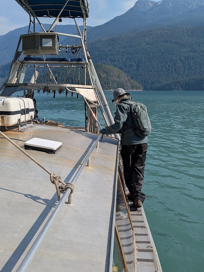
We saw one other bear during our 4 days in the valley. But plenty of other wonders too, especially when we signed up for a boat tour…which also, surprise! solved the mystery of my friend’s great-grampa’s missing grave.
Our boat captain was full of history, with photos. Turns out the Norwegian families who arrived in the late 1800s built their settlement at the north end of the inlet…I’m guessing to get as far away as possible from the Nuxalk People who lived there.
See the old settlement? Nope. Because it’s gone.
Joke was on the white folks. In 1936, about 40 years after building their settlement, the Norwegians saw the whole place flooded away and destroyed by a king tide. All they could save was their church, which they pushed with canoes over to the road, then carried Up Valley…where it sits today.
Photo courtesy of Captain Daniel
No longer Lutheran, and no cemetery, but this was the church I’d been looking at! I was able to share this story with my friend, both of us agreeing her forebear’s bones now rest “full fathom five” in the inlet.
Capt. Daniel also stopped at the site of the Norwegians’ old school, explaining how the kids had to hike along the bluffs above the inlet twice a day to attend.
Far left: site of old school. Far right, not quite in the frame: site of village where kids lived. Yikes.
Capt. Daniel, by the way, had the most awesome First Mate: Buck, the Golden Retriever.
Ahoy! Who’s a good boy?
When we arrived at a site, no ramp was lowered: Daniel simply butted the prow against any handy rock…
…and off we clambered. Gingerly.
Buck did it a little quicker.
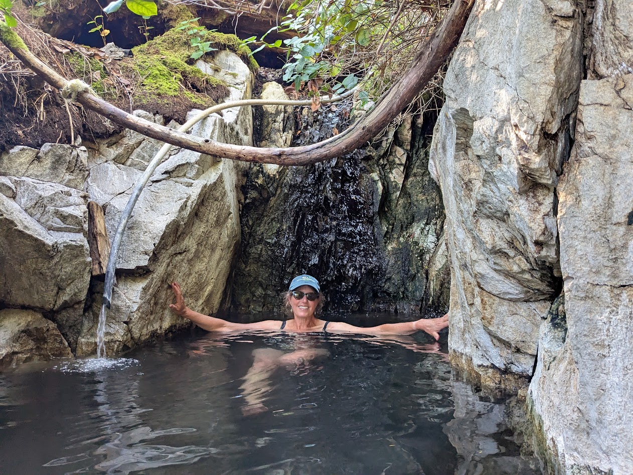
Our first stop was a hot spring. Have you ever sat in one that didn’t smell like sulphur? We hadn’t. It was MAGNIFICENT.
The big curvy thing above me is a cedar branch.
Here’s the view from Nature’s Best Hot Tub:
ahhhh…
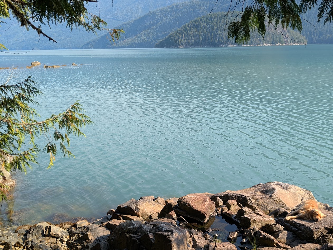
Wait. Is that First Mate Buck, asleep on the job?
Tough life.
When we got to the next drop-off site, our guides stayed in their roles: Daniel dropped us off and went fishing; Buck led us to the Big Cedar Tree.
Seriously. Not a guide dog–a dog guide.
“Wait up, Buck!”
Turns out Buck knew the way, all right.
“You’re not even capturing the whole tree in this frame.”
How about this?
That’s better.
Oh, that boat trip. We had waterfalls…
Can we get a little closer?OK, close enough!
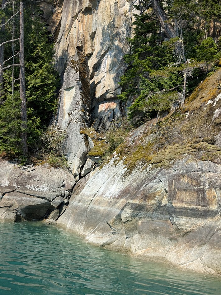
…ancient Nuxhalk pictographs…
See that reddish part of the rock?That’s supposed to be a person. Telling visitors this land is OCCUPIED, thanks.
…and more glaciers, this time from below.
Still can’t get enough.
Before we left the valley, we spent some time in and around the town of Bella Coola itself, where the Nuxhalk culture felt pretty vibrant, at least to us outsiders.
I only wish I could have learned to pronounce that.
A nearby grove of cedars, some ancient, bears the marks of age-old cultural harvesting, both bark…
Thank you!
…and even wood, all without damaging the tree:
So much to learn here.
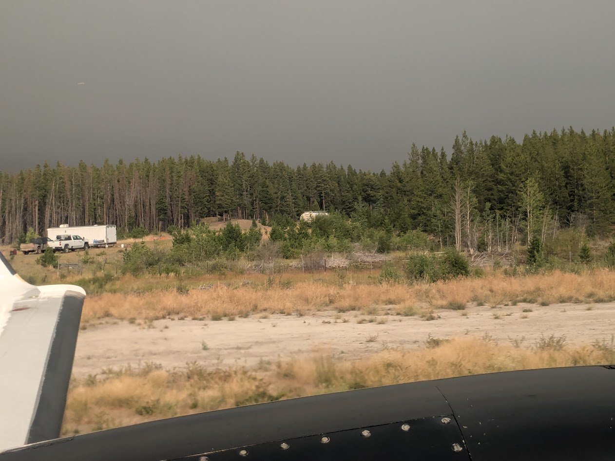
The last two days of our trip, the wind shifted and the valley grew smoky. We learned of uncontrolled wildfires to the east; Rt. 20 (The Hill) was closed. When it came time to fly out, this time we stopped in the tiny town of Anahim Lake, and got a good look at the fire-threatened sky for ourselves:
Not pictured: the ash falling from the sky
So after that sobering glimpse of what our planet’s facing, it was doubly gratifying and relieving to see those glaciers from above.
Restraining myself from quoting Robert Frost here…I’ll just say, “Hang in there.”
Next up: More BC! Islands, this time–the littler ones. Thanks for coming along.
You’ve probably heard of it, even if you haven’t read the memoir Wild, or seen the movie, or hiked part of the PCT yourself. 2,650 miles, it stretches from the Mexican border to the Canadian.
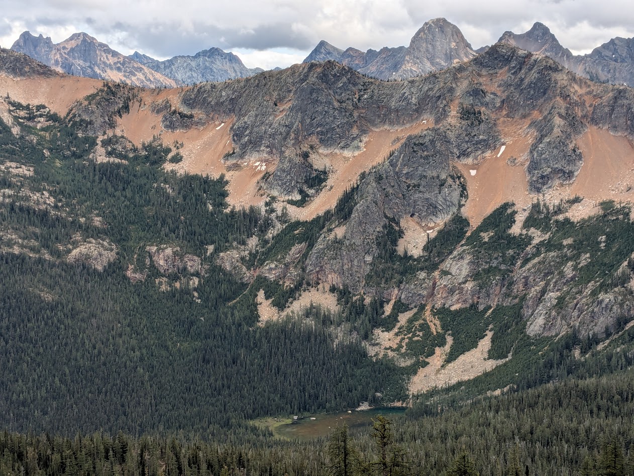
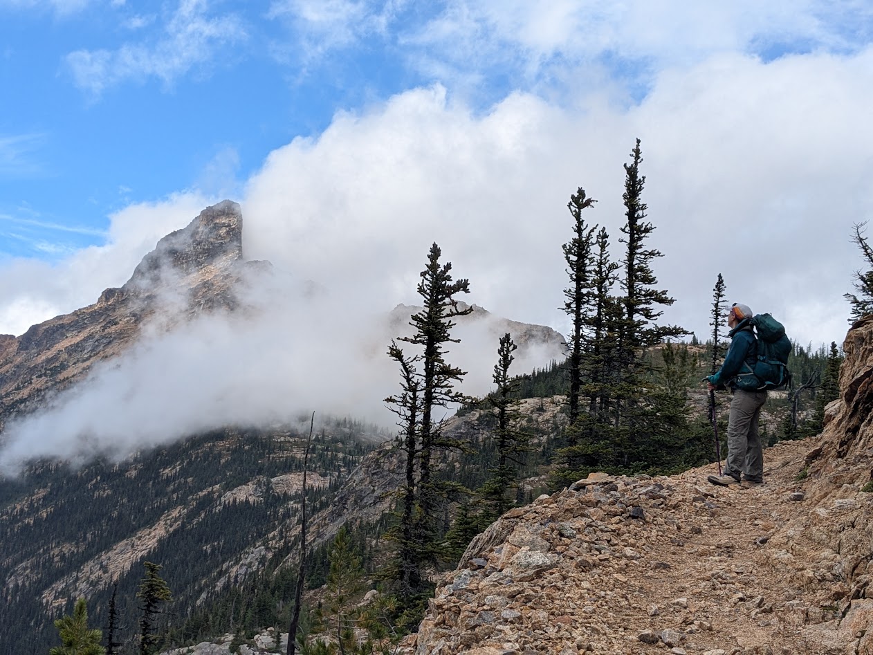
Think this is gorgeous? Wait till the larch trees turn golden and the shrubs turn red!
There’s so much to love about the PCT: it runs deliberately across the most dramatic stretches of western mountain (the “Crest”); it’s pretty accessible in places (like this, the Cutthroat Pass portion); and it’s blessed by a uniform “PCT grade” of 6%, meaning that it’s never too ridiculously steep (looking at YOU, Appalachian Trail!).
Imagine ALL the huckleberry leaves adopting the color of this influencer!
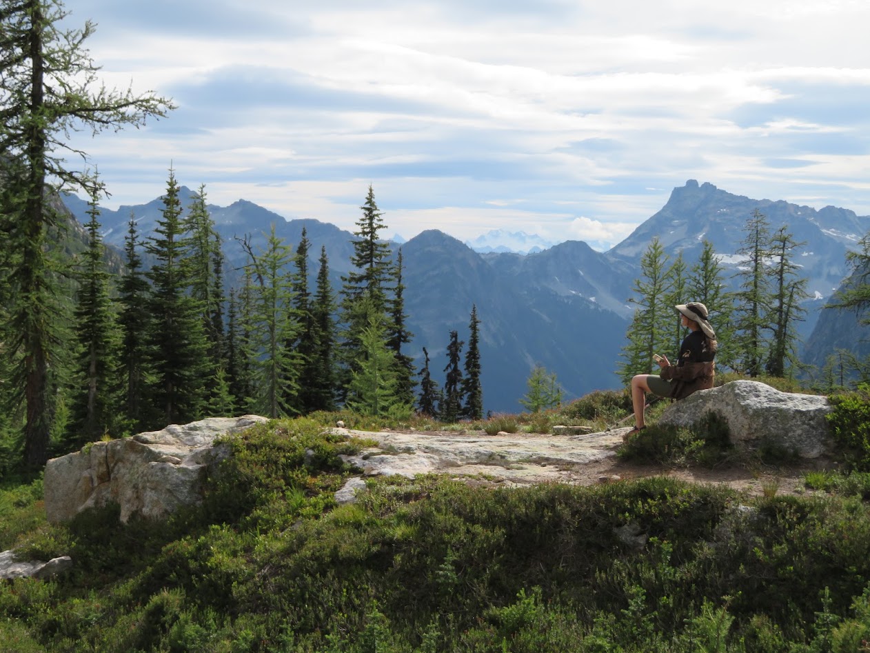
With only two nights, Ironwoman Goddaughter Allison & I opted for Cutthroat Pass, figuring we knew exactly what we’d be up for.
PCT: Perfectly Cute Tarn (i.e., snowmelt lake)
We were mistaken on most counts.
At first, we were thrilled to find ourselves all alone on a brilliant, sunny Tuesday: this enormous campsite, all for us???
PCT: Please, Camp There!
And blueberries? Sure, we expected to find some, but…
PCT: Pancakes! Crepes Too!
We happily took advantage, stuffing our faces like bears…
PCT: Practicing Cramming Technique
…taking photos of campsite flowers…
Sorry, no P, C or T: this is a gentian
…and marveling at the spruce cones, which are having themselves a season like I’ve never seen!
We couldn’t decide if they looked more like baby owls, or like glittery Christmas ornaments.
We enjoyed the sun all the more, knowing that the forecast called for “showers” the following afternoon.
But the rain started around 4 a.m. and continued to drizzle on and off all day.
PCT: Pack Cover Time
It was a warm drizzle, not bad at all–but we did have hopes that the sun might reward us for our intrepidness and burst out at our Day 2 destination, a pair of high lakes.
PCT: Partly Cloudy? Tough!
Instead…exactly when we’d finished the climb and were sitting down for lunch and rest…THAT’s when the rain really let loose.
*Not pictured: rain letting loose. Because I didn’t want it letting loose on my phone.
*Also not pictured: Gretchen and Ironwoman Allison enjoying a mid-hike rest, because they didn’t get one.
Well…the forecast DID call for afternoon rain. We just didn’t think that meant morning rain plus afternoon downpour. And we did get that hoped-for sunbreak…after we’d already left the lakes behind, heading back…
PCT: Poorly Conceived Tanning
…along a stretch of trail too sketchy to stop and rest on.
PCT: Pretty Crumbly There
With the rain FINALLY relenting, we were able to enjoy some of the crags we’d hiked past that morning, when they were hidden by clouds.
Like The Temple
…even though that blessed PCT Grade does make for a longer hike sometimes!
Only 4 more switchbacks to go
So, after 13 miles without much of a rest, we were pretty tired by the time we hiked back into camp. And pretty shocked to find our campsite looking like this:
PCT: People Commandeering Tentsites
Understand two things: 1) that olive-colored tent was pitched so close to ours you couldn’t walk between them
2) There were other sites available, just beyond ours! But when we pointed this out to the 4 hikers who’d pitched these, they shrugged us off–literally.
I was too pissed off to speak to them after that, thinking, Who DOES this?? But Allison engaged them in conversation, and that’s how we quickly came to understand: Ah. These are through-hikers, or at least they think of themselves that way. These folks–my age, seemingly–WERE doing the whole PCT, but they were doing it one section at a time–maybe a 10-day trip. Not the 5 months’ journey that would have caused us to feel a little more generous toward their entitled attitude…
…which showed up big time at 5:30 next morning when they all woke up and started using their outdoor voices.
This guy would’ve been a FAR preferable neighbor.
Allison’s winning submission for PCT: Pretentious Campsite Terrorizers!
So we learned a few things. PCT through-hikers seem to think the trail belongs to them, so next time, camp as far away from the trail as possible. And bring earplugs.
As I described last entry, we survived 40 degrees Celcius–that’s 102 for us!–in Jalpan by hiding out in its clear blue oases. But there weren’t enough of these within a reasonable drive (on unreasonable roads).
So we decided to spend out last 2 days (1 night) where we started, in Tamasopo.
Aquí
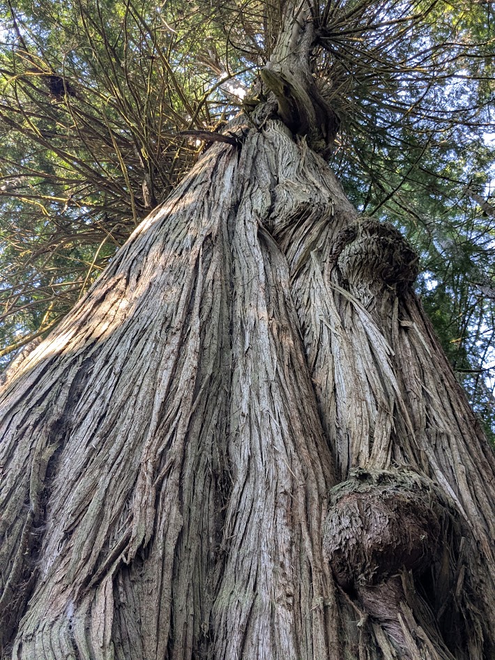
We had a couple of adventures getting back there–one on purpose, one not. The purposeful one was a visit to a tree Hijo Dos had found mention of online: a 1,000 year-old cypress, in a small town right off the main highway.
1,000 year old tree? Sí, por favor.
We were not disappointed.
If this thing looks big, please know the picture doesn’t come close to showing how MASSIVE this ancient goddess is. And since cypresses are deciduous, we got to enjoy the sight of this building-sized tree sporting tiny, fresh baby leaves. Circle of life!
El Arbol Milennario’s secret, I think, is this spring, right at its base. This part was fenced off (luckily), but I was able to sit in the clear water just downstream.
Adventure #2 was Google’s fault. Well, maybe it was ours…for taking the route as Google directed, even though the road appeared not to have a name. It started nice and paved, but when it abruptly turned to rutted dirt, it was too late to turn around.
At a maximum of 15 mph, I had plenty of opportunity to take cactus photos out the window.
Luckily we got through 45 minutes of potholes without damage to the car, and after regaining pavement, we were back in Tamasopo in no time, and back in that incredible river.
Miss you already
Early next morning, Hijo Dos y yo paid one last visit to the Puente de Diós we’d first met the week before. But there was a guide nearby, so no illegal swimming this time…plus it was a little chilly anyway.
Miss you too
Next morning, on our way back to the city of San Luis Potosí (as opposed to the state of the same name…it’s not that confusing; just thing New York, New York), we stopped at one more aquatic wonderland still on our list: El Trampolín. I’m still baffled why it’s called this, but…
…honestly, who cares? This photo is now my computer’s wallpaper.
A lazy part of the same blue river that starts at the Puente de Dios, El Trampolín has the added feature of being PUBLIC. No entrance fee, no guides, no nothing…just hop on in and float!
And look up at the Spanish moss while doing so.
The only disadvantage to the public part of this gorgeous oasis was…garbage. Not a ton, but enough to be noticeable. And disappointing. Sometimes people suck.
Back in the city of San Luis (or the outskirts; after all our beautiful blue-green experiences, we weren’t in the mood for touring a hot city), we took ourselves out to dinner at a place close by our airport hotel. Hijo Dos picked it out. “It’s famous for grilled meat,” he said.
If you’re thinking, “Wait–is The Mate eating a cheeseburger??” you are not wrong. What a gringo! (But he said it was one of the best cheeseburgers he ever had. The he helped me and Hijo Dos eat the big meatpile)
Next day we were up EARLY, flying back to Dallas. (My seatmates were two lovely women going on their own, Northern adventure; I had the pleasure of apologizing to them for my current wretched government.) In Dallas we said Adios to Hijo Dos, who flew back to Seattle, while we flew on to…
…guess where?
Here’s a hint.
But before this travel blog switches gears, can I just say this about the part of Mexico we saw? The people were LOVELY. The food was DELICIOUS. We felt SAFE. And we still feel humbled to have spent such happy time in a region that no one in the U.S. seems to have heard of.So…thank you, Aussie bloggers, for steering us there!
Next week: back down on the farm with the fam. Thanks for traveling with me!
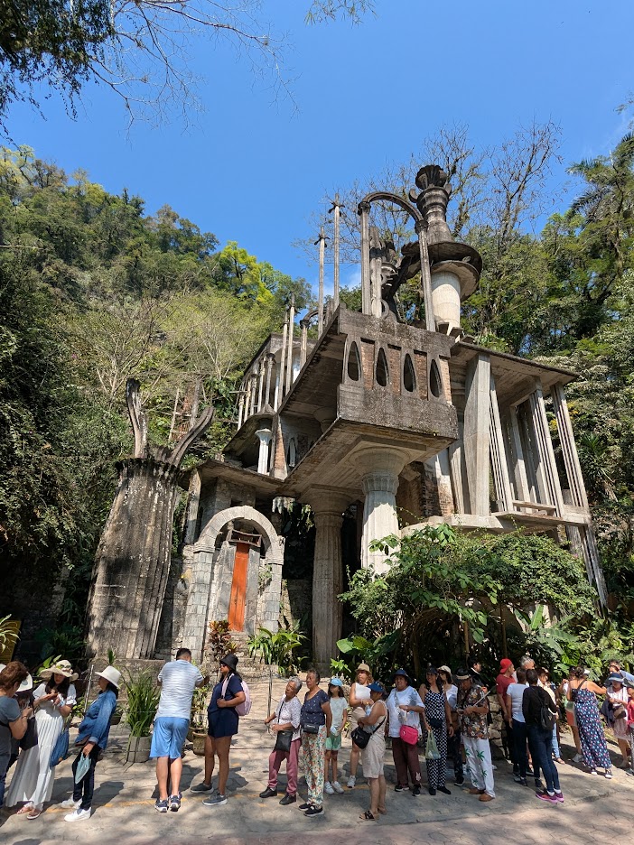
Leaving the blue waters of La Huasteca Potosina would have been hard, except that we were looking forward to new wonders. Starting with the town of Xilitla, which is famous for the Surrealist Gardens built by an eccentric Englishman almost a century ago.
Eccentric enough for ya?
Since we don’t enjoy standing in line, we decided to view the Gardens from the outside, which was still pretty cool.
Very M.C. Escher. But you aren’t allowed to walk in it, so…I’m not sure we missed much.
Instead, we spent a happy hour meandering through the main town of Xilitla (pronounced Hee-leet-la), which was as colorful as Aquismon, with an even prettier hilltop aspect.
It was a market day–even more colorful!
I found myself wishing I’d brought a bigger suitcase.
That sandy-looking pile on the left is brown sugar, ground from that dark cone in the middle. Mmmm!
Since there were no hikes in Xilitla, we hadn’t made reservations there. So we pushed on, crossing over into the state of Queretaro. To my dismay, while the mountains grew taller, they also grew drier.
And browner. Oh dear.
The main town, Jalpan, looked pretty enough, but…where’s all the green I expected?
Anybody see any waterfalls?
This new landscape worried me, given the weather forecast. It was supposed to be in the 90s our first day, followed by 102. That’s too hot for hiking! And too hot for anything else. I began to wonder if I’d made a mistake, bringing us here.
Our only neighbors: hummingbirds, doves, and a group of camping high schoolers.
And walking into town that night, we were equally cheered by Jalpan itself: another well-named Pueblo Mágico.
town plaza
Jalpan went all-out for their “Magic Town” designation, seemed like. Not only was the plaza decorated…
Ay, que precioso
…but each side alley had its own colorful theme.
Why can’t we do this at home?
Oh, and the church wasn’t bad either:
The front is intricately carved. I really should’ve taken close-ups. But you get the idea.
So Jalpan itself stole our hearts. Still, I worried: are we really going hiking in 98 degrees? Turns out, I wasted a good worry. La Sierra Gorda is all about hidden mountain oases.
Ahhhhhh…
Our first hike, along this creek, featured all the blue water we’d been missing. And big ol’ sycamore trees…
And yes! a waterfall.
Let me zoom in a sec on that fan of rock…which, understand, is CREATED by the water itself–a fan-shaped stalactite.
I’m a fan of stalactites, myself!
One wasn’t allowed to swim in this pool, as it’s a habitat for highly endangered axolotls. (Which we didn’t find.) But at the end of the hike…
¡¡¡SÍ!!!
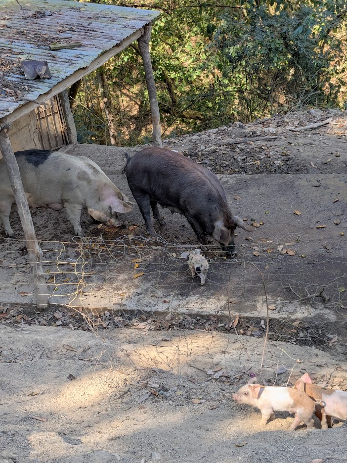
Oh–and another reward: highly cute piggies at the trail entrance.
Even cuter in the video.
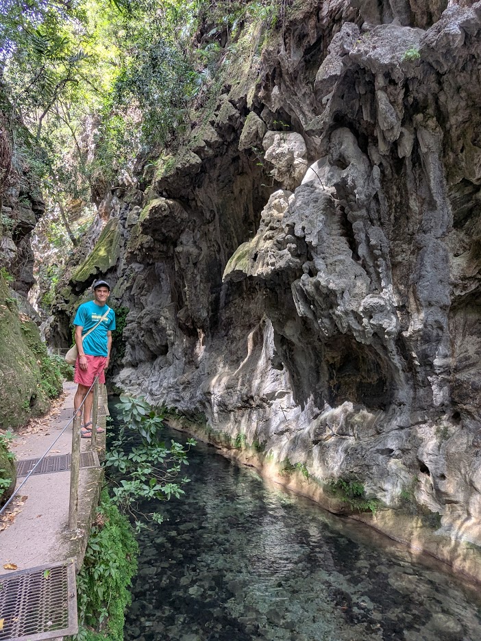
Buoyed by our first oasis experience, we ventured out on Day 2…the 102-degree day…with high hopes for lower temps in another cool oasis: El Puente de Diós (Sierra Gorda version, not to be confused with the one in Tamasopo). This hike is famous and sensitive enough that we were required to hire a local guide. And this time, we were also rewarded beyond our wildest expectations.
The hike started similarly to the day before: clear stream, big trees.
Hola, Madre
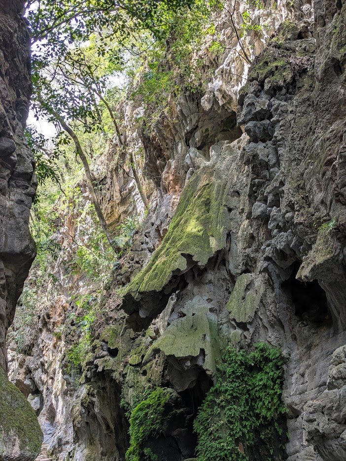
But soon enough the canyon narrowed.
Keep an eye on that fluted-looking rock, above.
And narrowed further.
Notice that some of those stalactite fans have broken off.
We didn’t realize it at the time, but those rocky fans on either side of the canyon are growing closer to each other with each drop of water than pours down.
Closer…and closer…
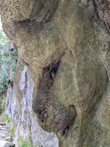
Soon we would see just how close those rocky sides could grow. But first…fun with rock faces!
I see a baboon. What do you see?
Soon after this stretch, the canyon opened back up…
…and we started hearing a waterfall roar.
But not just any waterfall. This Bridge of God was…
…awe-striking.
Can you see what happened here? The two sides of the canyon “grew” together, millennium by millennium, drop by mineral-laden drop, to connect into this bridge.
But the most incredible view was from underneath. Here’s looking THROUGH the bridge…
Oh, did those drips feel good!
…but here is looking UP…into the bridge’s belly.
Or whatever body parts you want to call these.
Imagine a roar too loud for conversation.
Hijo Dos noticing that some of God’s pipes seem to be blocked. (You okay, Madre?)
Our guide assured us the water was safe to drink; we took him at his word.
How could you NOT?
No need to swim at God’s Bridge; we were fully cooled by our own awe, all the way back down the trail. Oh, and our guide pointed out this tree, which he said was 800 years old.
Again: we saw no reason not to believe him. Gracias, Ricardo.
On the drive back to Jalpan, as coda to a perfect day, we stopped at the tiniest little lunch spot off the road, run by the tiniest little woman, Doña Mary.
Her kitchen was about the size of this table.
No menus; our host simply narrated what she’d cooked that day. Something she mentioned sounded to me like “little mushrooms” (honguitos), so I asked Hijo Dos to inquire. Turns out she served something called Huitlacoche, which Google told us later is “a fungus that grows on corn kernels, forming a blue-gray, tumor-like growth,” which is considered a delicacy.
It looked as disgusting as it tasted delicious.
You had me at blue-gray. Gracias, Doña Mary.
Approaching Jalpan, we watched the temp guage in our rental car climb and climb. I’d never seen 40 degrees Centigrade before! Let’s hear it for oases.
Next day, we decided to say goodbye to La Sierra Gorda. Most of it, we found, is inaccessible–a wonderful, thriving natural habitat, but not offering many more hikes than those we’d enjoyed. Not wishing to drive long distances on some INCREDIBLY twisty roads, we opted to spend our next night back in Tamasopo.
We ate brunch before leaving Jalpan next morning, where I tried one more ingredient new to me: prickly-pear fruit (in a burrito), which they call tuna or tunita.
Fresh, pretty…tastes a bit like okra, without the sliminess!
I just gotta say, Jalpan–you grew on us, big time.
“Oh, alright…I’ll get back in the car…”
Next up: last days in the blue waters, and giant Meatpile! Thanks for keeping me company.
I’ll be honest: I’d never heard of a Pueblo Mágico. Apparently it’s a special designation conferred in Mexico by the government–though state or federal, we never learned.
All I can say is: Aquismón fits the bill of Magical Town.
You could quibble with the colorlessness of their sign…but the rest of the place made up for that.
Word of warning. You know those really talky blog posts I sometimes do? This one isn’t that. I have pics to share!
Like this one, showing how picturesquely steep the village streets are.
Our first day there, all I really did was walk around and revel in the beauties of the place.
If my neighbor HERE painted their house like this, I’d hate it. But here? Fits right in.Ditto. And you gotta love that hillside behind.
Not only the houses, but the yards themselves spoke of people who loved color and design.
Yes, that is a “bush” made of deep blue glass bottles! (Ukrainians would love this backyard.)
Oh, and the gardens???
Nothin’ much…just your average 4-colored bouganvillea vines…
Carved out of the base of the jungly cliffs of the region, the village still hosted what looked like some magnificent old growth.
Hola, Guapo Viejo.
We stayed one night in one teensy little hotel, directly above an alley bustling with vendors…
…and two more in another small place, even more modest, with a very sweet courtyard. Pretty sure we were the only guests in both.
Again with the color!
The tree shading El Esposo in this picture was bursting with blossoms. Hijo Dos assured me that, yes–that’s a mango tree, meaning that these…
…are actually the TEENSIEST baby mangoes ever!
You could tell that the citizens of Aquismon had a lot of pride in their village. I saw zero trash, and this sign on a public wall explained why:
“If you have culture and pride, don’t litter”
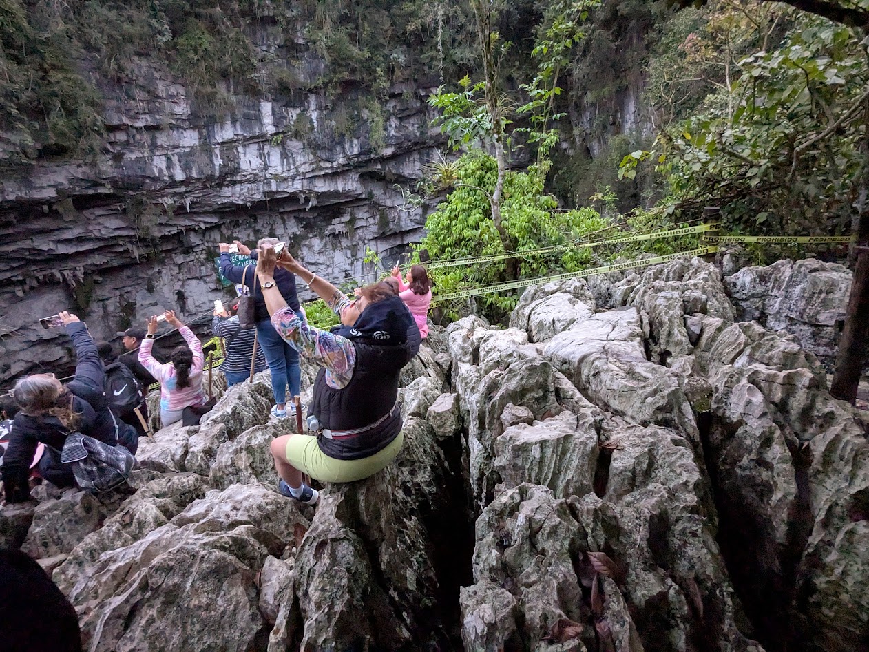
We made two excursions from Aquismon. The first involved getting up before daybreak, and driving up, up, up a twisty road into the mountains behind town…in order to walk down, down, down 600 steps to a giant hole in the ground.
This.
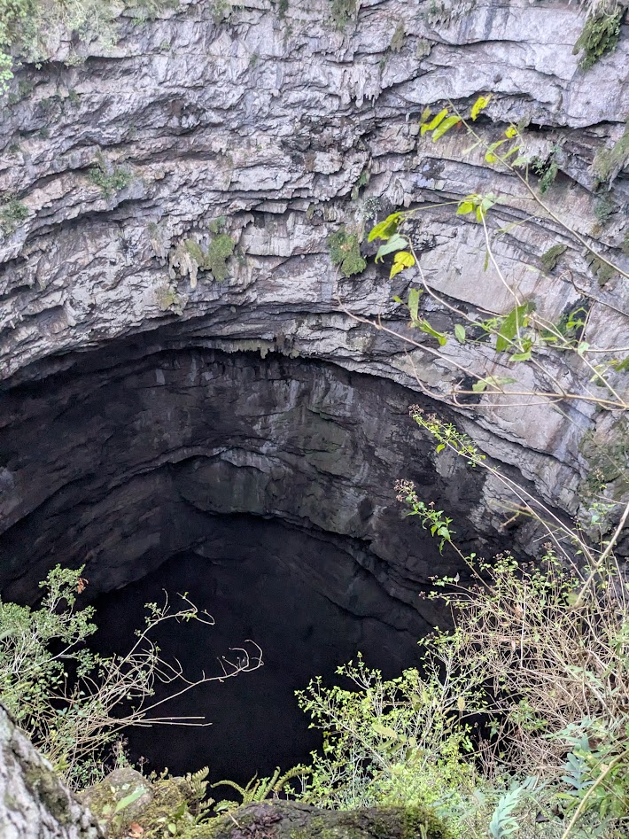
Not just any hole, though. This is El Sotano de Los Golondrinas, literally, Cellar of the Swallows.
Photo courtesy of Hijo Dos, who got himself roped up to peer into the depths from the edge. Eek.
Gazillion birds spend the night there, and at daybreak, come swirling out again. If you’re lucky. Sometimes, if it’s cloudy, they decide to sleep in, and you’re left just staring at their giant hole. Which is, admittedly, pretty cool: 1600 feet deep (512 m); the deepest cave shaft in the world, and the second-largest cave in Mexico.
Fellow tourists waiting to photograph the birds. Not a very comfy seat, that limestone.
We were semi-lucky: enough birds swirled out for us to be able to ooh and ahh and call it a swirl (though not exactly sky-blackening).
And now…back up those 600 steps!
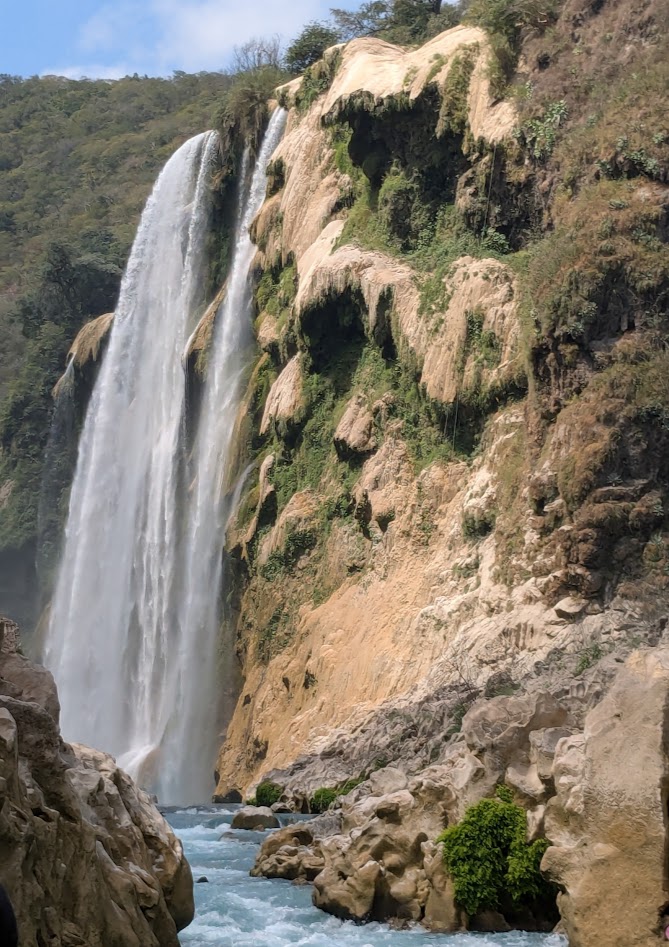
Next day’s excursion was a little further afield: Cascada Tamul, the highest waterfall in the region. We learned we could either hike to it–with instructions that sounded a bit iffy for folks like us with rental cars and bad knees–or rent a spot in a lancha and paddle up toward it.
We chose the lancha, with a half-dozen fellow tourists, from Mexico City.
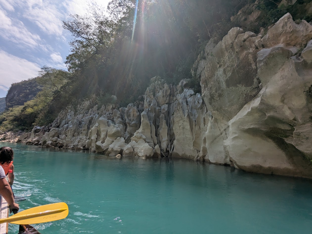
The trip wasn’t far, maybe 30 minutes of paddling, but it started spectacular and stayed that way.
We all got out and walked around as our boat captain hauled the boat over the only rapids on this stretch.
When we got to the actual falls themselves, so many other boats were there, full of people taking photos, it was actually an anticlimax.
A very pretty one–don’t get me wrong. And imagine what it looks like at high water season!
Truly, though, I was more captivated by the journey than the destination. Especially the fluted limestone…
…which I couldn’t stop taking photos of. Even though I was supposed to be paddling.
Such shapes! Such colors! OK, you get the idea.
But probably THE COOLEST part of the excursion was the Cueva de Agua (Water Cave) we stopped at on the way back downstream. Our captain pulled the boat over to let us all troop up some rough steps, then even more steps, up the bank…
This isn’t the river. Where’s all this water coming from??
…to this. Exactly as advertised: it’s a cave full of water sprung straight up from the earth. And warm.
Just don’t think about any of those giant stalactites dropping on your head.
I wish, oh how I wish, we could’ve seen it without anyone else there, as we did the Puente de Dios at Tamasopo. But being part of a group, we didn’t have a choice. Luckily folks were nice, and gave each other plenty of space in there.
Afterwards, waiting for everyone to have their swim, we enjoyed sitting in the cascading creek from that magical cave.
I am LITERALLY sitting in this waterfall pool to take this photo of Hijo 2.
This photo of that creek pouring into the river captures the whole experience better than I can describe.
But, lest you can’t quite believe what that photo is showing, here’s the same waterfall, looking up from the river.
(with El Esposo’s hat in the lower corner)
And one more:
(I did warn you about the pics)
Back in Aquismon, I walked around some more, soaking up that cute little town. I even found a few ugly things, like these drying intestines at a carniceria (butcher’s):
…but for intestines, they’re still pretty cool-looking.
But the sunset from our hotel balcony was right on brand.
Buenas noches…
Next up: Jalpan (another Magic Town) and La Sierra Gorda. Thanks for traveling with me!
As Staycations go, this one would’ve had a hard time failing.
Not CGI
A few months ago we paid for two nights at a rental house at Lake Quinault, only to have our travel companions cancel due to illness.
The view from that house
The renter allowed us to change our dates, so we invited intrepid friends: Ben & Lynn from Asheville, whom we’ve known for decades. They said YES!
Walking in W. Seattle’s Lincoln Park while we waited for their flight, we discovered this altar to LOVE. Seemed a good omen–Brussels sprouts & all.
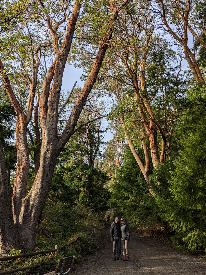
Since our friends were coming clear across the country, the least we could do was take them all the way around the Olympic Peninsula—a.k.a. part of our Big Backyard, across the Strait from our island.
Ben & Lynn–helping give some scale to the Lincoln Park madrona trees
Starting with the rainforests, at Quinault and the Hoh River, we all re-introduced ourselves to some big friends.
Well hello up there!
Ben & Gretchen agree, things are looking up.
In those wondrous, drippy forests, the enormous conifers–fir, spruce, cedar & hemlock–get most of the attention…
…whether alive or helping younger trees to be alive…
…but shoutout to the hardwoods, okay? The mosses seem to love the maples best.
Is that a hobbit hiding in there?
One of the nice thing about traveling with another couple is…
…couple photos! We tried not to take TOO much advantage.
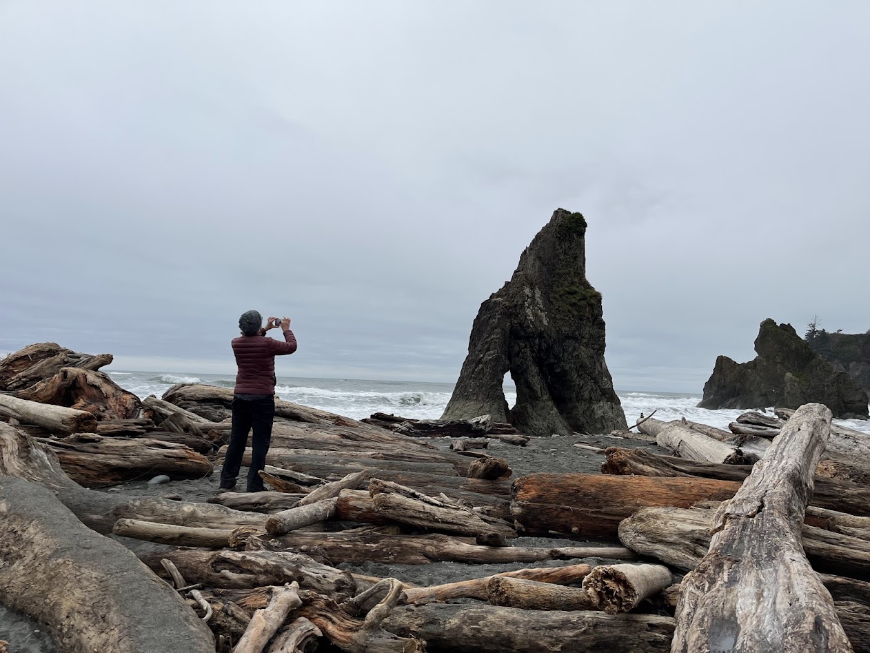
Moving up the Olympic coastline from Quinault, one has an embarrassing pick of beaches. Beach Three’s our favorite, for its tidepools, but the tide was too high this time of year. So we got to focus on other wonders–like this natural water feature.
Isn’t that the coolest little pool? We needed a 4 year-old to play in it.
Rialto Beach might be the most in-your-face breathtaking, if ya like that kinda thing
I have another photo of Lynn doing pretty much the same thing!
It was hard to leave the serenity of Lake Quinault. The northern shore of the lake was 95% deserted–all those empty vacation homes, what’s up, people?
And the sunrise didn’t hurt either.
But after our two nights, it was on to the furthest northwestern point on the Lower 48: the Makah Reservation at Neah Bay.
Along the way we stopped in Forks for groceries [not pictured: amazing apple fritters] and a hike to Third Beach (not to be confused with Beach 3).
Third Beach is the jumping-off point for a magnificent hike, out toward a garden of seastacks, up & down some rope ladders.
We just stayed put and admired ’em from afar.
Somehow, we did just fine.
Never any shortage of seats on these driftlog-piled beaches!
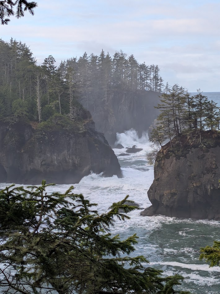
Up at Neah Bay, more choices: Cape Flattery, the very tippy-tip of the Rez, involving a 1.5 mile round trip walk, or Shi Shi Beach…which would’ve required a 2-mile slog through mud just to get to the start of the pretty stuff.
Guess what we chose?
Cape Flattery is difficult to describe without gothic-novel purple prose: surf crashing upon crags, mist and spray and boiling, roiling, heaving, breathing seas…
…or you could just look at the pictures.
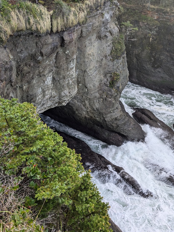
After we’d been there an hour, taking every conceivable photo, the sun came out. So what else could we do but start over?
Fine, if we must…
The best photos from Cape Flattery are videos, which capture all that roiling/boiling/heaving stuff I mentioned. But those are harder to embed into this blog, so I’ll just leave you with this one Lynn took:
Is it just me, or do you also see a whale in that rock? Right?
After our dalliance with the Cape and a lengthy visit to the Makah Museum (which was hosting a holiday craft fair), our crew was ready for a rest. But with the sun making such an unexpected appearance, I simply couldn’t resist one more beach visit, this one a simple drive & stroll on my own, to Tsoo-Yess Beach.
See what I mean about that sun? Tsoo-YESSSSS!
I couldn’t stop taking photos of the least little beachy items, which the sun rendered…let’s go ahead & use the term “glorious.”
“just” a piece of kelp, with foam on it
gargantuan log, turned into yet another water feature/sandbox (oh, where is that 4 year-old?)Sand arrows? Maybe kind of appropriate, on the Rez
Once more, it was hard leaving Neah Bay, especially with the sun out, and the thought of un-visited Shi Shi Beach. So we’ll have to come back one day…with better mudboots.
Meanwhile, it was on to a midday walk at Dungeness Spit, in Sequim (pronounced “Squim”):
It’s FIVE MILES long! No mud to slog through, but also not the most changeable scenery, eh? So we mostly stayed put.
Our final overnight stop was the ridiculously pretty town of Pt. Townsend.
also nice & quirky
The upper half of town, where the “proper” folks lived (as opposed to the rough & tumble crowd on the waterfront) is famous for its Victorians.
This was NOT our inn…at least not on this trip. I did stay here once with my HS Besties, years ago.
Oh, and did I mention the deer? I counted fifteen on a ten-minute walk through the leafy part of town.
These never budged as I walked past.
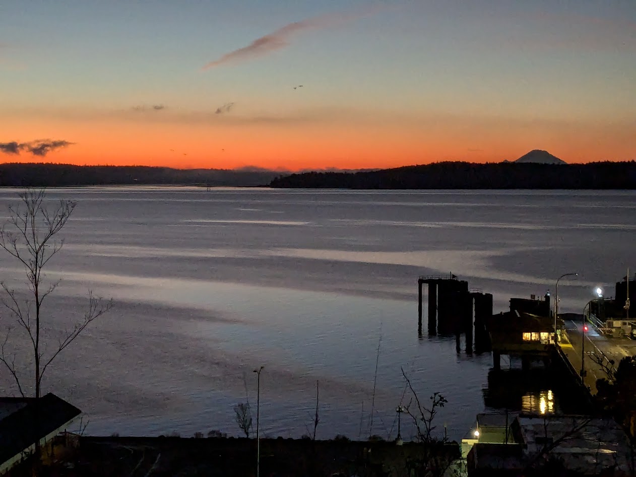
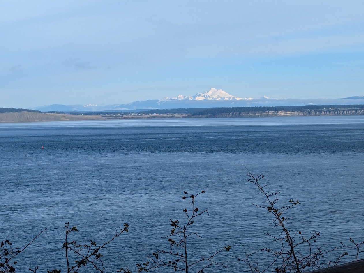
Our weather stayed amazingly clear, gifting us both a Mt. Rainier-silhoutted sunrise…
…over the ferry dock…
…and a Mt. Baker mid-morning, looking north from Ft. Worden State Park.
And if you moved the camera a little to the left, you’d be looking at Lopez Island!
Back in Seattle, we had one last hurrah of a meal w/ our adventure buddies, then left them at their airport hotel while we spent the night with Son Two. Our great fortune: he was dogsitting!
Even better than a 4 year-old!
Back home next day, after a week away, The Mate & I marveled at the deeply exotic beauty so close to our home. Then we looked around our little village and saw these community-crafted, recycled-bottle luminaries everywhere…and thought,
Y’know that “no place like home” thing?
I’ll say it again: (Cape) Flattery will get you. So will Tsoo-Yess, and Beach 3, and Third Beach. That whole peninsula is magical –and we didn’t even visit Lake Crescent, or the Elwha River, or the Sol Duc hot springs. We didn’t even drive up to see snowy Hurricane Ridge (road closed).
There’s just SO MUCH.
So if you go? Bring your camera. But try & bring a 4 year-old too.
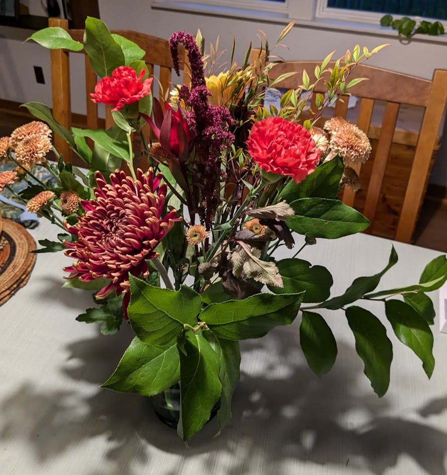
Confession #1: I think I’ve been harboring a witch in my house, for the past month.
Confession #2: I’ve loved every minute.
Confession #3: that “witch” is…a bouquet of flowers.
Who me, my pretty?
Specifically, this bouquet. Gifted to me by Son Two when he picked me up from the airport a day after my birthday. I took this photo a day after that: October 27.
Pretty, right? There’s even a rose, which I manage not to show in this snapshot. But nothing out of the ordinary. Just lovely flowers from a lovely young man who happens to be my son.
A week later, the bouquet was still going strong, except for that one rose, which I removed. I send Son Two this photo to share my pleasant surprise at his gift’s longevity.
Nov. 3. Who misses a rose? Still vibrant!
Two weeks later, when the bouquet continued to stay glossy and bright, I started having my suspicions.
Nov. 9. Ok, that one yellow flower’s getting a little mussed, but it’s been TWO WEEKS!
Week three began. We’re talking the first weekend after the election; hell, half the country needed flowers! But I had these, still giving their weirdly ageless joy.
Except for adding a little sugar to their water when I first got them, and changing the water once a week, I did NOTHING to these flowers. It’s all them.
We didn’t even need those extra dahlias. Doing just fine.
Granted, I freshened them up with a couple of dahlias rescued from a different bouquet, gifted by my Ironwoman Goddaughter Allison, but really…they were just bonus. Son Two’s bouquet was holding its own after THREE WEEKS.
That’s when I decided it must be a witch. But SUCH a good witch.
Finally, FINALLY, I made the decision today to liberate my lovely witchy companion to the compost heap. But not before taking its picture one last time.
***not…dead…yet!***
I seriously think I might have repurposed that bouquet one last time, in a smaller vase. But we’re coming up on Thanksgiving; counter space will soon be at a premium…and let’s face it: ONE MONTH is more than twice the joy I’d expect to receive from any bunch of flowers not planted in dirt. Why be greedy?
Unless somebody wants to bring me a new bunch. As witchy as possible, please.
It’s a chapbook, sometimes called “a slim volume.” (Which, now that I think about it, isn’t a bad description of my friend Kathleen herself, the author of A Cage in Search of a Bird.)
And if you’re like me–needing more than EVER to buffer the beginnings of each day with not-TV-news imagery, universal truths, or just plain fun wordplay–this little chapbook is just the thing.
Since Kathleen is a Lopez Islander like me (and a member of my writing group) it seems most fitting to describe her latest collection in the words of another fellow Lopezian (and onetime member of said writing group), H.M. Sanders:
Sometimes tongue-in-cheek but always insightful and brimming with poetic vignettes provided by nature’s gifts, Kathleen Holliday‘s new collection is thought provoking, wise, and rich with island imagery. Like a beachcomber of her own life, she picks up the most unassuming objects and uses the lighthouse beam of her poet’s eye to show us the beauty and sadness embedded there. These poems are quieter than her previous works; a little richer with imagery and a little darker, with beautifully wrought images derived from everyday occurrences that she elevates to higher observations of our world and our understanding of it. In this age of social media, AI, and the frantic noise of news and the horrors of our world, the profound gift of Holliday’s poems ring quiet and true – this collection of poems is a calm anchor that links us back to our spiritual roots.
–H.M. Sanders, author of The Widowed Warlock, and Ringmaker fantasy series.
“…rich with island imagery” indeed
Please visit Kathleen’s website to learn more about her poetry and to order a copy (or two–Christmas presents?) of her latest chapbook, OR her previous two: Boatman, Pass By, and Putting My Ash on the Line.
Remember what I said about the fun wordplay?
To summarize: Feeling disheartened?Start each day with a poem. Pass it on.
The first afternoon of my shiny-new Masters in Creative Writing residency in Culver City, a worried-looking man at the bus stop I was walking past stopped me, in halting English, with a question. Based on his appearance, I guessed he had immigrated from central Africa…but when his English failed, he tried a nice, fluent Spanish–and there we found a common place to converse about bus routes (and the fact that I, an out-of-towner, knew less than he did).
“Now that was an LA moment,” I thought. And that’s why I’m here: for the writing instruction, yes–but even more for the moments I cannot experience via Zoom.
Greater Los Angeles is a stunning place, in all the meanings of that word.
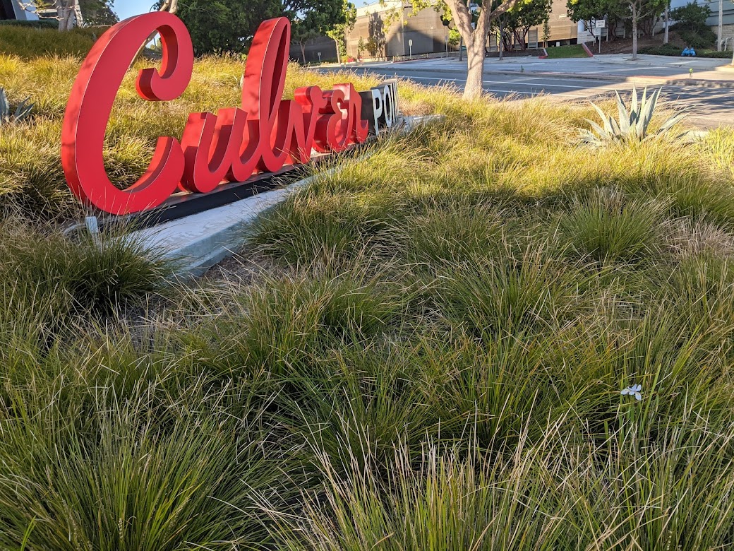
just your average Culver City yard
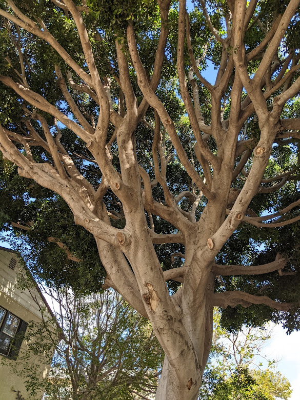
Since I’m here in full Writer Mode, I’m noticing every way that I’m being stunned, mostly on my 2-mile, twice-daily walks between the campus of Antioch University Los Angeles and the wonderful friends who are hosting me. Starting with these astounding ficus trees, planted down multiple Culver City streets…
Must…build…treehouse!
…whose roots are painfully constrained by concrete, and yet–they tower.
I’m so sorry, O Great One!
Since I’m entirely on foot, thanks be, I only have to deal with traffic when I cross the street. But this vehicle caught my eye as an embodiment of SoCal culture:
The decal on the window reads, “It’s always been about style!” Uh huh.
Antioch U itself is housed in a stunningly corporate-looking building, one of a cluster offering office space to such stunningly _____ (insert your own adverb here) corporations as Tik-Tok.
I still don’t get TikTok, but then I’m 60, so I guess that’s the point.
I’ve never worked in a building like this, but this scene through a window on the ground floor tells me that at least someone in there has a good sense of humor:
Yikes. Tough day at work.
Being, y’know, corporate and all, the building-cluster is thoroughly landscaped…
See that one tiny blooming white iris? I felt a kinship.
…and I didn’t know whether to laugh or cry when I found this Pacific Northwestern sister, this madrona tree, literally chained to a concrete block.
Makes me want to rescue her, like that scene in Harold & Maude (go see it if you haven’t)
I have no critique of Angelenos or anyone else who chooses to live in a megalopolis. There’s just so much here here, it takes my breath away. So I’m finding special comfort in whatever feels familiar–not in that creepy, chained-down-madrona way, but like these adorable turtles…
Sorry, buddies, I don’t have any treats for you!
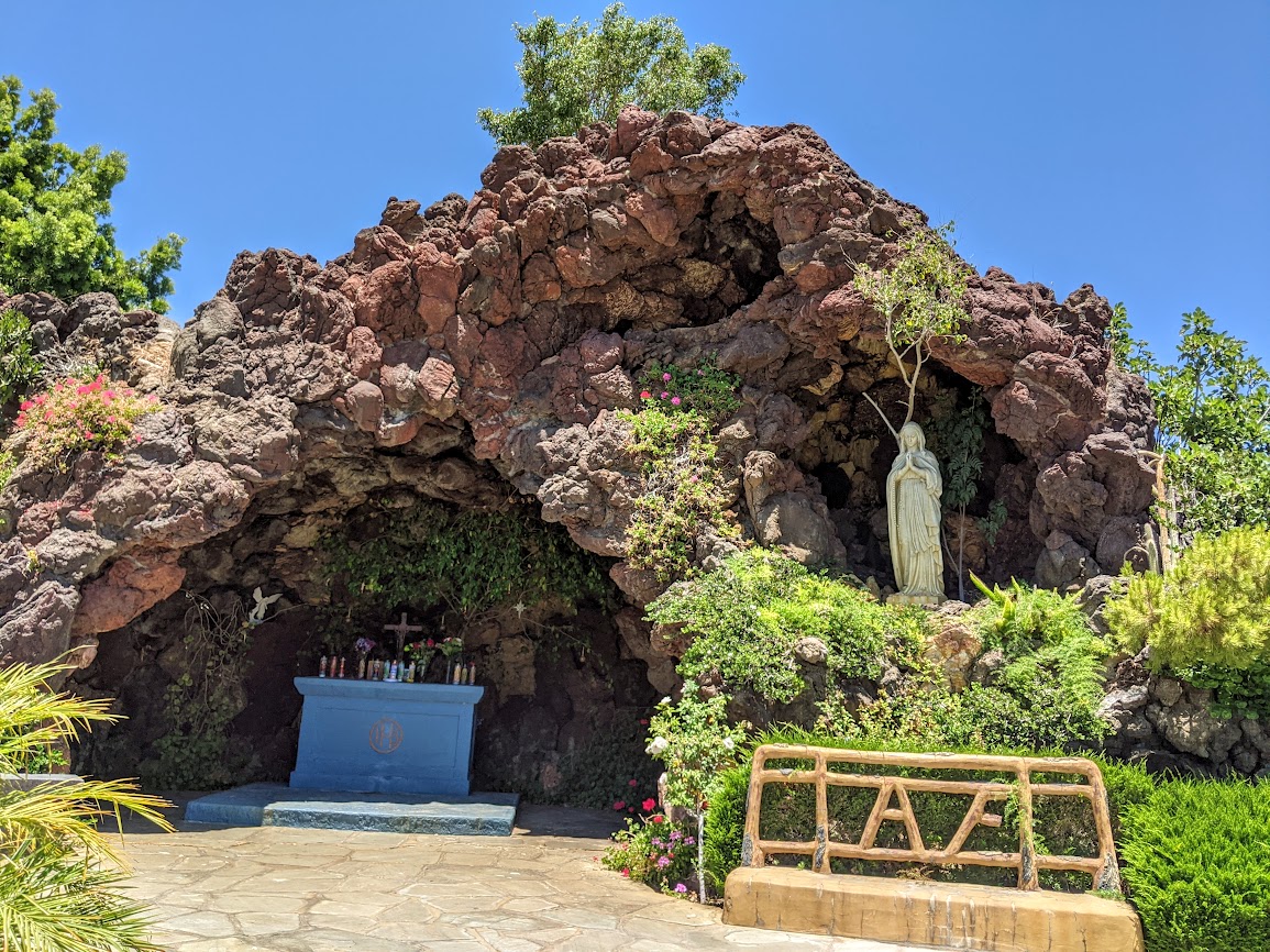
…in the grotto pool of the Catholic cemetery I cross through on my walks to & from campus.
candles burning inside for, in this case, all fathers on Fathers Day
In the end, everyone wants to feel at home, whatever home means, right? Which is a good thing to be pondering as I launch into a brand-new writing project with some brand-new helpers who come from places so very, very different from my little island. In the end, we all want comfort, whether that means a shiny sports car, an untethered tree…or just a sweet cat to lie on our tummy.